Pumphouse Belt
Wood, Forest in Wiltshire
England
Pumphouse Belt
Pumphouse Belt is a woodland area located in the county of Wiltshire, England. Situated within the larger forested region of Wiltshire, this particular belt of woodland covers an area of approximately [insert size] hectares.
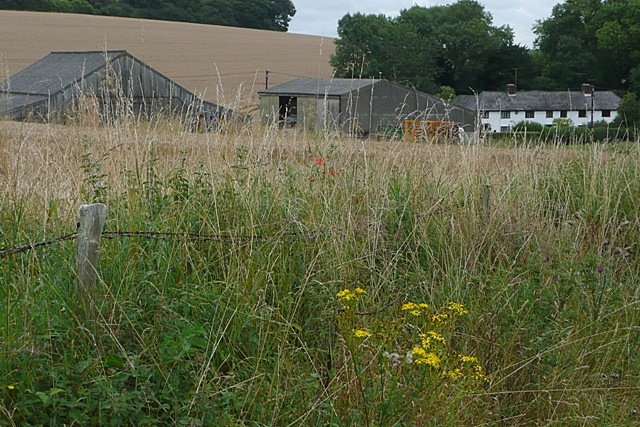
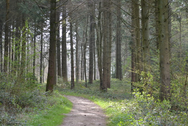
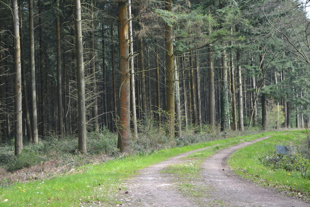
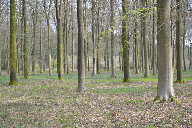
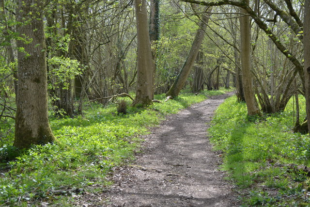
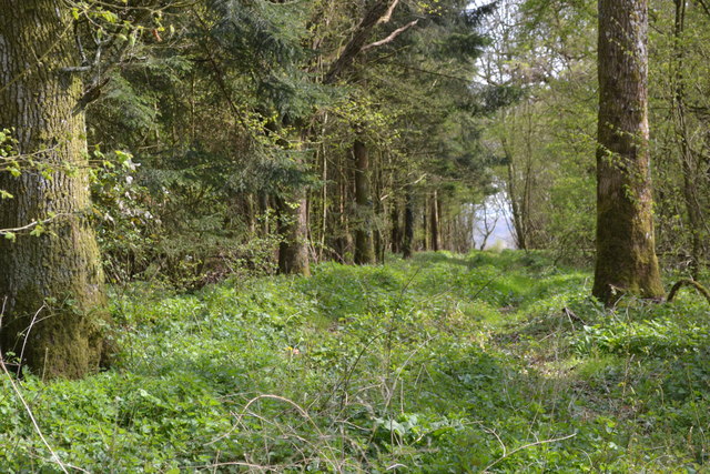
The Pumphouse Belt is characterized by a diverse range of tree species, including oak, beech, birch, and ash. These trees create a dense canopy, providing shade and shelter for a variety of wildlife. The forest floor is covered with an array of plants and vegetation, such as bluebells and ferns, adding to the natural beauty of the area.
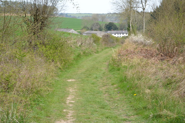
The woodland is intersected by a network of well-maintained footpaths, allowing visitors to explore and enjoy its peaceful surroundings. These paths wind through the trees, offering glimpses of the vibrant flora and fauna that call Pumphouse Belt their home.
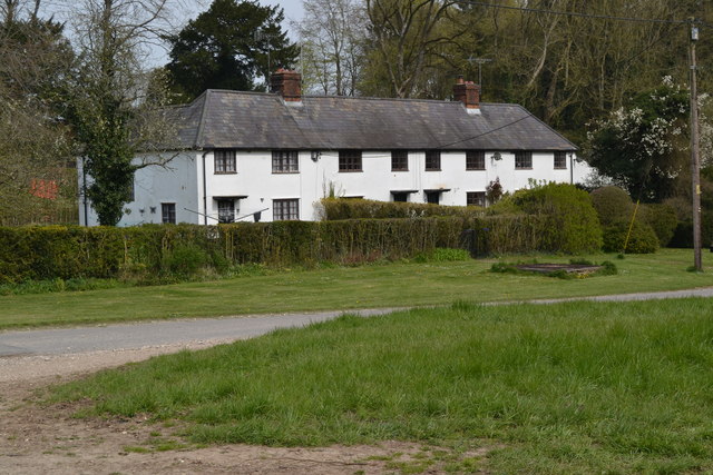
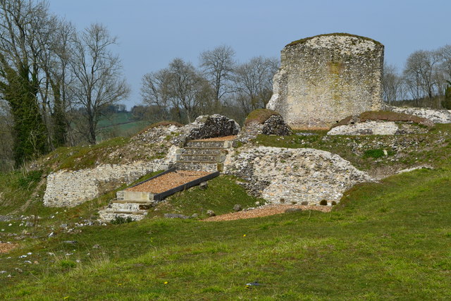
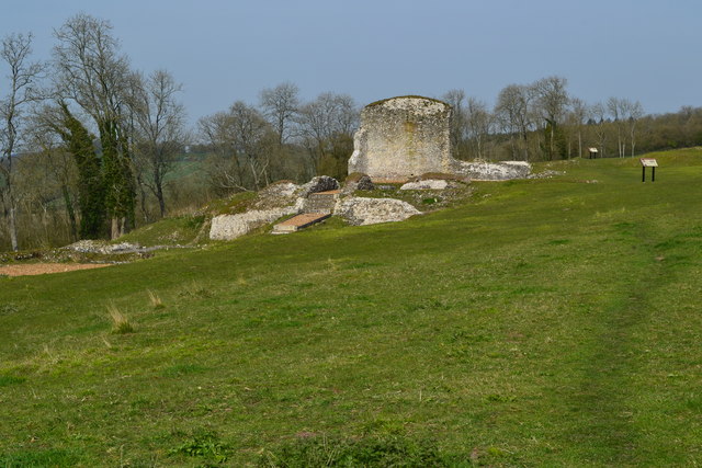
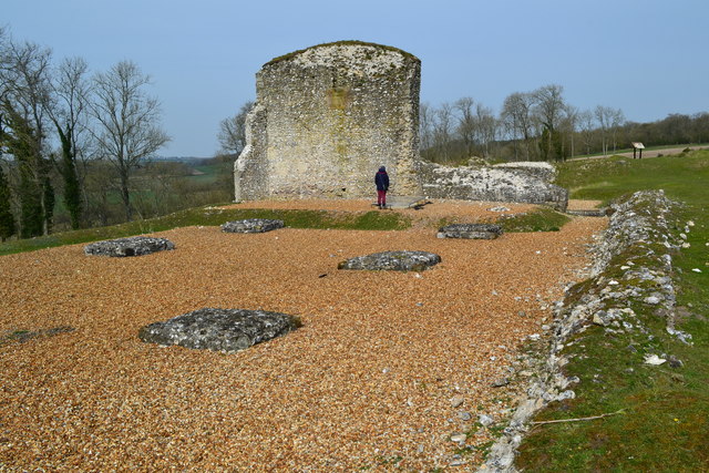
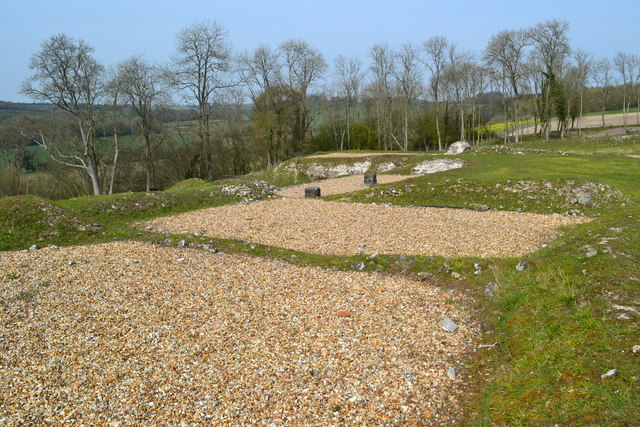
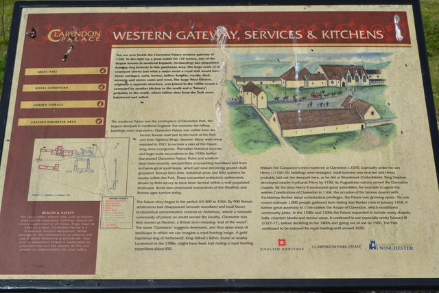
The Pumphouse Belt has a rich history, with evidence of human activity dating back centuries. Some areas of the woodland still contain remnants of ancient structures, such as old stone walls and the remains of a pump house, which gives the woodland its name. These historical features add intrigue and charm to the area.
The woodland is open to the public and is a popular destination for nature enthusiasts, walkers, and picnickers. It provides a tranquil escape from the hustle and bustle of everyday life and offers opportunities for relaxation and exploration.
If you have any feedback on the listing, please let us know in the comments section below.
Pumphouse Belt Images
Images are sourced within 2km of 51.07667/-1.7409848 or Grid Reference SU1830. Thanks to Geograph Open Source API. All images are credited.


Pumphouse Belt is located at Grid Ref: SU1830 (Lat: 51.07667, Lng: -1.7409848)
Unitary Authority: Wiltshire
Police Authority: Wiltshire
What 3 Words
///asked.whirlwind.shoulders. Near Alderbury, Wiltshire
Nearby Locations
Related Wikis

Clarendon Palace
Clarendon Palace is a medieval ruin 2+1⁄4 miles (3.6 km) east of Salisbury in Wiltshire, England. The palace was a royal residence during the Middle Ages...

Cockey Down
Cockey Down (grid reference SU170317) is a 15.2 hectare biological Site of Special Scientific Interest in Wiltshire, notified in 1971. The site is managed...

St Edmund's Girls' School
St Edmund's Girls' School was an all-girls secondary school located in Laverstock, near Salisbury, south Wiltshire, England. In 2022 the school formally...
Bracknell Croft
Bracknell Croft (grid reference SU180330) is a 4.8 hectare biological Site of Special Scientific Interest in Wiltshire, notified in 1971. == Sources... ==
St Joseph's Catholic School, Laverstock
St Joseph's Catholic School is a coeducational Roman Catholic secondary school in Laverstock, near Salisbury in Wiltshire, England.It is a voluntary aided...
Wyvern St Edmund's
Wyvern St Edmund's is a coeducational secondary school in Laverstock, near Salisbury in the English county of Wiltshire. == History == The school opened...
Laverstock
Laverstock is a village and civil parish on the north-east and east outskirts of Salisbury in the ceremonial county of Wiltshire, England. The parish is...
Laverstock & Ford F.C.
Laverstock & Ford Football Club is a football club based in Laverstock, near Salisbury, Wiltshire, England. They are currently members of the Wessex League...
Nearby Amenities
Located within 500m of 51.07667,-1.7409848Have you been to Pumphouse Belt?
Leave your review of Pumphouse Belt below (or comments, questions and feedback).