Little Ann Copse

Wood, Forest in Wiltshire

England

Little Ann Copse

Milton Lilbourne, Wiltshire A small pond to the north of Clay Lane, located to the south of the village of Milton Lilbourne.
Milton Lilbourne, Wiltshire Credit: Rebecca A Wills

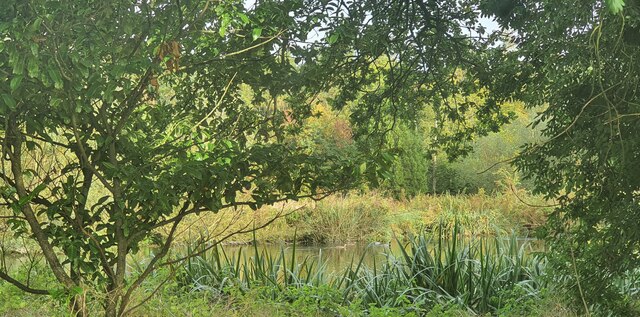
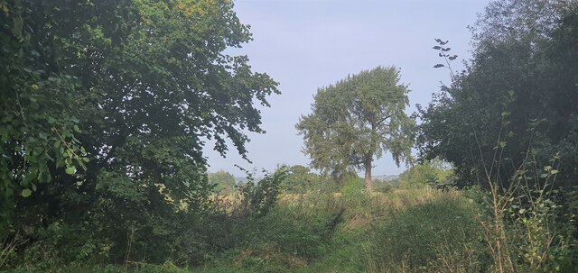
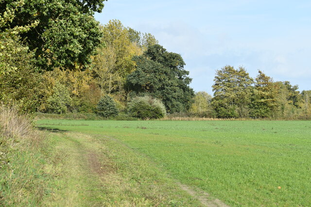
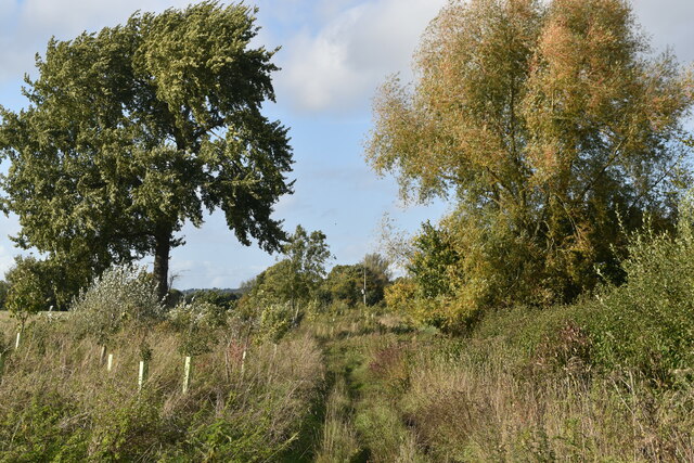
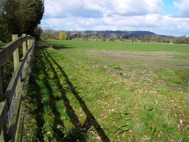
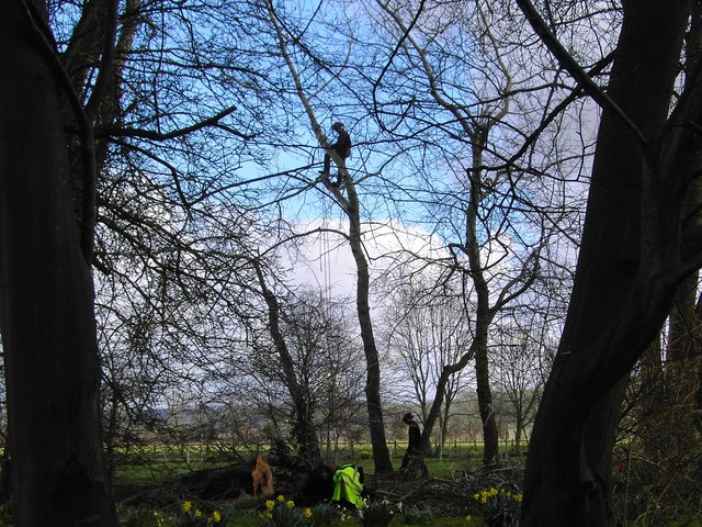
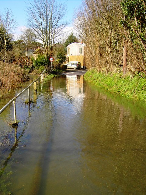
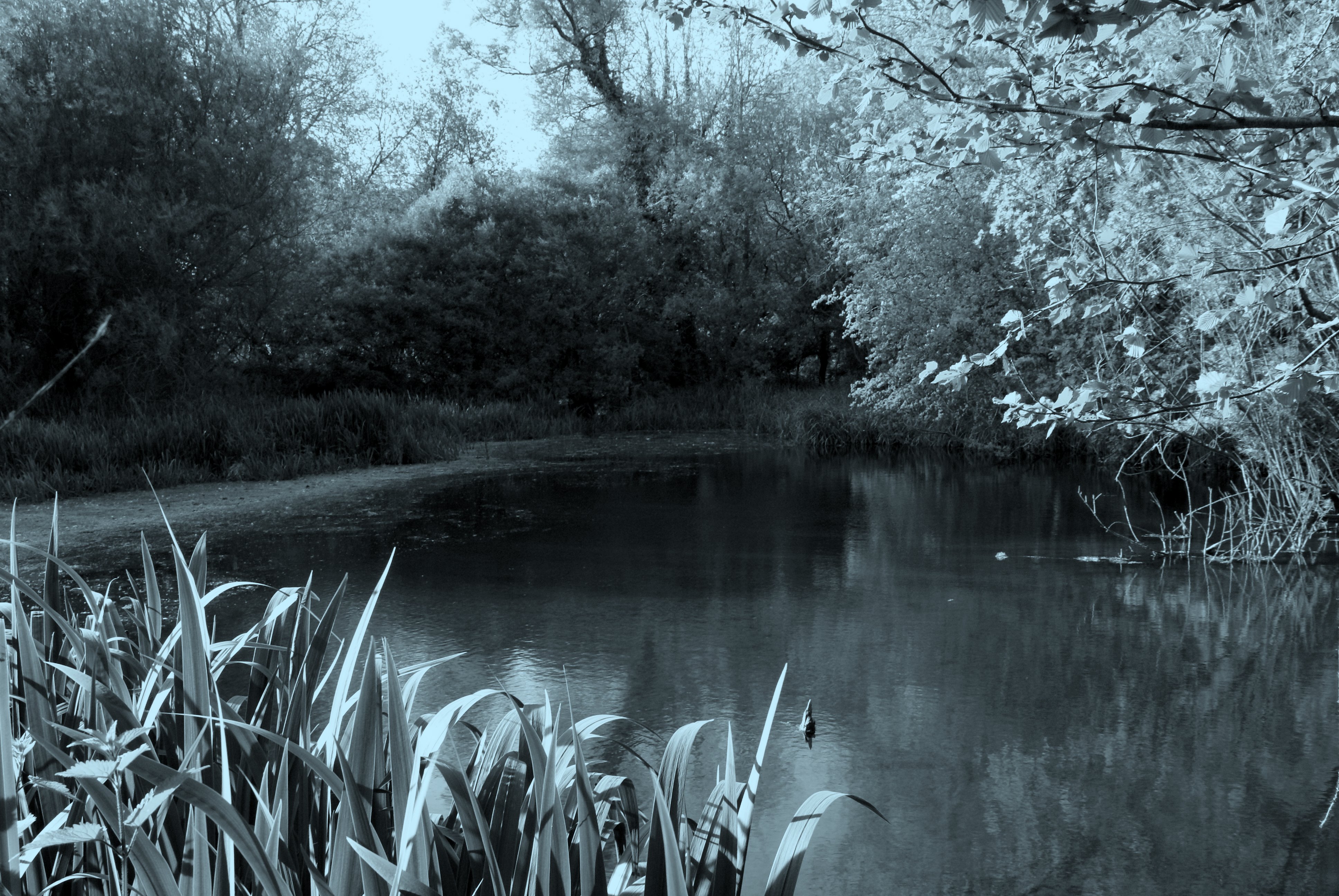
Little Ann Copse is a small woodland area located in the county of Wiltshire, England. Nestled within the picturesque landscape, this copse is known for its natural beauty and tranquil atmosphere. Spanning an area of approximately 20 acres, it is characterized by a dense collection of trees, predominantly consisting of oak, beech, and ash.

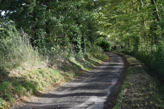
The copse is a popular destination for nature enthusiasts and hikers, offering a variety of walking trails that meander through the woodlands. The well-maintained paths allow visitors to explore the diverse flora and fauna that call this woodland home. Bluebells, wild garlic, and primroses bloom in abundance during the spring, creating a vibrant and colorful display.

Little Ann Copse also serves as an important habitat for various wildlife species. Birdwatchers can spot a range of bird species, including woodpeckers, owls, and various songbirds. Additionally, squirrels, rabbits, and foxes can be seen darting through the undergrowth, adding to the charm and natural ambiance of the area.

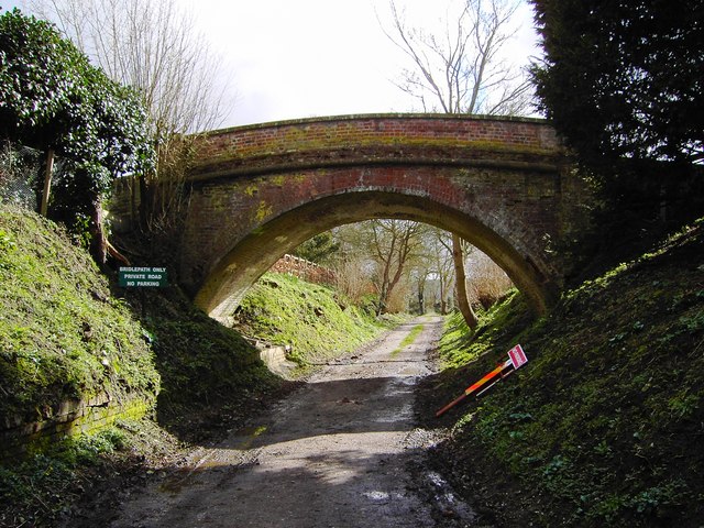
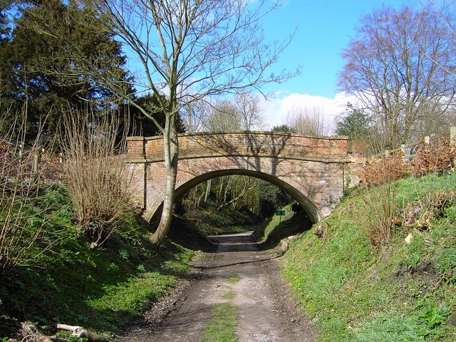
The copse is easily accessible, with a small parking area available for visitors. There are no specific facilities or amenities on-site, making it a perfect spot for those seeking an escape from the hustle and bustle of everyday life. The serene environment and the soothing sounds of nature make Little Ann Copse a haven for relaxation and a great place to connect with the natural world.

If you have any feedback on the listing, please let us know in the comments section below.

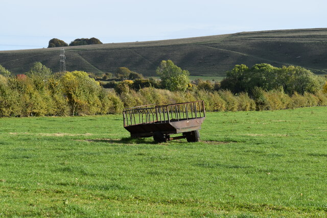
Little Ann Copse Images

Images are sourced within 2km of 51.345719/-1.7500542 or Grid Reference SU1760. Thanks to Geograph Open Source API. All images are credited.

Milton Lilbourne, Wiltshire A small pond to the north of Clay Lane, located to the south of the village of Milton Lilbourne.
Milton Lilbourne, Wiltshire
A small pond to the north of Clay Lane, located to the south of the village of Milton Lilbourne.
Pewsey, Wiltshire Farmland between Pewsey and the village of Milton Lilbourne. In the far distance Martinsell Hill can just be seen.
Pewsey, Wiltshire
Farmland between Pewsey and the village of Milton Lilbourne. In the far distance Martinsell Hill can just be seen.
Lane from Milton Lilbourne towards Priory Cottage
View across farmland to Milton Hill
Field edge path south of Abbey Farm
Old trailer in field south of Clay Lane
Grassy Bridleway south of Fyfield
River Street, Pewsey
Shops for sale in River Street, Pewsey
Pewsey, Wiltshire The church of St John the Baptist
Pewsey, Wiltshire
The church of St John the Baptist
Bridge over bridleway, Southcott, Wiltshire The bridge appears to be a private one as it is not the route of a right of way or old railway. The sign at the left of the bridge states, 'Bridlepath only, private road, no parking'.
Bridge over bridleway, Southcott, Wiltshire
The bridge appears to be a private one as it is not the route of a right of way or old railway. The sign at the left of the bridge states, 'Bridlepath only, private road, no parking'.
Bridge over bridleway, Southcott, Wiltshire (2) A look at the bridge from the south. Quite attractive in an unassuming sort of way.
Bridge over bridleway, Southcott, Wiltshire (2)
A look at the bridge from the south. Quite attractive in an unassuming sort of way.
Field near Southcott, Wiltshire Rather featureless land. On the skyline is Martinsell Hill at SU175637.
Field near Southcott, Wiltshire
Rather featureless land. On the skyline is Martinsell Hill at SU175637.
Tree surgery in progress, Southcott, Wiltshire The man in the tree seemed to be the one in charge of operations.
Tree surgery in progress, Southcott, Wiltshire
The man in the tree seemed to be the one in charge of operations.
Flooded road, Southcott, Wiltshire According to the map, the watercourse to the left of the railings is the River Avon. It has overflowed at this point following recent rain.
Flooded road, Southcott, Wiltshire
According to the map, the watercourse to the left of the railings is the River Avon. It has overflowed at this point following recent rain.
Pewsey: The Church of St John the Baptist There has been a church here since before Norman times, although the nave is the earliest part of the current structure, probably dating from the 12th century with the aisles probably added in the 13th century. The tower is early 16th century and there have been numerous additions, rebuildings and renovations since. The road in front is, unsurprisingly, Church Street, but is also the A345 to Amesbury.
Pewsey: The Church of St John the Baptist
There has been a church here since before Norman times, although the nave is the earliest part of the current structure, probably dating from the 12th century with the aisles probably added in the 13th century. The tower is early 16th century and there have been numerous additions, rebuildings and renovations since. The road in front is, unsurprisingly, Church Street, but is also the A345 to Amesbury.
Pewsey: The Court House Like its neighbour <a href="https://www.geograph.org.uk/photo/1401569">SU1659 : Pewsey: The Church of St John the Baptist</a> the Court House was built on a knoll of rising ground away from land liable to flood from the Avon. The building was probably built as the rectory house, the original part dating from the late 16th century being the two storey, two bay, house with the thatched porch at the far end here. The two storey addition with decorative half-timbering in the gable end nearer the photographer is thought to have been a fairly rapid addition, while the single storey part nearest the camera is a later extension, but again added not long after the original house was built. After the new rectory was built to the east in the early 18th century the house probably took on the function of a local court.

This was an unplanned reproduction of a Francis Frith image of 1955 <span class="nowrap"><a title="https://www.francisfrith.com/pewsey/pewsey-the-court-house-c1955_p51010" rel="nofollow ugc noopener" href="https://www.francisfrith.com/pewsey/pewsey-the-court-house-c1955_p51010">Link</a><img style="margin-left:2px;" alt="External link" title="External link - shift click to open in new window" src="https://s1.geograph.org.uk/img/external.png" width="10" height="10"/></span> from virtually the same viewpoint. The only major change since 1955 appears to be the loss of the hedge along the front of the house.
Pewsey: The Court House
Like its neighbour SU1659 : Pewsey: The Church of St John the Baptist the Court House was built on a knoll of rising ground away from land liable to flood from the Avon. The building was probably built as the rectory house, the original part dating from the late 16th century being the two storey, two bay, house with the thatched porch at the far end here. The two storey addition with decorative half-timbering in the gable end nearer the photographer is thought to have been a fairly rapid addition, while the single storey part nearest the camera is a later extension, but again added not long after the original house was built. After the new rectory was built to the east in the early 18th century the house probably took on the function of a local court. This was an unplanned reproduction of a Francis Frith image of 1955 LinkExternal link from virtually the same viewpoint. The only major change since 1955 appears to be the loss of the hedge along the front of the house.
Farmland, Pewsey A wheat crop to the south of Swan Meadow. Looking towards Green Drove Farm and the scarp of Pewsey Hill.
Farmland, Pewsey
A wheat crop to the south of Swan Meadow. Looking towards Green Drove Farm and the scarp of Pewsey Hill.
Show me another place!

Little Ann Copse is located at Grid Ref: SU1760 (Lat: 51.345719, Lng: -1.7500542)

Unitary Authority: Wiltshire

Police Authority: Wiltshire

What 3 Words

///defenders.rejected.relaxed. Near Pewsey, Wiltshire

Related Wikis

Fyfield, Milton Lilbourne

Fyfield is a small hamlet about 1 mile (1.6 km) east of Pewsey, Wiltshire, England. It is to be distinguished from the larger village of Fyfield, three...

Jones's Mill

Jones's Mill (grid reference SU168613) is an 11.6 hectare biological Site of Special Scientific Interest near Pewsey in Wiltshire, notified in 1975. The...

Pewsey Vale F.C.

Pewsey Vale F.C. is a football club based in the village of Pewsey, Wiltshire, England. They play in the Wiltshire Premier League. == History == The club...

Pewsey

Pewsey is a large village and civil parish at the centre of the Vale of Pewsey in Wiltshire, about 6 miles (10 km) south of Marlborough and 71 miles (114...

Pewsey railway station

Pewsey railway station serves the large village of Pewsey in the county of Wiltshire, England. The station is on the Berks and Hants line, 75 miles 26...

Milton Lilbourne

Milton Lilbourne is a village and civil parish in the county of Wiltshire, England, in the Vale of Pewsey between Pewsey and Burbage. It is largely a mixed...

Pewsey Vale School

Pewsey Vale School is a small, mixed secondary school in Pewsey, Wiltshire, England, for children aged 11 to 16. It became an academy in July 2011. The...

Clench, Wiltshire

Clench is a hamlet in Wiltshire, England, in the Vale of Pewsey to the east of Wootton Rivers. It is in the civil parish of Milton Lilbourne. Its nearest...

Nearby Amenities

Located within 500m of 51.345719,-1.7500542
Post Box
Brand: Royal Mail
Brand Wikidata: Q638098
Collection Times: Mo-Fr 09:00; Sa 07:00
Drive Through: no
Operator: Royal Mail
Operator Wikidata: Q638098
Post Box Type: lamp
Ref: SN9 14
Royal Cypher: EIIR
Royal Cypher Wikidata: Q33102113
Lat/Long: 51.3460688/-1.7513359
Power: pole
Lat/Long: 51.3450004/-1.7571071
Power: pole
Lat/Long: 51.3458968/-1.7554119
Power: pole
Lat/Long: 51.3465284/-1.7544812
Power: pole
Lat/Long: 51.3469573/-1.7538294
Power: pole
Lat/Long: 51.3469522/-1.755605
Power: pole
Lat/Long: 51.3470058/-1.753816
Power: pole
Lat/Long: 51.3474783/-1.7518956
Power: pole
Lat/Long: 51.3479507/-1.7500502
Power: pole
Lat/Long: 51.3484198/-1.7481405
Power: pole
Lat/Long: 51.3484282/-1.7463648
Power: pole
Lat/Long: 51.3484516/-1.7447153
The data included in this document is from www.openstreetmap.org. The data is made available under ODbL.

Have you been to Little Ann Copse?

Leave your review of Little Ann Copse below (or comments, questions and feedback).