Honey Joan Wood

Wood, Forest in Yorkshire

England

Honey Joan Wood

Potter Brow Road, Baildon Moor
Potter Brow Road, Baildon Moor Credit: habiloid

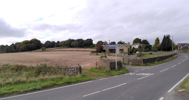
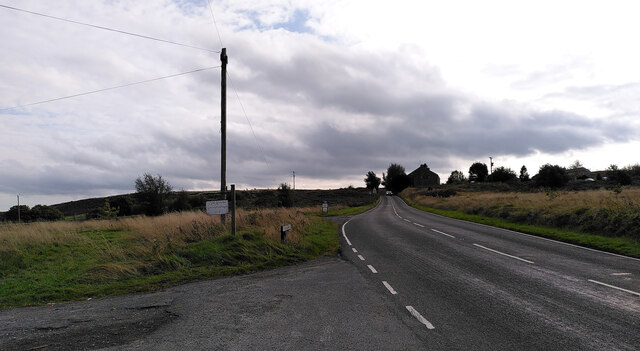
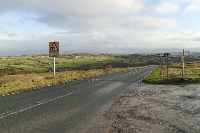
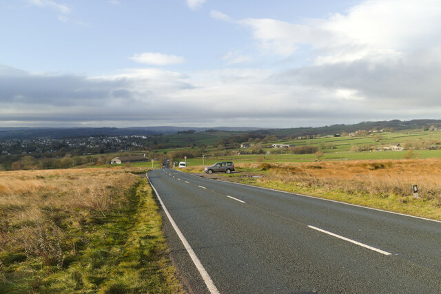
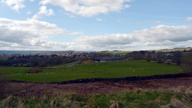
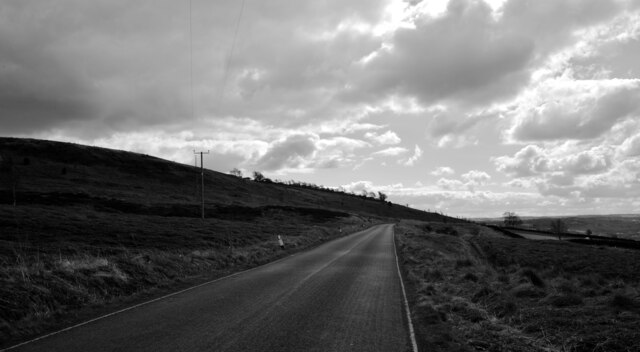
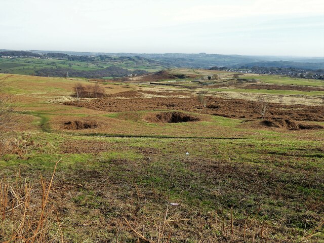
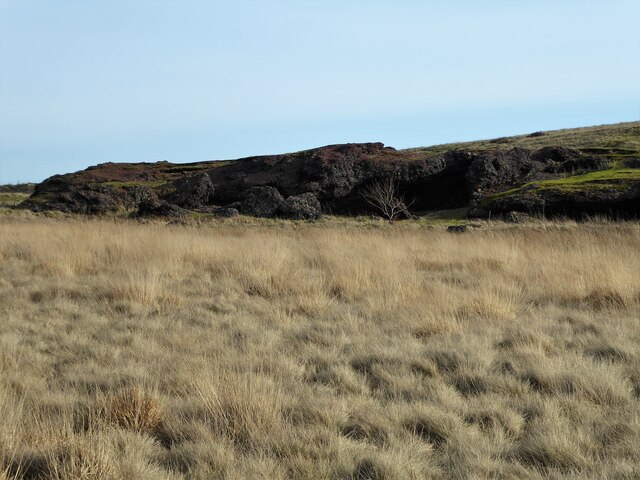
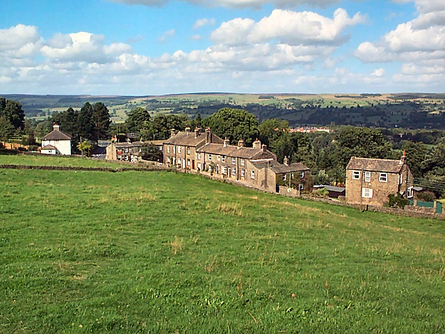
Honey Joan Wood, Yorkshire, also known as Wood or Forest, is a picturesque and serene area located in the county of Yorkshire, England. Situated amidst the captivating beauty of the North York Moors National Park, this charming woodland offers visitors a delightful escape from the hustle and bustle of city life.

Honey Joan Wood is characterized by its dense and ancient forest, which boasts a rich diversity of flora and fauna. The woodland is home to a range of tree species, including oak, ash, birch, and beech, creating a stunning tapestry of colors that change with the seasons. The forest floor is carpeted with vibrant wildflowers, enhancing the natural beauty of the area.

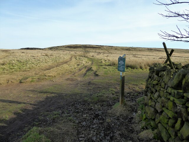
Nature enthusiasts will find plenty to explore in Honey Joan Wood. The woodland offers numerous walking trails and paths that wind through its enchanting landscape, providing opportunities to observe the local wildlife. Visitors may chance upon deer, foxes, badgers, and a variety of bird species, making it a paradise for birdwatchers.

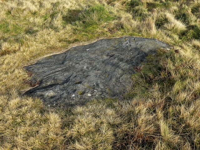
Moreover, Honey Joan Wood is steeped in history and folklore. It is said that the wood has been a source of inspiration for local legends and tales, adding a touch of mysticism to the area. The ancient ruins of a medieval priory can also be found nearby, further adding to the historical significance of the place.

With its natural beauty, tranquil atmosphere, and rich history, Honey Joan Wood, Yorkshire, is a must-visit destination for those seeking a peaceful retreat in the heart of nature.

If you have any feedback on the listing, please let us know in the comments section below.

Honey Joan Wood Images

Images are sourced within 2km of 53.868987/-1.7705433 or Grid Reference SE1541. Thanks to Geograph Open Source API. All images are credited.

Potter Brow Road, Baildon Moor
Hawksworth Road, Baildon Moor
Bingley Road, Baildon Moor Approaching the bends near Baildon Golf Club.
Bingley Road, Baildon Moor
Approaching the bends near Baildon Golf Club.
Bingley Road approaching Glovershaw Farm
Looking towards Glovershaw Farm from Glen Road, Baildon
Glen Road, Baildon
Glen Road, Baildon
Glovershaw Lane, Baildon
Junction of Bingley Road and Glen Road, Baildon
Glen Road, Baildon
Glen Road, Baildon
Modern milestone On the north-west corner of the cross roads west of Hawksworth, Hillings Lane/Old Lane/Mill Lane/Goose Lane.  When this was set up in 2002 the faces were painted white with the top and lettering in black.
Modern milestone
On the north-west corner of the cross roads west of Hawksworth, Hillings Lane/Old Lane/Mill Lane/Goose Lane. When this was set up in 2002 the faces were painted white with the top and lettering in black.
Old Bell Pit remains View from the bridleway to Dobrudden with the disused Baildon reservoir embankments beyond the pit hollows
Old Bell Pit remains
View from the bridleway to Dobrudden with the disused Baildon reservoir embankments beyond the pit hollows
Bridleway to Baildon Hill At the corner of Dobrudden Caravan Park where bridleways cross one another, with Baildon Hill ahead.
Bridleway to Baildon Hill
At the corner of Dobrudden Caravan Park where bridleways cross one another, with Baildon Hill ahead.
The Cinder Caves An old tip of furnace type waste on Baildon Moor that appears like a lava flow  with hollows and 'caves'.
The Cinder Caves
An old tip of furnace type waste on Baildon Moor that appears like a lava flow with hollows and 'caves'.
Cup marked rock On Baildon Moor described as having four clear cups and one possible cup, possible ring & groove
Cup marked rock
On Baildon Moor described as having four clear cups and one possible cup, possible ring & groove
The Dales Way Link Path near Golcar Farm, Eldwick
Hillings Lane This road heads north towards Ilkley, skirting the edge of Rombalds Moor (left).
Hillings Lane
This road heads north towards Ilkley, skirting the edge of Rombalds Moor (left).
Hawksworth Equestrian Centre Off Hillings Lane.  Rombalds Moor in the background. See <a href="https://www.geograph.org.uk/photo/6625884">SE1542 : Hawksworth Equestrian Centre, Hillings Lane</a> for a closer view of the main building.
Hawksworth Equestrian Centre
Off Hillings Lane. Rombalds Moor in the background. See SE1542 : Hawksworth Equestrian Centre, Hillings Lane for a closer view of the main building.
New Dam The name is given to a very small reservoir on the Jum Beck and presumably supplied Hawksworth Mill <a href="https://www.geograph.org.uk/photo/4128675">SE1541 : Remains of Hawksworth Corn Mill</a>. See also <a href="https://www.geograph.org.uk/photo/996920">SE1542 : Lake viewed from Hillings Lane, Hawksworth</a>.
New Dam
The name is given to a very small reservoir on the Jum Beck and presumably supplied Hawksworth Mill SE1541 : Remains of Hawksworth Corn Mill. See also SE1542 : Lake viewed from Hillings Lane, Hawksworth.
Show me another place!

Honey Joan Wood is located at Grid Ref: SE1541 (Lat: 53.868987, Lng: -1.7705433)

Division: West Riding

Unitary Authority: Leeds

Police Authority: West Yorkshire

What 3 Words

///yoga.prices.bucks. Near Baildon, West Yorkshire

Related Wikis

Hawksworth, Guiseley

Hawksworth is a village 1 mile (1.6 km) west of the town of Guiseley in West Yorkshire, England. It is located to the south of Menston and north of Baildon...

Baildon Urban District

Baildon was an urban district in the West Riding of Yorkshire, England between 1894 and 1974. It was enlarged on 1 April 1937 by gaining part of Wharfedale...

Colne Valley Urban District

Colne Valley was an urban district in the West Riding of Yorkshire, England between 1937 and 1974. It takes its name from the River Colne which rises above...

Baildon

Baildon is a town and civil parish in the Bradford Metropolitan Borough in West Yorkshire, England and within the historic boundaries of the West Riding...

Baildon railway station

Baildon railway station serves the town of Baildon near Shipley in West Yorkshire, England. The station reopened under British Rail on 5 January 1973,...
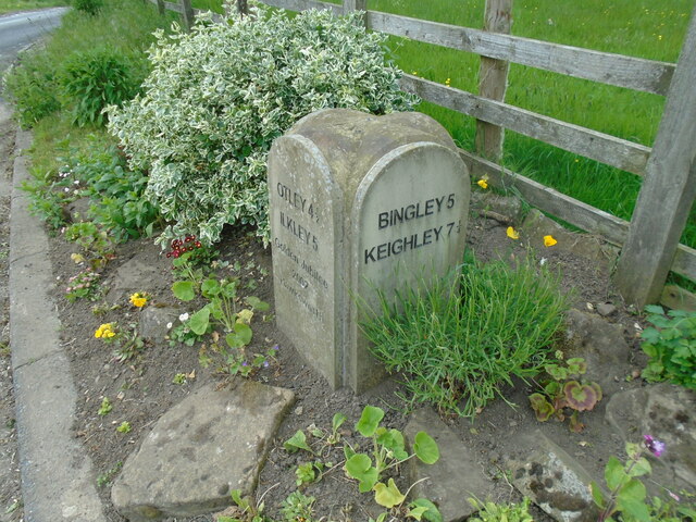
Welcome Way

The Welcome Way is a 36-mile (58 km) walking route in West Yorkshire, England. It connects Otley, Baildon, Burley in Wharfedale and Bingley, and takes...

Burley Woodhead

Burley Woodhead is a hamlet in the City of Bradford, in West Yorkshire, England. The hamlet is 1 mile (1.6 km) to the south-west of Burley in Wharfedale...

High Royds Hospital

High Royds Hospital is a former psychiatric hospital south of the village of Menston, West Yorkshire, England. The hospital, which opened in 1888, closed...

Nearby Amenities

Located within 500m of 53.868987,-1.7705433
Source: landsat
Lat/Long: 53.8695575/-1.7670426
Source: landsat
Lat/Long: 53.8689302/-1.7673451
Source: landsat
Lat/Long: 53.8685608/-1.7678483
Source: landsat
Lat/Long: 53.8676374/-1.7673179
Source: landsat
Lat/Long: 53.8669447/-1.7657122
Source: landsat
Lat/Long: 53.867098/-1.7672855
Source: landsat
Lat/Long: 53.8674005/-1.7686181
Source: landsat
Lat/Long: 53.8676458/-1.7690917
Source: landsat
Lat/Long: 53.8678446/-1.7692173
Source: landsat
Lat/Long: 53.8669512/-1.7694859
Source: landsat
Lat/Long: 53.8666367/-1.7685946
Source: landsat
Lat/Long: 53.8666093/-1.7666652
Source: landsat
Lat/Long: 53.8665789/-1.765568
Source: landsat
Lat/Long: 53.86673/-1.7651233
Source: landsat
Lat/Long: 53.8671018/-1.7639708
Source: landsat
Lat/Long: 53.867491/-1.765397
Source: landsat
Lat/Long: 53.8673904/-1.7660115
Source: landsat
Lat/Long: 53.8687071/-1.7667788
Source: landsat
Lat/Long: 53.8689081/-1.7667207
Source: landsat
Lat/Long: 53.8698122/-1.7666456
Note: FIXME - power line continues; survey required
Power: tower
Source: OS 1:25k
Lat/Long: 53.867355/-1.7715366
Round Hill
Natural: peak
Source: OS 1:25k
Lat/Long: 53.8698453/-1.7636417
Honey Joan Hill
Natural: peak
Source: OS 1:25k
Lat/Long: 53.8684725/-1.7648541
Power: tower
Source: OS 1:25k;Bing
Lat/Long: 53.8661119/-1.7680309
Power: tower
Source: OS 1:25k;Bing
Lat/Long: 53.8682753/-1.7743722
Access: no
Barrier: stile
Foot: yes
Material: stone
Stile: stepover
Lat/Long: 53.8664302/-1.768147
Access: no
Barrier: stile
Foot: yes
Material: stone
Stile: stepover
Lat/Long: 53.8657423/-1.7681248
Access: no
Barrier: kissing_gate
Foot: yes
Lat/Long: 53.8658054/-1.7703276
Access: no
Barrier: kissing_gate
Foot: yes
Lat/Long: 53.8655062/-1.7703847
Barrier: stile
Material: stone
Step Count: 5
Stile: stepover
Lat/Long: 53.873168/-1.7709824
Design: h-frame
Power: tower
Lat/Long: 53.8687906/-1.7743986
Power: pole
Lat/Long: 53.8696692/-1.7721281
Power: pole
Lat/Long: 53.8700938/-1.7701332
Power: pole
Lat/Long: 53.8699801/-1.7681172
Power: pole
Lat/Long: 53.8688962/-1.7653053
The data included in this document is from www.openstreetmap.org. The data is made available under ODbL.

Have you been to Honey Joan Wood?

Leave your review of Honey Joan Wood below (or comments, questions and feedback).