Eaves Wood

Wood, Forest in Yorkshire

England

Eaves Wood

The Southern End of Black Hill Looking across Hebden Dale from Mount Pleasant.  The farm to the left is Mansfield House and the one to the right is Black Scout.
The Southern End of Black Hill Credit: Steve Partridge

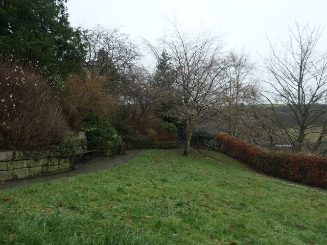
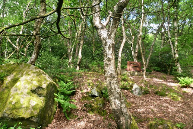
Eaves Wood, located in the county of Yorkshire, England, is a picturesque woodland that covers an area of approximately 200 acres. Situated near the village of Silverdale, it forms part of the larger Arnside and Silverdale Area of Outstanding Natural Beauty. Eaves Wood is renowned for its diverse range of flora and fauna, making it an ideal spot for nature enthusiasts and walkers alike.

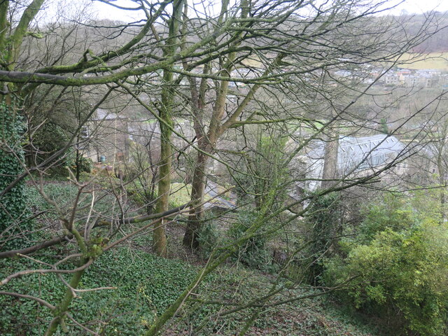
The wood is predominantly made up of broadleaf trees, including oak, beech, and birch, which create a rich and vibrant canopy throughout the seasons. The forest floor is carpeted with a variety of wildflowers, ferns, and mosses, adding a burst of color to the landscape. Eaves Wood is also home to numerous bird species, such as woodpeckers, thrushes, and owls, providing a haven for birdwatchers.

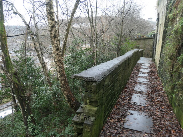
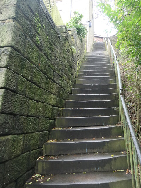
Trails and footpaths wind their way through Eaves Wood, offering visitors the opportunity to explore its beauty at their own pace. One of the highlights is the Fairy Steps, a narrow rocky staircase that leads up a limestone cliff face. Legend has it that if you can climb the steps without touching the sides, the fairies will grant you a wish.

The wood is easily accessible, with a car park and nearby public transportation options available for visitors. There are also picnic areas and benches scattered throughout the woodland, providing the perfect spot to relax and soak in the tranquility of the surroundings.

Eaves Wood, with its enchanting atmosphere and natural beauty, is a cherished gem within the Yorkshire countryside, captivating all who venture into its embrace.

If you have any feedback on the listing, please let us know in the comments section below.

Eaves Wood Images

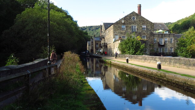
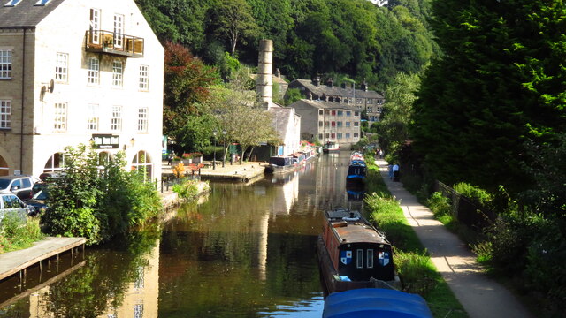
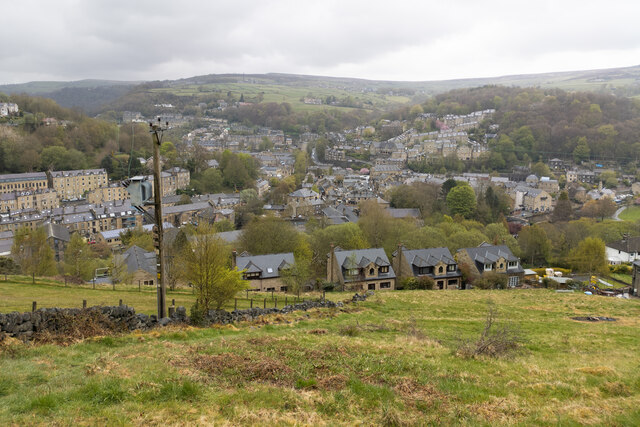
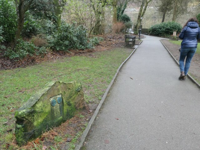
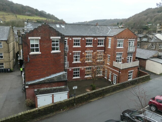
Images are sourced within 2km of 53.748962/-2.0279709 or Grid Reference SD9828. Thanks to Geograph Open Source API. All images are credited.

The Southern End of Black Hill Looking across Hebden Dale from Mount Pleasant.  The farm to the left is Mansfield House and the one to the right is Black Scout.
The Southern End of Black Hill
Looking across Hebden Dale from Mount Pleasant. The farm to the left is Mansfield House and the one to the right is Black Scout.
Halifax Road at Calderside View from rail line on Whiteley Arches
Halifax Road at Calderside
View from rail line on Whiteley Arches
Oakville Road at Calderside View from Rochdale to Leeds railway
Oakville Road at Calderside
View from Rochdale to Leeds railway
The aqueduct carrying the Rochdale Canal over the Calder at Hebden Bridge The Rochdale Canal runs for 33 miles between Manchester and Sowerby Bridge in West Yorkshire, UK. In Sowerby Bridge it connects with the Calder and Hebble Navigation. In Manchester it connects with the Ashton and Bridgewater Canals. 

The canal was opened between Sowerby Bridge and Todmorden and from Manchester to Rochdale in 1799 and between Todmorden and Rochdale in 1805. Most of the canal was closed in 1952. Restoration work began in late 1980s and by  1996 the canal was opened to navigation once again between Sowerby Bridge and the summit level. The canal was re-opened to navigation along its entire length in July 2002 and forms part of the South Pennine Ring. 

<span class="nowrap"><a title="http://www.penninewaterways.co.uk/rochdale/index.htm" rel="nofollow ugc noopener" href="http://www.penninewaterways.co.uk/rochdale/index.htm">Link</a><img style="margin-left:2px;" alt="External link" title="External link - shift click to open in new window" src="https://s1.geograph.org.uk/img/external.png" width="10" height="10"/></span>
The aqueduct carrying the Rochdale Canal over the Calder at Hebden Bridge
The Rochdale Canal runs for 33 miles between Manchester and Sowerby Bridge in West Yorkshire, UK. In Sowerby Bridge it connects with the Calder and Hebble Navigation. In Manchester it connects with the Ashton and Bridgewater Canals. The canal was opened between Sowerby Bridge and Todmorden and from Manchester to Rochdale in 1799 and between Todmorden and Rochdale in 1805. Most of the canal was closed in 1952. Restoration work began in late 1980s and by 1996 the canal was opened to navigation once again between Sowerby Bridge and the summit level. The canal was re-opened to navigation along its entire length in July 2002 and forms part of the South Pennine Ring. LinkExternal link
Seat at eastern end of Horsehold Wood & view over Calderside A seat with a view.
Seat at eastern end of Horsehold Wood & view over Calderside
A seat with a view.
View towards Hebden Bridge from eastern end of Horsehold Wood
Rochdale Canal at Hebden Bridge
Hebden Bridge viewed from hills to the south west
Warship adoption plaque, Hebden Bridge In the Memorial Gardens. "The plaque marks the adoption by Heben Bridge and Heptonstall of H.M.S. Bradford during Warship Week, 1942. It shows reliefs of the Old Bridge and Heptonstall's ruined Church." Quoted from 'Hebden Bridge Trail', published by Calder Civic Trust Ltd in 1979.
Warship adoption plaque, Hebden Bridge
In the Memorial Gardens. "The plaque marks the adoption by Heben Bridge and Heptonstall of H.M.S. Bradford during Warship Week, 1942. It shows reliefs of the Old Bridge and Heptonstall's ruined Church." Quoted from 'Hebden Bridge Trail', published by Calder Civic Trust Ltd in 1979.
Memorial garden, off Birchcliffe Road, Hebden Bridge A plaque in the north-western corner reads "This garden was opened on 8th June 1961 by Mrs P. K. Griffiths, of Maidenhead, and is the gift of Mrs Lilian Blackburn of Darlington, formerly of Hebden Bridge, in loving and treasured memory of her elder daughter, June Megan Blackburn, who died on 11th February 1932, aged 9 yaars".
Memorial garden, off Birchcliffe Road, Hebden Bridge
A plaque in the north-western corner reads "This garden was opened on 8th June 1961 by Mrs P. K. Griffiths, of Maidenhead, and is the gift of Mrs Lilian Blackburn of Darlington, formerly of Hebden Bridge, in loving and treasured memory of her elder daughter, June Megan Blackburn, who died on 11th February 1932, aged 9 yaars".
The western end of Common Bank Wood, Hebden Bridge High above Commercial Street, but far below Birchcliffe Road.
The western end of Common Bank Wood, Hebden Bridge
High above Commercial Street, but far below Birchcliffe Road.
Hillside path, leading towards Union Street Off Hebden Bridge's 'Hundred Steps'.
Hillside path, leading towards Union Street
Off Hebden Bridge's 'Hundred Steps'.
Steps between Commercial St and Osborne St, Hebden Bridge The top two-thirds of the 'Hundred Steps'. "This flight of steps, providing relatively easy access between Osborne Street and Commercial Street, actually consists of 106 steps altogether. It vividly indicates the local difficulties which Victorian builders had to overcome on this hillside."  Quoted from 'Hebden Bridge Trail', published by Calder Civic Trust Ltd in 1979.
Steps between Commercial St and Osborne St, Hebden Bridge
The top two-thirds of the 'Hundred Steps'. "This flight of steps, providing relatively easy access between Osborne Street and Commercial Street, actually consists of 106 steps altogether. It vividly indicates the local difficulties which Victorian builders had to overcome on this hillside." Quoted from 'Hebden Bridge Trail', published by Calder Civic Trust Ltd in 1979.
The Crofts, Garden Street, Hebden Bridge A former clothing factory, which was converted into nine flats in 2002.
The Crofts, Garden Street, Hebden Bridge
A former clothing factory, which was converted into nine flats in 2002.
Old Boundary Marker on Palace House Road, Hebden Bridge Township Boundary Marker on Palace House Road, Hebden Bridge, inscribed in the east parapet of the bridge over the Calder Valley Railway. Formerly on the boundary of Erringden and Sowerby townships in Halifax parish. It marked the boundary of the Sowerby Ramble, a narrow strip of land along the Calder valley and up Stoodley Glen between Erringden and Stansfield townships and Erringden and Langfield townships. Sowerby Ramble was part of Sowerby township but in 1850 it became part of Erringden township, later parish. This marker is now entirely in Hebden Royd parish. Inscribed with a reversed S for Sowerby.

Milestone Society National ID: YW_HEBR04pb
Old Boundary Marker on Palace House Road, Hebden Bridge
Township Boundary Marker on Palace House Road, Hebden Bridge, inscribed in the east parapet of the bridge over the Calder Valley Railway. Formerly on the boundary of Erringden and Sowerby townships in Halifax parish. It marked the boundary of the Sowerby Ramble, a narrow strip of land along the Calder valley and up Stoodley Glen between Erringden and Stansfield townships and Erringden and Langfield townships. Sowerby Ramble was part of Sowerby township but in 1850 it became part of Erringden township, later parish. This marker is now entirely in Hebden Royd parish. Inscribed with a reversed S for Sowerby. Milestone Society National ID: YW_HEBR04pb
Rawtonstall Wood The wood with a view to the memorial to Jeffery Stinson, an architect
Rawtonstall Wood
The wood with a view to the memorial to Jeffery Stinson, an architect
Oakville Road and Railway View towards Hebden Bridge where road and rail are hardly separated. A rail track cleaning train is going over Whiteley Arches
Oakville Road and Railway
View towards Hebden Bridge where road and rail are hardly separated. A rail track cleaning train is going over Whiteley Arches
Show me another place!

Eaves Wood is located at Grid Ref: SD9828 (Lat: 53.748962, Lng: -2.0279709)

Division: West Riding

Unitary Authority: Calderdale

Police Authority: West Yorkshire

What 3 Words

///takeover.emblem.defensive. Near Hebden Bridge, West Yorkshire

Related Wikis

Hepton Rural District

Hepton was a rural district in the West Riding of Yorkshire, England, from 1894 to 1974. The district included four civil parishes: Heptonstall, Blackshaw...

Heptonstall

Heptonstall is a small village and civil parish within the Calderdale borough of West Yorkshire, England, historically part of the West Riding of Yorkshire...

Hebden Bridge Town Hall

Hebden Bridge Town Hall, formerly Hebden Bridge Council Offices, is a municipal building in St George's Street, Hebden Bridge, West Yorkshire, England...

Battle of Heptonstall

The Battle of Heptonstall occurred in November 1643 during the First English Civil War at Hebden Bridge and Heptonstall, Yorkshire. During the battle,...

Nearby Amenities

Located within 500m of 53.748962,-2.0279709
Heptonstall
Place: village
Population: 1400
Wikidata: Q2677260
Wikipedia: en:Heptonstall
Lat/Long: 53.748713/-2.0209069
Bus Stop
Hepton Drive Longfield
Bus: yes
Local Ref: 45019595
Naptan AtcoCode: 450019595
Naptan Bearing: SW
Naptan CommonName: Hepton Drive Longfield
Naptan Crossing: Longfield
Naptan Indicator: Stop 45019595
Naptan PlusbusZoneRef: LEEDS
Naptan ShortCommonName: Hepton Drive
Naptan Street: Hepton Drive
Naptan Verified: no
Public Transport: platform
Shelter: no
Source: naptan_import
Lat/Long: 53.7482884/-2.020844
Bus Stop
Hepton Drive
Bench: yes
Bin: yes
Bus: yes
Departures Board: timetable
Ele: 257.2
Local Ref: 45019596
Naptan AtcoCode: 450019596
Naptan Bearing: N
Naptan CommonName: Hepton Drive
Naptan Crossing: Church Lane
Naptan Indicator: Stop 45019596
Naptan PlusbusZoneRef: LEEDS
Naptan ShortCommonName: Hepton Drive
Naptan Street: Hepton Drive
Naptan Verified: no
Public Transport: platform
Shelter: yes
Source: naptan_import
Lat/Long: 53.7484571/-2.0208817
Bus Stop
Heptonstall Smithwell Lane
Local Ref: 45019597
Naptan AtcoCode: 450019597
Naptan Bearing: W
Naptan CommonName: Heptonstall Smithwell Lane
Naptan Crossing: Church Lane
Naptan Indicator: Stop 45019597
Naptan Landmark: Post Office
Naptan PlusbusZoneRef: LEEDS
Naptan ShortCommonName: Church Lane
Naptan Street: Town Gate
Naptan Verified: no
Source: naptan_import
Lat/Long: 53.7487136/-2.0205023
Bus Stop
Heptonstall Smithwell Lane
Local Ref: 45019598
Naptan AtcoCode: 450019598
Naptan Bearing: NW
Naptan CommonName: Heptonstall Smithwell Lane
Naptan Crossing: Back Lane
Naptan Indicator: Stop 45019598
Naptan PlusbusZoneRef: LEEDS
Naptan ShortCommonName: Towngate
Naptan Street: Smithwell Lane
Naptan Verified: no
Shelter: no
Source: naptan_import
Lat/Long: 53.7495222/-2.0225196
Bus Stop
Smithwell Lane Green Lane
Bench: no
Bus: yes
Departures Board: no
Local Ref: 45019599
Naptan AtcoCode: 450019599
Naptan Bearing: SE
Naptan CommonName: Smithwell Lane Green Lane
Naptan Crossing: Green Lane
Naptan Indicator: Stop 45019599
Naptan PlusbusZoneRef: LEEDS
Naptan ShortCommonName: Green Lane
Naptan Street: Smithwell Lane
Naptan Verified: no
Public Transport: platform
Shelter: no
Source: naptan_import
Lat/Long: 53.7521278/-2.027465
Bus Stop
Eaves
Bus: yes
Departures Board: timetable
Local Ref: 45023530
Naptan AtcoCode: 450023530
Naptan Bearing: N
Naptan CommonName: Eaves
Naptan Crossing: Ragley View
Naptan Indicator: Stop 45023530
Naptan Notes: L/C No Num
Naptan PlusbusZoneRef: LEEDS
Naptan ShortCommonName: Ragley View
Naptan Street: Eaves Avenue
Naptan Verified: yes
Public Transport: platform
Shelter: no
Source: naptan_import
Lat/Long: 53.7470042/-2.0282654
Bus Stop
Smithwell Lane Lane Head
Local Ref: 45025529
Naptan AtcoCode: 450025529
Naptan Bearing: SE
Naptan CommonName: Smithwell Lane Lane Head
Naptan Crossing: Nr-Opp Silver Street
Naptan Indicator: Stop 45025529
Naptan Landmark: School
Naptan Notes: OSR taken place 031005
Naptan PlusbusZoneRef: LEEDS
Naptan ShortCommonName: Lane Head
Naptan Street: Smithwell Lane
Naptan Verified: no
Source: naptan_import
Lat/Long: 53.7502319/-2.0245218
Bus Stop
Smithwell Lane Green Lane
Bench: no
Bus: yes
Departures Board: no
Local Ref: 45025755
Naptan AtcoCode: 450025755
Naptan Bearing: NW
Naptan CommonName: Smithwell Lane Green Lane
Naptan Crossing: Green Lane
Naptan Indicator: Stop 45025755
Naptan PlusbusZoneRef: LEEDS
Naptan ShortCommonName: Green Lane
Naptan Street: Smithwell Lane
Naptan Verified: no
Public Transport: platform
Shelter: no
Source: naptan_import
Lat/Long: 53.7519386/-2.0274801
Smithwell Lane Heptonstall J&I School
Local Ref: 45051539
Naptan AtcoCode: 450051539
Naptan Bearing: NW
Naptan BusStopType: CUS
Naptan CommonName: Smithwell Lane Heptonstall J&I School
Naptan Indicator: Stop 45051539
Naptan PlusbusZoneRef: LEEDS
Naptan ShortCommonName: Lane Head
Naptan Street: Smithwell Lane
Naptan Verified: no
Source: naptan_import
Lat/Long: 53.7501676/-2.0237824
Pub
The Cross Inn
Addr City: Hebden Bridge
Addr Country: GB
Addr Hamlet: Heptonstall
Addr Housenumber: 46
Addr Postcode: HX7 7NB
Addr Street: Towngate
Fhrs Id: 347173
Operator: Timothy Taylor
Source Addr: FHRS Open Data
Toilets Wheelchair: no
Wheelchair: yes
Wikidata: Q26520559
Lat/Long: 53.749202/-2.0208665
Pub
The White Lion
Operator: Thwaites
Toilets Wheelchair: no
Wheelchair: limited
Wikidata: Q26556301
Lat/Long: 53.7493313/-2.02141
Bench
Backrest: yes
Ele: 288
Material: wood
Seats: 2
Tourism: viewpoint
Lat/Long: 53.7521212/-2.0278158
Turning Circle
Lat/Long: 53.7514743/-2.0338226
002
Ele: 266.6
Lat/Long: 53.7489723/-2.0263612
Cafe
Towngate Tearoom
Addr City: Hebden Bridge
Addr Country: GB
Addr Hamlet: Heptonstall
Addr Housenumber: 34
Addr Postcode: HX7 7NB
Addr Street: Towngate
Fhrs Id: 347154
Source Addr: FHRS Open Data
Wheelchair: limited
Lat/Long: 53.7488212/-2.0204019
Turning Circle
Lat/Long: 53.7470268/-2.0282113
Waste Basket
Lat/Long: 53.7493708/-2.0218594
Post Box
Brand: Royal Mail
Brand Wikidata: Q638098
Brand Wikipedia: en:Royal Mail
Collection Times: Mo-Fr 16:45; Sa 11:45
Drive Through: no
Operator: Royal Mail
Operator Wikidata: Q638098
Post Box Type: wall
Ref: HX7 188
Royal Cypher: EIIR
Royal Cypher Wikidata: Q33102113
Lat/Long: 53.748944/-2.020669
Post Box
Brand: Royal Mail
Brand Wikidata: Q638098
Brand Wikipedia: en:Royal Mail
Collection Times: Mo-Fr 09:00; Sa 07:00
Operator: Royal Mail
Operator Wikidata: Q638098
Post Box Type: wall
Ref: HX7 276D
Royal Cypher: EIIR
Royal Cypher Wikidata: Q33102113
Lat/Long: 53.7478956/-2.0211786
Telephone
Booth: K6
Covered: booth
Ele: 253.1
Listed Status: Grade II
Phone: +44 1422 843665
Lat/Long: 53.748622/-2.0208369
Sylvia Plath Hughes
Buried Wikidata: Q133054
Cemetery: grave
Historic: memorial
Inscription: IN MEMORY SYLVIA PLATH HUGHES 1932 – 1963 EVEN AMIDST FIERCE FLAMES THE GOLDEN LOTUS CAN BE PLANTED
Material: stone
Memorial: yes
Wikidata: Q133054
Wikipedia: en:Sylvia Plath
Lat/Long: 53.7478654/-2.0232777
Defibrillator
Access: yes
Defibrillator Location: outside post office Towngate, Heptonstall
Emergency: defibrillator
Indoor: no
Lat/Long: 53.7489039/-2.0206683
Bench
Backrest: yes
Material: wood
Seats: 2
Lat/Long: 53.7521527/-2.0278195
Barrier: stile
Bicycle: no
Foot: yes
Horse: no
Material: stone
Motor Vehicle: no
Stile: squeezer
Lat/Long: 53.7512741/-2.0267176
Waste Basket
Lat/Long: 53.7500323/-2.023925
Bench
Lat/Long: 53.7490447/-2.0219873
Bench
Lat/Long: 53.7491195/-2.021864
Bench
Lat/Long: 53.7491958/-2.0217374
Bench
Lat/Long: 53.7492498/-2.0216879
Grit Bin
Lat/Long: 53.7496211/-2.0206806
Entrance: yes
Lat/Long: 53.7488049/-2.0217247
Bench
Backrest: yes
Material: wood
Seats: 2
Lat/Long: 53.7485476/-2.0209512
Bench
Backrest: yes
Material: wood
Seats: 2
Lat/Long: 53.7486063/-2.0209929
Bench
Backrest: yes
Material: wood
Seats: 2
Lat/Long: 53.7486466/-2.0209684
Bench
Backrest: yes
Material: wood
Seats: 2
Lat/Long: 53.748712/-2.0208691
Barrier: stile
Lat/Long: 53.7497912/-2.0213876
Entrance: yes
Lat/Long: 53.7487909/-2.0215077
Entrance: yes
Lat/Long: 53.7489915/-2.021674
Generator Method: photovoltaic
Generator Output Electricity: yes
Generator Source: solar
Generator Type: solar_photovoltaic_panel
Power: generator
Lat/Long: 53.7470076/-2.023464
Public Bookcase
Public Bookcase Type: wooden_cabinet
Lat/Long: 53.7469076/-2.0228464
Information: guidepost
Tourism: information
Lat/Long: 53.7487586/-2.020742
Information: board
Tourism: information
Lat/Long: 53.7487369/-2.0207599
The data included in this document is from www.openstreetmap.org. The data is made available under ODbL.

Have you been to Eaves Wood?

Leave your review of Eaves Wood below (or comments, questions and feedback).