Heptonstall

Settlement in Yorkshire

England

Heptonstall

Bridge Clough Looking northeast to Green Hirst Wood.
Bridge Clough Credit: John Topping

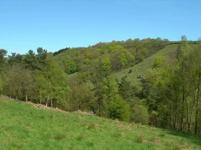
Heptonstall is a small village located in the Calderdale district of West Yorkshire, England. Situated on the southern slopes of the Pennines, it rests approximately 2 miles north of Hebden Bridge. With its picturesque setting, Heptonstall offers breathtaking views of the surrounding countryside and the valley below.

The village is known for its rich history, dating back to prehistoric times. It was mentioned in the Domesday Book of 1086, highlighting its long-standing presence. Heptonstall's medieval past is still evident in its architecture, as it boasts numerous well-preserved buildings, including the St. Thomas a Becket Church, which dates back to the 13th century. This ancient church is a prominent landmark and attracts visitors interested in its historical significance.

The village is also notable for its literary connections. The well-known poet Sylvia Plath is buried in Heptonstall's graveyard, drawing literary enthusiasts to pay their respects. Additionally, famous British poet Ted Hughes spent his childhood in the village, and his former residence, now a museum, offers insight into his life and work.

Despite its small size, Heptonstall is home to a vibrant community. The village hosts various events throughout the year, including the Heptonstall Festival, which showcases local talent in music, arts, and crafts. It also boasts a number of charming pubs, shops, and cafes that cater to both residents and tourists.

In summary, Heptonstall is a quaint and historically rich village in Yorkshire, offering visitors a glimpse into its past, stunning countryside views, and a warm community atmosphere.

If you have any feedback on the listing, please let us know in the comments section below.

Heptonstall Images

Images are sourced within 2km of 53.748781/-2.020545 or Grid Reference SD9828. Thanks to Geograph Open Source API. All images are credited.

Bridge Clough Looking northeast to Green Hirst Wood.
Bridge Clough
Looking northeast to Green Hirst Wood.
Weir on Bridge Clough, Wadsworth This is one of several weirs on this stream, and as there seems to be no open channel at that level I think that water must have been abstracted directly into a pipe laid in the river bank.
Weir on Bridge Clough, Wadsworth
This is one of several weirs on this stream, and as there seems to be no open channel at that level I think that water must have been abstracted directly into a pipe laid in the river bank.
Millpond above Bridge Clough, Wadsworth There is a string of millponds along the eastern hillside of Crimsworth Dean, above the stream where it is called Bridge Clough. These intercept streams coming down through Purprise Wood and Middle Dean Wood. They were built in 1860-1 to increase the supply of water to Midgehole Dyeworks (captioned Crimsworth Dyeworks on the 1:2500 map of c.1893). The works had been converted from Upper Midgehole Mill (cotton) during the 'Cotton Panic', a depression in the textile industry caused by overproduction and by import restrictions due to the American Civil War. (Information from 'From Fulling to Fustionopolis' website) The dyeworks survived until 2009. The uppermost millpond (they are also called water lodges) was on the other side of the stream, with outflow crossing the stream on an aqueduct bridge (not the one thus captioned on the current 'Explorer' map). There are also some weirs on the stream, but I don't know whether they also supplied water to the dyeworks, or perhaps to the Lower Midgehole cotton mill. A voluntary organisation called 'Slow the Flow, Calderdale', who are investigating ways to reduce the risk of flooding in the Calder Valley, considered recommending that the ponds be restored to store rainfall runoff, but I think that they probably found that the work would cost too much.
Millpond above Bridge Clough, Wadsworth
There is a string of millponds along the eastern hillside of Crimsworth Dean, above the stream where it is called Bridge Clough. These intercept streams coming down through Purprise Wood and Middle Dean Wood. They were built in 1860-1 to increase the supply of water to Midgehole Dyeworks (captioned Crimsworth Dyeworks on the 1:2500 map of c.1893). The works had been converted from Upper Midgehole Mill (cotton) during the 'Cotton Panic', a depression in the textile industry caused by overproduction and by import restrictions due to the American Civil War. (Information from 'From Fulling to Fustionopolis' website) The dyeworks survived until 2009. The uppermost millpond (they are also called water lodges) was on the other side of the stream, with outflow crossing the stream on an aqueduct bridge (not the one thus captioned on the current 'Explorer' map). There are also some weirs on the stream, but I don't know whether they also supplied water to the dyeworks, or perhaps to the Lower Midgehole cotton mill. A voluntary organisation called 'Slow the Flow, Calderdale', who are investigating ways to reduce the risk of flooding in the Calder Valley, considered recommending that the ponds be restored to store rainfall runoff, but I think that they probably found that the work would cost too much.
Wadsworth Footpath 35 in Purprise Wood Here the path crosses one of the many little streams that flow down the hillside.
Wadsworth Footpath 35 in Purprise Wood
Here the path crosses one of the many little streams that flow down the hillside.
Bridgegate
Bridgegate
The White Swan
The White Swan
Shoulder Of Mutton
Shoulder Of Mutton
Canal lock
Canal lock
Canal view
Canal view
Keighley Road
Keighley Road
The Flying Saucer at Hebden Bridge Cafe and studio in old canal warehouse
The Flying Saucer at Hebden Bridge
Cafe and studio in old canal warehouse
Northgate View along Northgate towards the main village
Northgate
View along Northgate towards the main village
From above the church tower Picture taken from my DJi Mini drone of the top of the church tower, the new graveyard just beyond, and in the far distance Whiteley Arches rail bridge in the green Calder Valley.
From above the church tower
Picture taken from my DJi Mini drone of the top of the church tower, the new graveyard just beyond, and in the far distance Whiteley Arches rail bridge in the green Calder Valley.
Whitehall Farm archway Archway marking the entrance to Whitehall Farm, inscribed on the lintel are the initials JB standing for John Bentley, once owner of the farm and the date of 1578..
Whitehall Farm archway
Archway marking the entrance to Whitehall Farm, inscribed on the lintel are the initials JB standing for John Bentley, once owner of the farm and the date of 1578..
View along the church roof A view along the roof of the church of St Thomas the Apostle, looking towards the village of Old town in the distance.
View along the church roof
A view along the roof of the church of St Thomas the Apostle, looking towards the village of Old town in the distance.
Heptonstall from Smeekin Hill Taken from the Smeekin Hill/Wadsworth war memorial looking across Hebden Dale towards Heptonstall and in the far distance the peace monument of Stoodley Pike Monument.
Heptonstall from Smeekin Hill
Taken from the Smeekin Hill/Wadsworth war memorial looking across Hebden Dale towards Heptonstall and in the far distance the peace monument of Stoodley Pike Monument.
Looking up the church tower Looking up the tower of the church of St Thomas the Apostle.
Looking up the church tower
Looking up the tower of the church of St Thomas the Apostle.
Halifax Road at Calderside View from rail line on Whiteley Arches
Halifax Road at Calderside
View from rail line on Whiteley Arches
Show me another place!

Heptonstall is located at Grid Ref: SD9828 (Lat: 53.748781, Lng: -2.020545)

Division: West Riding

Unitary Authority: Calderdale

Police Authority: West Yorkshire

What 3 Words

///archduke.truckload.back. Near Hebden Bridge, West Yorkshire

Related Wikis

Hepton Rural District

Hepton was a rural district in the West Riding of Yorkshire, England, from 1894 to 1974. The district included four civil parishes: Heptonstall, Blackshaw...

Hebden Bridge Town Hall

Hebden Bridge Town Hall, formerly Hebden Bridge Council Offices, is a municipal building in St George's Street, Hebden Bridge, West Yorkshire, England...

Battle of Heptonstall

The Battle of Heptonstall occurred in November 1643 during the First English Civil War at Hebden Bridge and Heptonstall, Yorkshire. During the battle,...

Birchcliffe Baptist Church

Birchcliffe Baptist Church is a redundant Baptist chapel in the town of Hebden Bridge, West Yorkshire, England. It was founded by Daniel Taylor in 1764...

Hebden Bridge Picture House

Hebden Bridge Picture House in Hebden Bridge, West Yorkshire, is one of the last remaining council-owned cinemas in Britain. Together with the adjacent...

Hebden Royd

Hebden Royd is a civil parish in the Metropolitan Borough of Calderdale in West Yorkshire, England. According to the 2001 census it had a population of...

Hebden Bridge

Hebden Bridge is a market town in the Calderdale district of West Yorkshire, England. It is in the Upper Calder Valley, 8 miles (13 km) west of Halifax...

Old Town, West Yorkshire

Old Town is a village in Calderdale, West Yorkshire, England. It is situated on a hilltop above Hebden Bridge and across the Hebden valley from Heptonstall...

Nearby Amenities

Located within 500m of 53.748781,-2.020545
Ele: 184.4
Lat/Long: 53.7463438/-2.0176495
Turning Circle
Lat/Long: 53.7505356/-2.0203634
Heptonstall
Place: village
Population: 1400
Wikidata: Q2677260
Wikipedia: en:Heptonstall
Lat/Long: 53.748713/-2.0209069
Bus Stop
Heptonstall Road
Local Ref: 45019592
Naptan AtcoCode: 450019592
Naptan Bearing: NW
Naptan CommonName: Heptonstall Road
Naptan Crossing: Adj Valley View Road
Naptan Indicator: Stop 45019592
Naptan PlusbusZoneRef: LEEDS
Naptan ShortCommonName: Heptonstall Road
Naptan Street: Heptonstall Road
Naptan Verified: no
Shelter: no
Source: naptan_import
Lat/Long: 53.7476712/-2.0187428
Bus Stop
Southfield
Local Ref: 45019593
Naptan AtcoCode: 450019593
Naptan Bearing: NW
Naptan CommonName: Southfield
Naptan Crossing: Longfield
Naptan Indicator: Stop 45019593
Naptan PlusbusZoneRef: LEEDS
Naptan ShortCommonName: Southfield
Naptan Street: Southfield
Naptan Verified: no
Shelter: no
Source: naptan_import
Lat/Long: 53.7464844/-2.0212443
Bus Stop
Heptonstall Longfield
Bench: yes
Bin: yes
Bus: yes
Departures Board: timetable
Local Ref: 45019594
Naptan AtcoCode: 450019594
Naptan Bearing: SE
Naptan CommonName: Heptonstall Longfield
Naptan Crossing: Valley View Road
Naptan Indicator: Stop 45019594
Naptan PlusbusZoneRef: LEEDS
Naptan ShortCommonName: Longfield
Naptan Street: Longfield
Naptan Verified: no
Public Transport: platform
Shelter: yes
Source: naptan_import
Lat/Long: 53.7469071/-2.0198039
Bus Stop
Hepton Drive Longfield
Bus: yes
Local Ref: 45019595
Naptan AtcoCode: 450019595
Naptan Bearing: SW
Naptan CommonName: Hepton Drive Longfield
Naptan Crossing: Longfield
Naptan Indicator: Stop 45019595
Naptan PlusbusZoneRef: LEEDS
Naptan ShortCommonName: Hepton Drive
Naptan Street: Hepton Drive
Naptan Verified: no
Public Transport: platform
Shelter: no
Source: naptan_import
Lat/Long: 53.7482884/-2.020844
Bus Stop
Hepton Drive
Bench: yes
Bin: yes
Bus: yes
Departures Board: timetable
Ele: 257.2
Local Ref: 45019596
Naptan AtcoCode: 450019596
Naptan Bearing: N
Naptan CommonName: Hepton Drive
Naptan Crossing: Church Lane
Naptan Indicator: Stop 45019596
Naptan PlusbusZoneRef: LEEDS
Naptan ShortCommonName: Hepton Drive
Naptan Street: Hepton Drive
Naptan Verified: no
Public Transport: platform
Shelter: yes
Source: naptan_import
Lat/Long: 53.7484571/-2.0208817
Bus Stop
Heptonstall Smithwell Lane
Local Ref: 45019597
Naptan AtcoCode: 450019597
Naptan Bearing: W
Naptan CommonName: Heptonstall Smithwell Lane
Naptan Crossing: Church Lane
Naptan Indicator: Stop 45019597
Naptan Landmark: Post Office
Naptan PlusbusZoneRef: LEEDS
Naptan ShortCommonName: Church Lane
Naptan Street: Town Gate
Naptan Verified: no
Source: naptan_import
Lat/Long: 53.7487136/-2.0205023
Bus Stop
Heptonstall Smithwell Lane
Local Ref: 45019598
Naptan AtcoCode: 450019598
Naptan Bearing: NW
Naptan CommonName: Heptonstall Smithwell Lane
Naptan Crossing: Back Lane
Naptan Indicator: Stop 45019598
Naptan PlusbusZoneRef: LEEDS
Naptan ShortCommonName: Towngate
Naptan Street: Smithwell Lane
Naptan Verified: no
Shelter: no
Source: naptan_import
Lat/Long: 53.7495222/-2.0225196
Bus Stop
Smithwell Lane Lane Head
Local Ref: 45025529
Naptan AtcoCode: 450025529
Naptan Bearing: SE
Naptan CommonName: Smithwell Lane Lane Head
Naptan Crossing: Nr-Opp Silver Street
Naptan Indicator: Stop 45025529
Naptan Landmark: School
Naptan Notes: OSR taken place 031005
Naptan PlusbusZoneRef: LEEDS
Naptan ShortCommonName: Lane Head
Naptan Street: Smithwell Lane
Naptan Verified: no
Source: naptan_import
Lat/Long: 53.7502319/-2.0245218
Heptonstall Road
Local Ref: 45050840
Naptan AtcoCode: 450050840
Naptan Bearing: SE
Naptan BusStopType: CUS
Naptan CommonName: Heptonstall Road
Naptan Indicator: Stop 45050840
Naptan PlusbusZoneRef: LEEDS
Naptan ShortCommonName: Valley View Road
Naptan Street: Heptonstall Road
Naptan Verified: no
Source: naptan_import
Lat/Long: 53.7477162/-2.0186367
Smithwell Lane Heptonstall J&I School
Local Ref: 45051539
Naptan AtcoCode: 450051539
Naptan Bearing: NW
Naptan BusStopType: CUS
Naptan CommonName: Smithwell Lane Heptonstall J&I School
Naptan Indicator: Stop 45051539
Naptan PlusbusZoneRef: LEEDS
Naptan ShortCommonName: Lane Head
Naptan Street: Smithwell Lane
Naptan Verified: no
Source: naptan_import
Lat/Long: 53.7501676/-2.0237824
Pub
The Cross Inn
Addr City: Hebden Bridge
Addr Country: GB
Addr Hamlet: Heptonstall
Addr Housenumber: 46
Addr Postcode: HX7 7NB
Addr Street: Towngate
Fhrs Id: 347173
Operator: Timothy Taylor
Source Addr: FHRS Open Data
Toilets Wheelchair: no
Wheelchair: yes
Wikidata: Q26520559
Lat/Long: 53.749202/-2.0208665
Pub
The White Lion
Operator: Thwaites
Toilets Wheelchair: no
Wheelchair: limited
Wikidata: Q26556301
Lat/Long: 53.7493313/-2.02141
002
Ele: 266.6
Lat/Long: 53.7489723/-2.0263612
Man Made: tower
Lat/Long: 53.7451452/-2.0207189
Bench
Ele: 182
Lat/Long: 53.7462608/-2.017463
Cafe
Towngate Tearoom
Addr City: Hebden Bridge
Addr Country: GB
Addr Hamlet: Heptonstall
Addr Housenumber: 34
Addr Postcode: HX7 7NB
Addr Street: Towngate
Fhrs Id: 347154
Source Addr: FHRS Open Data
Wheelchair: limited
Lat/Long: 53.7488212/-2.0204019
Waste Basket
Lat/Long: 53.7493708/-2.0218594
Post Box
Brand: Royal Mail
Brand Wikidata: Q638098
Brand Wikipedia: en:Royal Mail
Collection Times: Mo-Fr 16:45; Sa 11:45
Drive Through: no
Operator: Royal Mail
Operator Wikidata: Q638098
Post Box Type: wall
Ref: HX7 188
Royal Cypher: EIIR
Royal Cypher Wikidata: Q33102113
Lat/Long: 53.748944/-2.020669
Post Box
Brand: Royal Mail
Brand Wikidata: Q638098
Brand Wikipedia: en:Royal Mail
Collection Times: Mo-Fr 09:00; Sa 07:00
Operator: Royal Mail
Operator Wikidata: Q638098
Post Box Type: wall
Ref: HX7 276D
Royal Cypher: EIIR
Royal Cypher Wikidata: Q33102113
Lat/Long: 53.7478956/-2.0211786
Telephone
Booth: K6
Covered: booth
Ele: 253.1
Listed Status: Grade II
Phone: +44 1422 843665
Lat/Long: 53.748622/-2.0208369
Sylvia Plath Hughes
Buried Wikidata: Q133054
Cemetery: grave
Historic: memorial
Inscription: IN MEMORY SYLVIA PLATH HUGHES 1932 – 1963 EVEN AMIDST FIERCE FLAMES THE GOLDEN LOTUS CAN BE PLANTED
Material: stone
Memorial: yes
Wikidata: Q133054
Wikipedia: en:Sylvia Plath
Lat/Long: 53.7478654/-2.0232777
Defibrillator
Access: yes
Defibrillator Location: outside post office Towngate, Heptonstall
Emergency: defibrillator
Indoor: no
Lat/Long: 53.7489039/-2.0206683
Access: no
Barrier: stile
Bicycle: no
Foot: yes
Horse: no
Material: stone
Motor Vehicle: no
Stile: squeezer
Lat/Long: 53.7463357/-2.0175917
Barrier: stile
Bicycle: no
Foot: yes
Horse: no
Material: stone
Motor Vehicle: no
Stile: squeezer
Lat/Long: 53.7512741/-2.0267176
Waste Basket
Lat/Long: 53.7500323/-2.023925
Bench
Lat/Long: 53.7490447/-2.0219873
Bench
Lat/Long: 53.7491195/-2.021864
Bench
Lat/Long: 53.7491958/-2.0217374
Bench
Lat/Long: 53.7492498/-2.0216879
Grit Bin
Lat/Long: 53.7496211/-2.0206806
Entrance: yes
Lat/Long: 53.7488049/-2.0217247
Bench
Backrest: yes
Material: wood
Seats: 2
Lat/Long: 53.7485476/-2.0209512
Bench
Backrest: yes
Material: wood
Seats: 2
Lat/Long: 53.7486063/-2.0209929
Bench
Backrest: yes
Material: wood
Seats: 2
Lat/Long: 53.7486466/-2.0209684
Bench
Backrest: yes
Material: wood
Seats: 2
Lat/Long: 53.748712/-2.0208691
Barrier: stile
Lat/Long: 53.7497912/-2.0213876
Entrance: yes
Lat/Long: 53.7487909/-2.0215077
Entrance: yes
Lat/Long: 53.7489915/-2.021674
Generator Method: photovoltaic
Generator Output Electricity: yes
Generator Source: solar
Generator Type: solar_photovoltaic_panel
Power: generator
Lat/Long: 53.7470076/-2.023464
Public Bookcase
Public Bookcase Type: wooden_cabinet
Lat/Long: 53.7469076/-2.0228464
Covered: no
Leisure: picnic_table
Lat/Long: 53.7474832/-2.0138535
Bench
Backrest: yes
Material: metal
Lat/Long: 53.7451645/-2.0225705
Information: guidepost
Tourism: information
Lat/Long: 53.7487586/-2.020742
Information: board
Tourism: information
Lat/Long: 53.7487369/-2.0207599
Charging Station
Lat/Long: 53.7457788/-2.0205641
The data included in this document is from www.openstreetmap.org. The data is made available under ODbL.

Have you been to Heptonstall?

Leave your review of Heptonstall below (or comments, questions and feedback).