Colden Clough

Valley in Yorkshire

England

Colden Clough

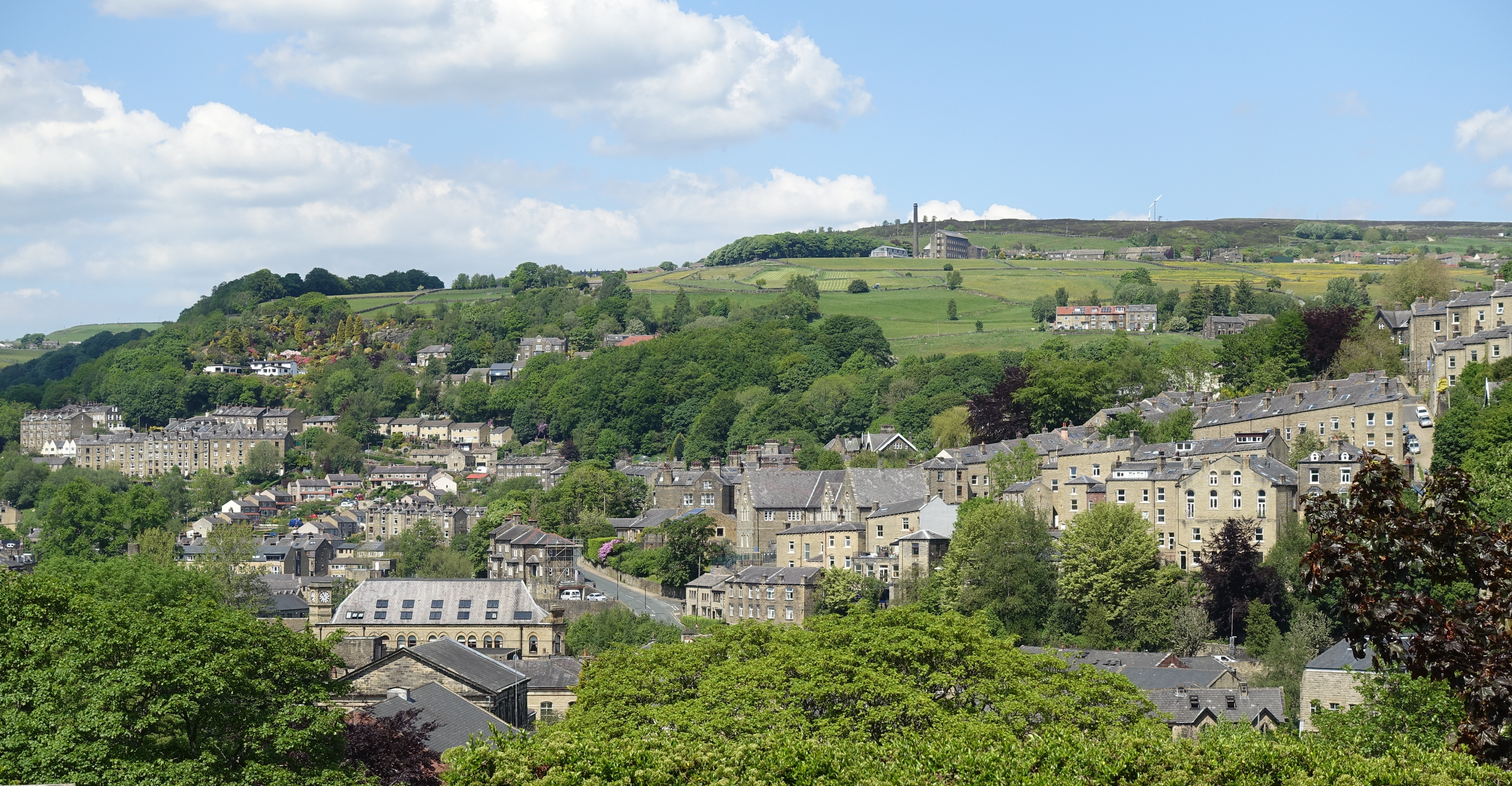
The Southern End of Black Hill Looking across Hebden Dale from Mount Pleasant.  The farm to the left is Mansfield House and the one to the right is Black Scout.
The Southern End of Black Hill Credit: Steve Partridge

Colden Clough is a picturesque valley nestled in the heart of Yorkshire, England. Located in the South Pennines, it is renowned for its breathtaking natural beauty and rich cultural heritage. The valley stretches for approximately two miles and is surrounded by rolling hills and dense woodlands, offering visitors a tranquil and idyllic escape from the hustle and bustle of city life.

The valley is intersected by the Colden Water, a meandering river that adds to the area's charm. The river flows through the valley, creating small cascades and waterfalls along its course. These water features, combined with the lush greenery, create a stunning landscape that is a haven for nature enthusiasts and photographers alike.

Colden Clough has a long history dating back centuries. It was once a thriving industrial hub, with cotton mills and other factories dotting the landscape. However, today, the remnants of the industrial era have been reclaimed by nature, leaving behind picturesque ruins that add a unique allure to the valley.

The valley also boasts a network of well-maintained walking trails, making it a popular destination for hikers and walkers. These trails provide access to the stunning views of the surrounding countryside and offer opportunities to spot wildlife such as deer, birds, and even the occasional elusive red squirrel.

For those seeking a peaceful retreat or a chance to reconnect with nature, Colden Clough in Yorkshire is a destination that promises breathtaking scenery, rich history, and a tranquil atmosphere that will leave visitors in awe.

If you have any feedback on the listing, please let us know in the comments section below.

Colden Clough Images

Images are sourced within 2km of 53.748709/-2.0316555 or Grid Reference SD9828. Thanks to Geograph Open Source API. All images are credited.
The Southern End of Black Hill Looking across Hebden Dale from Mount Pleasant.  The farm to the left is Mansfield House and the one to the right is Black Scout.
The Southern End of Black Hill
Looking across Hebden Dale from Mount Pleasant. The farm to the left is Mansfield House and the one to the right is Black Scout.
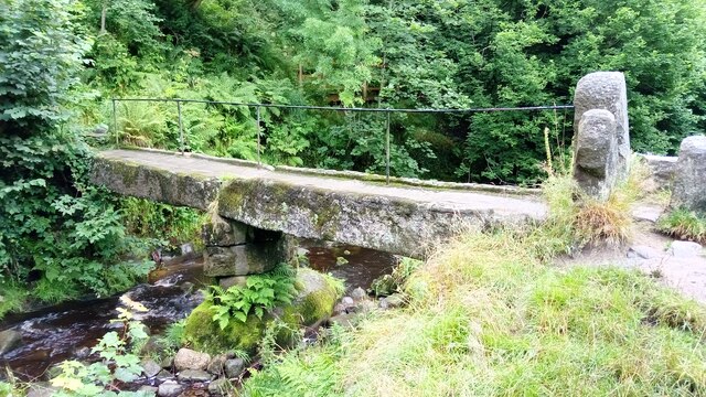
Clapper Bridge Bridge now repaired after collapse some time ago.
Clapper Bridge
Bridge now repaired after collapse some time ago.
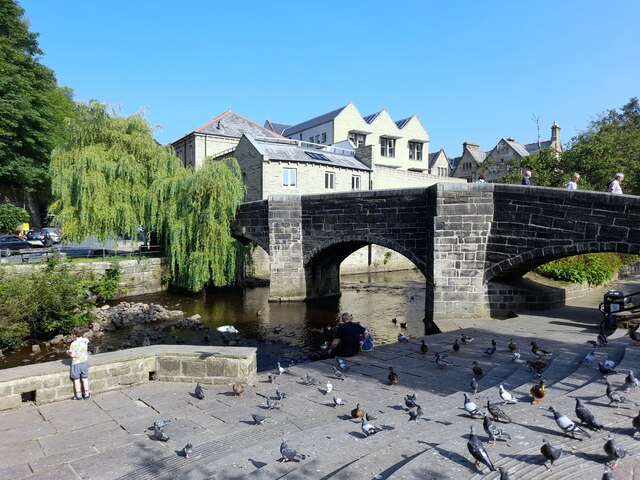
Bridgegate
Bridgegate
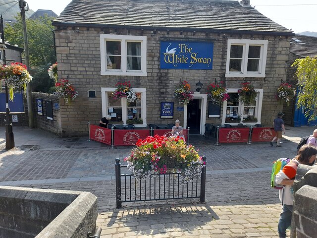
The White Swan
The White Swan
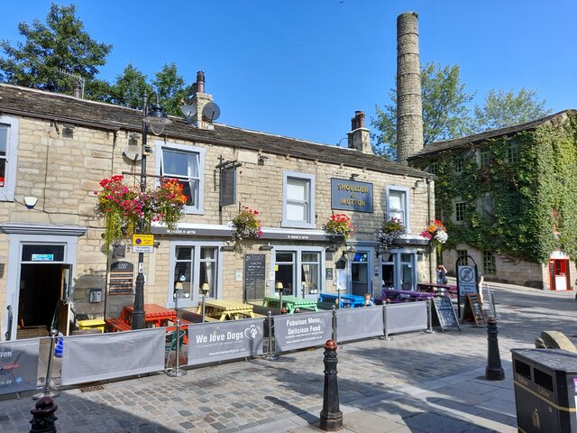
Shoulder Of Mutton
Shoulder Of Mutton
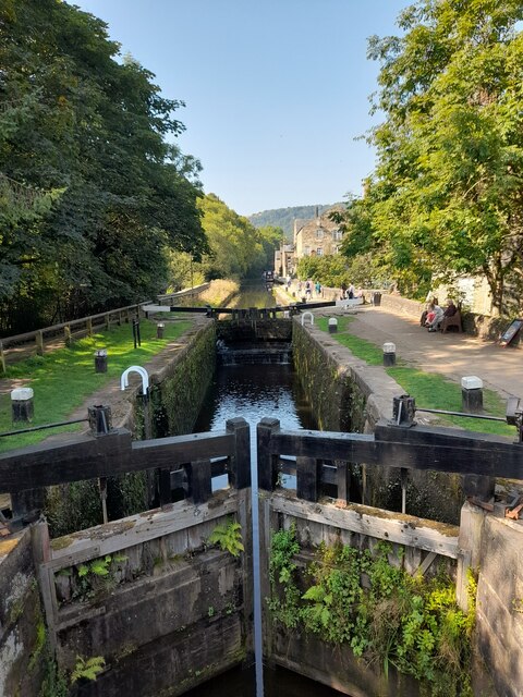
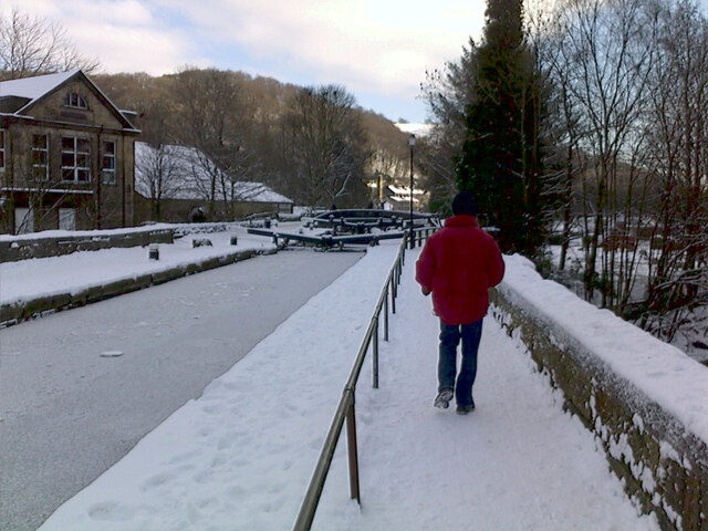
Canal lock
Canal lock
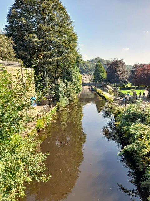
Canal view
Canal view
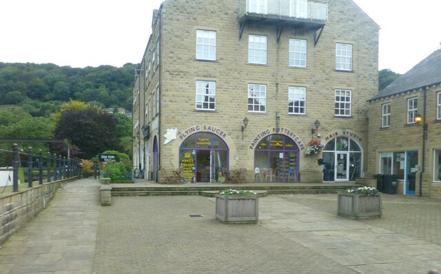
The Flying Saucer at Hebden Bridge Cafe and studio in old canal warehouse
The Flying Saucer at Hebden Bridge
Cafe and studio in old canal warehouse
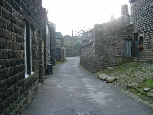
Northgate View along Northgate towards the main village
Northgate
View along Northgate towards the main village
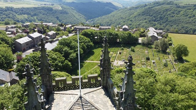
From above the church tower Picture taken from my DJi Mini drone of the top of the church tower, the new graveyard just beyond, and in the far distance Whiteley Arches rail bridge in the green Calder Valley.
From above the church tower
Picture taken from my DJi Mini drone of the top of the church tower, the new graveyard just beyond, and in the far distance Whiteley Arches rail bridge in the green Calder Valley.
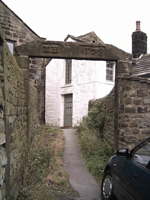
Whitehall Farm archway Archway marking the entrance to Whitehall Farm, inscribed on the lintel are the initials JB standing for John Bentley, once owner of the farm and the date of 1578..
Whitehall Farm archway
Archway marking the entrance to Whitehall Farm, inscribed on the lintel are the initials JB standing for John Bentley, once owner of the farm and the date of 1578..
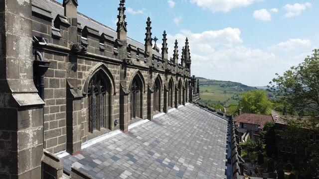
View along the church roof A view along the roof of the church of St Thomas the Apostle, looking towards the village of Old town in the distance.
View along the church roof
A view along the roof of the church of St Thomas the Apostle, looking towards the village of Old town in the distance.
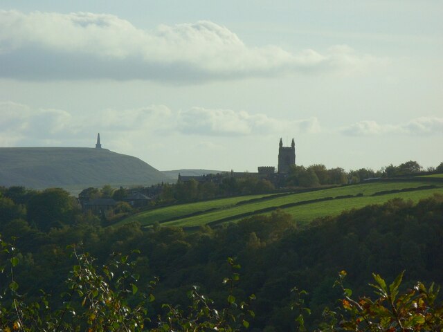
Heptonstall from Smeekin Hill Taken from the Smeekin Hill/Wadsworth war memorial looking across Hebden Dale towards Heptonstall and in the far distance the peace monument of Stoodley Pike Monument.
Heptonstall from Smeekin Hill
Taken from the Smeekin Hill/Wadsworth war memorial looking across Hebden Dale towards Heptonstall and in the far distance the peace monument of Stoodley Pike Monument.
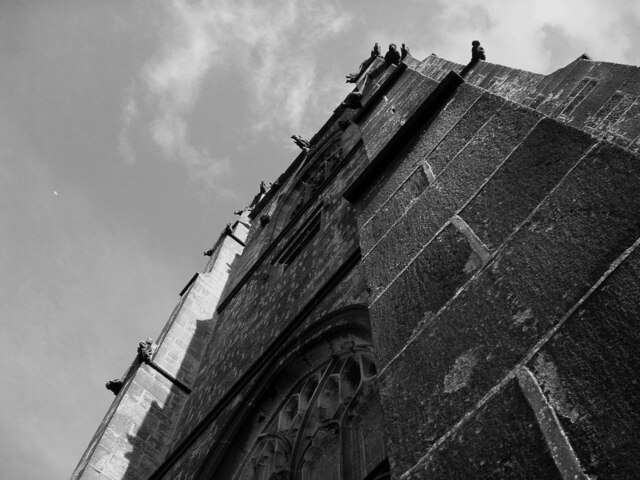
Looking up the church tower Looking up the tower of the church of St Thomas the Apostle.
Looking up the church tower
Looking up the tower of the church of St Thomas the Apostle.
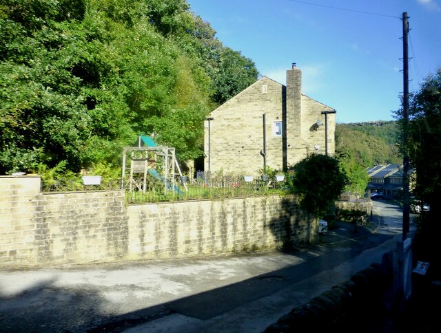
Halifax Road at Calderside View from rail line on Whiteley Arches
Halifax Road at Calderside
View from rail line on Whiteley Arches
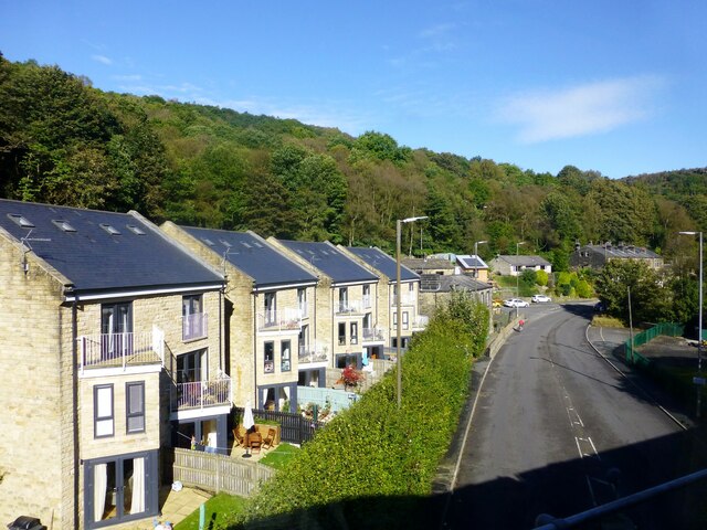
Oakville Road at Calderside View from Rochdale to Leeds railway
Oakville Road at Calderside
View from Rochdale to Leeds railway
The aqueduct carrying the Rochdale Canal over the Calder at Hebden Bridge The Rochdale Canal runs for 33 miles between Manchester and Sowerby Bridge in West Yorkshire, UK. In Sowerby Bridge it connects with the Calder and Hebble Navigation. In Manchester it connects with the Ashton and Bridgewater Canals. 

The canal was opened between Sowerby Bridge and Todmorden and from Manchester to Rochdale in 1799 and between Todmorden and Rochdale in 1805. Most of the canal was closed in 1952. Restoration work began in late 1980s and by  1996 the canal was opened to navigation once again between Sowerby Bridge and the summit level. The canal was re-opened to navigation along its entire length in July 2002 and forms part of the South Pennine Ring. 

<span class="nowrap"><a title="http://www.penninewaterways.co.uk/rochdale/index.htm" rel="nofollow ugc noopener" href="http://www.penninewaterways.co.uk/rochdale/index.htm">Link</a><img style="margin-left:2px;" alt="External link" title="External link - shift click to open in new window" src="https://s1.geograph.org.uk/img/external.png" width="10" height="10"/></span>
The aqueduct carrying the Rochdale Canal over the Calder at Hebden Bridge
The Rochdale Canal runs for 33 miles between Manchester and Sowerby Bridge in West Yorkshire, UK. In Sowerby Bridge it connects with the Calder and Hebble Navigation. In Manchester it connects with the Ashton and Bridgewater Canals. The canal was opened between Sowerby Bridge and Todmorden and from Manchester to Rochdale in 1799 and between Todmorden and Rochdale in 1805. Most of the canal was closed in 1952. Restoration work began in late 1980s and by 1996 the canal was opened to navigation once again between Sowerby Bridge and the summit level. The canal was re-opened to navigation along its entire length in July 2002 and forms part of the South Pennine Ring. LinkExternal link
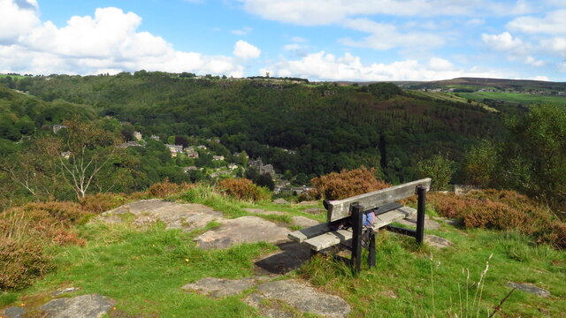
Seat at eastern end of Horsehold Wood & view over Calderside A seat with a view.
Seat at eastern end of Horsehold Wood & view over Calderside
A seat with a view.
Show me another place!

Colden Clough is located at Grid Ref: SD9828 (Lat: 53.748709, Lng: -2.0316555)

Division: West Riding

Unitary Authority: Calderdale

Police Authority: West Yorkshire

What 3 Words

///saving.massaged.charm. Near Hebden Bridge, West Yorkshire

Related Wikis

Heptonstall

Heptonstall is a small village and civil parish within the Calderdale borough of West Yorkshire, England, historically part of the West Riding of Yorkshire...

Hepton Rural District

Hepton was a rural district in the West Riding of Yorkshire, England, from 1894 to 1974. The district included four civil parishes: Heptonstall, Blackshaw...

Hebden Bridge Town Hall

Hebden Bridge Town Hall, formerly Hebden Bridge Council Offices, is a municipal building in St George's Street, Hebden Bridge, West Yorkshire, England...

Battle of Heptonstall

The Battle of Heptonstall occurred in November 1643 during the First English Civil War at Hebden Bridge and Heptonstall, Yorkshire. During the battle,...

Hebden Bridge Picture House

Hebden Bridge Picture House in Hebden Bridge, West Yorkshire, is one of the last remaining council-owned cinemas in Britain. Together with the adjacent...

Birchcliffe Baptist Church

Birchcliffe Baptist Church is a redundant Baptist chapel in the town of Hebden Bridge, West Yorkshire, England. It was founded by Daniel Taylor in 1764...

Hebden Royd

Hebden Royd is a civil parish in the Metropolitan Borough of Calderdale in West Yorkshire, England. According to the 2001 census it had a population of...

Hebden Bridge

Hebden Bridge is a market town in the Calderdale district of West Yorkshire, England. It is in the Upper Calder Valley, 8 miles (13 km) west of Halifax...

Nearby Amenities

Located within 500m of 53.748709,-2.0316555
Bus Stop
Smithwell Lane Green Lane
Bench: no
Bus: yes
Departures Board: no
Local Ref: 45019599
Naptan AtcoCode: 450019599
Naptan Bearing: SE
Naptan CommonName: Smithwell Lane Green Lane
Naptan Crossing: Green Lane
Naptan Indicator: Stop 45019599
Naptan PlusbusZoneRef: LEEDS
Naptan ShortCommonName: Green Lane
Naptan Street: Smithwell Lane
Naptan Verified: no
Public Transport: platform
Shelter: no
Source: naptan_import
Lat/Long: 53.7521278/-2.027465
Bus Stop
Eaves
Bus: yes
Departures Board: timetable
Local Ref: 45023530
Naptan AtcoCode: 450023530
Naptan Bearing: N
Naptan CommonName: Eaves
Naptan Crossing: Ragley View
Naptan Indicator: Stop 45023530
Naptan Notes: L/C No Num
Naptan PlusbusZoneRef: LEEDS
Naptan ShortCommonName: Ragley View
Naptan Street: Eaves Avenue
Naptan Verified: yes
Public Transport: platform
Shelter: no
Source: naptan_import
Lat/Long: 53.7470042/-2.0282654
Bus Stop
Smithwell Lane Lane Head
Local Ref: 45025529
Naptan AtcoCode: 450025529
Naptan Bearing: SE
Naptan CommonName: Smithwell Lane Lane Head
Naptan Crossing: Nr-Opp Silver Street
Naptan Indicator: Stop 45025529
Naptan Landmark: School
Naptan Notes: OSR taken place 031005
Naptan PlusbusZoneRef: LEEDS
Naptan ShortCommonName: Lane Head
Naptan Street: Smithwell Lane
Naptan Verified: no
Source: naptan_import
Lat/Long: 53.7502319/-2.0245218
Bus Stop
Smithwell Lane Green Lane
Bench: no
Bus: yes
Departures Board: no
Local Ref: 45025755
Naptan AtcoCode: 450025755
Naptan Bearing: NW
Naptan CommonName: Smithwell Lane Green Lane
Naptan Crossing: Green Lane
Naptan Indicator: Stop 45025755
Naptan PlusbusZoneRef: LEEDS
Naptan ShortCommonName: Green Lane
Naptan Street: Smithwell Lane
Naptan Verified: no
Public Transport: platform
Shelter: no
Source: naptan_import
Lat/Long: 53.7519386/-2.0274801
Bench
Backrest: yes
Ele: 288
Material: wood
Seats: 2
Tourism: viewpoint
Lat/Long: 53.7521212/-2.0278158
Turning Circle
Lat/Long: 53.7514743/-2.0338226
002
Ele: 266.6
Lat/Long: 53.7489723/-2.0263612
Turning Circle
Lat/Long: 53.7470268/-2.0282113
Man Made: chimney
Lat/Long: 53.7502945/-2.0381665
Waterway: weir
Lat/Long: 53.7504016/-2.0372157
Man Made: chimney
Lat/Long: 53.7504792/-2.0357094
Barrier: stile
Lat/Long: 53.7524337/-2.0332385
Bench
Backrest: yes
Material: wood
Seats: 2
Lat/Long: 53.7521527/-2.0278195
Barrier: stile
Bicycle: no
Foot: yes
Horse: no
Material: stone
Motor Vehicle: no
Stile: squeezer
Lat/Long: 53.7512741/-2.0267176
Bench
Lat/Long: 53.752234/-2.034749
Access: no
Barrier: stile
Foot: yes
Lat/Long: 53.7522675/-2.0347903
Bench
Backrest: yes
Lat/Long: 53.7522535/-2.0346858
The data included in this document is from www.openstreetmap.org. The data is made available under ODbL.

Have you been to Colden Clough?

Leave your review of Colden Clough below (or comments, questions and feedback).