Gun Plantation

Wood, Forest in Staffordshire Staffordshire Moorlands

England

Gun Plantation

Church of St Matthew, Meerbrook Grade II* parish church
Church of St Matthew, Meerbrook Credit: Eirian Evans

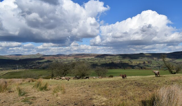
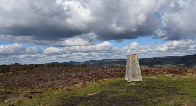
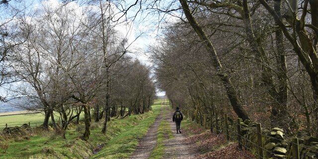
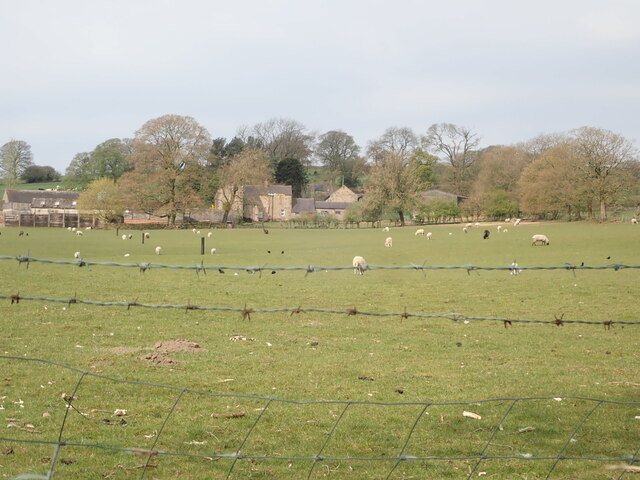
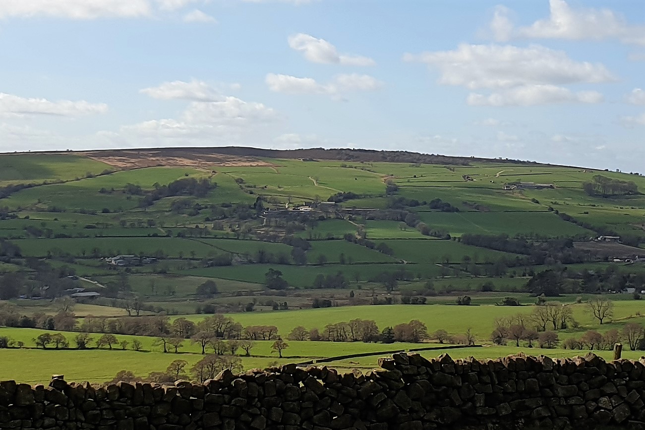
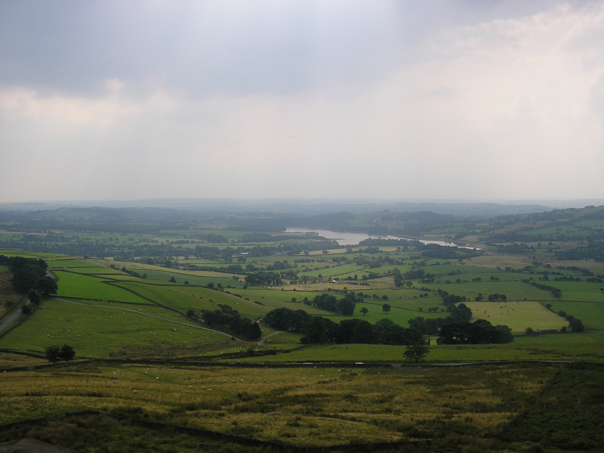
Gun Plantation is a woodland area located in the county of Staffordshire, England. Situated in the heart of the county, the plantation covers a vast area of approximately 500 acres and is part of the larger Cannock Chase Forest.

The woodland is primarily composed of coniferous trees, such as Scots pine and Norway spruce, which were planted in the early 20th century to meet the increasing demand for timber. These dense evergreen trees provide a picturesque landscape and offer a habitat for a variety of wildlife, including birds, mammals, and insects.

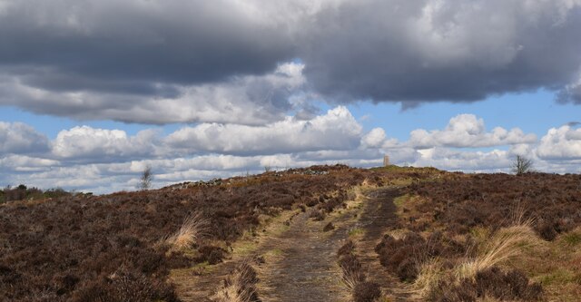
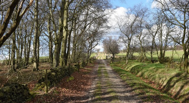
Gun Plantation is a popular destination for nature enthusiasts, hikers, and cyclists. It offers a network of well-maintained trails, allowing visitors to explore the woodland and enjoy its natural beauty. The plantation also provides a tranquil setting for picnics and family outings, with designated areas for relaxation and recreation.

Aside from its recreational value, Gun Plantation serves an important ecological purpose. The dense vegetation helps absorb carbon dioxide, contributing to the reduction of greenhouse gases. It also acts as a natural barrier, preventing soil erosion and protecting the surrounding areas from flooding.

Managed by the Forestry Commission, Gun Plantation is subject to ongoing conservation efforts. The commission ensures the sustainable management of the woodland, balancing the needs of wildlife and recreation. Regular maintenance, including tree thinning and replanting, helps maintain the health and diversity of the woodland ecosystem.

Overall, Gun Plantation in Staffordshire is a beautiful and ecologically significant woodland area, offering visitors a chance to connect with nature and enjoy the tranquility of the forest.

If you have any feedback on the listing, please let us know in the comments section below.

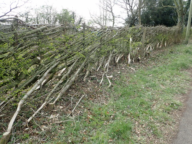
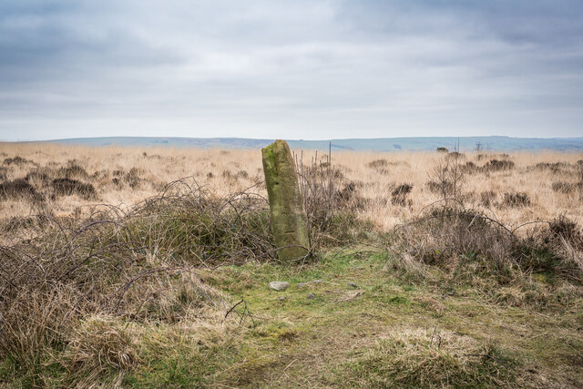
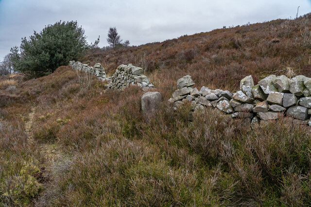
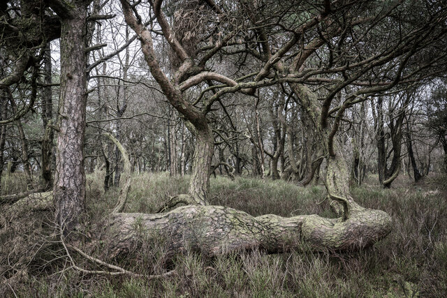
Gun Plantation Images

Images are sourced within 2km of 53.141136/-2.0467655 or Grid Reference SJ9660. Thanks to Geograph Open Source API. All images are credited.

Church of St Matthew, Meerbrook Grade II* parish church
Church of St Matthew, Meerbrook
Grade II* parish church
Newly layed hedge near Meerbrook The Derbyshire style of hedge laying where the brush (bushy growth) is placed to the livestock side of the hedge. Sawn timber stakes are used 24″ to 30″ apart. A strong, stock proof hedge is built by weaving the pleachers (layed stems) in front and behind the stakes – no binders are needed.
Newly layed hedge near Meerbrook
The Derbyshire style of hedge laying where the brush (bushy growth) is placed to the livestock side of the hedge. Sawn timber stakes are used 24″ to 30″ apart. A strong, stock proof hedge is built by weaving the pleachers (layed stems) in front and behind the stakes – no binders are needed.
Meerbrook, St Matthew's church The benchmark is cut into a west facing buttress of the church. The buttress is the opposite end of the church to the tower.
Meerbrook, St Matthew's church
The benchmark is cut into a west facing buttress of the church. The buttress is the opposite end of the church to the tower.
Meerbrook, St Matthew's church A wider angle showing the full church. There is a benchmark cut into the west face of the buttress which is to the left of the church door.
Meerbrook, St Matthew's church
A wider angle showing the full church. There is a benchmark cut into the west face of the buttress which is to the left of the church door.
Meerbrook Lane gatepost The gatehole is on the west side of Meerbrook Lane, and there is a benchmark cut into the right concrete gatepost.
Meerbrook Lane gatepost
The gatehole is on the west side of Meerbrook Lane, and there is a benchmark cut into the right concrete gatepost.
Meerbrook Lane, gatehole A wider angle showing the gatehole on the west side of Meerbrook Lane. There is a benchmark cut into the right concrete gatepost.
Meerbrook Lane, gatehole
A wider angle showing the gatehole on the west side of Meerbrook Lane. There is a benchmark cut into the right concrete gatepost.
Stone With Benchmark, Gun I think it's a spot height marker, as these are shown on the 1878 maps.
Stone With Benchmark, Gun
I think it's a spot height marker, as these are shown on the 1878 maps.
Boundary Stone (BS) Heaton / Leekfirth The wall runs past on the Leekfirth side of the BS.  Not sure when the Boundary stone's were placed but The wall was probably from the "Leek Inclosure act 1805"


<span class="nowrap"><a title="https://www.staffs-wildlife.org.uk/blog/alan-weeks/history-gun-moor-meadow-and-gun-hill" rel="nofollow ugc noopener" href="https://www.staffs-wildlife.org.uk/blog/alan-weeks/history-gun-moor-meadow-and-gun-hill">Link</a><img style="margin-left:2px;" alt="External link" title="External link - shift click to open in new window" src="https://s1.geograph.org.uk/img/external.png" width="10" height="10"/></span>
Boundary Stone (BS) Heaton / Leekfirth
The wall runs past on the Leekfirth side of the BS. Not sure when the Boundary stone's were placed but The wall was probably from the "Leek Inclosure act 1805" LinkExternal link
Gunn Woods Some strange and gnarly Trees
Gunn Woods
Some strange and gnarly Trees
Rough Pastureland alongside the path to Gun. Lovely walk up to Gun.
Rough Pastureland alongside the path to Gun.
Lovely walk up to Gun.
The 385 metre summit of Gun. A grand viewpoint.
The 385 metre summit of Gun.
A grand viewpoint.
Path to the summit of Gun. Looking back up towards the Trig pillar.
Path to the summit of Gun.
Looking back up towards the Trig pillar.
Track alongside Gun plantation. A lovely track to follow.
Track alongside Gun plantation.
A lovely track to follow.
Track alongside Gun plantation. Heading back to Rudyard.
Track alongside Gun plantation.
Heading back to Rudyard.
Franklins Farm, Meerbrook
North Hillswood Farm The gatepost is on the right of the drive entrance. The benchmark is about 1 foot from ground level.
North Hillswood Farm
The gatepost is on the right of the drive entrance. The benchmark is about 1 foot from ground level.
North Hillswood Farm This is the driveway entrance to the farm. There is a stone gatepost hidden in the dense vegetation on the right, close to the broken gate. There is a benchmark cut into the gatepost.
North Hillswood Farm
This is the driveway entrance to the farm. There is a stone gatepost hidden in the dense vegetation on the right, close to the broken gate. There is a benchmark cut into the gatepost.
Reservoir View The view of Tittesworth Reservoir from Meerbrook Road, Staffordshire.
Reservoir View
The view of Tittesworth Reservoir from Meerbrook Road, Staffordshire.
Show me another place!

Gun Plantation is located at Grid Ref: SJ9660 (Lat: 53.141136, Lng: -2.0467655)

Administrative County: Staffordshire

District: Staffordshire Moorlands

Police Authority: Staffordshire

What 3 Words

///builders.mirroring.butchers. Near Leek, Staffordshire

Related Wikis

Gun (Staffordshire)

Gun is a hill at the southern end of the Peak District, overlooking the town of Leek in the Staffordshire Moorlands. The hill is mainly moorland with some...

Meerbrook

Meerbrook (grid reference SJ989609) is a small village in North Staffordshire, on the River Churnet at the edge of the Peak District National Park. It...

Leekfrith

Leekfrith is a civil parish in the Staffordshire Moorlands, in Staffordshire, England, north of the town of Leek. The population of the civil parish at...

Tittesworth reservoir

Tittesworth Reservoir is a water storage reservoir near Leek, Staffordshire, England, fed by the River Churnet. The reservoir and associated water treatment...

Rudyard Lake Steam Railway

The Rudyard Lake Steam Railway is a ridable miniature railway and the third railway of any gauge to run along the side of Rudyard Lake in Staffordshire...

Abbey Green, Staffordshire Moorlands

Abbey Green is a village near Leek in the English county of Staffordshire. The village is close to the site of Dieulacres Abbey. The abbey was founded...

Rudyard Lake

Rudyard Lake is a reservoir in Rudyard, Staffordshire, located north-west of the town of Leek, Staffordshire. It was constructed in the late 18th century...

Dieulacres Abbey

Dieulacres Abbey was a Cistercian monastery established by Ranulf, Earl of Chester at Poulton in Cheshire. It moved to the present site at Abbey Green...

Nearby Amenities

Located within 500m of 53.141136,-2.0467655
Barrier: stile
Material: stone
Source: survey;gps
Stile: squeezer
Lat/Long: 53.1436151/-2.042406
Barrier: stile
Steps: 1
Stile: stepover
Lat/Long: 53.139929/-2.0453867
Barrier: stile
Steps: 1
Stile: wall
Lat/Long: 53.1407182/-2.0399686
Barrier: stile
Stile: squeezer
Lat/Long: 53.1424246/-2.0435069
The data included in this document is from www.openstreetmap.org. The data is made available under ODbL.

Have you been to Gun Plantation?

Leave your review of Gun Plantation below (or comments, questions and feedback).