Brookfold Wood

Wood, Forest in Cheshire

England

Brookfold Wood

Shops on Market Street 
 Hyde Convenience Store was A&M Multisaver <a href="https://www.geograph.org.uk/photo/3496699">SJ9594 : Changes on Market Street</a>. The premises originally belonged to the  "Philanthropic Mutual Life Assurance Collecting Society". Faded lettering of the name on the top of the façade was still visible in 2006 <a href="https://www.geograph.org.uk/photo/1074218">SJ9594 : Philanthropic Society</a> but had gone by 2009 <a href="https://www.geograph.org.uk/photo/1275232">SJ9594 : Established 1830</a>. The doormat in the entrance however still has the name "Philanthropic" on it <a href="https://www.geograph.org.uk/photo/5396378">SJ9594 : Philanthropic doormat</a>. It has been part of the Premier franchise (owned by Tesco) but the name has been covered over on the signage. Maybe it is about to be rebranded.

Next door was a single shop DP Flooring which was later split into two shops. One was YT Electronics and the other was being sold as an "investment property". YT Electronics has gone and is now Nakshi, an ethnic fashion shop. The other shop remains shuttered. 

Above these is the former Crown Inn, now the Rose Beauty Salon <a href="https://www.geograph.org.uk/photo/5868438">SJ9594 : Rose Beauty Salon</a> who are the sixth business to occupy the premises since it closed in 2009.
Shops on Market Street Credit: Gerald England

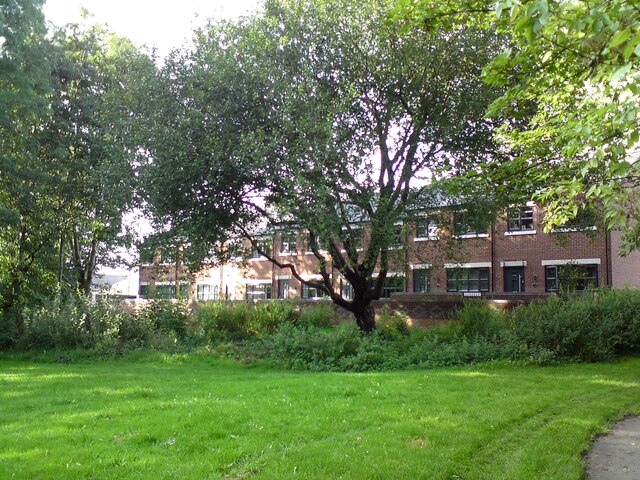
Brookfold Wood, located in Cheshire, England, is a picturesque woodland that offers a serene and tranquil escape for nature lovers and outdoor enthusiasts. Spanning approximately 100 acres, this enchanting forest is known for its diverse range of flora and fauna, making it a popular spot for wildlife enthusiasts and birdwatchers.

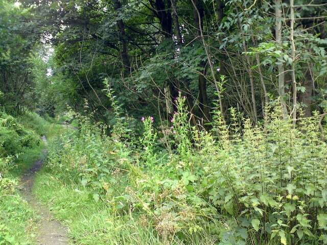
The woodland is characterized by its dense canopy of oak, beech, and birch trees, which provide a cool and shaded environment during the summer months. The forest floor is covered in a rich carpet of wildflowers, including bluebells, primroses, and wood anemones, creating a vibrant and colorful landscape.

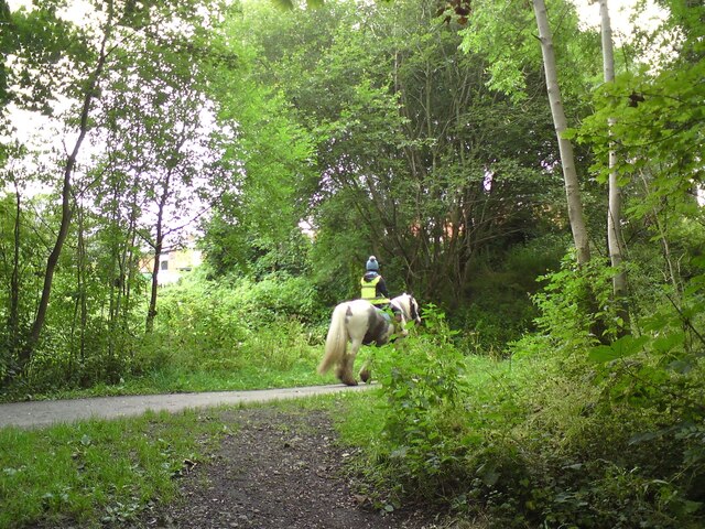
Several walking trails meander through the wood, offering visitors the opportunity to explore its hidden corners and discover its natural beauty. These paths wind along the banks of a gentle brook that runs through the heart of the woodland, adding to its idyllic charm.

Brookfold Wood is home to a variety of wildlife, including deer, foxes, badgers, and a plethora of bird species. Birdwatchers can spot woodpeckers, owls, and a diverse range of songbirds, making it a haven for ornithologists.

The wood is also a popular destination for families and nature enthusiasts, who can enjoy picnicking, photography, and nature walks. The peaceful atmosphere and stunning scenery make it an ideal location for those seeking solace in nature.

In conclusion, Brookfold Wood in Cheshire is a captivating forest that offers a delightful escape from the hustle and bustle of everyday life. With its diverse range of flora and fauna, picturesque walking trails, and serene ambiance, it is a must-visit destination for nature lovers and outdoor enthusiasts alike.

If you have any feedback on the listing, please let us know in the comments section below.

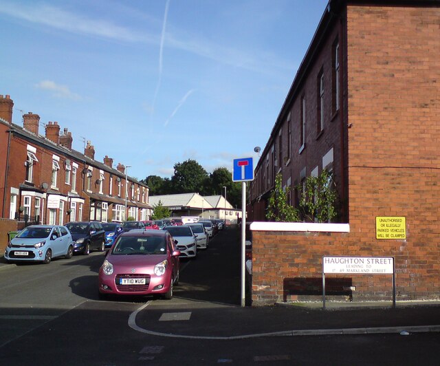
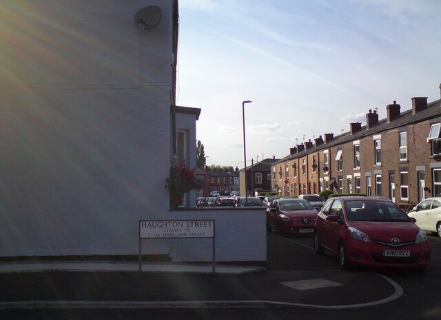
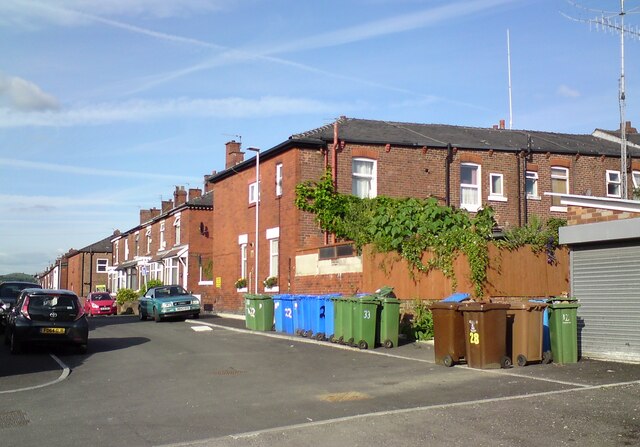
Brookfold Wood Images

Images are sourced within 2km of 53.445629/-2.0473119 or Grid Reference SJ9694. Thanks to Geograph Open Source API. All images are credited.

Shops on Market Street 
 Hyde Convenience Store was A&M Multisaver <a href="https://www.geograph.org.uk/photo/3496699">SJ9594 : Changes on Market Street</a>. The premises originally belonged to the  "Philanthropic Mutual Life Assurance Collecting Society". Faded lettering of the name on the top of the façade was still visible in 2006 <a href="https://www.geograph.org.uk/photo/1074218">SJ9594 : Philanthropic Society</a> but had gone by 2009 <a href="https://www.geograph.org.uk/photo/1275232">SJ9594 : Established 1830</a>. The doormat in the entrance however still has the name "Philanthropic" on it <a href="https://www.geograph.org.uk/photo/5396378">SJ9594 : Philanthropic doormat</a>. It has been part of the Premier franchise (owned by Tesco) but the name has been covered over on the signage. Maybe it is about to be rebranded.

Next door was a single shop DP Flooring which was later split into two shops. One was YT Electronics and the other was being sold as an "investment property". YT Electronics has gone and is now Nakshi, an ethnic fashion shop. The other shop remains shuttered. 

Above these is the former Crown Inn, now the Rose Beauty Salon <a href="https://www.geograph.org.uk/photo/5868438">SJ9594 : Rose Beauty Salon</a> who are the sixth business to occupy the premises since it closed in 2009.
Shops on Market Street
Hyde Convenience Store was A&M Multisaver SJ9594 : Changes on Market Street. The premises originally belonged to the "Philanthropic Mutual Life Assurance Collecting Society". Faded lettering of the name on the top of the façade was still visible in 2006 SJ9594 : Philanthropic Society but had gone by 2009 SJ9594 : Established 1830. The doormat in the entrance however still has the name "Philanthropic" on it SJ9594 : Philanthropic doormat. It has been part of the Premier franchise (owned by Tesco) but the name has been covered over on the signage. Maybe it is about to be rebranded. Next door was a single shop DP Flooring which was later split into two shops. One was YT Electronics and the other was being sold as an "investment property". YT Electronics has gone and is now Nakshi, an ethnic fashion shop. The other shop remains shuttered. Above these is the former Crown Inn, now the Rose Beauty Salon SJ9594 : Rose Beauty Salon who are the sixth business to occupy the premises since it closed in 2009.
159-163 Market Street 

#159 is the G D Hair & Beauty Salon. Previous businesses registered at this address include Anmel Technology & Consultants Ltd, Combined Motor Services Ltd and Whytes Investments Ltd.

#161 had looked rather derelict for a while but was renovated in 2020 and opened up as Flying Carpets. <a href="https://www.geograph.org.uk/photo/6593482">SJ9594 : 159-163 Market Street, Hyde</a>. Now it seems they too have flown.. Previous businesses registered at this address include Abbeyford Construction Ltd, PDB Enterprises Ltd and Sobrinca Nursery Products. 

#163 was recently Clean Lymph <a href="https://www.geograph.org.uk/photo/6783396">SJ9594 : 159-163 Market Street, Hyde</a> which offered manual lymphatic drainage therapy  Previous businesses registered at this address include Xcellsim PLC, MSF Easy Solutions Ltd, The Wardrobe <a href="https://www.geograph.org.uk/photo/5204284">SJ9594 : 159-163 Market Street</a>, which closed in 2017 <a href="https://www.geograph.org.uk/photo/5439475">SJ9594 : The Wardrobe closed</a> and Skin Perfect <a href="https://www.geograph.org.uk/photo/5890412">SJ9594 : 159-163 Market Street, Hyde</a>.  Now it seems to be carrying advertising banners for  Open House property sales and Noblestocks. The latter appears to be an online fashion website based in Huddersfield.
159-163 Market Street
#159 is the G D Hair & Beauty Salon. Previous businesses registered at this address include Anmel Technology & Consultants Ltd, Combined Motor Services Ltd and Whytes Investments Ltd. #161 had looked rather derelict for a while but was renovated in 2020 and opened up as Flying Carpets. SJ9594 : 159-163 Market Street, Hyde. Now it seems they too have flown.. Previous businesses registered at this address include Abbeyford Construction Ltd, PDB Enterprises Ltd and Sobrinca Nursery Products. #163 was recently Clean Lymph SJ9594 : 159-163 Market Street, Hyde which offered manual lymphatic drainage therapy Previous businesses registered at this address include Xcellsim PLC, MSF Easy Solutions Ltd, The Wardrobe SJ9594 : 159-163 Market Street, which closed in 2017 SJ9594 : The Wardrobe closed and Skin Perfect SJ9594 : 159-163 Market Street, Hyde. Now it seems to be carrying advertising banners for Open House property sales and Noblestocks. The latter appears to be an online fashion website based in Huddersfield.
Nettles on the TransPennine Trail The TransPennine Trail mostly follows the line of the former Godley to Apethorn Railway. Here the main line tracks to the south side of a clump of trees near Swains Valley. The north side is a path for horse riders but in recent years it has became a barely usable quagmire. Now abundant nettles are spreading across.
Nettles on the TransPennine Trail
The TransPennine Trail mostly follows the line of the former Godley to Apethorn Railway. Here the main line tracks to the south side of a clump of trees near Swains Valley. The north side is a path for horse riders but in recent years it has became a barely usable quagmire. Now abundant nettles are spreading across.
Horse rider on the TransPennine Trail 
The TransPennine Trail follows the line of the former Godley to Apethorn railway. For much of its length there is a metalled path for cyclists and walkers and a separate bridleway alongside. Much of the bridleway is now an unusable quagmire so riders are having to make use of the cycleway.
Horse rider on the TransPennine Trail
The TransPennine Trail follows the line of the former Godley to Apethorn railway. For much of its length there is a metalled path for cyclists and walkers and a separate bridleway alongside. Much of the bridleway is now an unusable quagmire so riders are having to make use of the cycleway.
Footpath to Marlborough Road From the bus stop on Dowson Road.
Footpath to Marlborough Road
From the bus stop on Dowson Road.
SE corner of Green Street and Haughton Street 
The Haughton Street signs reads "leading to 17-49 Markland Street" which is the unadopted road by Swain's Valley consisting of old terraced properties.
SE corner of Green Street and Haughton Street
The Haughton Street signs reads "leading to 17-49 Markland Street" which is the unadopted road by Swain's Valley consisting of old terraced properties.
SW corner of Green Street and Haughton Street 
The Haughton Street signs reads "leading to 5-15A Markland Street" which are recently constructed houses facing Swain's Valley.
SW corner of Green Street and Haughton Street
The Haughton Street signs reads "leading to 5-15A Markland Street" which are recently constructed houses facing Swain's Valley.
Wheelie bins on Haughton Street 
Some of these will belong to the houses on Green Street and others to the houses on Markland Street.
Wheelie bins on Haughton Street
Some of these will belong to the houses on Green Street and others to the houses on Markland Street.
5-15A Markland Street Newly built housing facing Swains Valley. The area around the big tree in the middle was cleared prior to construction but nature is now reclaiming it.
5-15A Markland Street
Newly built housing facing Swains Valley. The area around the big tree in the middle was cleared prior to construction but nature is now reclaiming it.
Mass Vaccination Site (Tameside) As we approach the second winter of this Coronavirus era people are being given injections for Flu and Covid-19 at this Tameside vaccination site. This area was formerly the car park for British Gas who have moved to Stockport from this site on Hattersley Industrial Estate.
Mass Vaccination Site (Tameside)
As we approach the second winter of this Coronavirus era people are being given injections for Flu and Covid-19 at this Tameside vaccination site. This area was formerly the car park for British Gas who have moved to Stockport from this site on Hattersley Industrial Estate.
Hyde Cenotaph Hyde War Memorial remembers the people who gave their lives for our country. This photograph was taken on Remembrance Say 2021.
Hyde Cenotaph
Hyde War Memorial remembers the people who gave their lives for our country. This photograph was taken on Remembrance Say 2021.
Tree-stump on Knott Lane 
One of the mature trees on Knott Lane near the entrance to Hyde Chapel has been felled leaving just a stump.
Tree-stump on Knott Lane
One of the mature trees on Knott Lane near the entrance to Hyde Chapel has been felled leaving just a stump.
Shell on Dowson Road At the Shell filling station on Dowson Road petrol is now 139.9 pence per litre and diesel is 142.9 pence per litre. This is an increase of 23p and 24p since December <a href="https://www.geograph.org.uk/photo/6714825">SJ9594 : Christmas Day on Dowson Road</a>.
Shell on Dowson Road
At the Shell filling station on Dowson Road petrol is now 139.9 pence per litre and diesel is 142.9 pence per litre. This is an increase of 23p and 24p since December SJ9594 : Christmas Day on Dowson Road.
Diverted traffic I assume the sign is expecting diverted traffic to turn immediately right into the side street just ahead (Thornley Street) rather than right at the traffic lights on to Market Street.
Diverted traffic
I assume the sign is expecting diverted traffic to turn immediately right into the side street just ahead (Thornley Street) rather than right at the traffic lights on to Market Street.
Fuel prices rising 
With traffic flows rising following the easing of Covid restrictions the price of petrol has gone up 7ppl from 139.9p to 146p in just the last four weeks <a href="https://www.geograph.org.uk/photo/7040242">SJ9594 : Shell on Dowson Road</a>. Diesel at the Shell filling station on Dowson Road is up 9ppl from 142.9p to 151p. This is an increase of 27p and 33p  since December <a href="https://www.geograph.org.uk/photo/6714825">SJ9594 : Christmas Day on Dowson Road</a>.
Fuel prices rising
With traffic flows rising following the easing of Covid restrictions the price of petrol has gone up 7ppl from 139.9p to 146p in just the last four weeks SJ9594 : Shell on Dowson Road. Diesel at the Shell filling station on Dowson Road is up 9ppl from 142.9p to 151p. This is an increase of 27p and 33p since December SJ9594 : Christmas Day on Dowson Road.
Knott Lane Decorated for Halloween.
Knott Lane
Decorated for Halloween.
Shell on Dowson Road 
Open on Christmas Day is the Shell filling station on Dowson Road (A627). Fuel prices have gone down 2ppl since 3rd November <a href="https://www.geograph.org.uk/photo/7042850">SJ9594 : Fuel prices rising</a>. Compared to last Christmas <a href="https://www.geograph.org.uk/photo/6714825">SJ9594 : Christmas Day on Dowson Road</a> though petrol is up 28ppl to 144.9p and diesel is up 31ppl to 149.9p.
Shell on Dowson Road
Open on Christmas Day is the Shell filling station on Dowson Road (A627). Fuel prices have gone down 2ppl since 3rd November SJ9594 : Fuel prices rising. Compared to last Christmas SJ9594 : Christmas Day on Dowson Road though petrol is up 28ppl to 144.9p and diesel is up 31ppl to 149.9p.
Cut bench mark on Dowson Road bridge On the east side of Dowson Road bridge <a href="https://www.geograph.org.uk/photo/7054415">SJ9594 : Dowson Road bridge</a>. Bench Mark Database: <span class="nowrap"><a title="https://www.bench-marks.org.uk/bm91157" rel="nofollow ugc noopener" href="https://www.bench-marks.org.uk/bm91157">Link</a><img style="margin-left:2px;" alt="External link" title="External link - shift click to open in new window" src="https://s1.geograph.org.uk/img/external.png" width="10" height="10"/></span>
Cut bench mark on Dowson Road bridge
On the east side of Dowson Road bridge SJ9594 : Dowson Road bridge. Bench Mark Database: LinkExternal link
Show me another place!

Brookfold Wood is located at Grid Ref: SJ9694 (Lat: 53.445629, Lng: -2.0473119)

Unitary Authority: Tameside

Police Authority: Greater Manchester

What 3 Words

///acted.dogs.points. Near Hyde, Manchester

Related Wikis

Godley East railway station

Godley East was a railway station in the Godley area of Hyde, Tameside, Greater Manchester, on the Woodhead Line. == Early history == On 17 November 1841...

Hattersley railway station

Hattersley railway station serves the Hattersley housing estate in Tameside, Greater Manchester, England. The station is 9 miles (14 km) east of Manchester...

Hyde Godley (ward)

Hyde Godley is an electoral ward of Tameside, England. It is represented in Westminster by Jonathan Reynolds Labour Co-operative MP for Stalybridge and...

Godley railway station

Godley railway station serves the Godley area of Hyde, Tameside, Greater Manchester, England. It is 8+1⁄2 miles (13.7 km) east of Manchester Piccadilly...

Alder Community High School

Alder Community High School is a state funded secondary school in Hyde, Greater Manchester, England. The School was built under the Private Funding Initiative...

Godley Reservoir

The Godley Reservoir is a reservoir in Godley, Hyde, Greater Manchester. It was completed in 1851, as a critical part of the Longdendale Chain project...

Mottram Tunnel

The Mottram Tunnel (Mottram in Longdendale) is a tunnel carrying drinking water by gravity from Arnfield Reservoir, Tintwistle, Derbyshire, in the valley...

Backbower

Backbower is an area in Tameside, England.

Nearby Amenities

Located within 500m of 53.445629,-2.0473119
Hattersley
Naptan AtcoCode: 9100HATRSLY
Network: National Rail
Network Website: https://www.nationalrail.co.uk/stations/hty/
Network Wikidata: Q26334
Operator: Northern Rail
Operator Website: https://www.northernrailway.co.uk/stations/hattersley
Operator Wikidata: Q85789775
Public Transport: station
Railway: station
Ref Crs: HTY
Wikidata: Q2196766
Wikipedia: en:Hattersley railway station
Lat/Long: 53.445183/-2.0399051
Barrier: stile
Lat/Long: 53.4469194/-2.0480391
Barrier: stile
Lat/Long: 53.4456721/-2.0533317
Bus Stop
Hattersle,y Hattersley Road West / Fields Farm Road (Stop A)
Bus: yes
Local Ref: A
Naptan AtcoCode: 1800EH37701
Naptan Bearing: NW
Naptan CommonName: Hattersley Rd West/Fields Farm Rd (A)
Naptan Indicator: Stop A
Naptan Landmark: NR SUB STATION
Naptan NaptanCode: mandgdam
Naptan PlusbusZoneRef: MNCRPIC
Naptan ShortCommonName: Fields Farm Rd
Naptan Street: Hattersley Road West
Naptan Verified: no
Network: TfGM
Operator: TfGM
Public Transport: platform
Source: naptan_import
Lat/Long: 53.4465146/-2.0406829
Godley Junction
Railway: junction
Lat/Long: 53.4481953/-2.0480713
Godley Junction
Historic Railway: station
Railway: site
Lat/Long: 53.44905/-2.049915
Bicycle Parking
Bicycle Parking: stands
Capacity: 10
Covered: yes
Fee: no
Lat/Long: 53.445761/-2.0398012
Barrier: bollard
Source: survey
Lat/Long: 53.4460042/-2.0400576
Crossing: unmarked
Traffic Calming: table
Lat/Long: 53.4496422/-2.0442858
Crossing: unmarked
Traffic Calming: bump
Lat/Long: 53.4496997/-2.0441353
Crossing
Crossing: zebra
Lat/Long: 53.4496884/-2.0492119
Generator Method: photovoltaic
Generator Output Electricity: yes
Generator Source: solar
Generator Type: solar_photovoltaic_panel
Location: roof
Power: generator
Lat/Long: 53.4480948/-2.0419323
Generator Method: photovoltaic
Generator Output Electricity: yes
Generator Source: solar
Generator Type: solar_photovoltaic_panel
Location: roof
Power: generator
Lat/Long: 53.4480789/-2.0420288
Generator Method: photovoltaic
Generator Output Electricity: yes
Generator Source: solar
Generator Type: solar_photovoltaic_panel
Location: roof
Power: generator
Lat/Long: 53.4480533/-2.042171
Generator Method: photovoltaic
Generator Output Electricity: yes
Generator Source: solar
Generator Type: solar_photovoltaic_panel
Location: roof
Power: generator
Lat/Long: 53.4476316/-2.0417364
The data included in this document is from www.openstreetmap.org. The data is made available under ODbL.

Have you been to Brookfold Wood?

Leave your review of Brookfold Wood below (or comments, questions and feedback).