Cressel Wood

Wood, Forest in Staffordshire Stafford

England

Cressel Wood

Southern end of the bridleway The track from Walton on the Hill, which runs in a generally southeasterly direction, emerges here onto Sawpit Lane at Brocton.
Southern end of the bridleway Credit: Richard Law

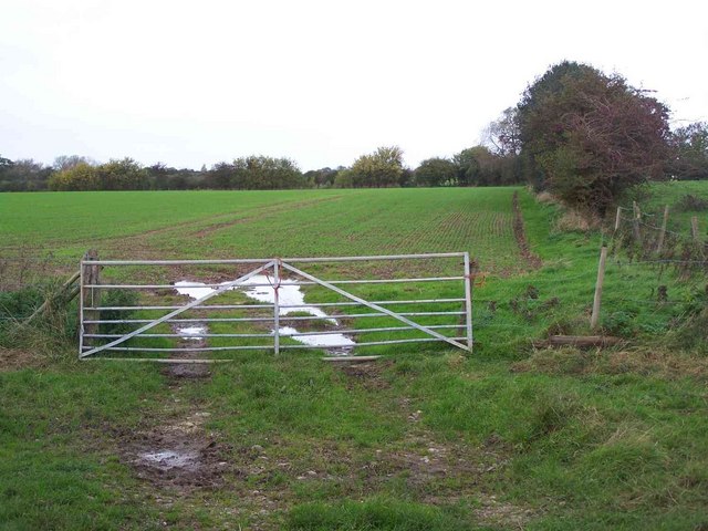
Cressel Wood is a small forest located in the county of Staffordshire, England. Covering an area of approximately 100 acres, it is known for its rich biodiversity and natural beauty. The wood is situated near the village of Cressel, which is surrounded by rolling hills and farmland.

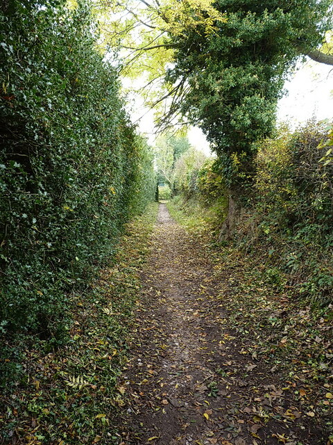
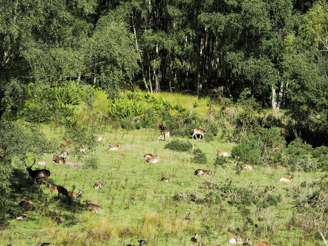
The forest is predominantly made up of deciduous trees, including oak, birch, and beech, which provide a stunning display of colors during the autumn season. The woodland floor is covered in a carpet of bluebells in spring, creating a picturesque scene. Cressel Wood is home to a variety of wildlife, including deer, foxes, badgers, and a wide range of bird species, making it a popular destination for birdwatchers and nature enthusiasts.

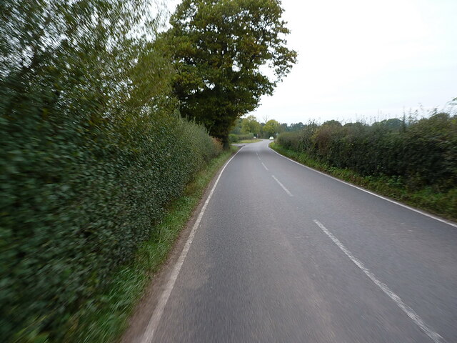
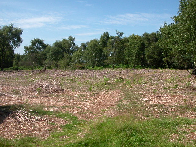
The wood offers several walking trails, allowing visitors to explore the serene surroundings and enjoy the peaceful atmosphere. There are also picnic areas and benches strategically placed throughout the forest, providing opportunities for relaxation and enjoying the scenery. Cressel Wood is managed by the local forestry commission, who ensure the preservation of the woodland and its inhabitants.

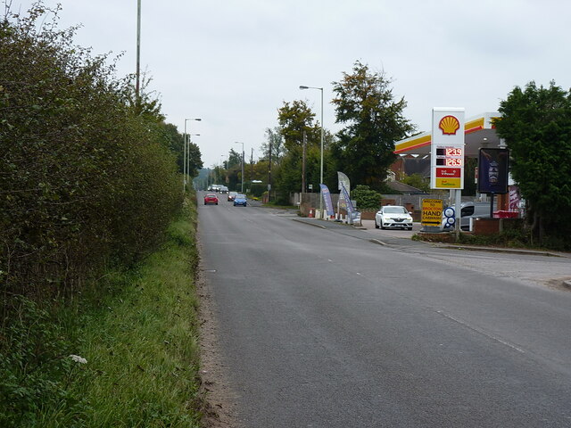
The forest is easily accessible by car, with a nearby parking area available for visitors. It also benefits from its close proximity to other attractions in Staffordshire, such as historic sites and charming villages, making it an ideal destination for day trips or longer stays. Cressel Wood offers a tranquil escape from the hustle and bustle of everyday life, providing a haven for those seeking solace in nature.

If you have any feedback on the listing, please let us know in the comments section below.
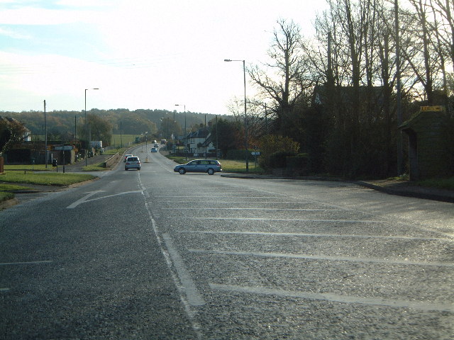
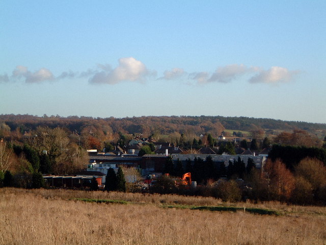
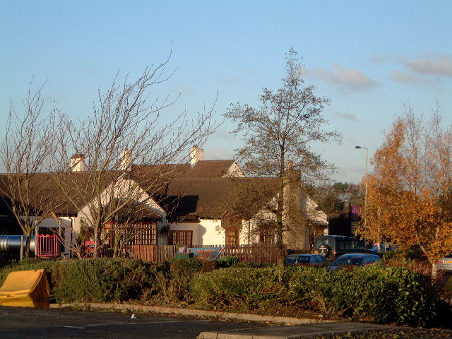
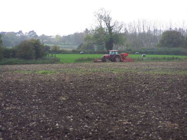
Cressel Wood Images

Images are sourced within 2km of 52.78213/-2.0547096 or Grid Reference SJ9620. Thanks to Geograph Open Source API. All images are credited.

Southern end of the bridleway The track from Walton on the Hill, which runs in a generally southeasterly direction, emerges here onto Sawpit Lane at Brocton.
Southern end of the bridleway
The track from Walton on the Hill, which runs in a generally southeasterly direction, emerges here onto Sawpit Lane at Brocton.
Dovecot at Brocton Hall In the grounds of Brocton Hall, which is now the golf club, this 18th century former dovecot was Grade II listed <span class="nowrap"><a title="https://britishlistedbuildings.co.uk/101116692-dovecote-at-brocton-hall-brocton#.Yle9wOjMI2w" rel="nofollow ugc noopener" href="https://britishlistedbuildings.co.uk/101116692-dovecote-at-brocton-hall-brocton#.Yle9wOjMI2w">Link</a><img style="margin-left:2px;" alt="External link" title="External link - shift click to open in new window" src="https://s1.geograph.org.uk/img/external.png" width="10" height="10"/></span> & <span class="nowrap"><a title="https://historicengland.org.uk/listing/the-list/list-entry/1116692" rel="nofollow ugc noopener" href="https://historicengland.org.uk/listing/the-list/list-entry/1116692">Link</a><img style="margin-left:2px;" alt="External link" title="External link - shift click to open in new window" src="https://s1.geograph.org.uk/img/external.png" width="10" height="10"/></span> in 1968.
Dovecot at Brocton Hall
In the grounds of Brocton Hall, which is now the golf club, this 18th century former dovecot was Grade II listed LinkExternal link & LinkExternal link in 1968.
Brocton Hall Originally the 18th century hall had a third floor, but this was lost to a fire around the start of WWII, and was never rebuilt. The hall is now the clubhouse of the golf club, and attracted a Grade II listing <span class="nowrap"><a title="https://britishlistedbuildings.co.uk/101116688-brocton-hall-brocton#.Yle__ujMI2w" rel="nofollow ugc noopener" href="https://britishlistedbuildings.co.uk/101116688-brocton-hall-brocton#.Yle__ujMI2w">Link</a><img style="margin-left:2px;" alt="External link" title="External link - shift click to open in new window" src="https://s1.geograph.org.uk/img/external.png" width="10" height="10"/></span> & <span class="nowrap"><a title="https://historicengland.org.uk/listing/the-list/list-entry/1116688" rel="nofollow ugc noopener" href="https://historicengland.org.uk/listing/the-list/list-entry/1116688">Link</a><img style="margin-left:2px;" alt="External link" title="External link - shift click to open in new window" src="https://s1.geograph.org.uk/img/external.png" width="10" height="10"/></span> in 1953.
Brocton Hall
Originally the 18th century hall had a third floor, but this was lost to a fire around the start of WWII, and was never rebuilt. The hall is now the clubhouse of the golf club, and attracted a Grade II listing LinkExternal link & LinkExternal link in 1953.
Ruins of a medieval building behind Brocton Hall Tucked away, attached to the wall of the large rear kitchen garden of <a href="https://www.geograph.org.uk/photo/7146661">SJ9619 : Brocton Hall</a>, these stone arches are the remains of an unknown building that once lay somewhere nearby. Despite the lack of detail, they were Grade II listed <span class="nowrap"><a title="https://britishlistedbuildings.co.uk/101116745-ruins-to-north-west-of-brocton-hall-brocton#.YlfBVujMI2w" rel="nofollow ugc noopener" href="https://britishlistedbuildings.co.uk/101116745-ruins-to-north-west-of-brocton-hall-brocton#.YlfBVujMI2w">Link</a><img style="margin-left:2px;" alt="External link" title="External link - shift click to open in new window" src="https://s1.geograph.org.uk/img/external.png" width="10" height="10"/></span> & <span class="nowrap"><a title="https://historicengland.org.uk/listing/the-list/list-entry/1116745" rel="nofollow ugc noopener" href="https://historicengland.org.uk/listing/the-list/list-entry/1116745">Link</a><img style="margin-left:2px;" alt="External link" title="External link - shift click to open in new window" src="https://s1.geograph.org.uk/img/external.png" width="10" height="10"/></span> in 1968.
Ruins of a medieval building behind Brocton Hall
Tucked away, attached to the wall of the large rear kitchen garden of SJ9619 : Brocton Hall, these stone arches are the remains of an unknown building that once lay somewhere nearby. Despite the lack of detail, they were Grade II listed LinkExternal link & LinkExternal link in 1968.
Filling station on the Cannock Road, A34, at Newtown Petrol at this point in time was for sale at £1.239 per litre, with diesel a few pence more than that.
Filling station on the Cannock Road, A34, at Newtown
Petrol at this point in time was for sale at £1.239 per litre, with diesel a few pence more than that.
Along Teddesley Road near Newtown
Fallow deer in hollow of old quarry There are around fifty deer in the image in open ground close to the village of Brocton on Cannock Chase. Maps indicate a quarry face of unknown height beyond the animals, screened by the woodland.
Fallow deer in hollow of old quarry
There are around fifty deer in the image in open ground close to the village of Brocton on Cannock Chase. Maps indicate a quarry face of unknown height beyond the animals, screened by the woodland.
Site of P.O.W. Camp at Cannock Chase 1914-1918 A small P.O.W. camp for U Boat crew was part of the Army Base. Some of the Prison Guards were men from the New Zealand Rifles, including my Father.
Site of P.O.W. Camp at Cannock Chase 1914-1918
A small P.O.W. camp for U Boat crew was part of the Army Base. Some of the Prison Guards were men from the New Zealand Rifles, including my Father.
Junction of A34 and Sawpit Lane and the way to Penkridge
Junction of A34 and Sawpit Lane
and the way to Penkridge
Newtown from the 7 stars Industrial estate outside Newtown, as viewed from the carpark of the Seven Stars at Brocton
Newtown from the 7 stars
Industrial estate outside Newtown, as viewed from the carpark of the Seven Stars at Brocton
Seven Stars at Brocton Public house
Seven Stars at Brocton
Public house
Ploughed Field, Near Bednall
Gateway Near Bednall
Road into Cannock Chase as  it leaves A34 at Brocton Road to Commonwealth and German War Cemetery on Cannock Chase
Road into Cannock Chase as it leaves A34 at Brocton
Road to Commonwealth and German War Cemetery on Cannock Chase
The Green, Brocton
The Green, Brocton
Village Green, Brocton
All Saints, Brocton
All Saints, Brocton
All Saints, Brocton
All Saints, Brocton
Show me another place!

Cressel Wood is located at Grid Ref: SJ9620 (Lat: 52.78213, Lng: -2.0547096)

Administrative County: Staffordshire

District: Stafford

Police Authority: Staffordshire

What 3 Words

///spearhead.acrobat.mailboxes. Near Great Haywood, Staffordshire

Related Wikis

Milford Hall

Milford Hall is a privately owned 18th-century English country house at Milford, near Stafford. It is the family seat of the Levett Haszard family and...

Walton-on-the-Hill, Staffordshire

Walton-on-the-Hill is a village in the Borough of Stafford in Staffordshire, England. It is about 5 km east of the centre of Stafford, and lies on the...

Milford, Staffordshire

Milford is a village in the county of Staffordshire, England. It lies at the edge of Cannock Chase, on the A513 road between Stafford and Rugeley. Just...

Brocton, Staffordshire

Brocton is a village and civil parish in the English county of Staffordshire. It is within the borough of Stafford. The village describes itself as the...

Walton High School, Stafford

Walton High School is a large mixed secondary school and sixth form serving a community in the southern part of Stafford, England.There are approximately...

Milford and Brocton railway station

Milford and Brocton railway station served the villages of Milford and Brocton in Staffordshire, England from 1877 to 1950 on the Trent Valley line....

Berkswich

Berkswich ( BAHK-switch) is a civil parish in the borough of Stafford in Staffordshire, England. According to the 2001 census it had a population of 1...

Shugborough Tunnel

The Shugborough Tunnel is a 777-yard (710 m) railway tunnel on the Trent Valley line running under part of the Shugborough Estate in Colwich, Staffordshire...

Nearby Amenities

Located within 500m of 52.78213,-2.0547096
Barrier: kissing_gate
Lat/Long: 52.7847327/-2.0599495
Power: pole
Lat/Long: 52.7848234/-2.0584507
Power: pole
Lat/Long: 52.7839478/-2.0575494
The data included in this document is from www.openstreetmap.org. The data is made available under ODbL.

Have you been to Cressel Wood?

Leave your review of Cressel Wood below (or comments, questions and feedback).