Manor Copse

Wood, Forest in Wiltshire

England

Manor Copse

Fonthill Estate, Wiltshire Looking north across parkland to Fonthill House and Little Ridge Wood behind.
Fonthill Estate, Wiltshire Credit: James Harrison

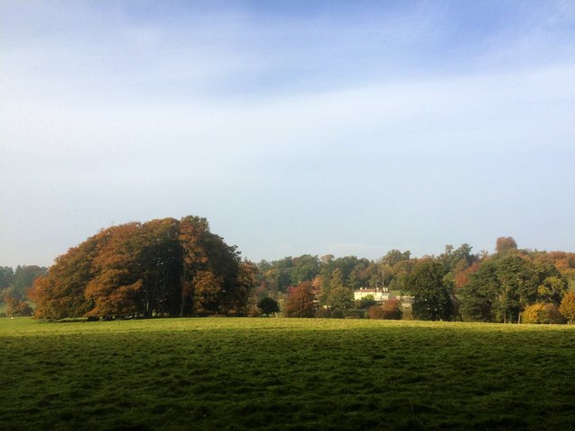
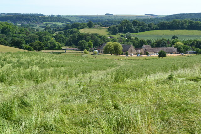
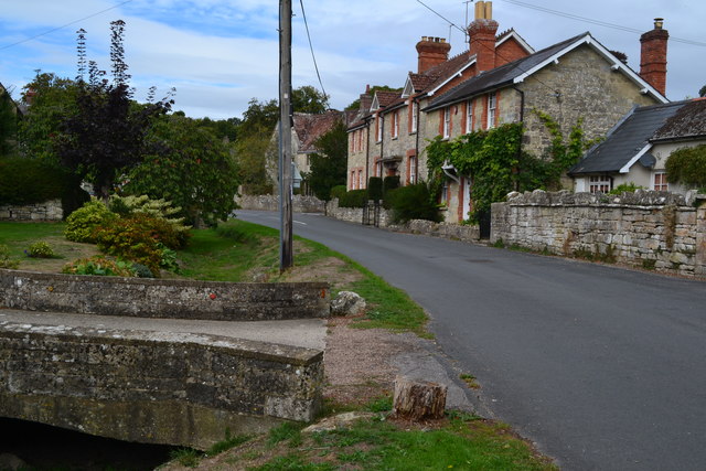
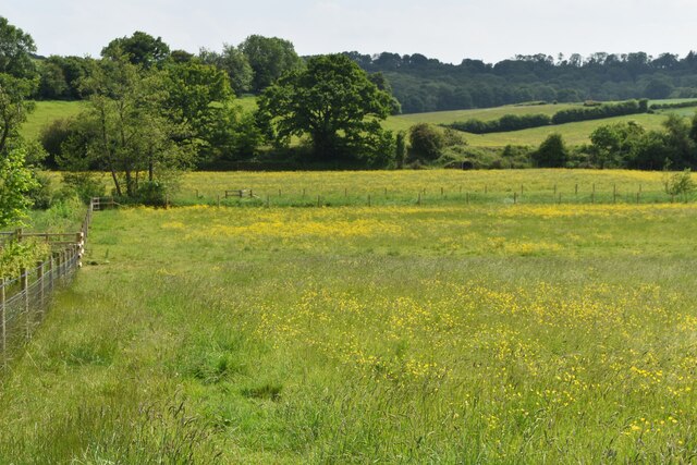
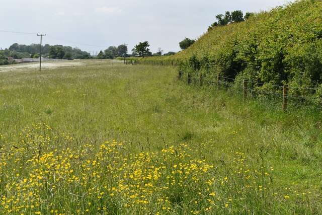
Manor Copse, located in Wiltshire, England, is a picturesque wood or forest that offers a tranquil and natural escape from the bustle of everyday life. Covering an area of approximately 100 acres, the copse is nestled within the county's beautiful countryside and boasts an array of native flora and fauna.

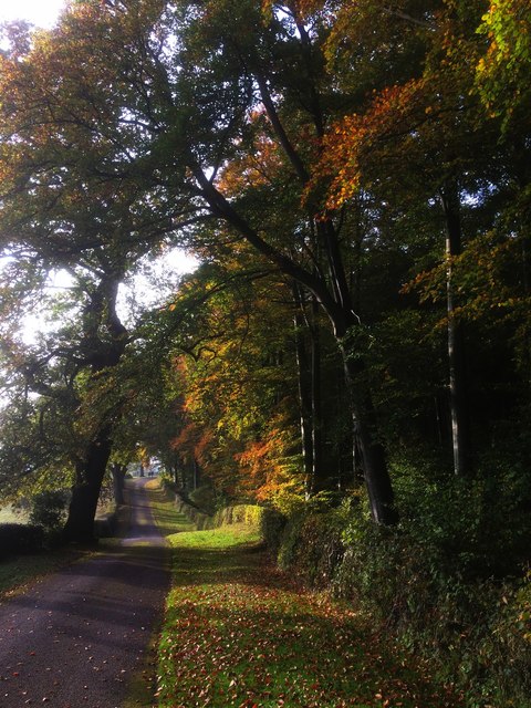
The woodland comprises a mix of broadleaf trees, predominantly oak and beech, which provide a striking canopy of green throughout the year. These ancient trees offer a haven for wildlife, including various bird species, small mammals, and insects. The copse is also home to a diverse range of plant life, with bluebells and wildflowers carpeting the forest floor during spring.

Visitors to Manor Copse can enjoy a variety of recreational activities such as walking, jogging, and birdwatching. The copse features well-maintained footpaths and trails that wind through the forest, allowing visitors to explore its enchanting beauty at their own pace. There are also designated picnic areas where visitors can relax and soak in the peaceful ambiance.

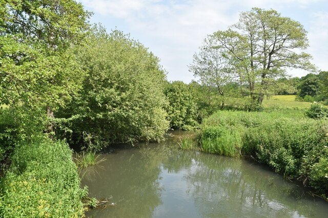
Manor Copse is managed by the local authorities to ensure the preservation of its natural habitat and promote biodiversity. Conservation efforts include regular tree maintenance, controlled burning of undergrowth, and the creation of wildlife corridors to encourage the movement of animals within the copse.

Overall, Manor Copse is a cherished natural gem in Wiltshire, providing a serene and idyllic setting for nature-lovers and outdoor enthusiasts alike.

If you have any feedback on the listing, please let us know in the comments section below.
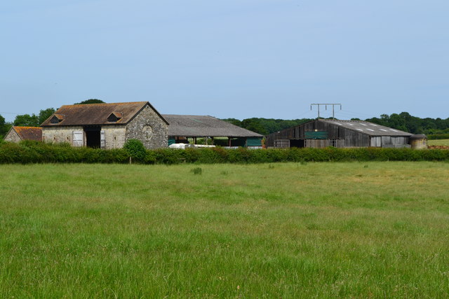
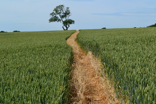
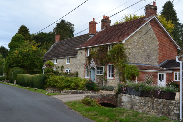
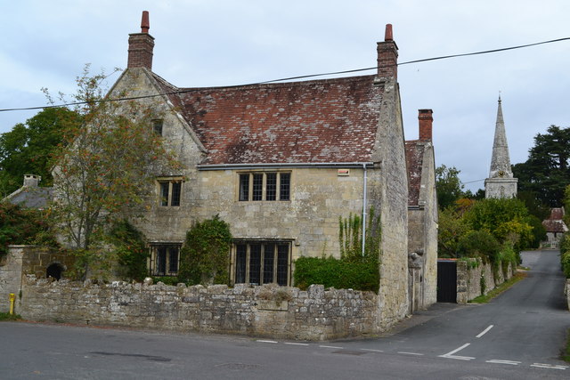
Manor Copse Images

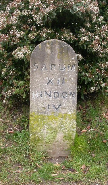
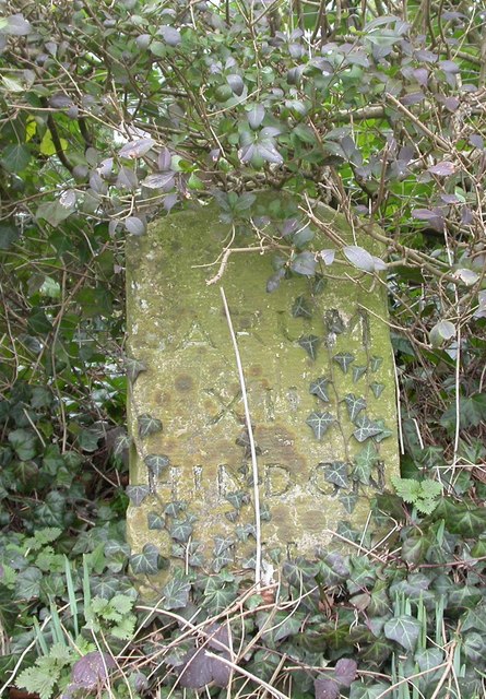
Images are sourced within 2km of 51.083723/-2.0553565 or Grid Reference ST9631. Thanks to Geograph Open Source API. All images are credited.

Fonthill Estate, Wiltshire Looking north across parkland to Fonthill House and Little Ridge Wood behind.
Fonthill Estate, Wiltshire
Looking north across parkland to Fonthill House and Little Ridge Wood behind.
Driveway to Fonthill House, Wiltshire Bounded on one side by Little Ridge Wood, and parkland on the other, this photograph shows the driveway from Ridge to Fonthill House, Wiltshire. The trees are showing their autumnal colours, emphasised by the low afternoon sunlight.
Driveway to Fonthill House, Wiltshire
Bounded on one side by Little Ridge Wood, and parkland on the other, this photograph shows the driveway from Ridge to Fonthill House, Wiltshire. The trees are showing their autumnal colours, emphasised by the low afternoon sunlight.
Salisbury Road
Salisbury Road
Salisbury Road
Salisbury Road
Black Dog pub A Wadworth pub on Salisbury Road.
Black Dog pub
A Wadworth pub on Salisbury Road.
Black Dog sign Sign for <a href="https://www.geograph.org.uk/photo/5444024">ST9632 : Black Dog pub</a>, a Wadworth pub on Salisbury Road.
Black Dog sign
Sign for ST9632 : Black Dog pub, a Wadworth pub on Salisbury Road.
Cottage at The Reeds
Valley view towards Place Farm The buildings at Place Farm now house an arts centre, Messums Wiltshire.
Valley view towards Place Farm
The buildings at Place Farm now house an arts centre, Messums Wiltshire.
Buildings at Vicarage Barn
No doubt about the footpath! Clearly marked path through crops towards distant tree.
No doubt about the footpath!
Clearly marked path through crops towards distant tree.
Houses near the school in Chilmark
House and church, Chilmark
Houses in The Street at Chilmark The stream channel to the left of the road is currently dry.
Houses in The Street at Chilmark
The stream channel to the left of the road is currently dry.
Old Milestone by the B3089, Salisbury Road, Chilmark Carved stone post by the B3089, in parish of CHILMARK (SALISBURY District), Salisbury Road; 200m East of Black Dog PH, by Parsons Paddock, by the road, on Northeast side of road. Hindon stone, erected by the Fisherton, Wilton, Heytesbury, Willoughby Hedge & Redhone turnpike trust in the 19th century. 

Inscription reads:-
SARUM
XII
HINDON
IV

Grade II listed.  
List Entry Number: 1130699 <span class="nowrap"><a title="https://historicengland.org.uk/listing/the-list/list-entry/1130699" rel="nofollow ugc noopener" href="https://historicengland.org.uk/listing/the-list/list-entry/1130699">Link</a><img style="margin-left:2px;" alt="External link" title="External link - shift click to open in new window" src="https://s1.geograph.org.uk/img/external.png" width="10" height="10"/></span>

Milestone Society National ID: WI_SAMR12.
Old Milestone by the B3089, Salisbury Road, Chilmark
Carved stone post by the B3089, in parish of CHILMARK (SALISBURY District), Salisbury Road; 200m East of Black Dog PH, by Parsons Paddock, by the road, on Northeast side of road. Hindon stone, erected by the Fisherton, Wilton, Heytesbury, Willoughby Hedge & Redhone turnpike trust in the 19th century. Inscription reads:- SARUM XII HINDON IV Grade II listed. List Entry Number: 1130699 LinkExternal link Milestone Society National ID: WI_SAMR12.
Old Milestone by the B3089, Ridge Farm, Salisbury Road, Chilmark Carved stone post by the B3089, in parish of CHILMARK (SALISBURY District), Salisbury Road, West of Chilmark, The Ridge, opposite Flower Ridge Farm in privet hedge, on North side of road. Hindon stone, erected by the Fisherton, Wilton, Heytesbury, Willoughby Hedge & Redhone turnpike trust in the 19th century. 

Inscription reads:-
SARUM
XIII
HINDON
III

Grade II listed.  
List Entry Number: 1249975 <span class="nowrap"><a title="https://historicengland.org.uk/listing/the-list/list-entry/1249975" rel="nofollow ugc noopener" href="https://historicengland.org.uk/listing/the-list/list-entry/1249975">Link</a><img style="margin-left:2px;" alt="External link" title="External link - shift click to open in new window" src="https://s1.geograph.org.uk/img/external.png" width="10" height="10"/></span>

Milestone Society National ID: WI_SAMR13.
Old Milestone by the B3089, Ridge Farm, Salisbury Road, Chilmark
Carved stone post by the B3089, in parish of CHILMARK (SALISBURY District), Salisbury Road, West of Chilmark, The Ridge, opposite Flower Ridge Farm in privet hedge, on North side of road. Hindon stone, erected by the Fisherton, Wilton, Heytesbury, Willoughby Hedge & Redhone turnpike trust in the 19th century. Inscription reads:- SARUM XIII HINDON III Grade II listed. List Entry Number: 1249975 LinkExternal link Milestone Society National ID: WI_SAMR13.
Buttercup meadow in Nadder Valley
Footpath beside road, Lower Chicksgrove The footpath enters the field just west of Lower Chicksgrove and provides an off-road route to the west.
Footpath beside road, Lower Chicksgrove
The footpath enters the field just west of Lower Chicksgrove and provides an off-road route to the west.
River Nadder just above Coleman's Farm
Show me another place!

Manor Copse is located at Grid Ref: ST9631 (Lat: 51.083723, Lng: -2.0553565)

Unitary Authority: Wiltshire

Police Authority: Wiltshire

What 3 Words

///stuff.dunk.dialects. Near Tisbury, Wiltshire

Related Wikis

Lady Down Quarry

Lady Down Quarry (grid reference ST961307) is a 2,300 square metre geological Site of Special Scientific Interest in the northeast of Tisbury parish in...

Chilmark, Wiltshire

Chilmark is a Wiltshire village and civil parish of some 150 houses straddling the B3089 road, 11 miles (18 km) west of Salisbury, England. The parish...

Chilmark Quarries

Chilmark Quarries (grid reference ST974312) is a 9.65 hectare biological and geological Site of Special Scientific Interest (SSSI), in the ravine south...

Lower Chicksgrove

Lower Chicksgrove is a hamlet on the north bank of the River Nadder in the south of the county of Wiltshire, England, within the Vale of Wardour. It is...

Chicksgrove Quarry

Chicksgrove Quarry (grid reference ST962296) is a 14 acres (5.7 ha) geological Site of Special Scientific Interest south of Upper Chicksgrove in Wiltshire...

Place Farm, Tisbury

Place Farm is a complex of medieval buildings in the village of Tisbury, Wiltshire, England. They originally formed a grange of Shaftesbury Abbey. The...

Tisbury, Wiltshire

Tisbury is a large village and civil parish approximately 13 miles (21 km) west of Salisbury in the English county of Wiltshire. With a population at the...

Teffont

Teffont is a civil parish in the south of Wiltshire, England, consisting of the villages of Teffont Magna and Teffont Evias. It is in the Nadder valley...

Nearby Amenities

Located within 500m of 51.083723,-2.0553565
Parking
Lat/Long: 51.0794071/-2.0543419
Barrier: stile
Lat/Long: 51.0875476/-2.0524642
The data included in this document is from www.openstreetmap.org. The data is made available under ODbL.

Have you been to Manor Copse?

Leave your review of Manor Copse below (or comments, questions and feedback).