Clap Lane Coppice

Wood, Forest in Wiltshire

England

Clap Lane Coppice

Parkland east of Oakley Lane Part of Rushmore Park.
Parkland east of Oakley Lane Credit: Robin Webster

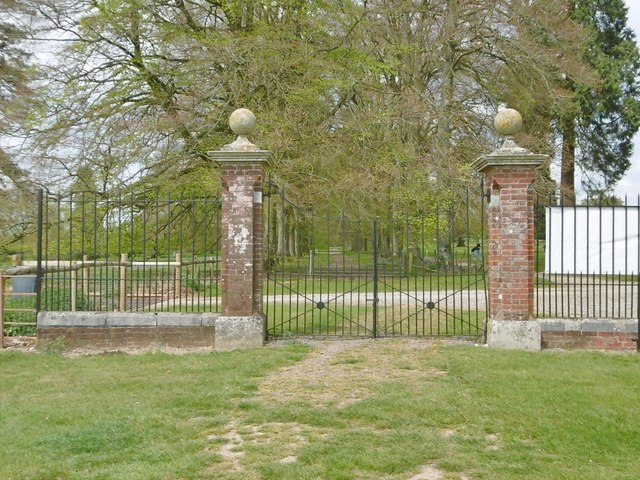
Clap Lane Coppice is a picturesque wood located in the county of Wiltshire, England. Covering an area of approximately 50 acres, it is situated on the outskirts of a charming village, surrounded by rolling countryside. The coppice is known for its dense and diverse woodland, which consists mainly of oak, beech, and ash trees.

The wood is a haven for wildlife, providing a rich habitat for a variety of species. Visitors can expect to encounter a plethora of birdlife, including woodpeckers, owls, and songbirds, as well as small mammals such as squirrels and foxes. The woodland floor is also home to an array of wildflowers, ferns, and fungi, adding to the natural beauty of the area.

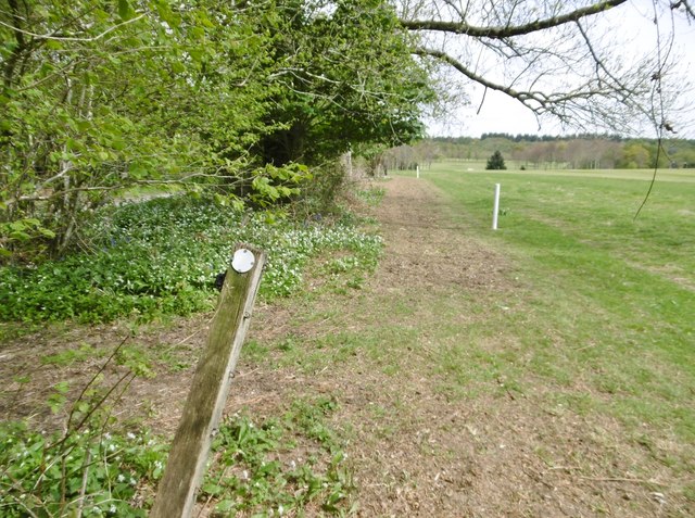
Clap Lane Coppice offers a tranquil escape for nature enthusiasts and walkers alike. There are several well-maintained footpaths that wind their way through the wood, providing opportunities for leisurely strolls and exploration. Along these paths, visitors can appreciate the peaceful ambiance and immerse themselves in the sights and sounds of the forest.

The wood has historical significance too, with evidence of human activity dating back centuries. Ancient earthworks and remnants of old boundary walls can be found within the coppice, offering a glimpse into the area's past. These historical features add to the charm and character of Clap Lane Coppice, making it a truly unique and captivating natural attraction in Wiltshire.

Whether one is seeking a serene escape or an opportunity to connect with nature, Clap Lane Coppice offers a delightful experience for visitors of all ages.

If you have any feedback on the listing, please let us know in the comments section below.

Clap Lane Coppice Images

Images are sourced within 2km of 50.952325/-2.0776215 or Grid Reference ST9416. Thanks to Geograph Open Source API. All images are credited.

Parkland east of Oakley Lane Part of Rushmore Park.
Parkland east of Oakley Lane
Part of Rushmore Park.
B3081 looking east Heading towards Sixpenny Handley.
B3081 looking east
Heading towards Sixpenny Handley.
Rushmore Park, avenue The remains of a once fine avenue of beech trees, at the southern entrance to the estate.
Rushmore Park, avenue
The remains of a once fine avenue of beech trees, at the southern entrance to the estate.
Rushmore Park, timber Beech trunks, awaiting collection by the roadside.
Rushmore Park, timber
Beech trunks, awaiting collection by the roadside.
Rushmore Park, footpath Skirting woodland, towards Shermel Gate.
Rushmore Park, footpath
Skirting woodland, towards Shermel Gate.
Rushmore Park, avenue A once fine avenue of beech trees leading from South Lodge. Several have disappeared or are in poor condition.
Rushmore Park, avenue
A once fine avenue of beech trees leading from South Lodge. Several have disappeared or are in poor condition.
Rushmore Park, platform Possibly used for watching equestrian events.
Rushmore Park, platform
Possibly used for watching equestrian events.
Rushmore Park, gate Entering Pollards Wood, on the path to Shermel Gate.
Rushmore Park, gate
Entering Pollards Wood, on the path to Shermel Gate.
Rushmore Park, footpath Through Pollards Wood, on the way to Shermel Gate; part of Hardy Way.
Rushmore Park, footpath
Through Pollards Wood, on the way to Shermel Gate; part of Hardy Way.
Rushmore Park, bluebells Wild bluebells under, unusually, a screen of conifers in Uddens Coppice.
Rushmore Park, bluebells
Wild bluebells under, unusually, a screen of conifers in Uddens Coppice.
Rushmore Park, marker On the path through Uddens Coppice towards Shermel Gate; on Hardy Way.
Rushmore Park, marker
On the path through Uddens Coppice towards Shermel Gate; on Hardy Way.
Rushmore Park, bluebell wood Wild bluebells in Brookes Coppice.
Rushmore Park, bluebell wood
Wild bluebells in Brookes Coppice.
Rushmore Park, golf course Part of an extensive 18-hole course: <span class="nowrap"><a title="http://www.rushmoregolfclub.co.uk/cms/" rel="nofollow ugc noopener" href="http://www.rushmoregolfclub.co.uk/cms/">Link</a><img style="margin-left:2px;" alt="External link" title="External link - shift click to open in new window" src="https://s1.geograph.org.uk/img/external.png" width="10" height="10"/></span>
Rushmore Park, golf course
Part of an extensive 18-hole course: LinkExternal link
Rushmore Park, dewpond Used by the local sheep.
Rushmore Park, dewpond
Used by the local sheep.
Rushmore Park, bluebells Wild bluebells next to the golf course.
Rushmore Park, bluebells
Wild bluebells next to the golf course.
Rushmore Park, golf course An extensive 18-hole course: <span class="nowrap"><a title="http://www.rushmoregolfclub.co.uk/cms/" rel="nofollow ugc noopener" href="http://www.rushmoregolfclub.co.uk/cms/">Link</a><img style="margin-left:2px;" alt="External link" title="External link - shift click to open in new window" src="https://s1.geograph.org.uk/img/external.png" width="10" height="10"/></span>
Rushmore Park, golf course
An extensive 18-hole course: LinkExternal link
Rushmore Park, gateway Also on the Wiltshire/Dorset boundary.
Rushmore Park, gateway
Also on the Wiltshire/Dorset boundary.
Rushmore Park, marker On the footpath to Shermel Gate, part of Hardy Way. Beware golf balls from the right!
Rushmore Park, marker
On the footpath to Shermel Gate, part of Hardy Way. Beware golf balls from the right!
Show me another place!

Clap Lane Coppice is located at Grid Ref: ST9416 (Lat: 50.952325, Lng: -2.0776215)

Unitary Authority: Wiltshire

Police Authority: Wiltshire

What 3 Words

///knee.croaking.lobbed. Near Pimperne, Dorset

Related Wikis

Larmer Tree Festival

Larmer Tree Festival was a three-day music, comedy and arts festival held annually from 1990 until 2019 at the Larmer Tree Gardens, near Tollard Royal...

Larmer Tree Gardens

The Larmer Tree Gardens near Tollard Royal in south Wiltshire, England, were created by landowner Augustus Pitt Rivers in 1880 as pleasure grounds for...

King John's House, Tollard Royal

King John's House is a former manor house in the south Wiltshire village of Tollard Royal, England. Just south of the church, the building has at its core...

South Lodge Camp

South Lodge Camp is an archaeological site of the Bronze Age, about 0.6 miles (1.0 km) south-east of the village of Tollard Royal, in Wiltshire, England...

Tollard Royal

Tollard Royal is a village and civil parish on Cranborne Chase, Wiltshire, England. The parish is on Wiltshire's southern boundary with Dorset and the...

Sandroyd School

Sandroyd School is an independent co-educational preparatory school for day and boarding pupils aged 2 to 13 in the south of Wiltshire, England. The school...

Woodcutts Settlement

Woodcutts Settlement is an archaeological site of the late Iron Age and Romano-British period on Cranborne Chase, England. It is situated about 1 mile...

Farnham, Dorset

Farnham is a village and civil parish in North Dorset, in the south of England, on Cranborne Chase, seven miles (eleven kilometres) northeast of Blandford...

Nearby Amenities

Located within 500m of 50.952325,-2.0776215
Leisure: playground
Lat/Long: 50.9513862/-2.0817376
Barrier: entrance
Lat/Long: 50.9504282/-2.0746604
Material: wood
Power: pole
Source: bing
Lat/Long: 50.9493645/-2.0729
Material: wood
Power: pole
Source: bing
Lat/Long: 50.9502026/-2.0734955
Material: wood
Power: pole
Source: bing
Lat/Long: 50.950865/-2.073989
Material: wood
Power: pole
Source: bing
Lat/Long: 50.951159/-2.0740051
Material: wood
Power: pole
Source: bing
Lat/Long: 50.9511658/-2.0747695
Material: wood
Power: pole
Source: bing
Lat/Long: 50.9511743/-2.0804451
Material: wood
Power: pole
Source: bing
Lat/Long: 50.9511996/-2.0762635
Material: wood
Power: pole
Source: bing
Lat/Long: 50.9512199/-2.0797477
Material: wood
Power: pole
Source: bing
Lat/Long: 50.9522219/-2.0741043
Material: wood
Power: pole
Source: bing
Lat/Long: 50.953136/-2.0741821
Material: wood
Power: pole
Source: bing
Lat/Long: 50.9538085/-2.0746488
Material: wood
Power: pole
Source: bing
Lat/Long: 50.9539031/-2.0750833
Material: wood
Power: pole
Source: bing
Lat/Long: 50.954192/-2.0742921
Material: wood
Power: pole
Source: bing
Lat/Long: 50.9542005/-2.0753998
Material: wood
Power: pole
Source: bing
Lat/Long: 50.9545435/-2.0756547
Material: wood
Power: pole
Source: bing
Lat/Long: 50.9547496/-2.0743457
Material: wood
Power: pole
Source: bing
Lat/Long: 50.9548915/-2.075947
Material: wood
Power: pole
Source: bing
Lat/Long: 50.9551416/-2.0735035
Material: wood
Power: pole
Source: bing
Lat/Long: 50.9555285/-2.0726372
Material: wood
Power: pole
Source: bing
Lat/Long: 50.9555758/-2.0750377
Entrance: yes
Lat/Long: 50.9522112/-2.0833029
Cafe
Coffee Grove Café
Lat/Long: 50.951455/-2.0826565
Grotto
Man Made: yes
Lat/Long: 50.951185/-2.083782
Defibrillator
Emergency: defibrillator
Lat/Long: 50.9514034/-2.0826315
The data included in this document is from www.openstreetmap.org. The data is made available under ODbL.

Have you been to Clap Lane Coppice?

Leave your review of Clap Lane Coppice below (or comments, questions and feedback).