Biles Coppice

Wood, Forest in Wiltshire

England

Biles Coppice

Parkland east of Oakley Lane Part of Rushmore Park.
Parkland east of Oakley Lane Credit: Robin Webster

Biles Coppice is a picturesque woodland located in Wiltshire, England. Covering an area of approximately 100 acres, it is a popular destination for nature lovers and outdoor enthusiasts. The coppice is situated near the village of Trowbridge, making it easily accessible for locals and visitors alike.

The woodland is predominantly made up of native broadleaf trees such as oak, beech, and ash, creating a diverse and vibrant ecosystem. These trees provide a rich habitat for a variety of flora and fauna, including bluebells, wood anemones, and various species of birds and insects.

Trails and footpaths have been established throughout Biles Coppice, allowing visitors to explore the woods at their own pace. These pathways wind through the dense foliage, offering stunning views of the surrounding countryside and providing a peaceful and tranquil atmosphere.

The coppice also boasts a small picnic area where visitors can relax and enjoy a packed lunch amidst the natural beauty. Additionally, the woodland is a popular spot for wildlife spotting and birdwatching, with many species making their home within its boundaries.

Biles Coppice is managed by the local authorities, ensuring its conservation and protection for future generations to enjoy. The wood is open to the public all year round, with no entry fee, making it an affordable and accessible destination for outdoor recreation.

Overall, Biles Coppice is a hidden gem in Wiltshire, offering a serene and enchanting woodland experience for nature enthusiasts and those seeking a peaceful escape from the hustle and bustle of everyday life.

If you have any feedback on the listing, please let us know in the comments section below.

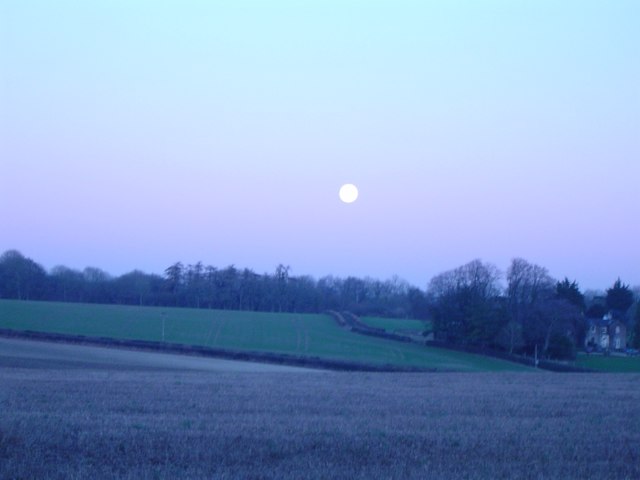
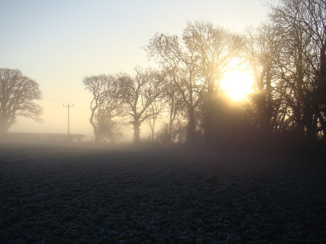
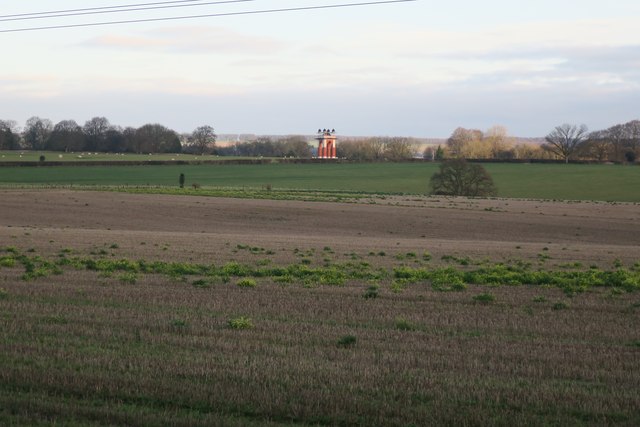
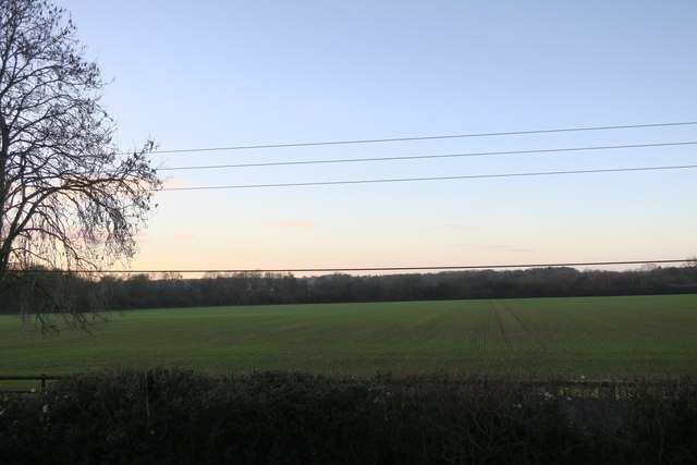
Biles Coppice Images

Images are sourced within 2km of 50.950313/-2.0865296 or Grid Reference ST9416. Thanks to Geograph Open Source API. All images are credited.

Parkland east of Oakley Lane Part of Rushmore Park.
Parkland east of Oakley Lane
Part of Rushmore Park.
Rushmore Park, avenue The remains of a once fine avenue of beech trees, at the southern entrance to the estate.
Rushmore Park, avenue
The remains of a once fine avenue of beech trees, at the southern entrance to the estate.
Rushmore Park, timber Beech trunks, awaiting collection by the roadside.
Rushmore Park, timber
Beech trunks, awaiting collection by the roadside.
Rushmore Park, footpath Skirting woodland, towards Shermel Gate.
Rushmore Park, footpath
Skirting woodland, towards Shermel Gate.
Rushmore Park, avenue A once fine avenue of beech trees leading from South Lodge. Several have disappeared or are in poor condition.
Rushmore Park, avenue
A once fine avenue of beech trees leading from South Lodge. Several have disappeared or are in poor condition.
Rushmore Park, platform Possibly used for watching equestrian events.
Rushmore Park, platform
Possibly used for watching equestrian events.
Rushmore Park, gate Entering Pollards Wood, on the path to Shermel Gate.
Rushmore Park, gate
Entering Pollards Wood, on the path to Shermel Gate.
Rushmore Park, footpath Through Pollards Wood, on the way to Shermel Gate; part of Hardy Way.
Rushmore Park, footpath
Through Pollards Wood, on the way to Shermel Gate; part of Hardy Way.
Rushmore Park, bluebells Wild bluebells under, unusually, a screen of conifers in Uddens Coppice.
Rushmore Park, bluebells
Wild bluebells under, unusually, a screen of conifers in Uddens Coppice.
Rushmore Park, marker On the path through Uddens Coppice towards Shermel Gate; on Hardy Way.
Rushmore Park, marker
On the path through Uddens Coppice towards Shermel Gate; on Hardy Way.
Rushmore Park, dewpond Used by the local sheep.
Rushmore Park, dewpond
Used by the local sheep.
Bleak midwinter Full moon, short day, midwinter sky
Bleak midwinter
Full moon, short day, midwinter sky
Field's edge
Field's edge
Field in Winter A collection of photographs taken around midday on 1st January 2019 by Geographers from all over Britain and Ireland.

To view all the photos on a map, see <a title="https://www.geograph.org.uk/search.php?i=134301129&page=1&displayclass=map" href="https://www.geograph.org.uk/search.php?i=134301129&page=1&displayclass=map">Link</a>
Field in Winter
A collection of photographs taken around midday on 1st January 2019 by Geographers from all over Britain and Ireland. To view all the photos on a map, see Link
Field in Winter
Field in Winter
Old Direction Sign - Signpost by Minchington Cross, Sixpenny Handley parish Annulus finial - 3 arms; Dorset halo without NGR by the UC road, in parish of Sixpenny Handley (East Dorset District), Minchington Cross, junction with UC road to Farnham, on verge.

Surveyed

Milestone Society National ID: DO_ST9516
Old Direction Sign - Signpost by Minchington Cross, Sixpenny Handley parish
Annulus finial - 3 arms; Dorset halo without NGR by the UC road, in parish of Sixpenny Handley (East Dorset District), Minchington Cross, junction with UC road to Farnham, on verge. Surveyed Milestone Society National ID: DO_ST9516
Bench's Lane at Dusk Provides an alternative route for walkers, horses and cycles to Tollard Royal - from the B3081
Bench's Lane at Dusk
Provides an alternative route for walkers, horses and cycles to Tollard Royal - from the B3081
Wessex Ridgeway heading for Tollard Royal The long distance footpath has adopted Bench's Lane to reach Tollard Royal.
On more recent Ordnance Survey maps the spelling is "Benches"
Wessex Ridgeway heading for Tollard Royal
The long distance footpath has adopted Bench's Lane to reach Tollard Royal. On more recent Ordnance Survey maps the spelling is "Benches"
Show me another place!

Biles Coppice is located at Grid Ref: ST9416 (Lat: 50.950313, Lng: -2.0865296)

Unitary Authority: Wiltshire

Police Authority: Wiltshire

What 3 Words

///chimp.loitering.smoking. Near Pimperne, Dorset

Related Wikis

Larmer Tree Festival

Larmer Tree Festival was a three-day music, comedy and arts festival held annually from 1990 until 2019 at the Larmer Tree Gardens, near Tollard Royal...

Larmer Tree Gardens

The Larmer Tree Gardens near Tollard Royal in south Wiltshire, England, were created by landowner Augustus Pitt Rivers in 1880 as pleasure grounds for...

King John's House, Tollard Royal

King John's House is a former manor house in the south Wiltshire village of Tollard Royal, England. Just south of the church, the building has at its core...

Tollard Royal

Tollard Royal is a village and civil parish on Cranborne Chase, Wiltshire, England. The parish is on Wiltshire's southern boundary with Dorset and the...

South Lodge Camp

South Lodge Camp is an archaeological site of the Bronze Age, about 0.6 miles (1.0 km) south-east of the village of Tollard Royal, in Wiltshire, England...

Sandroyd School

Sandroyd School is an independent co-educational preparatory school for day and boarding pupils aged 2 to 13 in the south of Wiltshire, England. The school...

Farnham, Dorset

Farnham is a village and civil parish in North Dorset, in the south of England, on Cranborne Chase, seven miles (eleven kilometres) northeast of Blandford...

Woodcutts Settlement

Woodcutts Settlement is an archaeological site of the late Iron Age and Romano-British period on Cranborne Chase, England. It is situated about 1 mile...

Nearby Amenities

Located within 500m of 50.950313,-2.0865296
Leisure: playground
Lat/Long: 50.9513862/-2.0817376
Material: wood
Power: pole
Source: bing
Lat/Long: 50.9461461/-2.0880223
Material: wood
Power: pole
Source: bing
Lat/Long: 50.9470232/-2.0892561
Material: wood
Power: pole
Source: bing
Lat/Long: 50.9479374/-2.0905597
Material: wood
Power: pole
Source: bing
Lat/Long: 50.9493924/-2.0912141
Material: wood
Poles: bipole
Power: pole
Source: bing
Lat/Long: 50.9508321/-2.0919008
Material: wood
Power: pole
Source: bing
Lat/Long: 50.9520419/-2.0918552
Material: wood
Power: pole
Source: bing
Lat/Long: 50.9531723/-2.091823
Material: wood
Power: pole
Source: bing
Lat/Long: 50.9511743/-2.0804451
Material: wood
Power: pole
Source: bing
Lat/Long: 50.9512199/-2.0797477
Entrance: yes
Lat/Long: 50.9522112/-2.0833029
Cafe
Coffee Grove Café
Lat/Long: 50.951455/-2.0826565
Grotto
Man Made: yes
Lat/Long: 50.951185/-2.083782
Defibrillator
Emergency: defibrillator
Lat/Long: 50.9514034/-2.0826315
The data included in this document is from www.openstreetmap.org. The data is made available under ODbL.

Have you been to Biles Coppice?

Leave your review of Biles Coppice below (or comments, questions and feedback).