Briery Hill Copse

Wood, Forest in Gloucestershire Cotswold

England

Briery Hill Copse

Converted vernacular farm buildings
Converted vernacular farm buildings Credit: P Gaskell

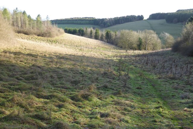
Briery Hill Copse is a picturesque woodland located in the county of Gloucestershire, England. Spread across several acres, this charming forest is a popular destination for nature enthusiasts and hikers alike.

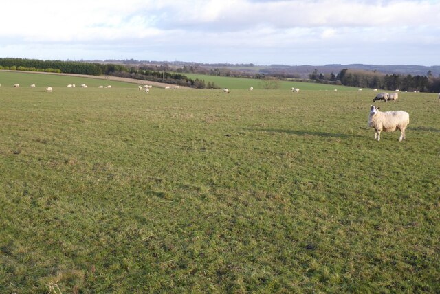
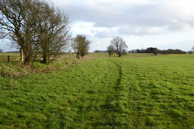
The copse is characterized by its dense canopy of trees, predominantly consisting of oak, beech, and ash. These towering trees provide shelter and habitat for a variety of wildlife, including birds, squirrels, and deer. The forest floor is covered with a lush carpet of ferns, moss, and wildflowers, adding to the area's natural beauty.

Tranquility is a defining feature of Briery Hill Copse, making it an ideal escape from the hustle and bustle of everyday life. The peaceful ambiance is enhanced by the absence of man-made structures, allowing visitors to immerse themselves in the serenity of the natural surroundings.

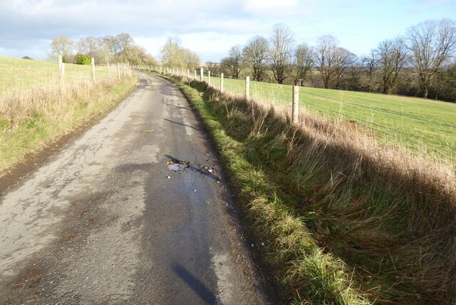
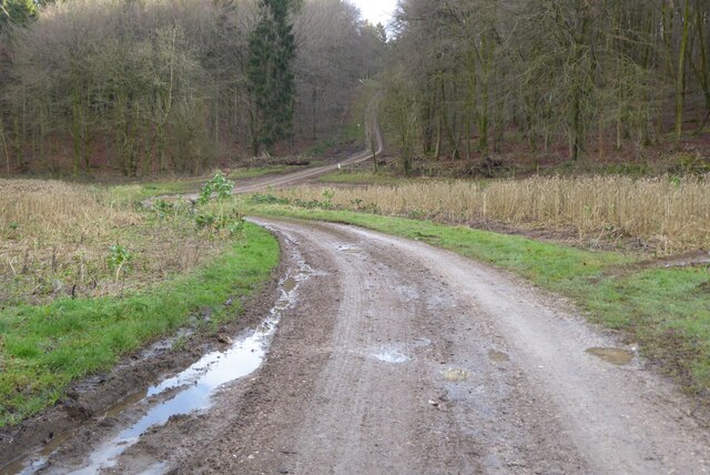
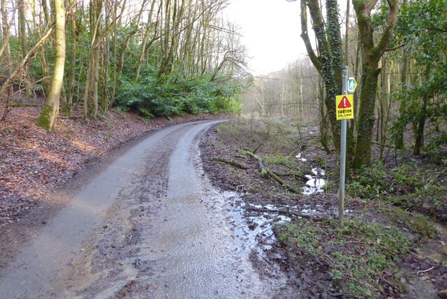
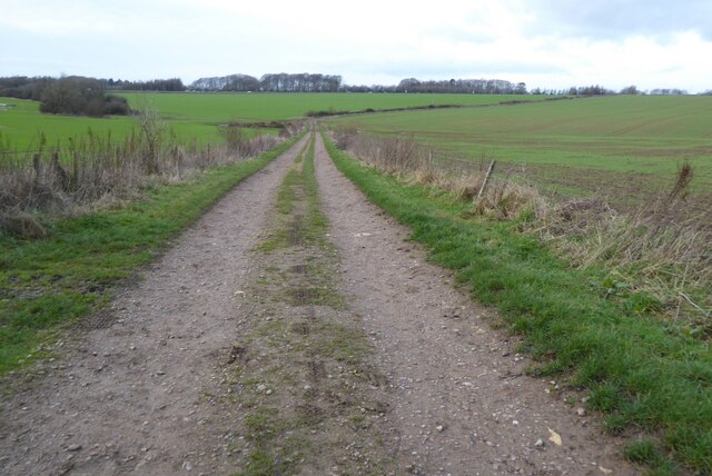
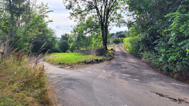
Several well-marked trails wind their way through the copse, providing visitors with the opportunity to explore and discover the woodland's hidden treasures. These paths cater to all levels of fitness, offering both gentle strolls and more challenging hikes. Along the way, walkers can enjoy breathtaking views of the surrounding countryside and may even stumble upon a babbling brook or two.

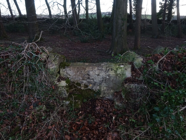
Briery Hill Copse is also home to a rich history, with evidence of human presence dating back centuries. Archaeological remnants, such as ancient burial mounds and hill forts, can be found within the woodland, adding an additional layer of intrigue for history enthusiasts.

Overall, Briery Hill Copse is a captivating woodland that offers a tranquil retreat for nature lovers, an opportunity for exploration, and a glimpse into the region's past.

If you have any feedback on the listing, please let us know in the comments section below.

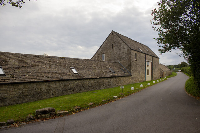
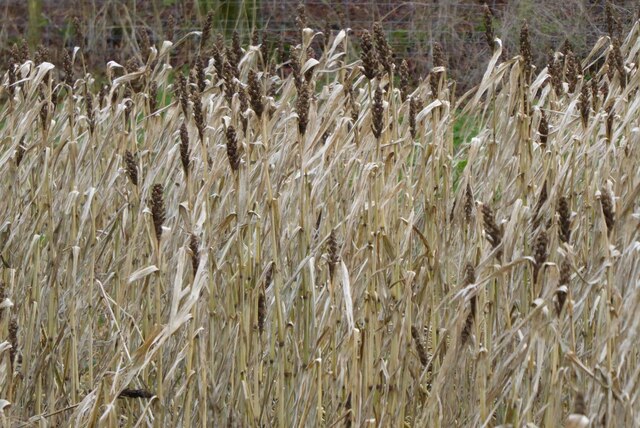
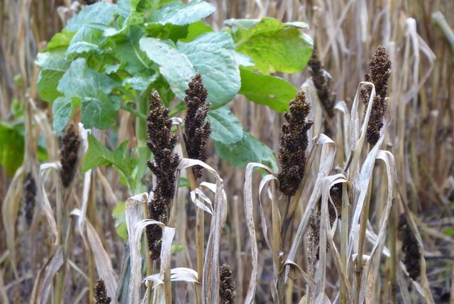
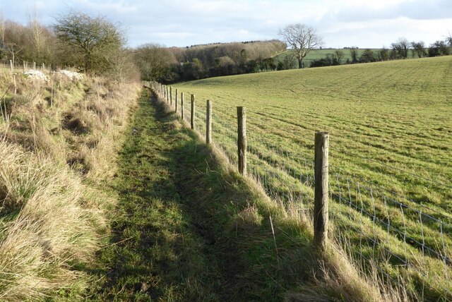
Briery Hill Copse Images

Images are sourced within 2km of 51.818443/-2.0800778 or Grid Reference SO9413. Thanks to Geograph Open Source API. All images are credited.

Converted vernacular farm buildings
Brimsfield Park Farm
Watercombe Farm
Watercombe Farm
The Gloucestershire Way The Gloucestershire Way crossing a field between forestry and entering the valley above Coberley known as Coldwell Bottom.
The Gloucestershire Way
The Gloucestershire Way crossing a field between forestry and entering the valley above Coberley known as Coldwell Bottom.
Country road to Cowley Country road to the south of Cowley.
Country road to Cowley
Country road to the south of Cowley.
Track into Cowley Track into Cowley Wood in Harcombe Bottom south of the village of Cowley.
Track into Cowley
Track into Cowley Wood in Harcombe Bottom south of the village of Cowley.
Game cover in Harcombe Bottom
Game cover crop Game cover crop in Harcombe Bottom.
Game cover crop
Game cover crop in Harcombe Bottom.
Road entering Harcombe Bottom
Bridleway to Barcombe Bottom A similar view to this picture <a href="https://www.geograph.org.uk/photo/1155031">SO9513 : Snow covered farmland, near Cowley</a> I took in February 2009 after a fall of snow.
Bridleway to Barcombe Bottom
A similar view to this picture SO9513 : Snow covered farmland, near Cowley I took in February 2009 after a fall of snow.
Farmland above Cowley Sheep grazing on farmland above Cowley.
Farmland above Cowley
Sheep grazing on farmland above Cowley.
Farmland near Stockwell A public right of way follows the field boundary on the left.
Farmland near Stockwell
A public right of way follows the field boundary on the left.
Track and footpath Track and footpath to Barrow Wake.
Track and footpath
Track and footpath to Barrow Wake.
Stone Stile, Elkstone Not on a registered footpath, this affords access to the woodland and the well trodden path leads to the private house "Highgate". This is the view from the woodland, the alternative view from the road is <a href="https://www.geograph.org.uk/photo/7104422">SO9512 : Stone Stile, Elkstone</a>.
Stone Stile, Elkstone
Not on a registered footpath, this affords access to the woodland and the well trodden path leads to the private house "Highgate". This is the view from the woodland, the alternative view from the road is SO9512 : Stone Stile, Elkstone.
Stone Stile, Elkstone Not on a registered footpath, this affords access to the woodland and the well trodden path leads to the private house "Highgate" to the West. This is the view from the road, the alternative view from the woodland is <a href="https://www.geograph.org.uk/photo/7104421">SO9512 : Stone Stile, Elkstone</a>.
Stone Stile, Elkstone
Not on a registered footpath, this affords access to the woodland and the well trodden path leads to the private house "Highgate" to the West. This is the view from the road, the alternative view from the woodland is SO9512 : Stone Stile, Elkstone.
Toll House, Birdlip The Old Pyke House, on the original part of the Ermin Way. Used by the Cirencester (Gloucester District) Turnpike Trust.

Milestone Society National ID: GL.BRI
Toll House, Birdlip
The Old Pyke House, on the original part of the Ermin Way. Used by the Cirencester (Gloucester District) Turnpike Trust. Milestone Society National ID: GL.BRI
Footpath to Coldwell Bottom Complete with a selection of signage relating to dog-walking and no parking.
Footpath to Coldwell Bottom
Complete with a selection of signage relating to dog-walking and no parking.
Forking lanes, Cowley, Gloucestershire The right lane meanders around some cottages the left goes directly to the village centre.
Forking lanes, Cowley, Gloucestershire
The right lane meanders around some cottages the left goes directly to the village centre.
Show me another place!

Briery Hill Copse is located at Grid Ref: SO9413 (Lat: 51.818443, Lng: -2.0800778)

Administrative County: Gloucestershire

District: Cotswold

Police Authority: Gloucestershire

What 3 Words

///argued.crib.sculpting. Near Shurdington, Gloucestershire

Related Wikis

Bushley Muzzard, Brimpsfield

Bushley Muzzard, Brimpsfield (grid reference SO944133) is a 1.13-hectare (2.8-acre) biological Site of Special Scientific Interest in Gloucestershire,...

Church of St Michael, Brimpsfield

The Anglican Church of St Michael at Brimpsfield in the Cotswold District of Gloucestershire, England was built in 12th century. It is a grade I listed...

Brimpsfield Priory

Brimpsfield Priory was a Benedictine monastic foundation in Brimpsfield, Gloucestershire, England, a cell or grange of the Abbey of Saint-Wandrille in...

Birdlip

Birdlip is a village and civil parish, in the Cotswold district, in the county of Gloucestershire, England. It is in the Cotswolds Area of Outstanding...

Church of St John the Evangelist, Elkstone

The Anglican Church of St John the Evangelist at Elkstone in the Cotswold District of Gloucestershire, England was built in the 12th century. It is a grade...

Elkstone

Elkstone is a village and civil parish in the English county of Gloucestershire. In the 2001 United Kingdom census, the parish had a population of 203...

Cowley, Gloucestershire

Cowley is a village and civil parish in the Cotswold District of Gloucestershire, England. It lies between the A417 and A435 roads between Cheltenham...

Barrow Wake

Barrow Wake is a scenic view in Gloucestershire, near Birdlip, England. Barrow Wake was used as the location for the music video "Wytches" by Pagan Rock...

Nearby Amenities

Located within 500m of 51.818443,-2.0800778
Pub
The Golden Heart Inn
Addr City: Gloucester
Addr Housename: The Golden Heart Inn
Addr Postcode: GL4 8LA
Addr Street: Birdlip
Contact Facebook: https://www.facebook.com/TheGoldenHeartInn/
Phone: +441242 870261
Website: https://thegoldenheart.co.uk/
Wikidata: Q26625839
Lat/Long: 51.8219365/-2.0838186
Nettleton
Is In: Gloucestershire, England, UK
Place: hamlet
Lat/Long: 51.8219414/-2.0809918
Archaeological Site: tumulus
Historic: archaeological_site
Source: NPE
Lat/Long: 51.8207325/-2.0813668
Watercombe
Is In: Gloucestershire, England, UK
Place: hamlet
Source: NPE
Lat/Long: 51.8175628/-2.0822679
Motorway Junction
Cowley Junction
Lat/Long: 51.8196192/-2.0757226
Motorway Junction
Cowley Junction
Lat/Long: 51.8196927/-2.0755681
Grit Bin
Lat/Long: 51.8217073/-2.0808204
Grit Bin
Lat/Long: 51.8196266/-2.0756415
Grit Bin
Lat/Long: 51.8196676/-2.0762345
Grit Bin
Lat/Long: 51.8193087/-2.0763961
The data included in this document is from www.openstreetmap.org. The data is made available under ODbL.

Have you been to Briery Hill Copse?

Leave your review of Briery Hill Copse below (or comments, questions and feedback).