New Ley Wood

Wood, Forest in Yorkshire

England

New Ley Wood

Plantation on Carr and Craggs Moor
Plantation on Carr and Craggs Moor Credit: Chris Heaton

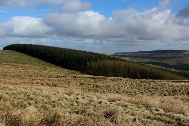
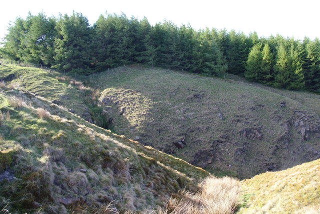
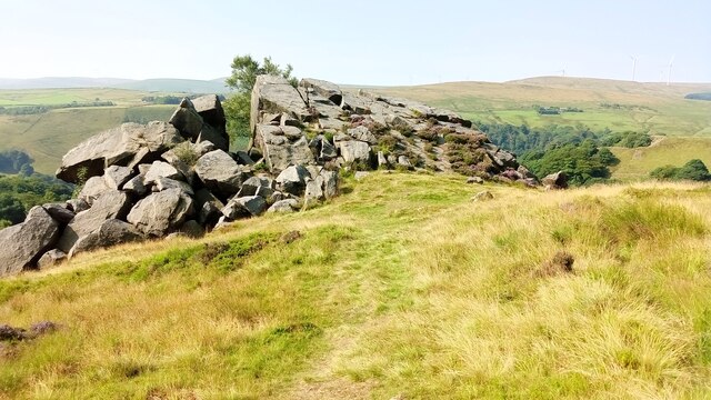
New Ley Wood, located in the county of Yorkshire, England, is a picturesque forest that spans over several acres. It is a popular destination for nature enthusiasts and outdoor adventurers due to its stunning natural beauty and diverse flora and fauna.

The wood boasts a rich history, with records dating back to the medieval period. It has served various purposes over the centuries, including as a source of timber and a hunting ground for the local nobility. Today, it is preserved as a nature reserve and managed by the local authorities.

New Ley Wood is characterized by its dense canopy of trees, which predominantly consist of native species such as oak, beech, and ash. These towering trees provide a haven for a wide range of wildlife, including birds, mammals, and insects. Visitors can often spot species such as deer, foxes, and squirrels roaming freely within the forest.

There are several well-maintained trails and footpaths that meander through the woodland, allowing visitors to explore its beauty at their own pace. These paths provide opportunities for activities such as hiking, birdwatching, and photography. Additionally, the forest is home to a small lake, which adds to the scenic charm of the area.

New Ley Wood offers a tranquil escape from the hustle and bustle of everyday life, allowing visitors to immerse themselves in the wonders of nature. With its stunning landscapes, diverse wildlife, and peaceful ambiance, it is no wonder that this forest is a beloved destination for both locals and tourists alike.

If you have any feedback on the listing, please let us know in the comments section below.
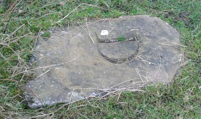
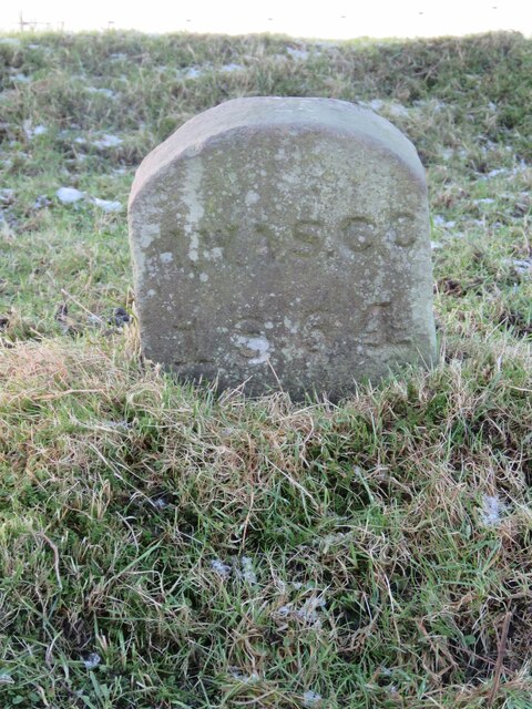
New Ley Wood Images

Images are sourced within 2km of 53.730076/-2.1271779 or Grid Reference SD9125. Thanks to Geograph Open Source API. All images are credited.

Plantation on Carr and Craggs Moor
Streams converge at the head of Tower Clough These drain off Carr & Craggs Moor, and eventually into the River Calder.
Streams converge at the head of Tower Clough
These drain off Carr & Craggs Moor, and eventually into the River Calder.
Top corner of the forest on Carr & Craggs Moor The beginning of Tower Clough is in the foreground.
Top corner of the forest on Carr & Craggs Moor
The beginning of Tower Clough is in the foreground.
A646 and disused mill
Carr Road, Portsmouth
Portsmouth, Level Crossing on Station Parade
Portsmouth, Burnley Road (A646) The A646 travels through Pennine valleys from Halifax in Yorkshire to Burnley in Lancashire, crossing the county border near Todmorden. It is a fairly slow route, passing through some traditional Pennine villages.
Portsmouth, Burnley Road (A646)
The A646 travels through Pennine valleys from Halifax in Yorkshire to Burnley in Lancashire, crossing the county border near Todmorden. It is a fairly slow route, passing through some traditional Pennine villages.
Portsmouth, Roebuck Inn
Burnley Road, Portsmouth The A646 travels through Pennine valleys from Halifax in Yorkshire to Burnley in Lancashire, crossing the county border near Todmorden. It is a fairly slow route, passing through some traditional Pennine villages.
Burnley Road, Portsmouth
The A646 travels through Pennine valleys from Halifax in Yorkshire to Burnley in Lancashire, crossing the county border near Todmorden. It is a fairly slow route, passing through some traditional Pennine villages.
Portsmouth - former mill on Burnley Road For an alternative (2010) view, please see <a href="https://www.geograph.org.uk/photo/1868474">SD8926 : Mill and pub, Portsmouth, Todmorden</a>.
Portsmouth - former mill on Burnley Road
For an alternative (2010) view, please see SD8926 : Mill and pub, Portsmouth, Todmorden.
Portsmouth - Beater Clough off Burnley Road For an alternative view, please see <a href="https://www.geograph.org.uk/photo/1511343">SD8926 : Walking up Beater Clough</a>.
Portsmouth - Beater Clough off Burnley Road
For an alternative view, please see SD8926 : Walking up Beater Clough.
A646, Burnley Road, Portsmouth
Cornholme and Beater Clough: aerial 2018
NW slopes of the Calder valley near Portsmouth and Cornholme Both the railway and A646 road make use of the narrow valley between Todmorden and Burnley.
NW slopes of the Calder valley near Portsmouth and Cornholme
Both the railway and A646 road make use of the narrow valley between Todmorden and Burnley.
Old Boundary Marker on Todmorden Moor, Todmorden Parish Estate Boundary Marker in parish of Todmorden (Calderdale District), on Todmorden Moor, 1250 metres East of Heald Top Farm. Inscribed D (for the Dearden family) and, possibly, T on opposite faces

Surveyed

Milestone Society National ID: YW_TOD05em
Old Boundary Marker on Todmorden Moor, Todmorden Parish
Estate Boundary Marker in parish of Todmorden (Calderdale District), on Todmorden Moor, 1250 metres East of Heald Top Farm. Inscribed D (for the Dearden family) and, possibly, T on opposite faces Surveyed Milestone Society National ID: YW_TOD05em
Old Milestone by the A646, Burnley Road, Todmorden parish Todmorden vertical by the A646, in parish of Todmorden (Calderdale District), Burnley Road, Portsmouth, in front of No. 927 (Holden Gate), corner of wall.

Inscription reads vertically:-
: TO BURNLEY / 6¼ MILES : : TO TODMORDEN / 3 MILES :
Defaced carved bench mark on base.

Grade II listed.
List Entry Number: 1314110 <span class="nowrap"><a title="https://historicengland.org.uk/listing/the-list/list-entry/1314110" rel="nofollow ugc noopener" href="https://historicengland.org.uk/listing/the-list/list-entry/1314110">Link</a><img style="margin-left:2px;" alt="External link" title="External link - shift click to open in new window" src="https://s1.geograph.org.uk/img/external.png" width="10" height="10"/></span>

Surveyed

Milestone Society National ID: YW_TOBL03
Old Milestone by the A646, Burnley Road, Todmorden parish
Todmorden vertical by the A646, in parish of Todmorden (Calderdale District), Burnley Road, Portsmouth, in front of No. 927 (Holden Gate), corner of wall. Inscription reads vertically:- : TO BURNLEY / 6¼ MILES : : TO TODMORDEN / 3 MILES : Defaced carved bench mark on base. Grade II listed. List Entry Number: 1314110 LinkExternal link Surveyed Milestone Society National ID: YW_TOBL03
Orchan Rocks Rocky outcrop.
Orchan Rocks
Rocky outcrop.
Old Boundary Marker near Flailcroft, Todmorden Chapelry Boundary Marker beside a footpath north of Flailcroft. Todmorden parish. Inscribed H W A S C C / 1864 for Harley Wood All Saints Consolidated Chapelry. See  <span class="nowrap"><a title="https://www.thegazette.co.uk/London/issue/22908/page/5170" rel="nofollow ugc noopener" href="https://www.thegazette.co.uk/London/issue/22908/page/5170">Link</a><img style="margin-left:2px;" alt="External link" title="External link - shift click to open in new window" src="https://s1.geograph.org.uk/img/external.png" width="10" height="10"/></span>.

Milestone Society National ID: YW_TOD10pb
Old Boundary Marker near Flailcroft, Todmorden
Chapelry Boundary Marker beside a footpath north of Flailcroft. Todmorden parish. Inscribed H W A S C C / 1864 for Harley Wood All Saints Consolidated Chapelry. See LinkExternal link. Milestone Society National ID: YW_TOD10pb
Show me another place!

New Ley Wood is located at Grid Ref: SD9125 (Lat: 53.730076, Lng: -2.1271779)

Division: West Riding

Unitary Authority: Calderdale

Police Authority: West Yorkshire

What 3 Words

///signified.monkeys.solid. Near Cornholme, West Yorkshire

Related Wikis

Cornholme railway station

Cornholme railway station served the village of Cornholme in West Yorkshire, England on the Copy Pit line. The station was opened by the Lancashire and...

Pudsey, Calderdale

Pudsey is a neighbourhood in the village of Cornholme, Calderdale, West Yorkshire, England. It is near the town of Todmorden and the A646 Burnley Road...
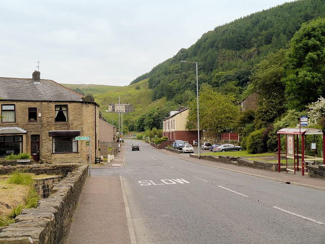
Cornholme

Cornholme is a village near Todmorden, in the metropolitan borough of Calderdale, in West Yorkshire, England. It lies at the edge of Calderdale, on the...

Todmorden High School

Todmorden High School is a comprehensive school in the town of Todmorden, Calderdale LEA, West Yorkshire, England. == Admissions == Todmorden High School...

Mons Mill, Todmorden

Mons Mill, Todmorden, is a former cotton spinning mill in Todmorden, Calderdale, West Yorkshire, England built for the Hare Spinning Company Limited. It...

Portsmouth, West Yorkshire

Portsmouth is a village on the A646 road in the Calderdale district, in the county of West Yorkshire, England. Nearby settlements include the towns of...

Portsmouth (Lancs) railway station

Portsmouth railway station was on the Copy Pit line and served the village of Portsmouth, which was part of Lancashire, before being incorporated into...

Todmorden War Memorial

Todmorden War Memorial is a war memorial located in Todmorden, West Yorkshire, England.The memorial is in the garden of remembrance in Centre Vale Park...

Nearby Amenities

Located within 500m of 53.730076,-2.1271779
Bus Stop
Burnley Road Knotts Road
Bus: yes
Local Ref: 45018901
Naptan AtcoCode: 450018901
Naptan Bearing: SE
Naptan CommonName: Burnley Road Knotts Road
Naptan Crossing: Knotts Road
Naptan Indicator: Stop 45018901
Naptan Notes: Shelter Removed 26/11/07 RTA Plate on L/C. New TF shelter installed on 4/12/07. Awiting survey.
Naptan PlusbusZoneRef: LEEDS
Naptan ShortCommonName: Knotts Road
Naptan Street: Burnley Road
Naptan Verified: no
Public Transport: platform
Source: naptan_import
Lat/Long: 53.7273898/-2.1278928
Bus Stop
Burnley Road Knotts Road
Bus: yes
Local Ref: 45018902
Naptan AtcoCode: 450018902
Naptan Bearing: NW
Naptan CommonName: Burnley Road Knotts Road
Naptan Crossing: Knotts Road
Naptan Indicator: Stop 45018902
Naptan PlusbusZoneRef: LEEDS
Naptan ShortCommonName: Knotts Road
Naptan Street: Burnley Road
Naptan Verified: no
Public Transport: platform
Source: naptan_import
Lat/Long: 53.7273357/-2.1280139
Bus Stop
Burnley Road
Bus: yes
Local Ref: 45018903
Naptan AtcoCode: 450018903
Naptan Bearing: SE
Naptan CommonName: Burnley Road
Naptan Crossing: Dundee Road
Naptan Indicator: Stop 45018903
Naptan Landmark: New Lay Wood
Naptan PlusbusZoneRef: LEEDS
Naptan ShortCommonName: Dundee Road
Naptan Street: Burnley Road
Naptan Verified: no
Public Transport: platform
Source: naptan_import
Lat/Long: 53.7297245/-2.1299462
Bus Stop
Burnley Road
Bus: yes
Local Ref: 45018904
Naptan AtcoCode: 450018904
Naptan Bearing: NW
Naptan CommonName: Burnley Road
Naptan Crossing: Dundee Road
Naptan Indicator: Stop 45018904
Naptan Landmark: New Lay Wood
Naptan PlusbusZoneRef: LEEDS
Naptan ShortCommonName: Dundee Road
Naptan Street: Burnley Road
Naptan Verified: no
Public Transport: platform
Source: naptan_import
Lat/Long: 53.7299843/-2.1306203
Bus Stop
Burnley Road Station Road
Bus: yes
Local Ref: 45018905
Naptan AtcoCode: 450018905
Naptan Bearing: NW
Naptan CommonName: Burnley Road Station Road
Naptan Crossing: Station Road
Naptan Indicator: Stop 45018905
Naptan PlusbusZoneRef: LEEDS
Naptan ShortCommonName: Station Road
Naptan Street: Burnley Road
Naptan Verified: no
Public Transport: platform
Source: naptan_import
Lat/Long: 53.7313391/-2.1330131
Bus Stop
Burnley Road
Bus: yes
Local Ref: 45018906
Naptan AtcoCode: 450018906
Naptan Bearing: SE
Naptan CommonName: Burnley Road
Naptan Crossing: Station Road
Naptan Indicator: Stop 45018906
Naptan PlusbusZoneRef: LEEDS
Naptan ShortCommonName: Station Road
Naptan Street: Burnley Road
Naptan Verified: no
Public Transport: platform
Source: naptan_import
Lat/Long: 53.731402/-2.1329981
Bus Stop
Burnley Road Picker Street
Bus: yes
Local Ref: 45019900
Naptan AtcoCode: 450019900
Naptan Bearing: NW
Naptan CommonName: Burnley Road Picker Street
Naptan Crossing: Picker Street
Naptan Indicator: Stop 45019900
Naptan Landmark: The Railway PH
Naptan Notes: OSR taken place 161105
Naptan PlusbusZoneRef: LEEDS
Naptan ShortCommonName: Jumps Road
Naptan Street: Burnley Road
Naptan Verified: no
Public Transport: platform
Source: naptan_import
Lat/Long: 53.7271889/-2.1223297
Barrier: stile
Material: wood
Stile: stepover
Lat/Long: 53.7292226/-2.1343661
Post Box
Brand: Royal Mail
Brand Wikidata: Q638098
Operator: Royal Mail
Operator Wikidata: Q638098
Ref: OL14 143
Lat/Long: 53.7275059/-2.1282796
Historic: milestone
Inscription: To Todmorden 2 Miles To Burnley 7¼ Miles
Lat/Long: 53.7305522/-2.1310196
Barrier: stile
Material: wood
Stile: stepover
Lat/Long: 53.7322099/-2.1286201
Barrier: stile
Lat/Long: 53.7344681/-2.1271421
Barrier: stile
Material: wood
Stile: stepover
Lat/Long: 53.7341525/-2.1272588
Barrier: stile
Material: wood
Stile: stepover
Lat/Long: 53.7334939/-2.1253433
Barrier: wicket_gate
Lat/Long: 53.7267813/-2.1265589
Eagle's Crag
Natural: rock
Lat/Long: 53.7259044/-2.1285763
Historic: ruins
Lat/Long: 53.7340115/-2.1270876
Barrier: stile
Material: wood
Stile: stepover
Lat/Long: 53.7317126/-2.1295147
Bench
Backrest: yes
Lat/Long: 53.7331817/-2.1318985
Ford: yes
Lat/Long: 53.7296061/-2.1337202
Catholes Stone
Historic: stone
Lat/Long: 53.7323748/-2.1228292
Noexit: yes
Lat/Long: 53.7268872/-2.1238569
Bench
Backrest: yes
Lat/Long: 53.7275156/-2.1225835
Bench
Backrest: yes
Lat/Long: 53.7275061/-2.1225104
Man Made: communications_tower
Tower Type: communication
Lat/Long: 53.728793/-2.1291724
The data included in this document is from www.openstreetmap.org. The data is made available under ODbL.

Have you been to New Ley Wood?

Leave your review of New Ley Wood below (or comments, questions and feedback).