D Plantation

Wood, Forest in Dorset

England

D Plantation

Path heading towards Kimmeridge Path going along across Smedmore Hill heading towards Kimmeridge
Path heading towards Kimmeridge Credit: Shaun Ferguson

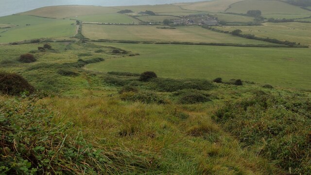
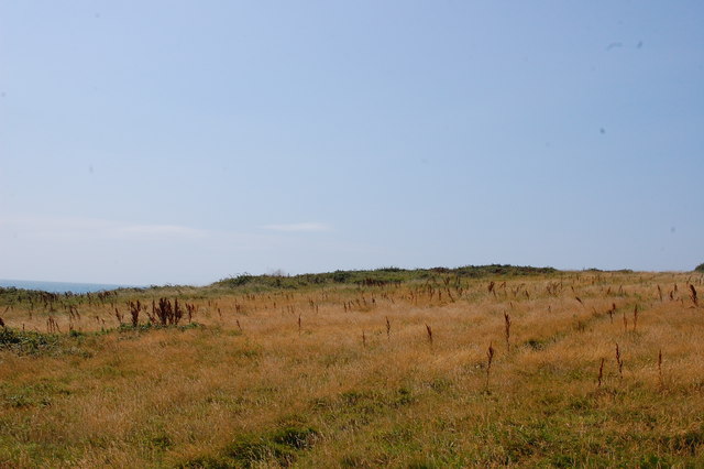
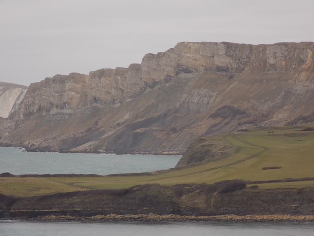
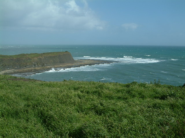
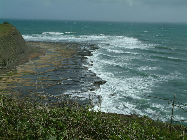
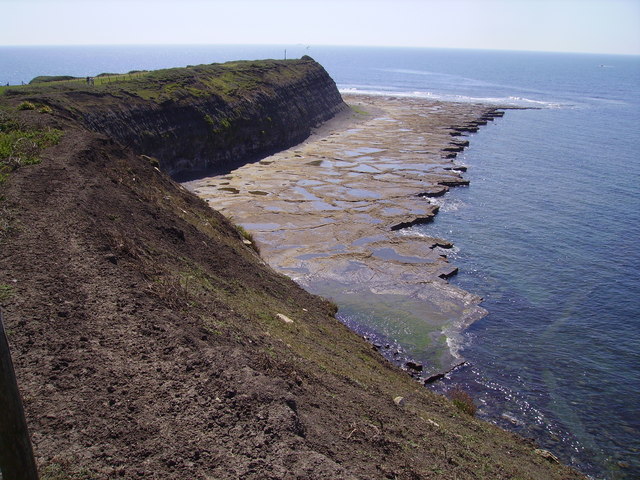
D Plantation is a picturesque woodland located in Dorset, England. Situated on the outskirts of the town, it covers a vast area and is known for its serene and untouched beauty. The plantation is predominantly composed of dense forests with a variety of tree species, including oak, beech, and pine.

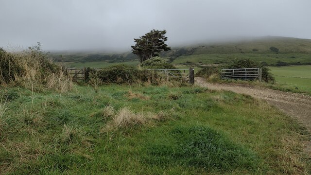
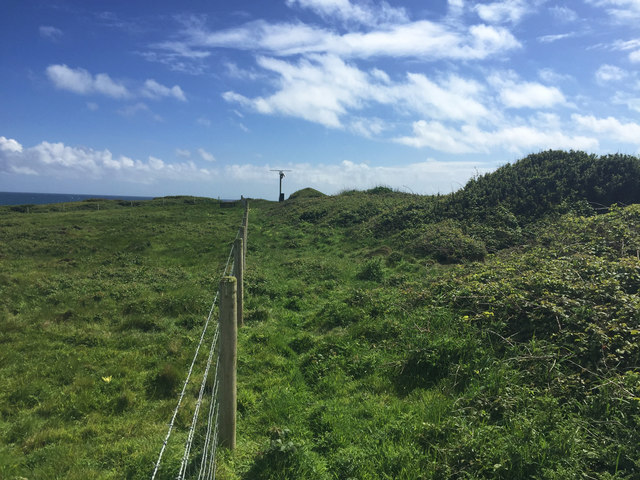
The woodland is a haven for nature lovers and outdoor enthusiasts, offering numerous walking trails that wind through the trees. These trails provide visitors with the opportunity to immerse themselves in the tranquility of the forest while appreciating the natural surroundings. The paths are well-maintained and offer varying levels of difficulty, catering to both casual strollers and experienced hikers.

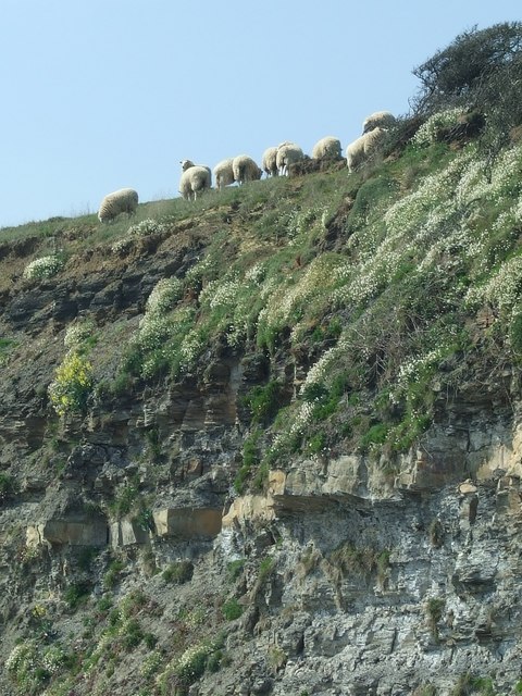
D Plantation is also home to a diverse array of wildlife. Birdwatchers can spot an abundance of species, including woodpeckers, owls, and various songbirds. The forest floor is teeming with small mammals such as rabbits and squirrels, while deer can occasionally be seen grazing in the more secluded areas.

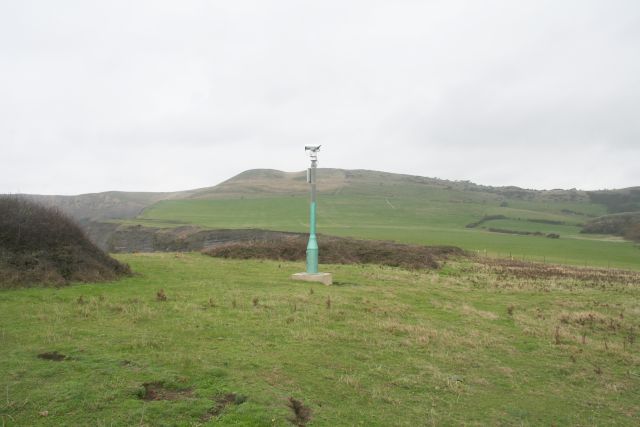
The plantation is open to the public year-round, with no admission fee, making it a popular destination for both locals and tourists. Visitors are advised to bring their own supplies, as there are no facilities within the woodland itself. However, there are picnic areas situated at various points along the trails, providing a perfect spot to rest and enjoy a packed lunch amidst the natural beauty.

Overall, D Plantation in Dorset is a delightful destination for those seeking solace in nature. With its dense woodland, diverse wildlife, and well-maintained trails, it offers a peaceful retreat for individuals of all ages to enjoy the wonders of the great outdoors.

If you have any feedback on the listing, please let us know in the comments section below.
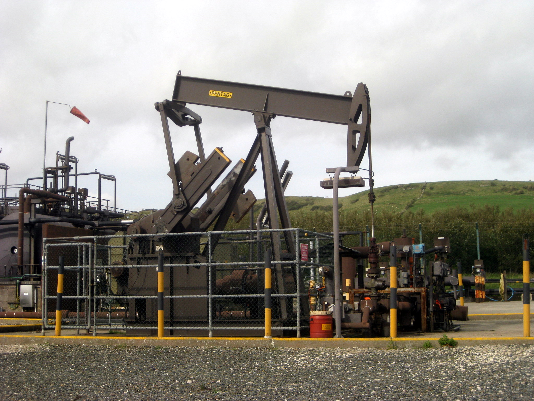
D Plantation Images

Images are sourced within 2km of 50.607404/-2.1214247 or Grid Reference SY9178. Thanks to Geograph Open Source API. All images are credited.

Path heading towards Kimmeridge Path going along across Smedmore Hill heading towards Kimmeridge
Path heading towards Kimmeridge
Path going along across Smedmore Hill heading towards Kimmeridge
Path coming down from Swyre Head Path coming down from Swyre Head heading down near Swalland Farm
Path coming down from Swyre Head
Path coming down from Swyre Head heading down near Swalland Farm
Path going past the drive to Swalland Farm Path going past the drive to Swalland Farm heading in the distance to a mist covered Swyre Head
Path going past the drive to Swalland Farm
Path going past the drive to Swalland Farm heading in the distance to a mist covered Swyre Head
South West Coast Path South West Coast Path passes the stile and path off to Swyre Head
South West Coast Path
South West Coast Path passes the stile and path off to Swyre Head
Cliff Top Sheep, Kimmeridge Bay No Fear! - these sheep appeared totally at ease on the edge of the cliffs, which are known for rock falls.
Cliff Top Sheep, Kimmeridge Bay
No Fear! - these sheep appeared totally at ease on the edge of the cliffs, which are known for rock falls.
Rough Grassland above Broad Bench Nothing here above the cliffs but rough grassland and a surveillance camera.
Rough Grassland above Broad Bench
Nothing here above the cliffs but rough grassland and a surveillance camera.
Kimmeridge Bay from Broad Bench View across Kimmeridge Bay from the coast path at Broad Bench, the Clavel Tower can be seen on Hen Cliff on the far side of the bay.
Kimmeridge Bay from Broad Bench
View across Kimmeridge Bay from the coast path at Broad Bench, the Clavel Tower can be seen on Hen Cliff on the far side of the bay.
West end of Kimmeridge Bay Out at sea is a shadow of a cloud.
West end of Kimmeridge Bay
Out at sea is a shadow of a cloud.
Cattle grid and stile on coast path This section of path on the low table of Kimmeridge Clay was waterlogged and very muddy.
Cattle grid and stile on coast path
This section of path on the low table of Kimmeridge Clay was waterlogged and very muddy.
Broad Bench peninsula The view towards Broad Bench from the ranges path.
Broad Bench peninsula
The view towards Broad Bench from the ranges path.
Kimmeridge: across Broad Bench to Gad Cliff Looking across the mouth of Kimmeridge Bay, with the long flat tongue of land, Broad Bench, cutting across the bottom of the picture and the dramatic zigzagging face of Gad Cliff in the background.
Kimmeridge: across Broad Bench to Gad Cliff
Looking across the mouth of Kimmeridge Bay, with the long flat tongue of land, Broad Bench, cutting across the bottom of the picture and the dramatic zigzagging face of Gad Cliff in the background.
Weather station at Broad Bench Access is not permitted to the coast within this gridsquare.
Weather station at Broad Bench
Access is not permitted to the coast within this gridsquare.
On top of Broad Bench Looking towards the mast of the weather station.
On top of Broad Bench
Looking towards the mast of the weather station.
Surveillance Camera, Broad Bench Headland Looking up towards the double peaked hill of Tyneham Cap. The camera was pointing eastwards towards Clavell's Tower. Probably used to check pedestrians had not strayed into the military firing range during exercise days.
Surveillance Camera, Broad Bench Headland
Looking up towards the double peaked hill of Tyneham Cap. The camera was pointing eastwards towards Clavell's Tower. Probably used to check pedestrians had not strayed into the military firing range during exercise days.
Broad Bench Looking from the cliff to the flat hard shale surface.
Broad Bench
Looking from the cliff to the flat hard shale surface.
Broad Bench, Kimmeridge
Broad Bench, Kimmeridge The strata in this area causes sea ledges such as this. There are other examples around Kimmeridge.
Broad Bench, Kimmeridge
The strata in this area causes sea ledges such as this. There are other examples around Kimmeridge.
Broad Bench Broad bench looking south from Dorset Coast path.
Broad Bench
Broad bench looking south from Dorset Coast path.
Show me another place!

D Plantation is located at Grid Ref: SY9178 (Lat: 50.607404, Lng: -2.1214247)

Unitary Authority: Dorset

Police Authority: Dorset

What 3 Words

///engages.elevates.wires. Near Corfe Castle, Dorset

Related Wikis

Related Videos

England's Best Hiking Path? For Royal Marines! South West Coast Path Ep.2

England's Best Hiking Path? For Royal Marines! South West Coast Path. If you're a Royal Marine you'll really enjoy this extreme ...

coastal Walks

Coastal Walks Kimmeridge to Tyneham . . . . . #nature #seascape #dorset #travel #summer #sea.

Kimmeridge Bay Dorset~ September Holiday 2018 Day #2

caravanningUKCommunity #kimmeridgebay #placestovisitindorset #holidaysindorset Today we visit the Silent Woman for Sunday ...

WALKS IN DORSET at KIMMERIDGE BAY (including SWYRE HEAD & THE CLAVELL TOWER) [4K]

This is another video in my series “ Walks in Dorset” accompanied by my Whippet (Logan). In this episode, I take a walk in and ...

Nearby Amenities

Located within 500m of 50.607404,-2.1214247
Source: PGS
Lat/Long: 50.603703/-2.1248516
Source: PGS
Lat/Long: 50.6033557/-2.1233924
Source: PGS
Lat/Long: 50.6030221/-2.1222337
Material: wood
Power: pole
Source: bing
Lat/Long: 50.60841/-2.1265863
Material: wood
Power: pole
Source: bing
Lat/Long: 50.6085897/-2.1255467
Material: wood
Power: pole
Source: bing
Lat/Long: 50.6087681/-2.1232736
Material: wood
Power: pole
Source: bing
Lat/Long: 50.6089577/-2.1220963
Material: wood
Power: pole
Source: bing
Lat/Long: 50.6090032/-2.1154807
Material: wood
Power: pole
Source: bing
Lat/Long: 50.6090795/-2.1164543
Material: wood
Power: pole
Source: bing
Lat/Long: 50.6091608/-2.1175948
Material: wood
Power: pole
Source: bing
Lat/Long: 50.6092322/-2.1186343
The data included in this document is from www.openstreetmap.org. The data is made available under ODbL.

Have you been to D Plantation?

Leave your review of D Plantation below (or comments, questions and feedback).