Giles Wood

Wood, Forest in Wiltshire

England

Giles Wood

Common Butterbur on footpath At the junction between the footpath and the bridleway a small number of these Common Butterburs (Petasites hybridus) were flowering.

Although the inflorescences of the common butterbur can be up to twenty centimetres high most of those in this area were eight to twelve centimetres although this one was about five or six centimetres.  This early in the season no leaves were visible as the plant will come into flower before putting out the large leaves which will be apparent later in the season.

Butterburs prefer moist or wet environments and again the ones in this area seems slightly atypical in that it is not especially damp, although the paths are shaded by trees and hedgerows here so the ground is not particularly prone to drying out.
Common Butterbur on footpath Credit: Doug Lee

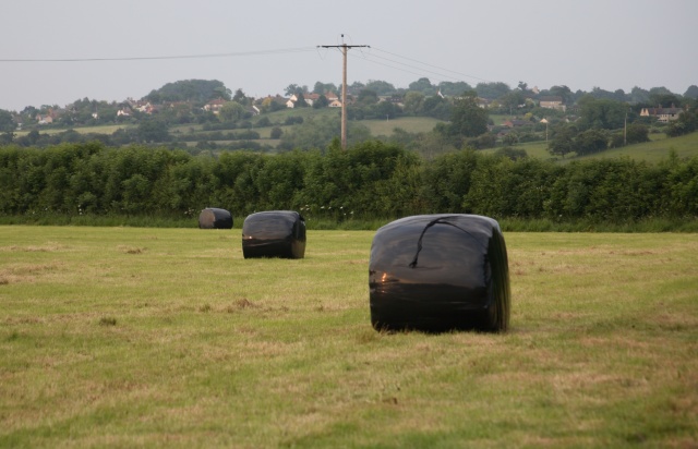
Giles Wood is a picturesque woodland located in the county of Wiltshire, England. Situated near the village of Woodford, this enchanting forest covers an area of approximately 100 acres and is renowned for its natural beauty and tranquil surroundings.

The woodland is characterized by a diverse range of trees, including oak, beech, and ash, which create a dense canopy that filters sunlight and provides a haven for various wildlife species. The forest floor is carpeted with a rich tapestry of bluebells, wild garlic, and ferns, adding to the area's charm and allure.

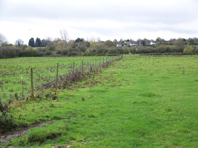
Giles Wood offers a myriad of walking trails that wind through its leafy confines, allowing visitors to immerse themselves in nature and explore its hidden treasures. These paths are well-maintained and range from easy strolls suitable for families, to more challenging routes for avid hikers.

Birdwatching enthusiasts will be delighted by the presence of numerous avian species that call Giles Wood their home. From woodpeckers and tawny owls to nuthatches and song thrushes, the forest is a haven for birdlife, making it a popular destination for birdwatchers throughout the year.

In addition to its natural splendor, Giles Wood also has historical significance. It is believed to have been part of the ancient Savernake Forest, a royal hunting ground since Norman times. The area is steeped in folklore and legends, further enriching its appeal.

Overall, Giles Wood in Wiltshire offers visitors a tranquil and captivating escape from the hustle and bustle of everyday life. Whether it's for a leisurely walk, birdwatching, or simply reconnecting with nature, this charming woodland provides a serene oasis for all who venture within its leafy embrace.

If you have any feedback on the listing, please let us know in the comments section below.

Giles Wood Images

Images are sourced within 2km of 51.347835/-2.1233468 or Grid Reference ST9160. Thanks to Geograph Open Source API. All images are credited.

Common Butterbur on footpath At the junction between the footpath and the bridleway a small number of these Common Butterburs (Petasites hybridus) were flowering.

Although the inflorescences of the common butterbur can be up to twenty centimetres high most of those in this area were eight to twelve centimetres although this one was about five or six centimetres.  This early in the season no leaves were visible as the plant will come into flower before putting out the large leaves which will be apparent later in the season.

Butterburs prefer moist or wet environments and again the ones in this area seems slightly atypical in that it is not especially damp, although the paths are shaded by trees and hedgerows here so the ground is not particularly prone to drying out.
Common Butterbur on footpath
At the junction between the footpath and the bridleway a small number of these Common Butterburs (Petasites hybridus) were flowering. Although the inflorescences of the common butterbur can be up to twenty centimetres high most of those in this area were eight to twelve centimetres although this one was about five or six centimetres. This early in the season no leaves were visible as the plant will come into flower before putting out the large leaves which will be apparent later in the season. Butterburs prefer moist or wet environments and again the ones in this area seems slightly atypical in that it is not especially damp, although the paths are shaded by trees and hedgerows here so the ground is not particularly prone to drying out.
Semington Brook and Seend Head The brook is unusually low this winter after lower than average rainfall.

The view here is along the line of the brook towards Seend Head.  The old disused mill is hidden behind the trees.
Semington Brook and Seend Head
The brook is unusually low this winter after lower than average rainfall. The view here is along the line of the brook towards Seend Head. The old disused mill is hidden behind the trees.
View across fields from the Bridleway
Field and barn by Trowbridge Road
Farm building and fields
The Lamb On The Strand
View from Great Hinton The bright area to the mid right of the image is Melksham Police Station as shown in <a href="https://www.geograph.org.uk/gridref/ST9061">ST9061</a>
View from Great Hinton
The bright area to the mid right of the image is Melksham Police Station as shown in ST9061
Recently cut field and hay bales Some of the houses of Seend can be seen in the distance on the hillside.
Recently cut field and hay bales
Some of the houses of Seend can be seen in the distance on the hillside.
2008 : Seend Head Looking down to Seend Head Mill, a long disused mill on the Semington Brook. Quite a small brook but still able to power a grist mill, perhaps it could be used to generate electricity for the grid.
2008 : Seend Head
Looking down to Seend Head Mill, a long disused mill on the Semington Brook. Quite a small brook but still able to power a grist mill, perhaps it could be used to generate electricity for the grid.
2008 : An old farmhouse, ruined Standing unseen by the A361.
Abandoned many years ago.
2008 : An old farmhouse, ruined
Standing unseen by the A361. Abandoned many years ago.
2008 : From the A361 near Seend Looking north over a pasture toward Seend Row Farms.
2008 : From the A361 near Seend
Looking north over a pasture toward Seend Row Farms.
2008 : South west near Seend Head Looking south west from the lane to Seend Head toward Woodhouse Farm.
2008 : South west near Seend Head
Looking south west from the lane to Seend Head toward Woodhouse Farm.
Fields near Great Hinton Small fields beside the A361.
Fields near Great Hinton
Small fields beside the A361.
2009 : Frosty fields and a bridleway to Seend Head After a bright start the sun hid itself for a few minutes.
The A361 passes a few yards to the right.
2009 : Frosty fields and a bridleway to Seend Head
After a bright start the sun hid itself for a few minutes. The A361 passes a few yards to the right.
2009 : Peppercorn Orchard, Great Hinton
2009 : A361 looking west between Seend and Semington The road is strangely quiet after 9am, had to wait over a minute for these two to arrive.
2009 : A361 looking west between Seend and Semington
The road is strangely quiet after 9am, had to wait over a minute for these two to arrive.
2009 : Frosty field seen from the A361 Looking north toward Bowerhill on the other side of the Kennet & Avon Canal.
The lane to Seend Park Farm is on the other side of the hedge.
2009 : Frosty field seen from the A361
Looking north toward Bowerhill on the other side of the Kennet & Avon Canal. The lane to Seend Park Farm is on the other side of the hedge.
2009 : On the lane to Great Hinton Looking back to The Strand and the A361.
2009 : On the lane to Great Hinton
Looking back to The Strand and the A361.
Show me another place!

Giles Wood is located at Grid Ref: ST9160 (Lat: 51.347835, Lng: -2.1233468)

Unitary Authority: Wiltshire

Police Authority: Wiltshire

What 3 Words

///removals.renews.hissing. Near Seend, Wiltshire

Nearby Locations

Giles Wood Littleton

Related Wikis

New Semington Aqueduct

New Semington Aqueduct (grid reference ST904609) carries the Kennet and Avon Canal over the carriageway of the A350 road Trowbridge Bypass, at Semington...

Bowerhill

Bowerhill is a village near Melksham, Wiltshire, England, in the civil parish of Melksham Without. Central Bowerhill is approximately 1.75 miles (2.8 km...

Wiltshire Air Ambulance

Wiltshire Air Ambulance is a helicopter emergency medical service (HEMS) serving Wiltshire and surrounding areas. The service was launched in 1990, but...

Melksham Oak Community School

Melksham Oak Community School is a mixed secondary school and sixth form located in the southeast outskirts of Melksham, Wiltshire, England, for students...

Semington Locks

The Semington Locks (grid reference ST900609) are situated at Semington, Wiltshire on the Kennet and Avon Canal, England. They have a combined rise/fall...

Seend Cleeve

Seend Cleeve is a large hamlet or sub-village immediately west of Seend in Wiltshire, England. It lies about 2.3 miles (3.7 km) southeast of the town of...

Semington Halt railway station

Semington Halt railway station was a small railway station serving Semington in Wiltshire, England, between 1906 and 1966. The station was on the Devizes...

Seend Cleeve Quarry

Seend Cleeve Quarry (grid reference ST933609) is a 7.5 acres (3.0 ha) Geological Site of Special Scientific Interest at Seend Cleeve, Wiltshire, England...

Nearby Amenities

Located within 500m of 51.347835,-2.1233468
Brook Mill
Place: hamlet
Source: NPE
Lat/Long: 51.3444333/-2.1267262
Barrier: stile
Lat/Long: 51.3441135/-2.1235893
Barrier: stile
Lat/Long: 51.3440401/-2.1227197
Barrier: stile
Lat/Long: 51.3467406/-2.1233178
Barrier: stile
Lat/Long: 51.344024/-2.1202101
Leisure: picnic_table
Lat/Long: 51.3468932/-2.1234375
Material: wood
Power: pole
Lat/Long: 51.3505858/-2.1287727
Material: wood
Power: pole
Lat/Long: 51.3502726/-2.128062
Material: wood
Power: pole
Lat/Long: 51.3503831/-2.1264231
Material: wood
Power: pole
Lat/Long: 51.3504753/-2.124854
Material: wood
Power: pole
Lat/Long: 51.3506294/-2.1269193
Material: wood
Power: pole
Lat/Long: 51.3506395/-2.1251062
Material: wood
Power: pole
Lat/Long: 51.350673/-2.1233949
Material: wood
Power: pole
Lat/Long: 51.3509728/-2.1219975
Material: wood
Power: pole
Lat/Long: 51.3512375/-2.1201092
Material: wood
Power: pole
Lat/Long: 51.3505406/-2.123462
Material: wood
Power: pole
Lat/Long: 51.3508488/-2.1220028
Material: wood
Power: pole
Lat/Long: 51.3510013/-2.120938
Material: wood
Power: pole
Lat/Long: 51.3511219/-2.1199241
The data included in this document is from www.openstreetmap.org. The data is made available under ODbL.

Have you been to Giles Wood?

Leave your review of Giles Wood below (or comments, questions and feedback).