Hawk Wood

Wood, Forest in Dorset

England

Hawk Wood

Church in Winterborne Zelston
Church in Winterborne Zelston Credit: Owen lovell

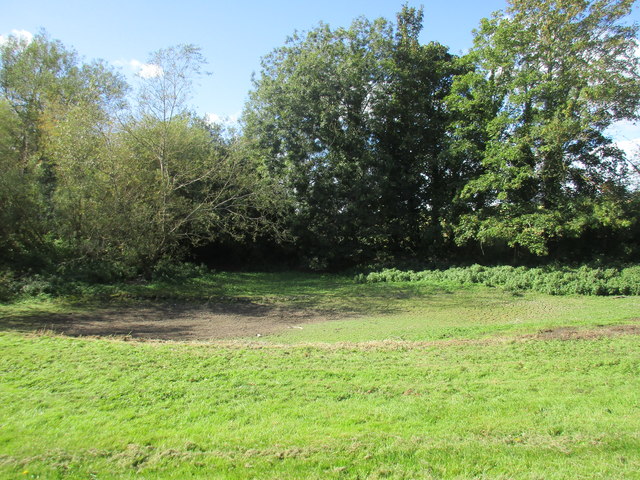
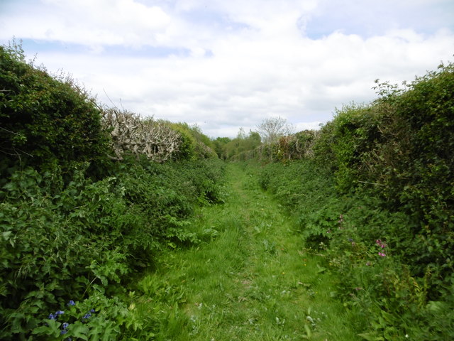
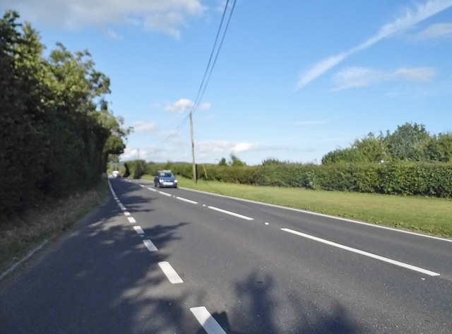
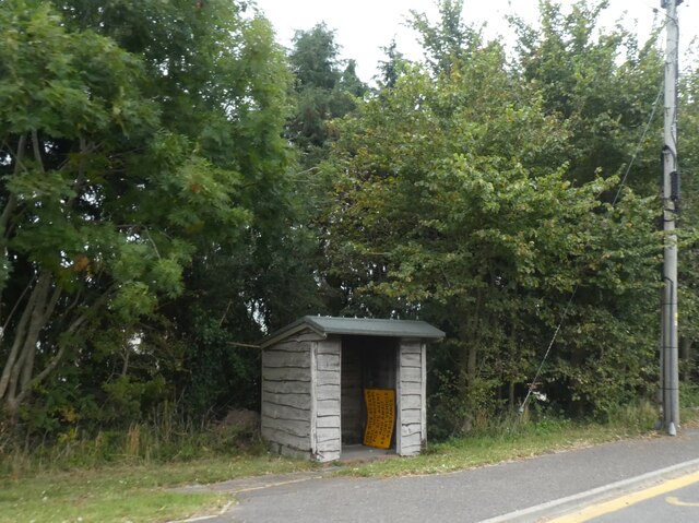
Hawk Wood is a picturesque forested area located in the county of Dorset, England. Covering an expansive area of land, the wood is renowned for its natural beauty and diverse wildlife. It is a popular destination for nature enthusiasts and outdoor adventurers alike.

The wood is predominantly made up of a mixture of broadleaf and coniferous trees, creating a rich and varied landscape. Towering oak, beech, and birch trees dominate the woodland, providing a dense canopy that is both visually stunning and ecologically important. The forest floor is blanketed with a tapestry of wildflowers, ferns, and mosses, adding to the enchanting atmosphere.

Hawk Wood is home to a wide range of wildlife, making it an ideal spot for birdwatching and animal spotting. The area is teeming with a variety of bird species, including woodpeckers, owls, and finches. Foxes, badgers, and deer can also be spotted roaming through the wood, adding to the sense of wilderness.

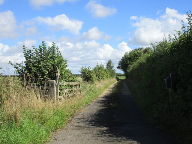
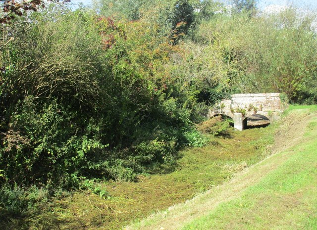
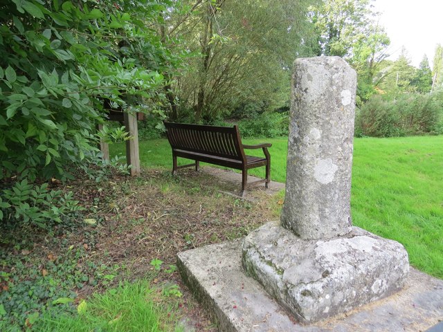
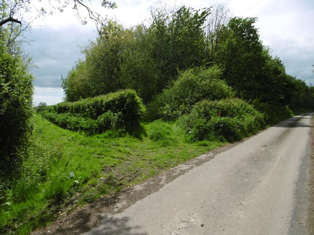
There are several walking trails and footpaths that crisscross the wood, allowing visitors to fully immerse themselves in this natural haven. These paths provide opportunities for leisurely strolls, invigorating hikes, and even mountain biking. Along the way, visitors can enjoy breathtaking views of the surrounding countryside and catch glimpses of the occasional babbling brook or tranquil pond.

Hawk Wood offers a peaceful retreat away from the hustle and bustle of everyday life, inviting visitors to reconnect with nature and enjoy the beauty of the great outdoors.

If you have any feedback on the listing, please let us know in the comments section below.

Hawk Wood Images

Images are sourced within 2km of 50.777834/-2.1218806 or Grid Reference SY9197. Thanks to Geograph Open Source API. All images are credited.

Church in Winterborne Zelston
St. Mary's church, Winterborne Zelston
The River Winterborne At the end of summer living up to its name. No sign of any water.
The River Winterborne
At the end of summer living up to its name. No sign of any water.
Track on the edge of Winterborne Zelston
Dried up bed of the River Winterborne The River Winterborne is true to its name and dries up in the summer.
Dried up bed of the River Winterborne
The River Winterborne is true to its name and dries up in the summer.
Brookside and Pond Cottage Typical of this area <span class="nowrap"><a title="http://www.britishlistedbuildings.co.uk/en-103608-brookside-and-pond-cottage-winterborne-z#.VhUzz2vocnA" rel="nofollow ugc noopener" href="http://www.britishlistedbuildings.co.uk/en-103608-brookside-and-pond-cottage-winterborne-z#.VhUzz2vocnA">Link</a><img style="margin-left:2px;" alt="External link" title="External link - shift click to open in new window" src="https://s1.geograph.org.uk/img/external.png" width="10" height="10"/></span>
Brookside and Pond Cottage
Typical of this area LinkExternal link
Bridge over the dried-up River Winterborne
Ancient cross in Winterborne Zelston
Winterborne Zelston, bridleway Approaching the village from West Morden.
Winterborne Zelston, bridleway
Approaching the village from West Morden.
Winterborne Zelston, bridleway junction Left (behind the hedge), to West Morden; right, metalled road and bridleway to Rectory Farm.
Winterborne Zelston, bridleway junction
Left (behind the hedge), to West Morden; right, metalled road and bridleway to Rectory Farm.
Winterborne Zelston, Botany Bay Inne Hall & Woodhouse public house on A31; middle bar to right, eating and drinking areas left, front, back, right. Cask ales on offer at my visit: Badger Fursty Ferret, Hopping Hare.
Winterborne Zelston, Botany Bay Inne
Hall & Woodhouse public house on A31; middle bar to right, eating and drinking areas left, front, back, right. Cask ales on offer at my visit: Badger Fursty Ferret, Hopping Hare.
The Botany Bay Inne, Winterborne Zelston All the Winterbourne villages are along the river of the same name.
The Botany Bay Inne, Winterborne Zelston
All the Winterbourne villages are along the river of the same name.
The A31, Winterbourne Zelston
Bus shelter by A31 at Winterborne Zelston The A31 is a 87 mile long trunk road from Guildford to Bere Regis. It passes through or close to Farnham, Winchester and Ringwood.
<span class="nowrap"><a title="http://www.sabre-roads.org.uk/wiki/index.php?title=A31" rel="nofollow ugc noopener" href="http://www.sabre-roads.org.uk/wiki/index.php?title=A31">Link</a><img style="margin-left:2px;" alt="External link" title="External link - shift click to open in new window" src="https://s1.geograph.org.uk/img/external.png" width="10" height="10"/></span> 
Wikipedia: <span class="nowrap"><a title="http://en.wikipedia.org/wiki/A31_road" rel="nofollow ugc noopener" href="http://en.wikipedia.org/wiki/A31_road">Link</a><img style="margin-left:2px;" alt="External link" title="External link - shift click to open in new window" src="https://s1.geograph.org.uk/img/external.png" width="10" height="10"/></span>
Bus shelter by A31 at Winterborne Zelston
The A31 is a 87 mile long trunk road from Guildford to Bere Regis. It passes through or close to Farnham, Winchester and Ringwood. LinkExternal link Wikipedia: LinkExternal link
Farm buildings at East Almer Farm
Main entrance to Charborough Park at Almer
St Mary's Church, Almer
Benchmark on St Mary's Church, Almer Ordnance Survey benchmark, described on database at <span class="nowrap"><a title="http://www.bench-marks.org.uk/bm53454" rel="nofollow ugc noopener" href="http://www.bench-marks.org.uk/bm53454">Link</a><img style="margin-left:2px;" alt="External link" title="External link - shift click to open in new window" src="https://s1.geograph.org.uk/img/external.png" width="10" height="10"/></span>. See also <a href="https://www.geograph.org.uk/photo/5129860">SY9198 : St Mary's Church, Almer</a>.
Benchmark on St Mary's Church, Almer
Ordnance Survey benchmark, described on database at LinkExternal link. See also SY9198 : St Mary's Church, Almer.
Show me another place!

Hawk Wood is located at Grid Ref: SY9197 (Lat: 50.777834, Lng: -2.1218806)

Unitary Authority: Dorset

Police Authority: Dorset

What 3 Words

///prepare.opts.procures. Near Lytchett Matravers, Dorset

Related Wikis

Almer

Almer is a village and former civil parish, now in the parish of Sturminster Marshall, in the Dorset district, in the ceremonial county of Dorset, England...
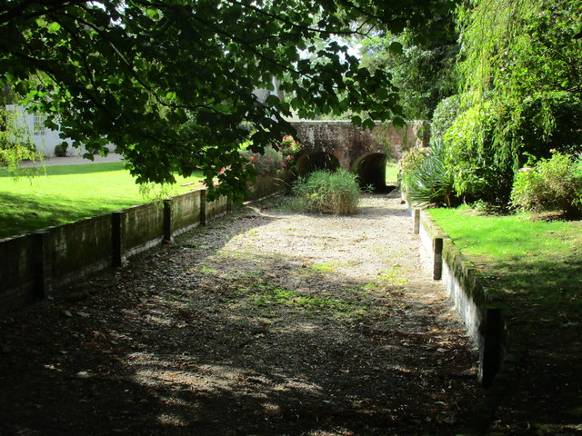
Charborough House

Charborough House, also known as Charborough Park, is a Grade I listed building, the manor house of the ancient manor of Charborough. The house is between...

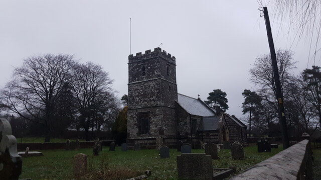
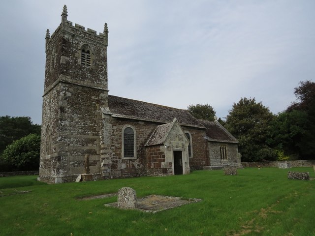
Church of St Mary, Almer, Dorset

Church of Mary is a Grade I listed church in Almer, Dorset, England. It became a listed building on 18 March 1955. According to Arthur Mee's The King...

Winterborne Zelston

Winterborne Zelston is a village and civil parish in north Dorset, England. It is situated in a winterbourne valley on the A31 road eight miles (thirteen...

Rushmore Hundred

Rushmore Hundred was a hundred in the county of Dorset, England, containing the parish of Winterborne Zelston == See also == List of hundreds in Dorset...

Morden, Dorset

Morden (otherwise Moreden) is a civil parish in the Purbeck district of south Dorset, England. Morden is about 6 miles (10 km) north-west of Poole. At...

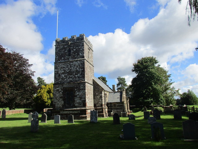
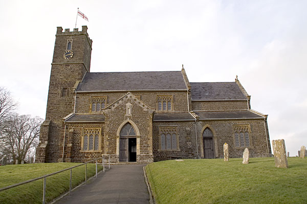
St Mary the Virgin, Lytchett Matravers

St Mary the Virgin is the Church of England parish church of Lytchett Matravers in Dorset. Its parish is part of the Diocese of Salisbury. The building...

Loosebarrow Hundred

Loosebarrow Hundred was a hundred in the county of Dorset, England, containing the following parishes: Almer Morden Spetisbury == See also == List of...

Nearby Amenities

Located within 500m of 50.777834,-2.1218806
Material: wood
Power: pole
Source: bing
Lat/Long: 50.7734902/-2.1228582
Location Transition: yes
Material: wood
Power: pole
Source: survey
Lat/Long: 50.7742603/-2.1243688
Location Transition: yes
Material: wood
Power: pole
Source: bing
Transformer: distribution
Lat/Long: 50.7754169/-2.1249071
Material: wood
Power: pole
Source: bing
Lat/Long: 50.7762425/-2.1263519
Material: wood
Power: pole
Source: bing
Lat/Long: 50.7772253/-2.1280747
Material: wood
Power: pole
Source: bing
Lat/Long: 50.7786075/-2.1284529
Material: wood
Power: pole
Source: bing
Transformer: distribution
Lat/Long: 50.7791713/-2.1273656
Colour: green
Man Made: street_cabinet
Operator: BT OpenReach
Ref: 2
Street Cabinet: telecom
Lat/Long: 50.7743954/-2.124797
Distribution Point: yes
Man Made: utility_pole
Material: wood
Operator: BT OpenReach
Ref: DP12
Source: survey
Utility: telecom
Lat/Long: 50.7744281/-2.1241781
Man Made: utility_pole
Material: wood
Operator: BT OpenReach
Ref: 1A
Source: survey
Utility: telecom
Lat/Long: 50.7743272/-2.12358
Man Made: utility_pole
Material: wood
Operator: BT OpenReach
Ref: 1B
Source: survey
Utility: telecom
Lat/Long: 50.7742865/-2.1232367
Man Made: utility_pole
Material: wood
Operator: BT OpenReach
Ref: 2A
Source: survey
Utility: telecom
Lat/Long: 50.7742487/-2.1229295
Man Made: utility_pole
Material: wood
Operator: BT OpenReach
Ref: 3A
Source: survey
Utility: telecom
Lat/Long: 50.7741728/-2.1221571
Man Made: utility_pole
Material: wood
Operator: BT OpenReach
Ref: 4A
Source: survey
Utility: telecom
Lat/Long: 50.7741007/-2.1214409
Man Made: utility_pole
Material: wood
Operator: BT OpenReach
Ref: CP5A
Source: survey
Utility: telecom
Lat/Long: 50.774038/-2.1207207
Man Made: utility_pole
Material: wood
Operator: BT OpenReach
Ref: CP6A
Source: survey
Utility: telecom
Lat/Long: 50.7740024/-2.1201696
Man Made: utility_pole
Material: wood
Operator: BT OpenReach
Ref: 7A
Source: survey
Utility: telecom
Lat/Long: 50.7739913/-2.1196559
Man Made: utility_pole
Material: wood
Operator: BT OpenReach
Ref: 8A
Source: survey
Utility: telecom
Lat/Long: 50.7739816/-2.1191604
Man Made: utility_pole
Material: wood
Operator: BT OpenReach
Ref: 9A
Source: survey
Utility: telecom
Lat/Long: 50.7739892/-2.1186414
Man Made: utility_pole
Material: wood
Operator: BT OpenReach
Ref: 10A
Source: survey
Utility: telecom
Lat/Long: 50.7740172/-2.1181277
The data included in this document is from www.openstreetmap.org. The data is made available under ODbL.

Have you been to Hawk Wood?

Leave your review of Hawk Wood below (or comments, questions and feedback).