Withybed Planation

Wood, Forest in Wiltshire

England

Withybed Planation

Church Green, Semley
Church Green, Semley Credit: David Martin

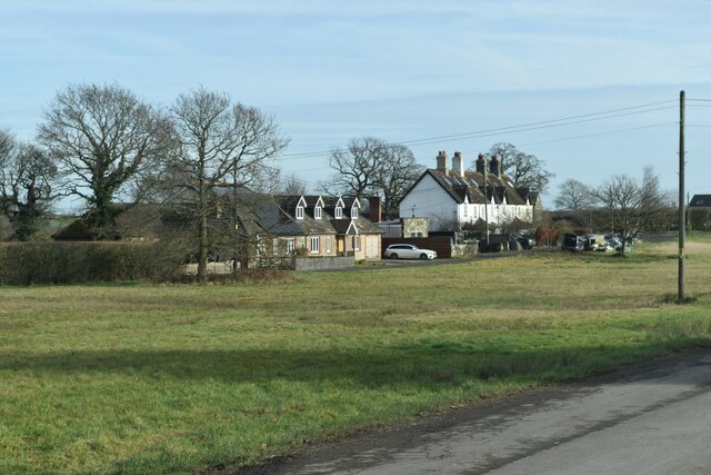
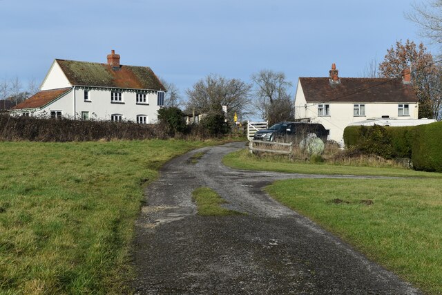
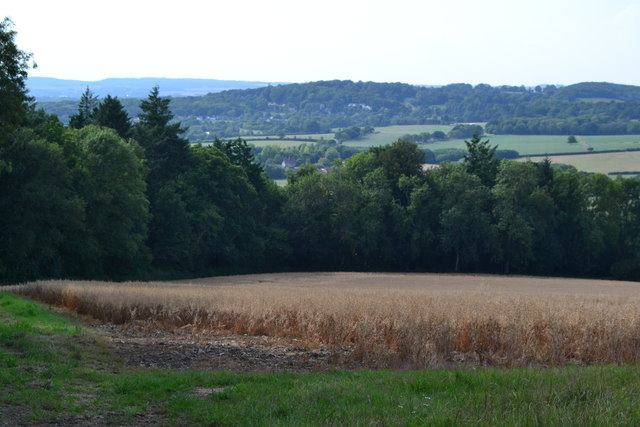
Withybed Plantation is a picturesque woodland located in Wiltshire, England. Spanning over a vast area, this forested area is known for its natural beauty and diverse flora and fauna. It is situated near the village of Withybed Green, surrounded by rolling hills and a tranquil countryside.

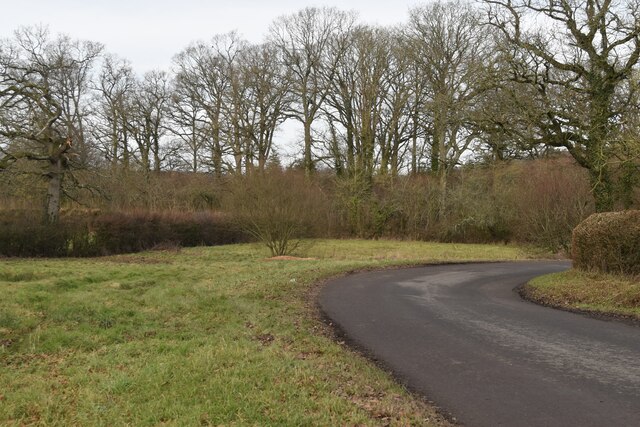
The plantation is primarily composed of deciduous trees, such as oak, beech, and ash, which create a dense canopy overhead. This lush green cover provides a habitat for numerous wildlife species, including deer, foxes, and a variety of bird species. The forest floor is adorned with a rich carpet of ferns, wildflowers, and mosses, adding to the enchanting atmosphere.

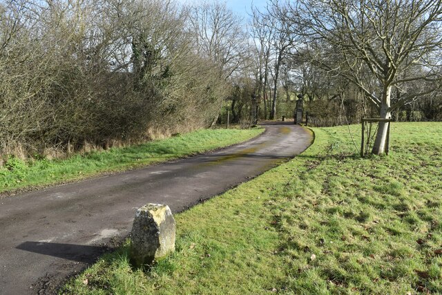
Visitors to Withybed Plantation can enjoy a range of activities, including hiking, birdwatching, and nature photography. The well-maintained trails meander through the woodland, allowing visitors to explore its various nooks and crannies. The peaceful surroundings and serene ambiance make it an ideal destination for those seeking a tranquil retreat from the hustle and bustle of city life.

Withybed Plantation is also of historical significance, as it was once part of an ancient hunting ground for local nobility. The remnants of this history can still be seen in the form of old stone walls and earthworks scattered throughout the woodland.

Overall, Withybed Plantation offers a captivating natural experience, combining stunning scenery, abundant wildlife, and a touch of history. It serves as a haven for nature enthusiasts and provides a serene setting for all who visit.

If you have any feedback on the listing, please let us know in the comments section below.

Withybed Planation Images

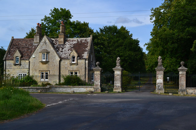
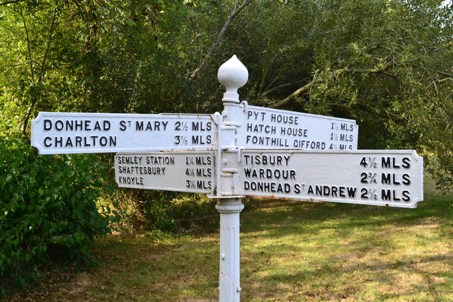
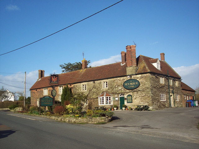
Images are sourced within 2km of 51.05847/-2.1574617 or Grid Reference ST8928. Thanks to Geograph Open Source API. All images are credited.

Church Green, Semley
Track to Semley Gates Crossing The white gate of the level crossing can just be seen between the houses.
Track to Semley Gates Crossing
The white gate of the level crossing can just be seen between the houses.
Footpath and drive to The Grange, Semley The footpath turns off to the left by the post and crosses the stream by a small bridge.
Footpath and drive to The Grange, Semley
The footpath turns off to the left by the post and crosses the stream by a small bridge.
Bend in the road at Semley Common The common is a small strip of land on either side of the road at this point
Bend in the road at Semley Common
The common is a small strip of land on either side of the road at this point
The Street, East Knoyle ca 1980
Field north of Pythouse Plantation
War Memorial, East Knoyle: late August 2016
East Knoyle: shop sign Inside is a notice alluding to their recent "Wrenovation"<span class="nowrap"><a title="http://www.eastknoyle.org.uk/" rel="nofollow ugc noopener" href="http://www.eastknoyle.org.uk/">Link</a><img style="margin-left:2px;" alt="External link" title="External link - shift click to open in new window" src="https://s1.geograph.org.uk/img/external.png" width="10" height="10"/></span>
(at least I'm not the only one)
East Knoyle: shop sign
Inside is a notice alluding to their recent "Wrenovation"LinkExternal link (at least I'm not the only one)
Pond at Semley Green
Old Milestone by the A350, Shaftesbury Road, East Knoyle parish Carved stone post by the A350, in parish of East Knoyle (Salisbury District), Shaftesbury Road, The Turnpike, by Southernmost unnamed cottage in hedgerow on bend, on East side of road. Shaston stone, erected by the Shaftesbury & New Road to Blandford turnpike trust in the 19th century. 

Inscription reads:-
: EAST KNOYLE (vertical) : : IV / Miles from / SHASTON : : (not possible to see) :
Carved benchmark lower front middle.

Grade II listed.  
List Entry Number: 1131144 <span class="nowrap"><a title="https://historicengland.org.uk/listing/the-list/list-entry/1131144" rel="nofollow ugc noopener" href="https://historicengland.org.uk/listing/the-list/list-entry/1131144">Link</a><img style="margin-left:2px;" alt="External link" title="External link - shift click to open in new window" src="https://s1.geograph.org.uk/img/external.png" width="10" height="10"/></span>

Milestone Society National ID: WI_WMSH11
Old Milestone by the A350, Shaftesbury Road, East Knoyle parish
Carved stone post by the A350, in parish of East Knoyle (Salisbury District), Shaftesbury Road, The Turnpike, by Southernmost unnamed cottage in hedgerow on bend, on East side of road. Shaston stone, erected by the Shaftesbury & New Road to Blandford turnpike trust in the 19th century. Inscription reads:- : EAST KNOYLE (vertical) : : IV / Miles from / SHASTON : : (not possible to see) : Carved benchmark lower front middle. Grade II listed. List Entry Number: 1131144 LinkExternal link Milestone Society National ID: WI_WMSH11
Old Direction Sign - Signpost in Semley Ogee finial - 4 arms; Wilts finial by the UC road, in parish of Sedgehill and Semley (Salisbury District), Semley, opposite North West entrance to churchyard, on village green, by pond.

Grade II listed.
List Entry Number: 1318800 <span class="nowrap"><a title="https://historicengland.org.uk/listing/the-list/list-entry/1318800" rel="nofollow ugc noopener" href="https://historicengland.org.uk/listing/the-list/list-entry/1318800">Link</a><img style="margin-left:2px;" alt="External link" title="External link - shift click to open in new window" src="https://s1.geograph.org.uk/img/external.png" width="10" height="10"/></span>

Surveyed

Milestone Society National ID: WI_ST8926
Old Direction Sign - Signpost in Semley
Ogee finial - 4 arms; Wilts finial by the UC road, in parish of Sedgehill and Semley (Salisbury District), Semley, opposite North West entrance to churchyard, on village green, by pond. Grade II listed. List Entry Number: 1318800 LinkExternal link Surveyed Milestone Society National ID: WI_ST8926
South Lodge and gate, Pythouse
Lane from Pythouse to Semley
Church Farm, Semley Seen across Church Green.
Church Farm, Semley
Seen across Church Green.
The Benett Arms, Semley
St Leonard's Church, Semley
Direction sign, Semley
The Seymour Arms, East Knoyle The inn is 17th century and is named after the Seymour family who once owned part of the village.  Until recently, this historic building shook to the sound of traffic thundering by on the main A350 road at the front of the pub.  However, the much needed East Knoyle bypass, completed in 1996, has restored peace and calm to the village.
East Knoyle is a large scattered village on a greensand ridge and is surrounded by some fine walking country.  Christopher Wren, whose father was Rector of East Knoyle, was born in a room above the village shop in October 1632.
The Seymour Arms, East Knoyle
The inn is 17th century and is named after the Seymour family who once owned part of the village. Until recently, this historic building shook to the sound of traffic thundering by on the main A350 road at the front of the pub. However, the much needed East Knoyle bypass, completed in 1996, has restored peace and calm to the village. East Knoyle is a large scattered village on a greensand ridge and is surrounded by some fine walking country. Christopher Wren, whose father was Rector of East Knoyle, was born in a room above the village shop in October 1632.
Show me another place!

Withybed Planation is located at Grid Ref: ST8928 (Lat: 51.05847, Lng: -2.1574617)

Unitary Authority: Wiltshire

Police Authority: Wiltshire

What 3 Words

///scrolled.noticing.contour. Near Hindon, Wiltshire

Related Wikis

Pythouse

Pythouse, sometimes spelled Pyt House and pronounced pit-house, is a country house in southwest Wiltshire, in the west of England. It is about 2+1⁄2 miles...

Semley

Semley is a village and former civil parish, now in the parish of Sedgehill and Semley, in Wiltshire, England, about 3 miles (4.8 km) north-east of Shaftesbury...

East Knoyle

East Knoyle is a village and civil parish in Wiltshire, in the south-west of England, just west of the A350 and about 9 miles (14 km) south of Warminster...

East Knoyle War Memorial

The East Knoyle War Memorial is a monument that commemorates the lives of soldiers from East Knoyle, Wiltshire, England, who were killed in war. Unveiled...

Nearby Amenities

Located within 500m of 51.05847,-2.1574617
Post Box
Operator: Royal Mail
Post Box Type: lamp
Ref: SP3 221
Royal Cypher: EIIR
Royal Cypher Wikidata: Q33102113
Lat/Long: 51.0606476/-2.1521187
The data included in this document is from www.openstreetmap.org. The data is made available under ODbL.

Have you been to Withybed Planation?

Leave your review of Withybed Planation below (or comments, questions and feedback).