High Wood
Wood, Forest in Worcestershire Wychavon
England
High Wood

High Wood is a picturesque woodland located in Worcestershire, England. Situated within the larger area known as the Wyre Forest, it covers an area of approximately 100 hectares. The wood is a mix of mature trees, including oak, birch, and beech, creating a diverse and vibrant ecosystem.
The woodland is known for its rich biodiversity, providing a habitat for a wide range of flora and fauna. It is home to various species of birds, small mammals, and insects, making it a popular spot for birdwatching and nature enthusiasts. The wood also features a number of walking trails, allowing visitors to explore its natural beauty on foot.
High Wood has a long history, with evidence of human activity dating back to the prehistoric period. Archaeological excavations have uncovered remnants of ancient settlements and burial grounds, indicating that the wood has been an important location for thousands of years.
Today, High Wood is managed by the Forestry Commission, who work to preserve its natural heritage and ensure its sustainable use. The woodland is open to the public throughout the year, offering a tranquil and peaceful escape from the hustle and bustle of modern life.
In addition to its natural beauty, High Wood also holds cultural and historical significance. It has been a source of inspiration for artists and writers, with its enchanting atmosphere and idyllic scenery. Overall, High Wood is a treasured natural gem in Worcestershire, providing a haven for wildlife and a peaceful retreat for visitors.
If you have any feedback on the listing, please let us know in the comments section below.
High Wood Images
Images are sourced within 2km of 52.225728/-2.185398 or Grid Reference SO8758. Thanks to Geograph Open Source API. All images are credited.


High Wood is located at Grid Ref: SO8758 (Lat: 52.225728, Lng: -2.185398)
Administrative County: Worcestershire
District: Wychavon
Police Authority: West Mercia
What 3 Words
///humble.frogs.robot. Near Fernhill Heath, Worcestershire
Nearby Locations
Related Wikis
Hindlip
Hindlip or Hinlip is a village and civil parish 3 miles (4.8 km) north east of Worcester, in the Wychavon district, in the county of Worcestershire, England...
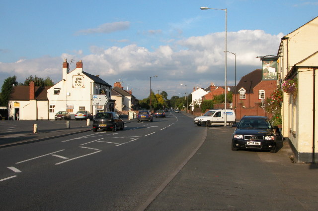
Fernhill Heath
Fernhill Heath is a village in Worcestershire, England. It is in the civil parish of North Claines in Wychavon district. Fernhill Heath is located on the...
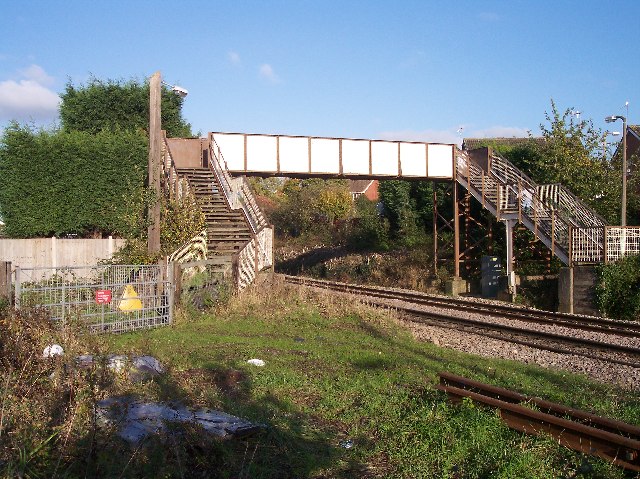
Fernhill Heath railway station
Fernhill Heath railway station was an intermediate railway station on the Oxford, Worcester and Wolverhampton Railway between Worcester (Tunnel Junction...
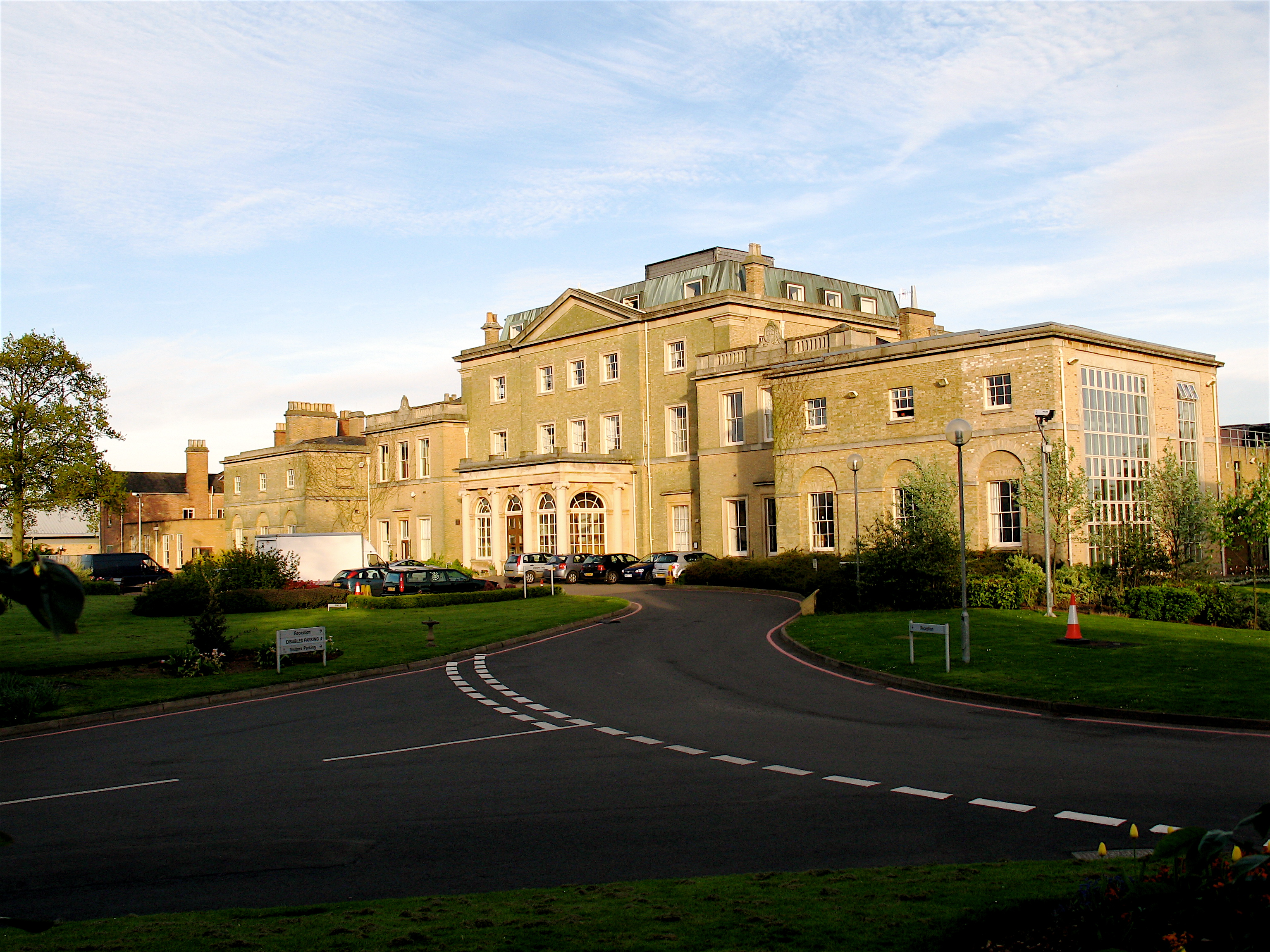
Hindlip Hall
Hindlip Hall is a stately home in Hindlip, Worcestershire, England. The first major hall was built before 1575, and it played a significant role in both...
Nearby Amenities
Located within 500m of 52.225728,-2.185398Have you been to High Wood?
Leave your review of High Wood below (or comments, questions and feedback).