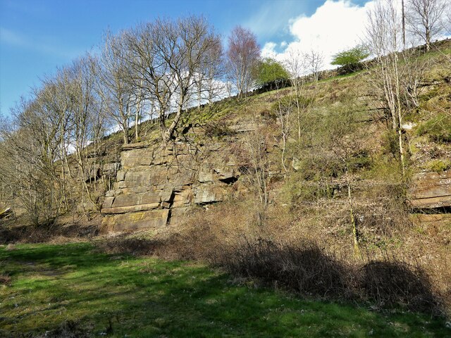
Broughton's Wood

Wood, Forest in Lancashire Burnley

England

Broughton's Wood

Cant Clough With the remains of Hey Laithe on the right in this view
Cant Clough Credit: Kevin Waterhouse

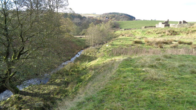
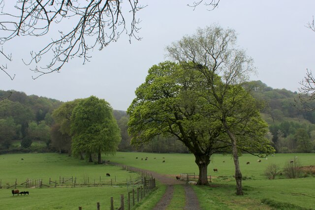
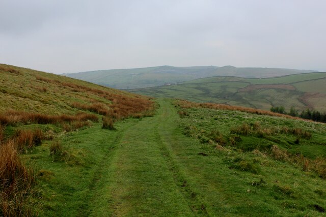
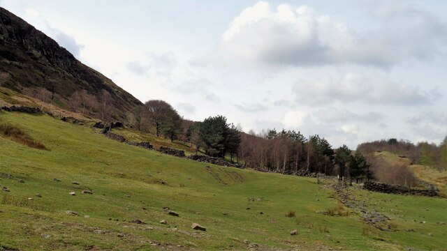
Broughton's Wood is a charming and picturesque woodland located in the county of Lancashire, England. Spanning over a vast area of lush greenery, it is nestled on the outskirts of the village of Broughton. This woodland is renowned for its natural beauty, making it a popular destination for nature enthusiasts, hikers, and wildlife lovers.

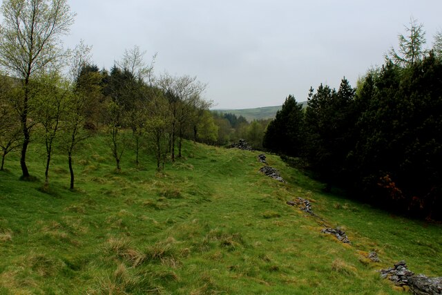
The woodland boasts a diverse range of tree species, including oak, beech, and birch, which create a dense canopy overhead. The forest floor is adorned with a rich carpet of ferns, bluebells, and wildflowers, adding a splash of color to the serene surroundings. As visitors venture deeper into the wood, they are greeted by a tranquil atmosphere and the soothing sounds of birdsong.

Broughton's Wood is home to a variety of wildlife, providing a sanctuary for many species. Birdwatchers can spot an array of feathered friends, including woodpeckers, owls, and songbirds. Squirrels scamper through the trees, while rabbits and deer can occasionally be spotted foraging in the undergrowth.

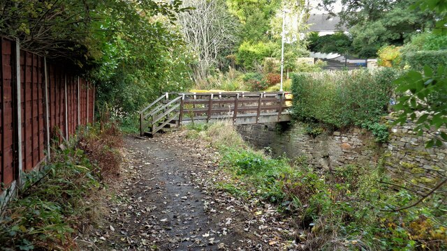
The woodland is crisscrossed with a network of well-maintained footpaths and trails, allowing visitors to explore the area at their leisure. These paths meander through the forest, offering breathtaking views and tranquil spots for picnicking or simply immersing oneself in the peaceful ambiance.

Broughton's Wood is not only a haven for nature lovers but also serves as an important ecological site. It plays a vital role in maintaining the local ecosystem, providing habitats for various flora and fauna species.

Overall, Broughton's Wood is a hidden gem in Lancashire, offering a tranquil escape from the hustle and bustle of everyday life. Whether it's for a leisurely stroll, birdwatching, or simply appreciating the beauty of nature, this woodland is a must-visit destination for all.

If you have any feedback on the listing, please let us know in the comments section below.

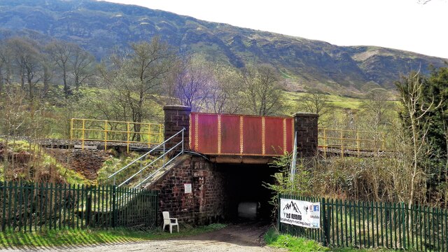
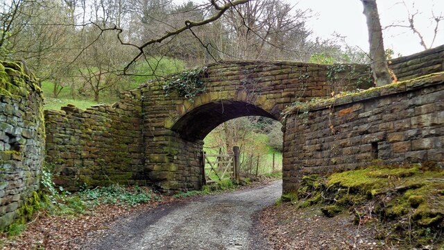
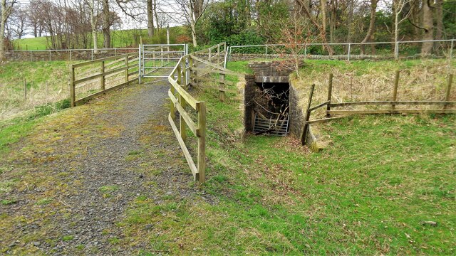
Broughton's Wood Images

Images are sourced within 2km of 53.759731/-2.192126 or Grid Reference SD8729. Thanks to Geograph Open Source API. All images are credited.

Cant Clough With the remains of Hey Laithe on the right in this view
Cant Clough
With the remains of Hey Laithe on the right in this view
Burnley Way Footbridge Crosses the River Calder to give access to Park Road
Burnley Way Footbridge
Crosses the River Calder to give access to Park Road
Monk's Well In Thanet Lee Wood on the Towneley Estate. Whilst it contains a stone trough, the construction around it is believed to be a re-created Gothick folly.
Monk's Well
In Thanet Lee Wood on the Towneley Estate. Whilst it contains a stone trough, the construction around it is believed to be a re-created Gothick folly.
Rebuilt bridge across Shedden Clough Used by the Pennine Bridleway and the Burnley Way
Rebuilt bridge across Shedden Clough
Used by the Pennine Bridleway and the Burnley Way
Work at Middle Pasture Farm Is it renovation work?
Work at Middle Pasture Farm
Is it renovation work?
The Long Causeway at Stump Cross The way marking stone known as Stump Cross is at the top of the roadside embankment on the bend. This stone has not been dressed unlike the Mount Cross which is further along this ancient route
The Long Causeway at Stump Cross
The way marking stone known as Stump Cross is at the top of the roadside embankment on the bend. This stone has not been dressed unlike the Mount Cross which is further along this ancient route
Round Hill There are earthworks marked on the OS map for the hill. There are surface stones visible in that area. More remarkable are the large monoliths built into the field walls around this area and perhaps they had been in the earthworks in times past.
Round Hill
There are earthworks marked on the OS map for the hill. There are surface stones visible in that area. More remarkable are the large monoliths built into the field walls around this area and perhaps they had been in the earthworks in times past.
Disused Rock Quarry By Rock Water
Disused Rock Quarry
By Rock Water
Track heading towards Buckley Wood Public footpath from A646 south of Holme Chapel leading to Buckley Wood over the River Calder
Track heading towards Buckley Wood
Public footpath from A646 south of Holme Chapel leading to Buckley Wood over the River Calder
Footpath on the Southern Edge of Buckley Wood Woods on the flanks of Deerplay Moor
Footpath on the Southern Edge of Buckley Wood
Woods on the flanks of Deerplay Moor
Burnley Way ascending Deerplay Moor The long distance footpath climbs steeply beside Dean Scout
Burnley Way ascending Deerplay Moor
The long distance footpath climbs steeply beside Dean Scout
Flanks of Thieveley Scout
Grass Track on the Flanks of Deerplay Moor
Maiden Cross Marker Stone The history of the Maiden Cross appears to be that of one of a series of way markers along the route of the Long Causeway. This crudely inscribed stone appears to just mark the site of a missing cross and has no Historic England listing unlike Stump Cross and Mount Cross.
Maiden Cross Marker Stone
The history of the Maiden Cross appears to be that of one of a series of way markers along the route of the Long Causeway. This crudely inscribed stone appears to just mark the site of a missing cross and has no Historic England listing unlike Stump Cross and Mount Cross.
Railway Bridge at Calder Head Used by the farmer to store baled sileage. Thieveley Scout is beyond the railway
Railway Bridge at Calder Head
Used by the farmer to store baled sileage. Thieveley Scout is beyond the railway
Track to Millennium Wood (Thieveley) An indistinct footpath to the gate for the wood on the flank of Thieveley Scout
Track to Millennium Wood (Thieveley)
An indistinct footpath to the gate for the wood on the flank of Thieveley Scout
Former Private Footbridge The footbridge gave access to Holmes Chapel railway station for the owners of the large house The Holme. The path from The Holme has already come through an underpass under the main road and another under the railway to reach this bridge
Former Private Footbridge
The footbridge gave access to Holmes Chapel railway station for the owners of the large house The Holme. The path from The Holme has already come through an underpass under the main road and another under the railway to reach this bridge
Private Subway This subway under the now A646 allowed the owners of The Holme to walk to the railway station in private. A public footpath now comes through the gate in the view to join and go forward to a gated subway under the railway
Private Subway
This subway under the now A646 allowed the owners of The Holme to walk to the railway station in private. A public footpath now comes through the gate in the view to join and go forward to a gated subway under the railway
Show me another place!

Broughton's Wood is located at Grid Ref: SD8729 (Lat: 53.759731, Lng: -2.192126)

Administrative County: Lancashire

District: Burnley

Police Authority: Lancashire

What 3 Words

///ports.shower.glitz. Near Cornholme, West Yorkshire

Related Wikis

Church of St John the Divine, Holme Chapel

The Church of St John the Divine is in Burnley Road, Holme Chapel, a village in the civil parish of Cliviger, near Burnley, Lancashire, England. It is...

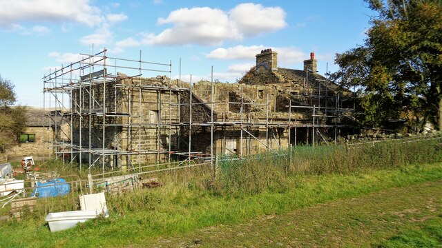
Holme Hall, Cliviger

Holme Hall (or The Holme) is a Grade II* listed manor house in Cliviger near Burnley, in Lancashire, England. The house dates back to at least the 15th...

Holme railway station (Lancashire)

Holme railway station served Holme Chapel on the Copy Pit line. The station closed in July 1930 and the line now serves as a non-stop route between Hebden...
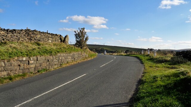
Cliviger

Cliviger is a civil parish in the Borough of Burnley, in Lancashire, England. It is situated to the southeast of Burnley, and northwest of Todmorden....

Hurstwood

Hurstwood is a rural hamlet on the eastern outskirts of Burnley in Lancashire, England. It is in the civil parish of Worsthorne-with-Hurstwood and the...

Fother Royd Wood

Fother Royd Wood is a woodland in Lancashire, England, near Worsthorne. It covers a total area of 1.03 hectares (2.55 acres). It is owned and managed by...

Singing Ringing Tree (sculpture)

The Singing Ringing Tree is a wind powered sound sculpture resembling a tree set in the landscape of the Pennine hill range overlooking Burnley, in Lancashire...

Worsthorne-with-Hurstwood

Worsthorne-with-Hurstwood is a civil parish in the Borough of Burnley, in Lancashire, England. Situated on the eastern outskirts of Burnley, in 2011 it...

Related Videos

23 October 2023

A671 passing vehicle with woman on horseback.

A Snowy Hike over Cliviger Gorge, Thieveley Pike & Frozen Waterfalls. Todmorden / Burnley

Cliviger Gorge is a high steep sided valley which was formed in the last Ice Age, and is on the boundary of Todmorden and ...

The Ghost Stories of Towneley Hall. Towneley Park. Burnley

Towneley Hall is one of the jewels in Burnley and dates back many Centuries. The building itself standing in its present location ...

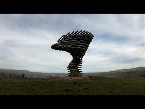
Singing Ringing Tree Hike

The Singing Ringing Tree located in Burnley England. The sculpture is a strange place it has a very strange sound when the wind ...

Nearby Amenities

Located within 500m of 53.759731,-2.192126
Post Box
Post Box Mounting: lamp_post
Post Box Type: lamp
Ref: BB10 194D
Royal Cypher: EIIR
Royal Cypher Wikidata: Q33102113
Lat/Long: 53.7598191/-2.1983992
Bench
Lat/Long: 53.7604851/-2.1981405
Bus Stop
Bus: yes
Naptan AtcoCode: 2500IMG2505
Naptan NaptanCode: langdgmp
Public Transport: platform
Lat/Long: 53.7599181/-2.1982555
Southward Bottom
Place: hamlet
Lat/Long: 53.7618205/-2.1977298
The data included in this document is from www.openstreetmap.org. The data is made available under ODbL.

Have you been to Broughton's Wood?

Leave your review of Broughton's Wood below (or comments, questions and feedback).