Hindlip

Settlement in Worcestershire Wychavon

England

Hindlip

The Malvern Hills from Fernhill Heath The Malvern Hills are just visible on the horizon, viewed from just north of Fernhill Heath
The Malvern Hills from Fernhill Heath Credit: Philip Halling

Hindlip is a small village located in the county of Worcestershire, England. Situated approximately 5 miles north of the city of Worcester, Hindlip is a rural settlement that offers a tranquil environment with stunning views of the surrounding countryside.

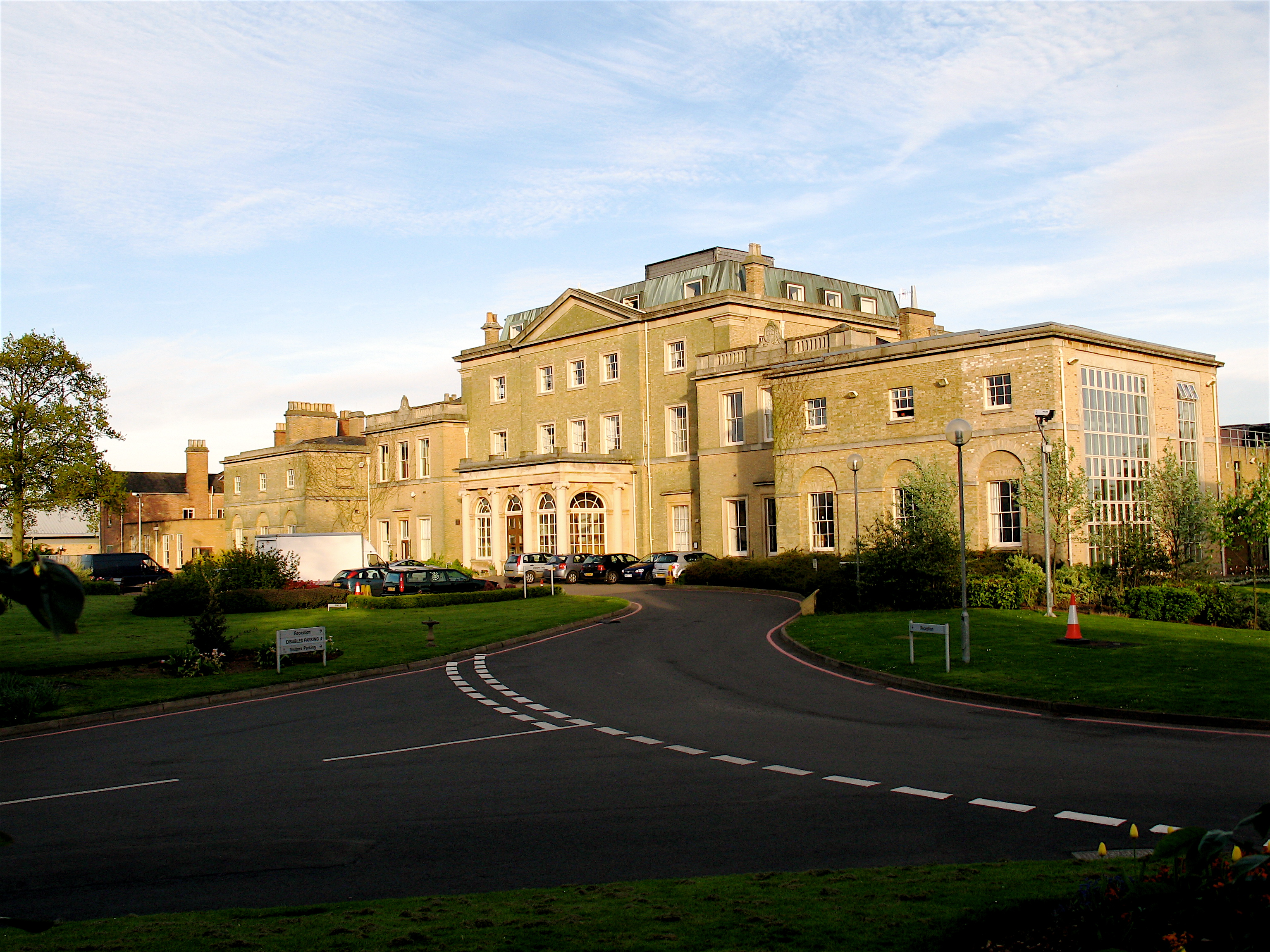
The village is primarily known for Hindlip Hall, a beautiful country house that dates back to the 16th century. Hindlip Hall is an impressive Grade I listed building that was once the home of the infamous Gunpowder Plot conspirator, Thomas Wintour. Today, the hall is a popular venue for weddings, corporate events, and private functions.

Despite its small size, Hindlip offers a range of amenities for its residents. These include a village hall, a primary school, and a church, providing a strong sense of community. The countryside setting provides opportunities for outdoor activities such as walking and cycling, with nearby Hindlip Hills offering scenic trails and breathtaking views.

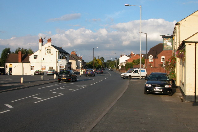
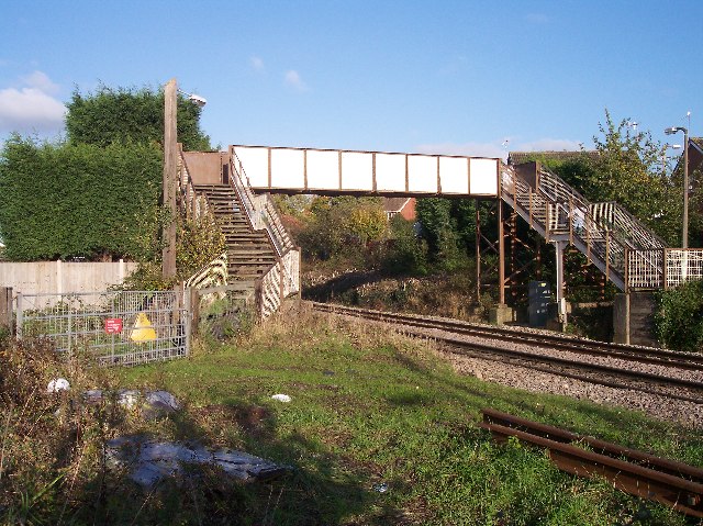
In terms of transportation, Hindlip benefits from good road links, with the A449 passing through the village, connecting it to Worcester and nearby towns. Worcester Foregate Street railway station is the nearest train station, providing convenient access to other major cities and towns in the region.

Overall, Hindlip is a picturesque village that combines historical charm with natural beauty. Its peaceful surroundings and convenient location make it an attractive place to live for those seeking a quieter lifestyle while still having easy access to urban amenities.

If you have any feedback on the listing, please let us know in the comments section below.

Hindlip Images

Images are sourced within 2km of 52.222783/-2.189194 or Grid Reference SO8758. Thanks to Geograph Open Source API. All images are credited.

The Malvern Hills from Fernhill Heath The Malvern Hills are just visible on the horizon, viewed from just north of Fernhill Heath
The Malvern Hills from Fernhill Heath
The Malvern Hills are just visible on the horizon, viewed from just north of Fernhill Heath
Worcester to Droitwich Railway Looking towards Worcester from the bridge on Strand Lane.
Worcester to Droitwich Railway
Looking towards Worcester from the bridge on Strand Lane.
Field near The Knoll farm
Road junction Junction of two minor roads in Martin Hussingtree.
Road junction
Junction of two minor roads in Martin Hussingtree.
Hogbrook Farm, Porter's Hill Lane An ideal name for a pig farm.
Taken from Station Road, Ferhill Heath
The clock tower at Abberley can just be made out in the distance.
Hogbrook Farm, Porter's Hill Lane
An ideal name for a pig farm. Taken from Station Road, Ferhill Heath The clock tower at Abberley can just be made out in the distance.
Lane from Martin Hussingtree to Ladywood
Station Road Approaching Strand Lane Junction Fernhill Heath
Station Road & Strand Lane Junction Fernhill Heath
Piggery and Lower Town, Fernhill Heath
House in Lower Town, Fernhill Heath
Cummins Farm, Hindlip Cummins Farm lies just beyond the northern edge of the city of Worcester and near Hindlip Hall, headquarters of West Mercia Constabulary.
Cummins Farm, Hindlip
Cummins Farm lies just beyond the northern edge of the city of Worcester and near Hindlip Hall, headquarters of West Mercia Constabulary.
Fernhill Heath The Bull Inn and the White Hart on the A38 as it passes through Fernhill Heath.
Fernhill Heath
The Bull Inn and the White Hart on the A38 as it passes through Fernhill Heath.
Railway at Fernhill Heath Site of the old station at Fernhill Heath on the Worcester to Droitwich line.
Railway at Fernhill Heath
Site of the old station at Fernhill Heath on the Worcester to Droitwich line.
Blackpole East Industrial Estate north of Blackpole
Blackpole East
Industrial Estate north of Blackpole
Worcester Bosch Factory Units north of the B4639
Worcester Bosch
Factory Units north of the B4639
Worcester Canal Canal - looking east - one of the main canal links from Birmingham to the Severn navigation (although it doesn't look so major now!)
Worcester Canal
Canal - looking east - one of the main canal links from Birmingham to the Severn navigation (although it doesn't look so major now!)
Woodgreen Evangelical Church A modern church for a modern housing estate crisscrossed with roads intersecting with roundabouts in the infill between the old city and the M5.
Woodgreen Evangelical Church
A modern church for a modern housing estate crisscrossed with roads intersecting with roundabouts in the infill between the old city and the M5.
Perdiswell Lock The Worcester to Birmingham Canal passes by the Perdiswell sports ground and golf course. this lock No 8. Looking north towards Birmingham.
Perdiswell Lock
The Worcester to Birmingham Canal passes by the Perdiswell sports ground and golf course. this lock No 8. Looking north towards Birmingham.
Show me another place!

Hindlip is located at Grid Ref: SO8758 (Lat: 52.222783, Lng: -2.189194)

Administrative County: Worcestershire

District: Wychavon

Police Authority: West Mercia

What 3 Words

///laws.skills.richer. Near Fernhill Heath, Worcestershire

Related Wikis

Fernhill Heath

Fernhill Heath is a village in Worcestershire, England. It is in the civil parish of North Claines in Wychavon district. Fernhill Heath is located on the...

Hindlip

Hindlip or Hinlip is a village and civil parish 3 miles (4.8 km) north east of Worcester, in the Wychavon district, in the county of Worcestershire, England...

Blackpole Halt railway station

Blackpole Halt railway station was a station to the north of Worcester, Worcestershire, England. The station was opened during World War I to serve a nearby...

Fernhill Heath railway station

Fernhill Heath railway station was an intermediate railway station on the Oxford, Worcester and Wolverhampton Railway between Worcester (Tunnel Junction...

RAF Worcester

Royal Air Force Worcester, or more simply RAF Worcester, is a former Royal Air Force relief landing ground (RLG) which was located 1.7 miles (2.7 km) north...

Hindlip Hall

Hindlip Hall is a stately home in Hindlip, Worcestershire, England. The first major hall was built before 1575, and it played a significant role in both...

River School

The River School is an independent Christian School, affiliated with the Christian Schools Trust. The school is located in Worcester, England, in a large...

Worcester City F.C.

Worcester City Football Club is an English football club based in Worcester, Worcestershire. The club play in the Hellenic Football League Premier Division...

Nearby Amenities

Located within 500m of 52.222783,-2.189194
Motorway Junction
Lat/Long: 52.2210536/-2.1891855
Motorway Junction
Lat/Long: 52.2234105/-2.1957546
Power: tower
Lat/Long: 52.218855/-2.1864694
Spellis Green
Place: hamlet
Lat/Long: 52.2225828/-2.1908076
Give Way
Lat/Long: 52.2205141/-2.1931196
Give Way
Lat/Long: 52.220581/-2.1931912
Parking
Parking: surface
Source: bing
Lat/Long: 52.2201986/-2.1836346
Power: pole
Lat/Long: 52.2269439/-2.1916927
Power: pole
Lat/Long: 52.2269028/-2.1903268
Power: pole
Lat/Long: 52.2263097/-2.1911207
Power: pole
Lat/Long: 52.2255215/-2.1903951
Power: pole
Lat/Long: 52.2248774/-2.1905346
Hurst Cottage
Power: pole
Transformer: distribution
Voltage Primary: 11000
Lat/Long: 52.2245956/-2.1917336
Power: pole
Lat/Long: 52.2243956/-2.1906728
Power: pole
Lat/Long: 52.2234044/-2.1909504
Power: pole
Lat/Long: 52.2229369/-2.1910932
Spellis Green
Power: pole
Transformer: distribution
Voltage Primary: 11000
Lat/Long: 52.2224194/-2.1913037
Power: pole
Lat/Long: 52.222191/-2.1914037
Power: pole
Lat/Long: 52.2214014/-2.1917845
Power: pole
Lat/Long: 52.2206723/-2.1921372
BT Kiosk Blackpole Road
Power: pole
Transformer: distribution
Voltage Primary: 11000
Lat/Long: 52.2200885/-2.1924222
Power: pole
Lat/Long: 52.2191716/-2.1928681
Give Way
Lat/Long: 52.2245786/-2.1925328
Give Way
Lat/Long: 52.2247867/-2.1922261
Give Way
Lat/Long: 52.221585/-2.1929718
Give Way
Direction: backward
Lat/Long: 52.2205251/-2.1930158
The data included in this document is from www.openstreetmap.org. The data is made available under ODbL.

Have you been to Hindlip?

Leave your review of Hindlip below (or comments, questions and feedback).