Gorse Covert

Wood, Forest in Cheshire

England

Gorse Covert

Aircraft on final approach Looking towards an aircraft at sunset near the junction of Hollin Lane and Moss Lane.
Aircraft on final approach Credit: DS Pugh

Gorse Covert is a small wood located in the county of Cheshire, England. Situated near the town of Northwich, it is a popular destination for nature enthusiasts and locals looking to escape the hustle and bustle of urban life.

Covering an area of approximately 20 acres, Gorse Covert is characterized by its dense and diverse vegetation. The woodland is dominated by a variety of tree species, including oak, beech, and birch, which provide a rich habitat for numerous bird species, small mammals, and insects. The forest floor is covered in a carpet of wildflowers and ferns, adding to the vibrant and diverse ecosystem.

Gorse Covert is known for its tranquil and peaceful atmosphere, making it a perfect place for leisurely walks or picnics. Several footpaths wind through the wood, allowing visitors to explore its hidden corners and discover its natural beauty. The wood is also equipped with picnic areas and benches, providing ample opportunities for visitors to relax and enjoy the surroundings.

In addition to being a haven for wildlife and a recreational space, Gorse Covert also plays a role in the local community. The wood is often used for educational purposes, with school groups and nature clubs visiting to learn about the importance of conservation and the natural world.

Overall, Gorse Covert is a charming woodland that offers a sanctuary for both flora and fauna, as well as a peaceful retreat for visitors seeking a connection with nature.

If you have any feedback on the listing, please let us know in the comments section below.

Gorse Covert Images

Images are sourced within 2km of 53.378958/-2.2508207 or Grid Reference SJ8386. Thanks to Geograph Open Source API. All images are credited.

Aircraft on final approach Looking towards an aircraft at sunset near the junction of Hollin Lane and Moss Lane.
Aircraft on final approach
Looking towards an aircraft at sunset near the junction of Hollin Lane and Moss Lane.
Manchester Airport Eastern Link Road Looking across the junction with Styal Road as an aircraft approaches the airport.
Manchester Airport Eastern Link Road
Looking across the junction with Styal Road as an aircraft approaches the airport.
Bridge on Finney Lane Looking towards a pedestrian crossing. The railway is below with Heald Green Station on the right.
Bridge on Finney Lane
Looking towards a pedestrian crossing. The railway is below with Heald Green Station on the right.
Portrush Road and Simonsway junction In Wythenshawe, which was originally in Cheshire but became part of Manchester in 1931.
Portrush Road and Simonsway junction
In Wythenshawe, which was originally in Cheshire but became part of Manchester in 1931.
Approach to the terminus The approach tracks to the Manchester Airport terminus of the Metrolink tram service from Cornbrook and Manchester City Centre.
Approach to the terminus
The approach tracks to the Manchester Airport terminus of the Metrolink tram service from Cornbrook and Manchester City Centre.
Overgrown Bee Overgrown was created by: Lizzie Rose Chapman and sponsored by Wyth Love from Wythenshawe.

"The design for this Bee was inspired by pollination, the bees' love of flowers and Wythenshawe itself, Manchester's original Garden City. You are encouraged to follow the Bees on their trails and explore Wythenshawe's variety of green spaces. At the Edible Transport Interchange, anyone can help themselves to the herbs, vegetables and fruit grown here, then simply throw them into a pot to create a delicious evening meal."

The Bee started its life on the Forum Concourse <a href="https://www.geograph.org.uk/photo/5996004">SJ8287 : Overgrown</a>, in her very own garden, with smaller, but equally amazing, learning Bees. Once the Summer had ended, she moved to her forever hive, in Wythenshawe's Edible Transport Interchange.
Overgrown Bee
Overgrown was created by: Lizzie Rose Chapman and sponsored by Wyth Love from Wythenshawe. "The design for this Bee was inspired by pollination, the bees' love of flowers and Wythenshawe itself, Manchester's original Garden City. You are encouraged to follow the Bees on their trails and explore Wythenshawe's variety of green spaces. At the Edible Transport Interchange, anyone can help themselves to the herbs, vegetables and fruit grown here, then simply throw them into a pot to create a delicious evening meal." The Bee started its life on the Forum Concourse SJ8287 : Overgrown, in her very own garden, with smaller, but equally amazing, learning Bees. Once the Summer had ended, she moved to her forever hive, in Wythenshawe's Edible Transport Interchange.
Heald Green winter 1975 I took this photograph on Styal Road, Heald Green, Wythenshawe in the 1970s winter.  I wonder what they are doing now?
Heald Green winter 1975
I took this photograph on Styal Road, Heald Green, Wythenshawe in the 1970s winter. I wonder what they are doing now?
Moat Bridge View towards the site of Peel Hall which was a moated site. It is now the centre of Peel Hall Park.
Moat Bridge
View towards the site of Peel Hall which was a moated site. It is now the centre of Peel Hall Park.
Direction Sign – Signpost on Styal Road in Gatley Located on the northeast side of the junction of the B5166 Styal Road and Church Road in Gatley, Stockport. 2 arms but missing finial. 

Milestone Society National ID: CH_SJ8488
Direction Sign – Signpost on Styal Road in Gatley
Located on the northeast side of the junction of the B5166 Styal Road and Church Road in Gatley, Stockport. 2 arms but missing finial. Milestone Society National ID: CH_SJ8488
Renold House, Styal Road, Manchester Quality, and well-preserved, office block of 1954 by stalwarts Cruickshank  & Seward.
Now housing the Manchester International Office Centre.
Another view <a href="https://www.geograph.org.uk/photo/4122103">SJ8485 : Manchester International Office Centre</a>.
Renold House, Styal Road, Manchester
Quality, and well-preserved, office block of 1954 by stalwarts Cruickshank & Seward. Now housing the Manchester International Office Centre. Another view SJ8485 : Manchester International Office Centre.
Delta House, Wavell Road, Manchester An interesting Y-shaped 1960s office block, the upper storeys above a hexagonal ground floor.
I would have tried to get a closer look, but the "ISO27001-compliant building has some of the most sophisticated security of any data centre in Europe ... with an on-site police-linked, NSI Gold Approved, BS5979 certified control room and alarm receiving centre [it is] unique in the UK. ...biometric access controls, virtual tripwires, visitor turnstiles and man-traps, and full-height perimeter fencing provide multiple layers of physical security." Operated by Teledata UK Ltd.
Delta House, Wavell Road, Manchester
An interesting Y-shaped 1960s office block, the upper storeys above a hexagonal ground floor. I would have tried to get a closer look, but the "ISO27001-compliant building has some of the most sophisticated security of any data centre in Europe ... with an on-site police-linked, NSI Gold Approved, BS5979 certified control room and alarm receiving centre [it is] unique in the UK. ...biometric access controls, virtual tripwires, visitor turnstiles and man-traps, and full-height perimeter fencing provide multiple layers of physical security." Operated by Teledata UK Ltd.
Alpha House, Rowlandsway, Manchester Alpha House is the far section, the nearer is Centron House. They are linked by an elevated section over Wavell Road.
Alpha House, Rowlandsway, Manchester
Alpha House is the far section, the nearer is Centron House. They are linked by an elevated section over Wavell Road.
Detail of Alpha House, Rowlandsway, Manchester A bit of 1960s concrete in all its glory. This is the elevated section crossing Wavell Road.
Wider view: <a href="https://www.geograph.org.uk/photo/7571690">SJ8287 : Alpha House, Rowlandsway, Manchester</a>.
Detail of Alpha House, Rowlandsway, Manchester
A bit of 1960s concrete in all its glory. This is the elevated section crossing Wavell Road. Wider view: SJ8287 : Alpha House, Rowlandsway, Manchester.
Edwards Court, Birch Tree Drive, Manchester Two eight-storey blocks, Edwards Court on the left and Birch Tree Court on the right, each containing 86 flats. Built c1965. Originally there were four blocks but two have been demolished.
Edwards Court, Birch Tree Drive, Manchester
Two eight-storey blocks, Edwards Court on the left and Birch Tree Court on the right, each containing 86 flats. Built c1965. Originally there were four blocks but two have been demolished.
Etrop Grange, Thorley Lane, Manchester A very fine mid-Georgian house, built c1780. Five bays, a pediment over the central three bays, and pedimented doorcase. Grade II listed.
Now the eponymous hotel, handily situated for the airport.
Etrop Grange, Thorley Lane, Manchester
A very fine mid-Georgian house, built c1780. Five bays, a pediment over the central three bays, and pedimented doorcase. Grade II listed. Now the eponymous hotel, handily situated for the airport.
Metrolink tracks View towards Benchill Metro station on Brownley Road, Wythenshawe.
Metrolink tracks
View towards Benchill Metro station on Brownley Road, Wythenshawe.
Stream between culverts This stream appears on some open ground alongside Woodend Road, Benchill, otherwise it is within culverts.
Stream between culverts
This stream appears on some open ground alongside Woodend Road, Benchill, otherwise it is within culverts.
Tree lined Woodhouse Lane At Benchill, Wythenshawe
Tree lined Woodhouse Lane
At Benchill, Wythenshawe
Show me another place!

Gorse Covert is located at Grid Ref: SJ8386 (Lat: 53.378958, Lng: -2.2508207)

Unitary Authority: Manchester

Police Authority: Greater Manchester

What 3 Words

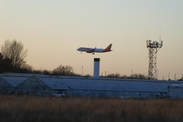
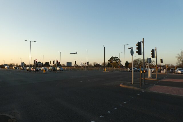
///driven.noise.tides. Near Ringway, Manchester

Related Wikis

Peel Hall, Wythenshawe

Peel Hall is a suburb of Manchester, England, nine miles south of the city centre and a mile north of Manchester Airport. Peel Hall is on the eastern edge...
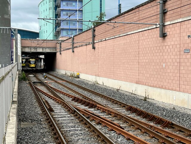
Peel Hall tram stop

Peel Hall is a tram stop for Phase 3b of the Manchester Metrolink. The station opened on 3 November 2014 and is on the Airport Line on Simonsway next to...

Robinswood Road tram stop

Robinswood Road is a tram stop for Phase 3b of the Manchester Metrolink. It opened on 3 November 2014. and is on the Airport Line on Simonsway at the junction...

Crossacres tram stop

Crossacres is a tram stop for the Phase 3B Extension of Greater Manchester's Metrolink system. The stop is part of the Airport Line and is at the junction...

Nearby Amenities

Located within 500m of 53.378958,-2.2508207
Turning Circle
Lat/Long: 53.3821875/-2.2496559
Turning Circle
Lat/Long: 53.3812139/-2.2523972
Turning Circle
Lat/Long: 53.3811186/-2.2513833
Turning Circle
Lat/Long: 53.3795684/-2.2534617
Turning Circle
Lat/Long: 53.3805662/-2.2543262
Turning Circle
Lat/Long: 53.3807584/-2.2494153
Bus Stop
Peel Hall, Peel Hall Road / opposite Shone Avenue
Bus: yes
Naptan AtcoCode: 1800SB08801
Naptan Bearing: S
Naptan CommonName: Peel Hall Road/Shone Avenue
Naptan Indicator: Bungalow
Naptan Landmark: HOUSE 141
Naptan NaptanCode: mangpmgm
Naptan PlusbusZoneRef: MNCRPIC
Naptan ShortCommonName: Shone Avenue
Naptan Street: PEEL HALL ROAD
Naptan Verified: no
Network: TfGM
Operator: TfGM
Public Transport: platform
Source: naptan_import
Lat/Long: 53.377914/-2.2475687
Bus Stop
Peel Hall, Peel Hall Road / near Shone Avenue
Bus: yes
Naptan AtcoCode: 1800SB08811
Naptan Bearing: N
Naptan CommonName: Peel Hall Road/Shone Avenue
Naptan Indicator: O/s House 114
Naptan Landmark: HOUSE 114
Naptan NaptanCode: mangpmgp
Naptan PlusbusZoneRef: MNCRPIC
Naptan ShortCommonName: Shone Avenue
Naptan Street: PEEL HALL ROAD
Naptan Verified: no
Network: TfGM
Operator: TfGM
Public Transport: platform
Source: naptan_import
Toilets Wheelchair: yes
Wheelchair: yes
Lat/Long: 53.3777609/-2.2477182
Bus Stop
Peel Hall, Peel Hall Road / near Bleak Hey Road
Bus: yes
Naptan AtcoCode: 1800SB09741
Naptan Bearing: S
Naptan CommonName: Peel Hall Road/Bleak Hey Road
Naptan Indicator: Opp Church
Naptan Landmark: CHURCH
Naptan NaptanCode: mangpmtw
Naptan PlusbusZoneRef: MNCRPIC
Naptan ShortCommonName: Bleak Hey Road
Naptan Street: PEEL HALL ROAD
Naptan Verified: no
Network: TfGM
Operator: TfGM
Public Transport: platform
Source: naptan_import
Lat/Long: 53.3787861/-2.2475137
Bus Stop
Peel Hall, Peel Hall Road / Coleby Avenue (Stop D)
Bus: yes
Local Ref: D
Naptan AtcoCode: 1800SB12711
Naptan Bearing: S
Naptan CommonName: Peel Hall Road/Coleby Avenue
Naptan Indicator: O/s House 223
Naptan Landmark: HOUSE 223
Naptan NaptanCode: mangpwdp
Naptan PlusbusZoneRef: MNCRPIC
Naptan ShortCommonName: Coleby Avenue
Naptan Street: PEEL HALL ROAD
Naptan Verified: no
Network: TfGM
Operator: TfGM
Public Transport: platform
Ref: D
Source: naptan_import
Lat/Long: 53.3748839/-2.2479871
Bus Stop
Peel Hall, Peel Hall Road / opposite The Tudor
Bus: yes
Naptan AtcoCode: 1800SB12721
Naptan Bearing: S
Naptan CommonName: Peel Hall Road/The Tudor
Naptan Indicator: Flats
Naptan Landmark: PUBLIC HOUSE
Naptan NaptanCode: mangpwdt
Naptan PlusbusZoneRef: MNCRPIC
Naptan ShortCommonName: The Tudor
Naptan Street: PEEL HALL ROAD
Naptan Verified: no
Network: TfGM
Operator: TfGM
Public Transport: platform
Source: naptan_import
Lat/Long: 53.3763769/-2.2475899
Bus Stop
Peel Hall, Peel Hall Road / outside The Tudor
Bus: yes
Naptan AtcoCode: 1800SB12731
Naptan Bearing: N
Naptan CommonName: Peel Hall Road/The Tudor
Naptan Indicator: Tudor Tavern
Naptan Landmark: PUBLIC HOUSE
Naptan NaptanCode: mangpwdw
Naptan PlusbusZoneRef: MNCRPIC
Naptan ShortCommonName: The Tudor
Naptan Street: PEEL HALL ROAD
Naptan Verified: no
Network: TfGM
Operator: TfGM
Public Transport: platform
Source: naptan_import
Lat/Long: 53.3766283/-2.2477417
Bus Stop
Peel Hall, Peel Hall Road / near Leominster Drive
Bus: yes
Naptan AtcoCode: 1800SB12741
Naptan Bearing: N
Naptan CommonName: Peel Hall Road/Leominster Drive
Naptan Indicator: O/s House 84
Naptan Landmark: HOUSE 84
Naptan NaptanCode: mangpwga
Naptan PlusbusZoneRef: MNCRPIC
Naptan ShortCommonName: Leominster Drive
Naptan Street: PEEL HALL ROAD
Naptan Verified: no
Network: TfGM
Operator: TfGM
Public Transport: platform
Source: naptan_import
Lat/Long: 53.3796039/-2.2475785
Bus Stop
Peel Hall, Peel Hall Road / near Upavon Road
Bus: yes
Naptan AtcoCode: 1800SB12751
Naptan Bearing: S
Naptan CommonName: Peel Hall Road/Upavon Road
Naptan Indicator: Shops
Naptan Landmark: SHOPS
Naptan NaptanCode: mangpwgd
Naptan PlusbusZoneRef: MNCRPIC
Naptan ShortCommonName: Upavon Road
Naptan Street: PEEL HALL ROAD
Naptan Verified: no
Network: TfGM
Operator: TfGM
Public Transport: platform
Source: naptan_import
Lat/Long: 53.3818223/-2.2484784
Bus Stop
Peel Hall, Peel Hall Road / opposite Upavon Road
Bus: yes
Naptan AtcoCode: 1800SB12761
Naptan Bearing: N
Naptan CommonName: Peel Hall Road/Upavon Road
Naptan Indicator: O/s House 24
Naptan Landmark: HOUSE 24
Naptan NaptanCode: mangpwgj
Naptan PlusbusZoneRef: MNCRPIC
Naptan ShortCommonName: Upavon Road
Naptan Street: PEEL HALL ROAD
Naptan Verified: no
Network: TfGM
Operator: TfGM
Public Transport: platform
Source: naptan_import
Lat/Long: 53.3821899/-2.2489316
Bus Stop
Wythenshawe, Crossacres Road / near Longwood Road
Bus: yes
Naptan AtcoCode: 1800SB39601
Naptan Bearing: W
Naptan CommonName: Crossacres Road/Longwood Road
Naptan Indicator: O/s House 157
Naptan Landmark: O/S HOUSE 157
Naptan NaptanCode: mangwjmd
Naptan PlusbusZoneRef: MNCRPIC
Naptan ShortCommonName: Longwood Road
Naptan Street: CROSSACRES ROAD
Naptan Verified: no
Network: TfGM
Operator: TfGM
Public Transport: platform
Source: naptan_import
Lat/Long: 53.3831635/-2.251884
Bus Stop
Wythenshawe, Crossacres Road / Brownley Road (Stop B)
Bus: yes
Local Ref: B
Naptan AtcoCode: 1800SB39611
Naptan Bearing: E
Naptan CommonName: Crossacres Road/Brownley Road
Naptan Indicator: O/s House 184
Naptan Landmark: HOUSE 184
Naptan NaptanCode: mangwjmg
Naptan PlusbusZoneRef: MNCRPIC
Naptan ShortCommonName: Brownley Road
Naptan Street: CROSSACRES ROAD
Naptan Verified: no
Network: TfGM
Operator: TfGM
Public Transport: platform
Ref: B
Source: naptan_import
Lat/Long: 53.3824546/-2.255518
Bus Stop
Simonsway/Brownley Road
Bus: yes
Local Ref: B
Naptan AtcoCode: 1800SB18211
Naptan Bearing: NW
Naptan CommonName: Simonsway/Brownley Road
Naptan Indicator: Nr Open Land
Naptan Landmark: NR OPEN LAND
Naptan NaptanCode: mangtjgp
Naptan PlusbusZoneRef: MNCRPIC
Naptan ShortCommonName: Brownley Road
Naptan Street: SIMONSWAY
Naptan Verified: no
Network: TfGM
Public Transport: platform
Source: naptan_import
Lat/Long: 53.3761135/-2.2565865
Bus Stop
Simonsway/Brownley Road
Bus: yes
Local Ref: A
Naptan AtcoCode: 1800SB18221
Naptan Bearing: SE
Naptan CommonName: Simonsway/Brownley Road
Naptan Indicator: Op Hatchetts Wd
Naptan Landmark: OP HATCHETTS WD
Naptan NaptanCode: mangtjgt
Naptan PlusbusZoneRef: MNCRPIC
Naptan ShortCommonName: Brownley Road
Naptan Street: SIMONSWAY
Naptan Verified: no
Network: TfGM
Public Transport: platform
Source: naptan_import
Lat/Long: 53.375992/-2.255329
Turning Circle
Lat/Long: 53.3780727/-2.2566065
Turning Circle
Lat/Long: 53.3798642/-2.258137
Turning Circle
Lat/Long: 53.3746659/-2.2506808
Crossing
Lat/Long: 53.3752703/-2.2528246
Recycling
Recycling Clothes: yes
Recycling Type: container
Lat/Long: 53.3768636/-2.2478253
Telephone
Booth: KX100
Covered: booth
Operator: British Telecom
Payment Coins: yes
Phone: +44 161 437 6163
Lat/Long: 53.3790193/-2.2474381
Bicycle Parking
Bicycle Parking: stands
Capacity: 2
Covered: no
Source: survey
Lat/Long: 53.3820245/-2.2486091
Telephone
Booth: KX100
Contact Phone: +44 161 437 1439
Covered: booth
Operator: BT
Operator Wikidata: Q593786
Payment Coins: yes
Postal Code: M22 5HP
Lat/Long: 53.3820127/-2.2486
Post Box
Brand: Royal Mail
Brand Wikidata: Q638098
Brand Wikipedia: en:Royal Mail
Collection Times: Mo-Fr 17:00; Sa 12:00
Drive Through: no
Operator: Royal Mail
Operator Wikidata: Q638098
Post Box Type: pillar
Ref: M22 733
Royal Cypher: GVIR
Royal Cypher Wikidata: Q33102169
Lat/Long: 53.3816688/-2.2483596
Post Office
Peel Hall Post Office
Addr Country: GB
Addr Postcode: M22 5DW
Brand: Post Office
Brand Wikidata: Q1783168
Contact Website: https://www.postoffice.co.uk/branch-finder/3214222/peel-hall
Ref Pol Id: 12767
Lat/Long: 53.3816994/-2.248269
Morrisons Daily
Addr City: Manchester
Addr Country: GB
Addr Housenumber: 45-49
Addr Postcode: M22 5DW
Addr Street: Peel Hall Road
Brand: Morrisons Daily
Brand Wikidata: Q99752411
Shop: convenience
Source Addr: fhrs
Website: https://my.morrisons.com/storefinder/66335/morrisons-daily-wythenshawe-peel-hall-road
Lat/Long: 53.3816813/-2.2482532
Fast Food
Jin Bi Won
Addr City: Manchester
Addr Country: GB
Addr Housenumber: 33
Addr Postcode: M22 5DW
Addr Street: Peel Hall Road
Contact Phone: +44 161 437 3939
Cuisine: chinese
Drive Through: no
Fhrs Id: 861280
Fhrs Rating: 1
Smoking: no
Source: survey 2017
Source Addr: fhrs opendata
Takeaway: yes
Lat/Long: 53.3819786/-2.2484748
Starfreeze Groceries
Addr City: Manchester
Addr Country: GB
Addr Housenumber: 35-37
Addr Postcode: M22 5DW
Addr Street: Peel Hall Road
Fhrs Id: 43325
Fhrs Rating: 3
Shop: frozen_food
Lat/Long: 53.3819576/-2.2484604
Childcare
DeeDee's Childcare
Addr City: Manchester
Addr Place: Wythenshawe
Addr Street: Brownley Road
Operator: DeeDee's Childcare Limited
Lat/Long: 53.3789217/-2.2578699
Post Box
Lat/Long: 53.3751773/-2.2528732
Crossing
Lat/Long: 53.3758235/-2.2542632
Railway: crossing
Lat/Long: 53.3751875/-2.2532781
Railway: crossing
Lat/Long: 53.3756086/-2.254464
Railway: crossing
Lat/Long: 53.3756346/-2.2544462
Railway: crossing
Lat/Long: 53.3751642/-2.253305
Generator Method: photovoltaic
Generator Output Electricity: yes
Generator Source: solar
Generator Type: solar_photovoltaic_panel
Location: roof
Power: generator
Lat/Long: 53.3823918/-2.2463544
Generator Method: photovoltaic
Generator Output Electricity: yes
Generator Source: solar
Generator Type: solar_photovoltaic_panel
Location: roof
Power: generator
Lat/Long: 53.3823326/-2.2463115
Generator Method: photovoltaic
Generator Output Electricity: yes
Generator Source: solar
Generator Type: solar_photovoltaic_panel
Location: roof
Power: generator
Lat/Long: 53.3822654/-2.2462605
Generator Method: photovoltaic
Generator Output Electricity: yes
Generator Source: solar
Generator Type: solar_photovoltaic_panel
Location: roof
Power: generator
Lat/Long: 53.3822094/-2.2462283
Generator Method: photovoltaic
Generator Output Electricity: yes
Generator Source: solar
Generator Type: solar_photovoltaic_panel
Location: roof
Power: generator
Lat/Long: 53.3821086/-2.2461747
Generator Method: photovoltaic
Generator Output Electricity: yes
Generator Source: solar
Generator Type: solar_photovoltaic_panel
Location: roof
Power: generator
Lat/Long: 53.3820527/-2.2461371
Generator Method: photovoltaic
Generator Output Electricity: yes
Generator Source: solar
Generator Type: solar_photovoltaic_panel
Location: roof
Power: generator
Lat/Long: 53.3819807/-2.2460996
Generator Method: photovoltaic
Generator Output Electricity: yes
Generator Source: solar
Generator Type: solar_photovoltaic_panel
Location: roof
Power: generator
Lat/Long: 53.3819327/-2.2460567
Generator Method: photovoltaic
Generator Output Electricity: yes
Generator Source: solar
Generator Type: solar_photovoltaic_panel
Location: roof
Power: generator
Lat/Long: 53.3818255/-2.2460084
Generator Method: photovoltaic
Generator Output Electricity: yes
Generator Source: solar
Generator Type: solar_photovoltaic_panel
Location: roof
Power: generator
Lat/Long: 53.3817695/-2.2459708
Generator Method: photovoltaic
Generator Output Electricity: yes
Generator Source: solar
Generator Type: solar_photovoltaic_panel
Location: roof
Power: generator
Lat/Long: 53.3817071/-2.2459279
Turning Circle
Lat/Long: 53.3792942/-2.2542196
Barrier: bollard
Lat/Long: 53.3779274/-2.255199
Generator Method: photovoltaic
Generator Output Electricity: yes
Generator Source: solar
Generator Type: solar_photovoltaic_panel
Location: roof
Power: generator
Lat/Long: 53.3756965/-2.2518969
Bus Stop
Bleak Hey Road
Bus: yes
Naptan AtcoCode: 1800SBH0361
Naptan Bearing: W
Naptan CommonName: Bleak Hey Road
Naptan Indicator: W-bound
Naptan Landmark: BLEAK HEY ROAD
Naptan Street: LOMOND ROAD
Naptan Verified: no
Network: TfGM
Public Transport: platform
Source: naptan;bing;naptan_compare_tool
Lat/Long: 53.3770407/-2.2442706
The data included in this document is from www.openstreetmap.org. The data is made available under ODbL.

Have you been to Gorse Covert?

Leave your review of Gorse Covert below (or comments, questions and feedback).