Worthy Hill Plantation

Wood, Forest in Yorkshire Craven

England

Worthy Hill Plantation

Ordnance Survey Cut Mark This mark can be found on the gatepost at the entrance to Long Bank Farm.
The benchmark has a recorded height of 155.9753 metres above sea level.
For more detail see : <span class="nowrap"><a title="https://www.bench-marks.org.uk/bm152156" rel="nofollow ugc noopener" href="https://www.bench-marks.org.uk/bm152156">Link</a><img style="margin-left:2px;" alt="External link" title="External link - shift click to open in new window" src="https://s1.geograph.org.uk/img/external.png" width="10" height="10"/></span>
Ordnance Survey Cut Mark Credit: Peter Wood

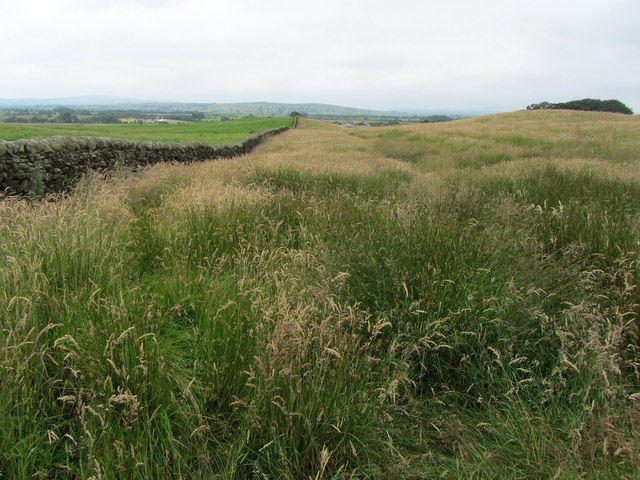
Worthy Hill Plantation is an expansive wooded area located in Yorkshire, England. Situated in the heart of the county, it covers an area of approximately 500 acres and is known for its lush greenery and diverse range of flora and fauna. The plantation is surrounded by rolling hills and offers breathtaking views of the surrounding countryside.

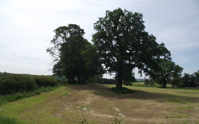
The woodland within Worthy Hill Plantation is dominated by a variety of native tree species, including oak, beech, and birch. These trees create a dense canopy, providing a haven for an array of bird species such as woodpeckers, owls, and thrushes. Small mammals like squirrels, hedgehogs, and rabbits can also be found within the plantation.

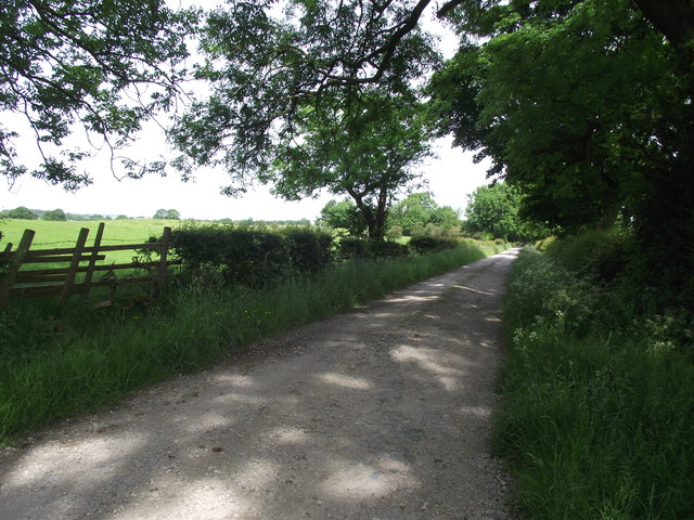
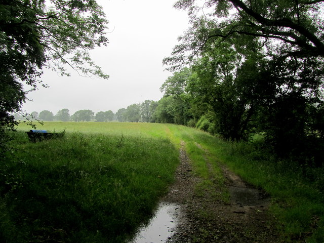
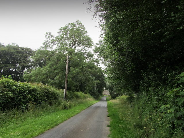
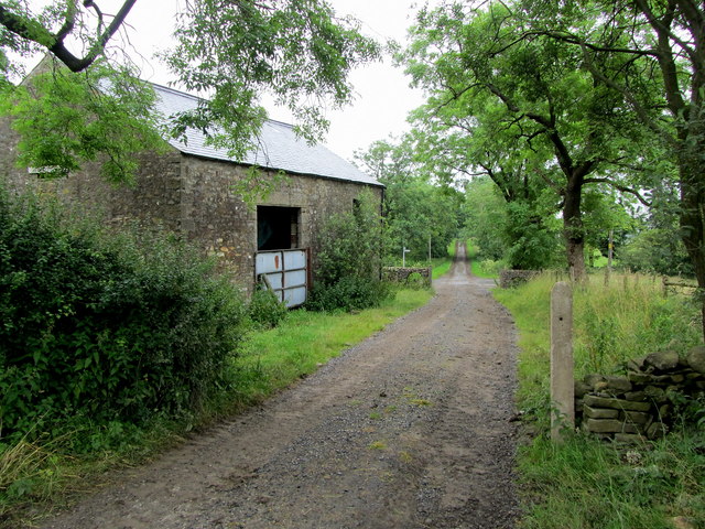
Walking through Worthy Hill Plantation, visitors can explore a network of well-maintained footpaths that wind their way through the forest. These paths offer an opportunity to immerse oneself in nature and enjoy the tranquility of the surroundings. The plantation is also home to a small lake, which adds to the scenic beauty and attracts a variety of water birds.

Worthy Hill Plantation is a popular destination for nature lovers and outdoor enthusiasts, offering a range of recreational activities. It provides ample opportunities for hiking, birdwatching, and wildlife photography. The plantation is managed by local authorities, ensuring the protection and preservation of its natural resources.

In conclusion, Worthy Hill Plantation is a picturesque woodland area in Yorkshire, offering a peaceful retreat for those seeking solace in nature. With its diverse range of flora and fauna, it provides a valuable habitat for numerous species and serves as an important ecological asset for the region.

If you have any feedback on the listing, please let us know in the comments section below.

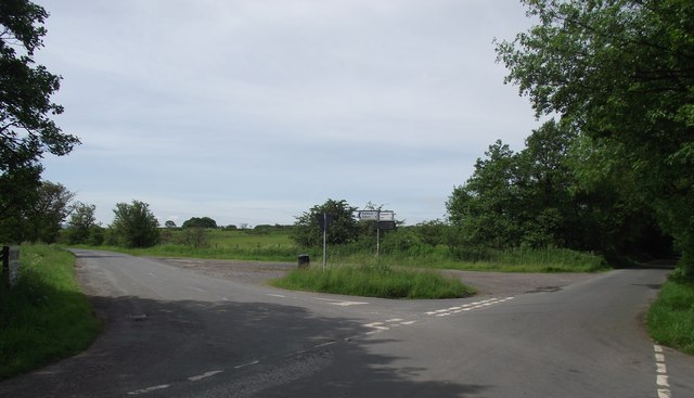
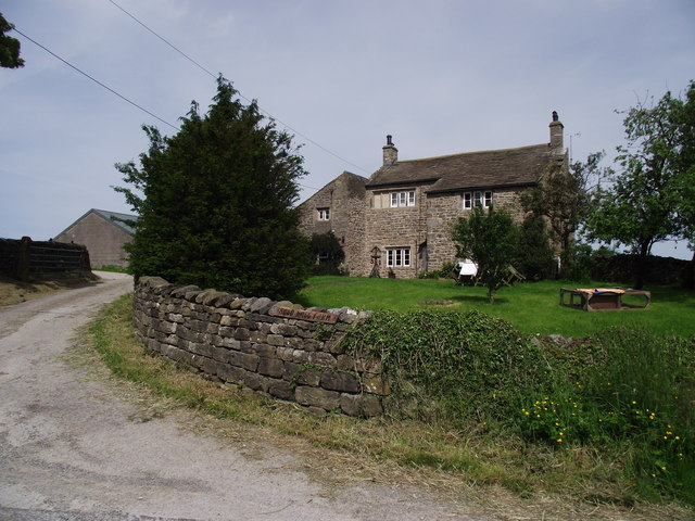
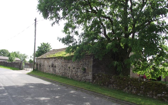
Worthy Hill Plantation Images

Images are sourced within 2km of 53.98814/-2.2671135 or Grid Reference SD8254. Thanks to Geograph Open Source API. All images are credited.
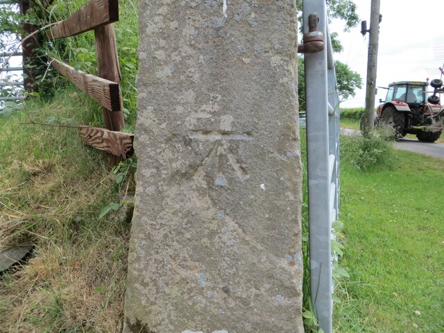
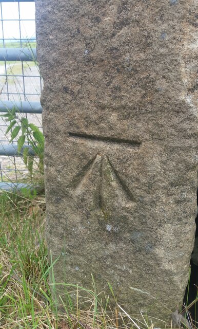
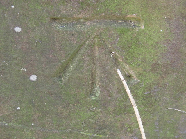
Ordnance Survey Cut Mark This mark can be found on the gatepost at the entrance to Long Bank Farm.
The benchmark has a recorded height of 155.9753 metres above sea level.
For more detail see : <span class="nowrap"><a title="https://www.bench-marks.org.uk/bm152156" rel="nofollow ugc noopener" href="https://www.bench-marks.org.uk/bm152156">Link</a><img style="margin-left:2px;" alt="External link" title="External link - shift click to open in new window" src="https://s1.geograph.org.uk/img/external.png" width="10" height="10"/></span>
Ordnance Survey Cut Mark
This mark can be found on the gatepost at the entrance to Long Bank Farm. The benchmark has a recorded height of 155.9753 metres above sea level. For more detail see : LinkExternal link
Ordnance Survey Cut Mark with Rivet This mark and rivet can be found on the top of a boundary stone at Carr Moor crossroads.
The benchmark has a recorded height of 165.7167 metres above sea level.
For more detail see : <span class="nowrap"><a title="https://www.bench-marks.org.uk/bm124037" rel="nofollow ugc noopener" href="https://www.bench-marks.org.uk/bm124037">Link</a><img style="margin-left:2px;" alt="External link" title="External link - shift click to open in new window" src="https://s1.geograph.org.uk/img/external.png" width="10" height="10"/></span>
[Since the earlier picture <a title="https://www.geograph.org.uk/photo/6038091" href="https://www.geograph.org.uk/photo/6038091">Link</a> the boundary stone seems to have been involved in a RTA and is now leaning at a 45 degree angle]
Ordnance Survey Cut Mark with Rivet
This mark and rivet can be found on the top of a boundary stone at Carr Moor crossroads. The benchmark has a recorded height of 165.7167 metres above sea level. For more detail see : LinkExternal link [Since the earlier picture Link the boundary stone seems to have been involved in a RTA and is now leaning at a 45 degree angle]
Ordnance Survey Cut Mark This mark can be found on a gatepost at the entrance to a track to Stubb Farm.
The benchmark has a recorded height of 207.706 metres above sea level.
For more detail see : <span class="nowrap"><a title="https://www.bench-marks.org.uk/bm65858" rel="nofollow ugc noopener" href="https://www.bench-marks.org.uk/bm65858">Link</a><img style="margin-left:2px;" alt="External link" title="External link - shift click to open in new window" src="https://s1.geograph.org.uk/img/external.png" width="10" height="10"/></span>
Ordnance Survey Cut Mark
This mark can be found on a gatepost at the entrance to a track to Stubb Farm. The benchmark has a recorded height of 207.706 metres above sea level. For more detail see : LinkExternal link
Paythorne, Boundary stone The benchmark and rivet are cut into the top of the boundary stone found on the grass verge at the crossroads.
Paythorne, Boundary stone
The benchmark and rivet are cut into the top of the boundary stone found on the grass verge at the crossroads.
Paythorne, Boundary stone  There is a benchmark and rivet cut into the top of the boundary stone found on the grass verge at the crossroads.
Paythorne, Boundary stone
There is a benchmark and rivet cut into the top of the boundary stone found on the grass verge at the crossroads.
Crossroads north of Paythorne Also the boundary between the civil parishes of Paythorne and Halton West.
Crossroads north of Paythorne
Also the boundary between the civil parishes of Paythorne and Halton West.
Auld Hall Farm One of several farms in the hamlet of Halton West.
Auld Hall Farm
One of several farms in the hamlet of Halton West.
Field at Halton West Farm field in use on this day for the grazing of calves.
Field at Halton West
Farm field in use on this day for the grazing of calves.
Barn at Halton West On the lane running through the hamlet, in a working farmyard.
Barn at Halton West
On the lane running through the hamlet, in a working farmyard.
Brook Lane, Halton West Part of the Ribble Way footpath.
Brook Lane, Halton West
Part of the Ribble Way footpath.
Field by Long Bank Farm Seen from Long Bank Lane - a pasture on a wet misty day
Field by Long Bank Farm
Seen from Long Bank Lane - a pasture on a wet misty day
Long Bank Lane A minor road near Halton West
Long Bank Lane
A minor road near Halton West
Access Lane from Lower Thornber Farm The access lane reaches the Queen's highway by the stone barn, which appears to act like a functional lodge
Access Lane from Lower Thornber Farm
The access lane reaches the Queen's highway by the stone barn, which appears to act like a functional lodge
Dairy Operations at West Thornber Farm The farm has expanded, but there has been no attempt to deal with the four public footpaths that converge at this location.  Hence I became lost and was wandering around the huge outbuildings, eventually finding the exit that was completely buried under nettles.
Dairy Operations at West Thornber Farm
The farm has expanded, but there has been no attempt to deal with the four public footpaths that converge at this location. Hence I became lost and was wandering around the huge outbuildings, eventually finding the exit that was completely buried under nettles.
High Laithe Stone Barn surrounded by nettles, thistles and other rampant vegetation at West Thornber Farm
High Laithe
Stone Barn surrounded by nettles, thistles and other rampant vegetation at West Thornber Farm
Ordnance Survey Cut Mark This mark can be found on a gatepost in Brook Lane.
For more detail see : <span class="nowrap"><a title="http://www.bench-marks.org.uk/bm44334" rel="nofollow ugc noopener" href="http://www.bench-marks.org.uk/bm44334">Link</a><img style="margin-left:2px;" alt="External link" title="External link - shift click to open in new window" src="https://s1.geograph.org.uk/img/external.png" width="10" height="10"/></span>
Ordnance Survey Cut Mark
This mark can be found on a gatepost in Brook Lane. For more detail see : LinkExternal link
Approaching Hunters Hill The path wriggles through long thick vegetation beside the dry stone wall
Approaching Hunters Hill
The path wriggles through long thick vegetation beside the dry stone wall
On Hunters Hill Field of long grass on the western flanks of Hunters Hill
On Hunters Hill
Field of long grass on the western flanks of Hunters Hill
Show me another place!

Worthy Hill Plantation is located at Grid Ref: SD8254 (Lat: 53.98814, Lng: -2.2671135)

Division: West Riding

Administrative County: North Yorkshire

District: Craven

Police Authority: North Yorkshire

What 3 Words

///appetite.accusing.gobblers. Near Hellifield, North Yorkshire

Related Wikis

Halton West

Halton West is a village and civil parish in the Craven district of North Yorkshire, England. North Yorkshire County Council estimated the population in...

Wigglesworth

Wigglesworth is a village and civil parish in the Craven district of North Yorkshire, England. The population of the civil parish taken at the 2011 Census...

Paythorne

Paythorne is a small village and civil parish in Ribble Valley, Lancashire, England. It is situated alongside the River Ribble, north-east of Clitheroe...

Nappa, North Yorkshire

Nappa is a hamlet in the civil parish of Hellifield, in North Yorkshire, England. It is on the A682 road and 6 miles (9.7 km) north-west of Barnoldswick...

Long Preston railway station

Long Preston is a railway station on the Bentham Line, which runs between Leeds and Morecambe via Skipton. The station, situated 37+1⁄2 miles (60 km) north...

Long Preston

Long Preston is a village and civil parish in the Craven district of North Yorkshire, England, in the Yorkshire Dales. It lies along the A65 road, and...

Hellifield

Hellifield is a village and civil parish in the Craven district of North Yorkshire, England (grid reference SD855565). Historically part of the West Riding...

Swinden

Swinden is a village in the civil parish of Hellifield, in North Yorkshire, England. It is near Halton West and Nappa and about 7 miles north of Barnoldswick...

Related Videos

Early Morning take off with Airborne Adventures Ltd

A typical early morning take off from our launch site in Wigglesworth, near to Settle in the Yorkshire Dales. No couples getting ...

Nearby Amenities

Located within 500m of 53.98814,-2.2671135
Worthy Hill
Is In Country Code: GB
Natural: peak
Source: OS 1:25k
Lat/Long: 53.989132/-2.2697923
Round Hill
Is In Country Code: GB
Natural: peak
Source: OS 1:25k
Lat/Long: 53.9874793/-2.2649643
Power: pole
Lat/Long: 53.9858686/-2.2609252
Power: pole
Lat/Long: 53.9867297/-2.2604799
Power: pole
Lat/Long: 53.9874867/-2.260024
Power: pole
Lat/Long: 53.9882815/-2.2596538
The data included in this document is from www.openstreetmap.org. The data is made available under ODbL.

Have you been to Worthy Hill Plantation?

Leave your review of Worthy Hill Plantation below (or comments, questions and feedback).