Gawber Plantation

Wood, Forest in Yorkshire Ribble Valley

England

Gawber Plantation

Ordnance Survey Cut Mark This mark can be found on the wall of St Mary's Church, Gisburn
The benchmark has a recorded height of 138.3304 metres above sea level.
For more detail see : <span class="nowrap"><a title="https://www.bench-marks.org.uk/bm36317" rel="nofollow ugc noopener" href="https://www.bench-marks.org.uk/bm36317">Link</a><img style="margin-left:2px;" alt="External link" title="External link - shift click to open in new window" src="https://s1.geograph.org.uk/img/external.png" width="10" height="10"/></span>
Ordnance Survey Cut Mark Credit: Peter Wood

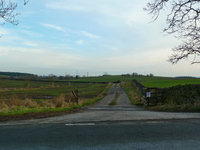
Gawber Plantation is a scenic woodland located in Yorkshire, England. Situated in the Barnsley district, this captivating plantation covers a vast area of approximately 300 acres. The plantation is known for its dense forest and abundant greenery, making it a popular destination for nature enthusiasts and hikers alike.

Gawber Plantation is home to a diverse range of tree species, including but not limited to oak, birch, and beech. The towering trees create a dense canopy, providing shade and shelter to various wildlife species that call this woodland their home. The plantation is teeming with wildlife, with sightings of deer, foxes, and various bird species being quite common.

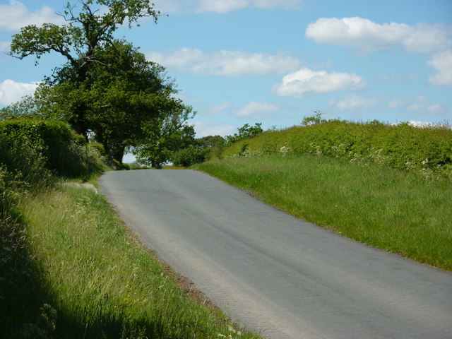
Visitors to Gawber Plantation can enjoy a network of well-maintained walking trails that allow for exploration of the woodland's natural beauty. The trails wind through the plantation, offering breathtaking views of the surrounding landscape. Along the way, visitors may come across picturesque streams and small ponds, adding to the tranquility of the experience.

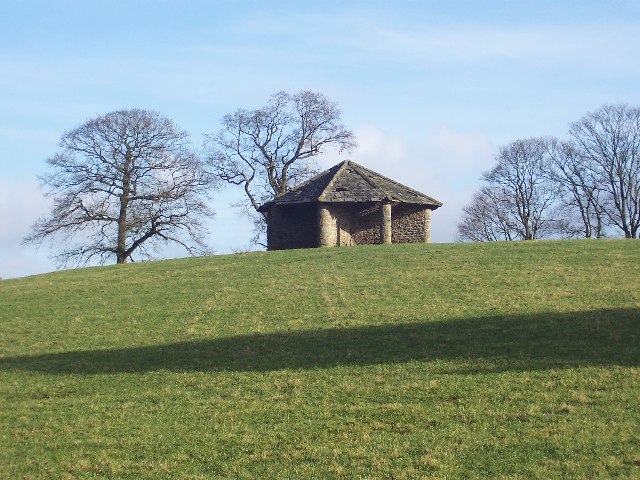
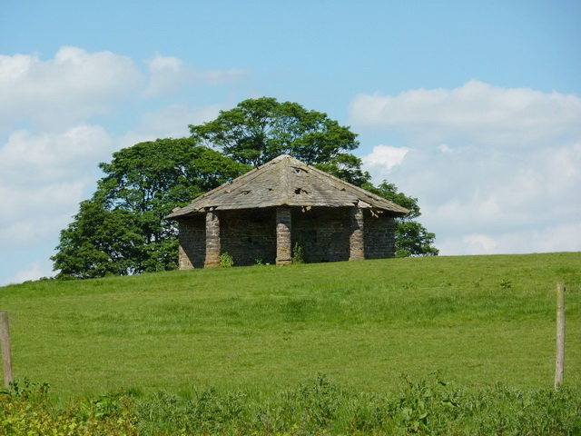
Gawber Plantation also boasts a rich history, with evidence of its use as a hunting ground dating back to medieval times. The woodland has since been managed for timber production, and remnants of old sawmills can still be found within its boundaries.

Overall, Gawber Plantation offers a serene and idyllic escape for nature lovers, with its lush forest, diverse wildlife, and well-maintained trails. Whether it's a leisurely stroll or a more adventurous hike, this Yorkshire woodland provides a memorable experience for all who visit.

If you have any feedback on the listing, please let us know in the comments section below.

Gawber Plantation Images

Images are sourced within 2km of 53.931761/-2.2666616 or Grid Reference SD8248. Thanks to Geograph Open Source API. All images are credited.

Ordnance Survey Cut Mark This mark can be found on the wall of St Mary's Church, Gisburn
The benchmark has a recorded height of 138.3304 metres above sea level.
For more detail see : <span class="nowrap"><a title="https://www.bench-marks.org.uk/bm36317" rel="nofollow ugc noopener" href="https://www.bench-marks.org.uk/bm36317">Link</a><img style="margin-left:2px;" alt="External link" title="External link - shift click to open in new window" src="https://s1.geograph.org.uk/img/external.png" width="10" height="10"/></span>
Ordnance Survey Cut Mark
This mark can be found on the wall of St Mary's Church, Gisburn The benchmark has a recorded height of 138.3304 metres above sea level. For more detail see : LinkExternal link
Delicious Deli and Café - Gisburn
Fields East of Gisburn
West Portal Gisburne Park  Railway Tunnel A cut and cover short tunnel required by the landowner and decorated appropriately. The turrets of the east portal can be seen as well across this part of Gisburne Park
West Portal Gisburne Park Railway Tunnel
A cut and cover short tunnel required by the landowner and decorated appropriately. The turrets of the east portal can be seen as well across this part of Gisburne Park
Gisburne Park Railway Tunnel Turrets A curious view of mock castle turrets in parkland, disguising a railway line
Gisburne Park Railway Tunnel Turrets
A curious view of mock castle turrets in parkland, disguising a railway line
Old Guide Stone by A682, Rimington Lane junction with Hardacre Lane (East face) The Guide Stone is located in angle of minor roads, next to grey metal junction box on the West side of the road.  Parish of Rimington (Ribble Valley District). Carved stone post, erected in the 18th Century, old edge chips. An earlier photograph can be found here: <a title="https://www.geograph.org.uk/photo/6076649" href="https://www.geograph.org.uk/photo/6076649">Link</a> 

Inscription reads:- 
TO / {hand to left}  / BurnLey /(1) 2 m : : TO / {hand to right} / (?) /5 ms / TO E {hand to left} / Gisbern / 1m 

Grade II listed. 
List Entry Number: 1165264 <span class="nowrap"><a title="https://historicengland.org.uk/listing/the-list/list-entry/1165264" rel="nofollow ugc noopener" href="https://historicengland.org.uk/listing/the-list/list-entry/1165264">Link</a><img style="margin-left:2px;" alt="External link" title="External link - shift click to open in new window" src="https://s1.geograph.org.uk/img/external.png" width="10" height="10"/></span> 

Milestone Society National ID: YW_XGIS
Old Guide Stone by A682, Rimington Lane junction with Hardacre Lane (East face)
The Guide Stone is located in angle of minor roads, next to grey metal junction box on the West side of the road.  Parish of Rimington (Ribble Valley District). Carved stone post, erected in the 18th Century, old edge chips. An earlier photograph can be found here: Link  Inscription reads:- TO / {hand to left} / BurnLey /(1) 2 m : : TO / {hand to right} / (?) /5 ms / TO E {hand to left} / Gisbern / 1m Grade II listed. List Entry Number: 1165264 LinkExternal link Milestone Society National ID: YW_XGIS
Old Guide Stone by A682, Rimington Lane junction with Hardacre Lane (West Face) The Guide Stone is located in angle of minor roads, next to grey metal junction box on the West side of the road.  Parish of Rimington (Ribble Valley District). Carved stone post, erected in the 18th Century, old edge chips. East face photograph can be found here: <a title="https://www.geograph.org.uk/photo/7383066" href="https://www.geograph.org.uk/photo/7383066">Link</a> 

Inscription reads:- 
TO / {hand to left}  / BurnLey /(1) 2 m : : TO / {hand to right} / (?) / 5 ms / TO E {hand to left} / Gisbern / 1m 

Grade II listed. 
List Entry Number: 1165264 <span class="nowrap"><a title="https://historicengland.org.uk/listing/the-list/list-entry/1165264" rel="nofollow ugc noopener" href="https://historicengland.org.uk/listing/the-list/list-entry/1165264">Link</a><img style="margin-left:2px;" alt="External link" title="External link - shift click to open in new window" src="https://s1.geograph.org.uk/img/external.png" width="10" height="10"/></span> 

Milestone Society National ID: YW_XGIS
Old Guide Stone by A682, Rimington Lane junction with Hardacre Lane (West Face)
The Guide Stone is located in angle of minor roads, next to grey metal junction box on the West side of the road.  Parish of Rimington (Ribble Valley District). Carved stone post, erected in the 18th Century, old edge chips. East face photograph can be found here: Link Inscription reads:- TO / {hand to left} / BurnLey /(1) 2 m : : TO / {hand to right} / (?) / 5 ms / TO E {hand to left} / Gisbern / 1m Grade II listed. List Entry Number: 1165264 LinkExternal link Milestone Society National ID: YW_XGIS
Old milestone This milestone which would have stood at the southeast corner of the A59/B6265 Bracewll Lane is now built into steps at the back of the White Bull PH in Gisburn.  This face is engraved with a hand pointing left/To/SKipton/9 Miles/hand pointing right/Gisbor(n)/2 Ms.  The other visible face is engraved with a hand pointing left To/Settle 11 ms/hand to right/Colne 7 ms.
Old milestone
This milestone which would have stood at the southeast corner of the A59/B6265 Bracewll Lane is now built into steps at the back of the White Bull PH in Gisburn. This face is engraved with a hand pointing left/To/SKipton/9 Miles/hand pointing right/Gisbor(n)/2 Ms. The other visible face is engraved with a hand pointing left To/Settle 11 ms/hand to right/Colne 7 ms.
Gisburne Park Entrance Lodges At the south entrance at the end of Park Road from the centre of Gisburn
Gisburne Park Entrance Lodges
At the south entrance at the end of Park Road from the centre of Gisburn
Rivet benchmark on a milestone north of Gisburn Settle 10 miles on the south face, Gisburn 1 mile on the north.   The Ordnance Survey arrow is on the east face
Rivet benchmark on a milestone north of Gisburn
Settle 10 miles on the south face, Gisburn 1 mile on the north. The Ordnance Survey arrow is on the east face
Road to Middle Breaks
Short muddy track into arable field At the top of the hill in amongst the trees is a Tumulus
Short muddy track into arable field
At the top of the hill in amongst the trees is a Tumulus
A682 near Middle Breaks
Extraordinary Structure near Ellenthorpe Near the kennels and farm at Ellenthorpe. This odd structure stands alone and isolated in an empty pasture. Is it an elaborate ancient shelter for livestock or a folly of some sort? What category shall I file it under? Must be curiosity
Extraordinary Structure near Ellenthorpe
Near the kennels and farm at Ellenthorpe. This odd structure stands alone and isolated in an empty pasture. Is it an elaborate ancient shelter for livestock or a folly of some sort? What category shall I file it under? Must be curiosity
Low Laithe
Low Laithe
Culvert or Bridge You have a choice as to what you call this, but you will still keep your feet dry when you use it to cross the stream
Culvert or Bridge
You have a choice as to what you call this, but you will still keep your feet dry when you use it to cross the stream
Barn north east of Ellenthorpe Farm
Carter's Lane
Carter's Lane
Show me another place!

Gawber Plantation is located at Grid Ref: SD8248 (Lat: 53.931761, Lng: -2.2666616)

Division: West Riding

Administrative County: Lancashire

District: Ribble Valley

Police Authority: Lancashire

What 3 Words

///testers.guitar.sprayer. Near Barnoldswick, Lancashire

Related Wikis

Gisburn

Gisburn (formerly Gisburne) is a village and civil parish within the Ribble Valley borough of Lancashire, England. Historically within the West Riding...

Gisburn railway station

Gisburn railway station served the small village of Gisburn, which is now in Lancashire, England, but was in the West Riding of Yorkshire at the time....

Gisburn Tunnel

Gisburn Tunnel is a short railway tunnel on the Ribble Valley line in Lancashire, England. The tunnel is 157 yards (144 m) long, just to the east of Gisburn...

Gisburne Park

Gisburne Park is an 18th-century country house and associated park in Gisburn, Lancashire, England, in the Ribble Valley some 6 miles (10 km) north-east...

Stock Beck

Stock Beck is a minor river in the West Craven area of Pendle, Lancashire (formerly in Yorkshire). It is 8.25 miles (13.27 km) long and has a catchment...

A59 road

The A59 is a major road in England which is around 109 miles (175 km) long and runs from Wallasey, Merseyside to York, North Yorkshire. The alignment formed...

Rimington

Rimington is a rural village and civil parish in the Ribble Valley, Lancashire, England. The population of the civil parish was 382 at the 2001 Census...

Newsholme railway station

Newsholme railway station was a railway station that served the small village of Newsholme in Lancashire. It was built by the Lancashire and Yorkshire...

Related Videos

Todber Valley Holiday Park, Lancashire

Get a preview of what you can expect at our Todber Valley Holiday Park in Lancashire. Todber Valley Holiday Park Borders rural ...

Todber Valley Holiday Park | Weekends Holidays

todbervalleyholidaypark #caravanholiday #parkdeanresorts #weekendsholidays At Todber Valley Holiday Park, located in ...

Caravans For Sale at Todber Valley Holiday Park, Lancashire

Join us to experience what it is like to own a holiday home at Todber Valley Holiday Park in Lancashire. Todber Valley Holiday ...

Holiday Lodge Hire at Holgates Ribble Valley

Take a look around our brand-new holiday lodges, available to book for weekend breaks, week long breaks and also mid-week ...

Nearby Amenities

Located within 500m of 53.931761,-2.2666616
Gisburn
Is In Country Code: GB
Is In County: Lancashire
Is In Historic County: Yorkshire
Is In Municipality: Ribble Valley
Is In Valley: Ribblesdale
Old Name: Gisburne
Place: village
Postal Code: BB7
Source: npe
Lat/Long: 53.9345098/-2.262089
Westby Hall
Building: yes
Source: NPE
Lat/Long: 53.9279762/-2.270201
Gisburn
Abandoned Railway: station
End Date: 1962-09
Railway: site
Source: NPE
Start Date: 1879
Wikidata: Q5564887
Wikipedia: en:Gisburn railway station
Lat/Long: 53.9358816/-2.2668923
Barrier: yes
Lat/Long: 53.9340093/-2.2693533
Generator Method: photovoltaic
Generator Output Electricity: yes
Generator Source: solar
Generator Type: solar_photovoltaic_panel
Location: roof
Power: generator
Lat/Long: 53.9340688/-2.2625227
Barrier: yes
Lat/Long: 53.9350271/-2.2652746
Post Box
Post Box Type: pillar
Royal Cypher: EIIR
Lat/Long: 53.9349541/-2.2631835
Historic: memorial
Memorial: war_memorial
Lat/Long: 53.9347059/-2.2636415
The data included in this document is from www.openstreetmap.org. The data is made available under ODbL.

Have you been to Gawber Plantation?

Leave your review of Gawber Plantation below (or comments, questions and feedback).