Valley Field Covert

Wood, Forest in Staffordshire South Staffordshire

England

Valley Field Covert

Sheep grazing near Hartsgreen in Shropshire Looking north-east from the bridleway by New Barns Farm. Land in the vicinity is shared between grazing and the growing of cereal crops.
Sheep grazing near Hartsgreen in Shropshire Credit: Roger Kidd

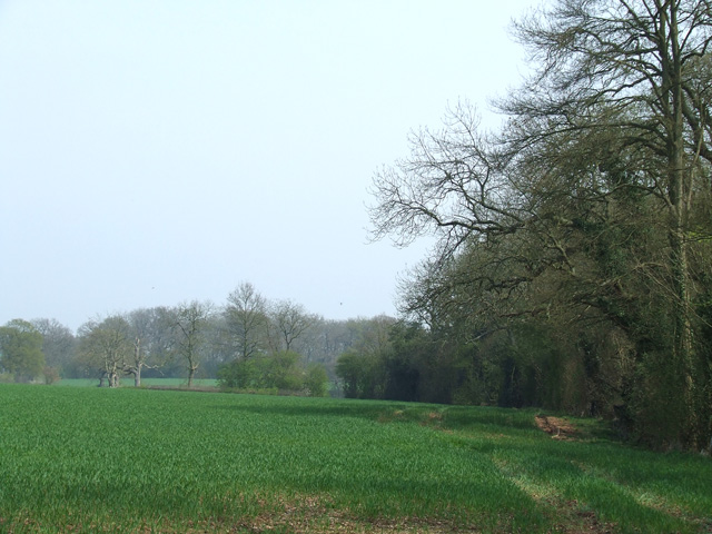
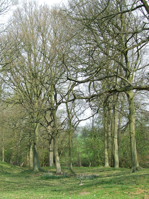
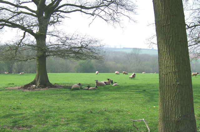
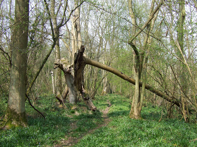
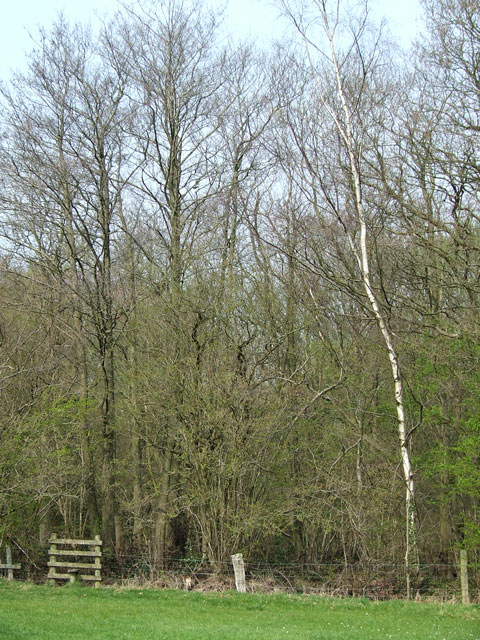
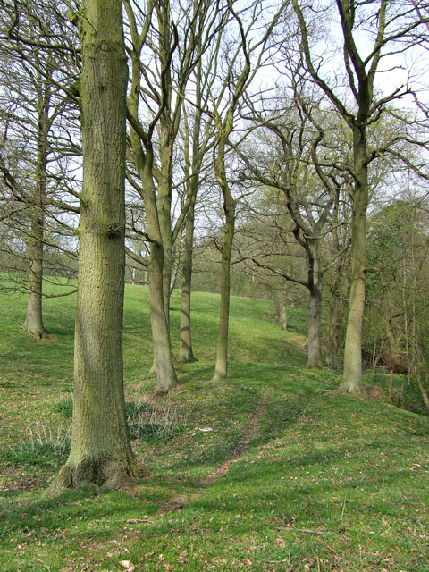
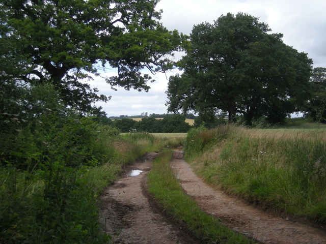
Valley Field Covert is a picturesque wood located in Staffordshire, England. Nestled amidst the countryside, this forested area covers an approximate area of 100 acres, offering a tranquil retreat from the bustling city life. The wood is characterized by its diverse range of tree species, including oak, ash, beech, and birch, providing a lush green canopy that attracts nature enthusiasts and hikers alike.

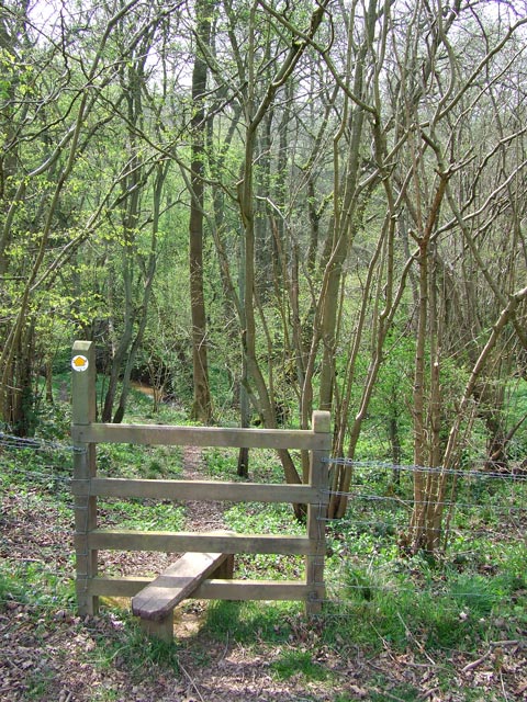
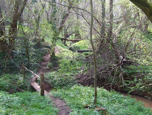
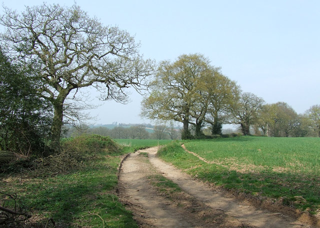
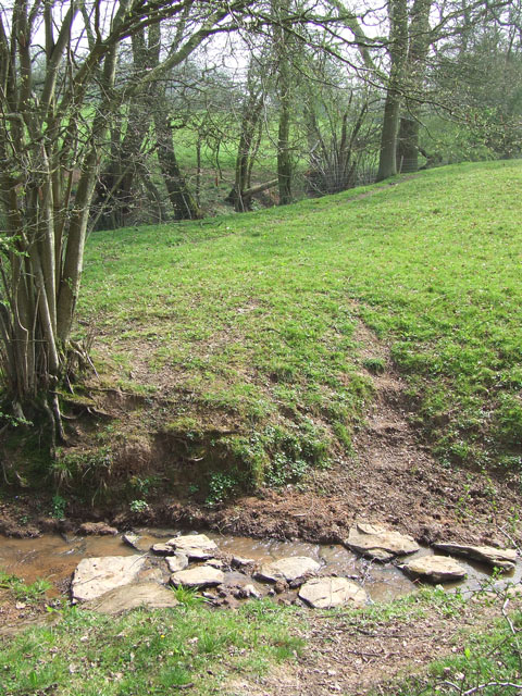
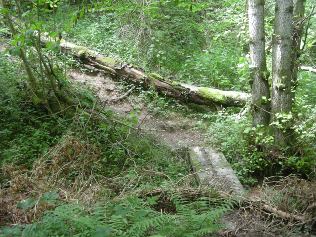
The woodland is intersected by a network of well-maintained footpaths, allowing visitors to explore the area at their leisure. These paths wind through the forest, leading to hidden clearings and secluded spots perfect for picnics or quiet contemplation. The presence of a small stream adds to the charm of the wood, providing a calming ambiance as it meanders through the trees.

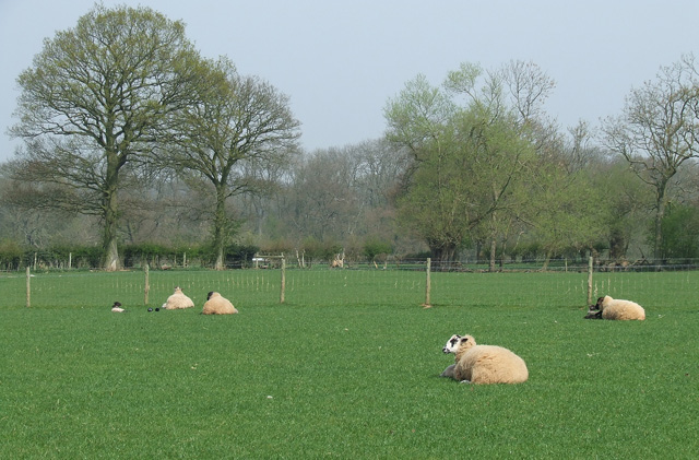
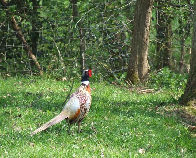
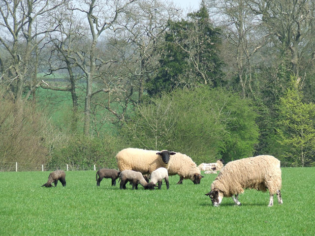
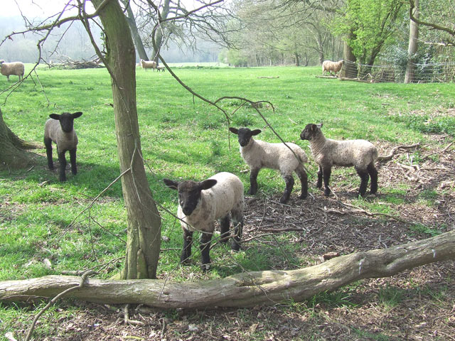
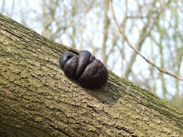
Valley Field Covert is a haven for wildlife, providing a habitat for a variety of species. Birdwatchers can spot a wide array of avian residents, such as woodpeckers, nuthatches, and warblers. Additionally, mammals like deer, foxes, and squirrels can often be seen darting through the undergrowth, adding to the enchantment of the woodland experience.

The wood is also rich in history, with remnants of ancient Roman settlements discovered in the surrounding area. Archaeological enthusiasts can explore these historical sites and learn about the region's past.

Valley Field Covert is a true gem in Staffordshire, offering visitors a chance to immerse themselves in the beauty of nature while enjoying the tranquility and serenity that this woodland provides.

If you have any feedback on the listing, please let us know in the comments section below.

Valley Field Covert Images

Images are sourced within 2km of 52.453794/-2.2870677 or Grid Reference SO8084. Thanks to Geograph Open Source API. All images are credited.

Sheep grazing near Hartsgreen in Shropshire Looking north-east from the bridleway by New Barns Farm. Land in the vicinity is shared between grazing and the growing of cereal crops.
Sheep grazing near Hartsgreen in Shropshire
Looking north-east from the bridleway by New Barns Farm. Land in the vicinity is shared between grazing and the growing of cereal crops.
Cereal crop and woodland near Hartsgreen in Shropshire Most land in the vicinity is dedicated to cereal crops or grazing, with small areas of woodland still remaining.
Cereal crop and woodland near Hartsgreen in Shropshire
Most land in the vicinity is dedicated to cereal crops or grazing, with small areas of woodland still remaining.
"Down into the Dingle" - Bowhills, Shropshire The public footpath to Cross Farm enters a long strip of woodland in a steep narrow valley, known as Bowhills Dingle.
"Down into the Dingle" - Bowhills, Shropshire
The public footpath to Cross Farm enters a long strip of woodland in a steep narrow valley, known as Bowhills Dingle.
"And Across the Rickety Bridge" - Bowhills, Shropshire Crossing this deeply cut stream valley can be a problem after heavy rain. The public footpath is well marked, but this part tends to be muddy except during dry spells.
"And Across the Rickety Bridge" - Bowhills, Shropshire
Crossing this deeply cut stream valley can be a problem after heavy rain. The public footpath is well marked, but this part tends to be muddy except during dry spells.
Pheasant, near Hartsgreen, Shropshire The whole area rings with the sound of these attractive birds.
Pheasant, near Hartsgreen, Shropshire
The whole area rings with the sound of these attractive birds.
Tractors, New Barns Farm, Hartsgreen, Shropshire
Ewes and Lambs, New Barns Farm, Hartsgreen, Shropshire The land this side of the dingle is dedicated mainly to grazing; the other side to cereal crops.
Ewes and Lambs, New Barns Farm, Hartsgreen, Shropshire
The land this side of the dingle is dedicated mainly to grazing; the other side to cereal crops.
A Woodland Walk, near Hartsgreen, Shropshire A beautiful footpath - and it's public! Enjoy woods and fields all the way to Birdsgreen (3km) and Alveley.
A Woodland Walk, near Hartsgreen, Shropshire
A beautiful footpath - and it's public! Enjoy woods and fields all the way to Birdsgreen (3km) and Alveley.
Sheep Grazing, near Hartsgreen, Shropshire
Inquisitive Lambs, near Hartsgreen, Shropshire This bunch came right up to me; the ewes didn't seem bothered.
Inquisitive Lambs, near Hartsgreen, Shropshire
This bunch came right up to me; the ewes didn't seem bothered.
Bridleway near Filletts, Shropshire
Footpath to Bowhills Dingle, Shropshire The public footpath drops sharply into the dingle (slippery in poor weather) about 200 metres further on.
Footpath to Bowhills Dingle, Shropshire
The public footpath drops sharply into the dingle (slippery in poor weather) about 200 metres further on.
He's Burnt the Cakes Again. Fungus Another example of the fungus commonly found on dead trees in the area: King Alfred's Cakes, or Cramp Balls.
He's Burnt the Cakes Again. Fungus
Another example of the fungus commonly found on dead trees in the area: King Alfred's Cakes, or Cramp Balls.
The Footpath to Bowhills Dingle, Shropshire The track leaves open grass fields and enters the woods at the stile, and after another well defined 200 metres turns right, down into the potentially very slippery stream bed.
The Footpath to Bowhills Dingle, Shropshire
The track leaves open grass fields and enters the woods at the stile, and after another well defined 200 metres turns right, down into the potentially very slippery stream bed.
Stepping Stones, Public Footpath near Hartsgreen, Shropshire Although rudimentary stepping stones have been laid, this public footpath will be difficult to negotiate after heavy rain!
Stepping Stones, Public Footpath near Hartsgreen, Shropshire
Although rudimentary stepping stones have been laid, this public footpath will be difficult to negotiate after heavy rain!
Footpath Through the Trees, Hartsgreen, Shropshire This very attractive public footpath leads through fields and woods, but there are places which could be difficult in wet weather.
Footpath Through the Trees, Hartsgreen, Shropshire
This very attractive public footpath leads through fields and woods, but there are places which could be difficult in wet weather.
Track beside Square Coppice
The path is getting rough
Show me another place!

Valley Field Covert is located at Grid Ref: SO8084 (Lat: 52.453794, Lng: -2.2870677)

Administrative County: Staffordshire

District: South Staffordshire

Police Authority: Staffordshire

What 3 Words

///bets.leaky.dusters. Near Romsley, Shropshire

Related Wikis

Castle Hill, Wolverley

Castle Hill or Baron Hill is about a mile from the hamlet of Kingsford in the civil parish of Wolverley and Cookley, Worcestershire. In 1912 the site consisted...

Romsley, Shropshire

Romsley (grid reference SO783826) is a hamlet and civil parish in southeast Shropshire, England. It is bounded on the north and west by Alveley and on...

Great Fountain, Enville

The Great Fountain, Enville, was a fountain created in the mid-19th century by the Earl of Stamford in the middle of a lake on his Enville Hall estate...

Enville Hall

Enville Hall is an English Tudor country house in the village of Enville, Staffordshire. It is a Grade II listed building.The house has a 16th and 17th...

Kingsford, Worcestershire

Kingsford is a large hamlet in Worcestershire, England. == Location == Kingsford is located one mile (1.6 km) north of the village of Wolverley, Worcestershire...

Kingsford Country Park

Kingsford Country Park, officially Kingsford Forest Park, was in Worcestershire, England, U.K. and managed by Worcestershire County Council. It adjoined...

Kinver Edge

Kinver Edge is a high heath and woodland escarpment just west of Kinver, about four miles west of Stourbridge, and four miles north of Kidderminster, and...

Kinver Edge Hillfort

Kinver Edge Hillfort, is a univallate Iron Age hillfort with a massive rampart and outer ditch along the south-west and south-east sides, with natural...

Have you been to Valley Field Covert?

Leave your review of Valley Field Covert below (or comments, questions and feedback).