The Jubilee Covert

Wood, Forest in Staffordshire Stafford

England

The Jubilee Covert

Plardiwick Bridge, Shropshire Union Canal Erected around 1830 as an agricultural accommodation bridge, and Grade II listed <span class="nowrap"><a title="https://britishlistedbuildings.co.uk/101273080-plardiwick-bridge-no-36-at-sj-815-206-gnosall#.YS5APo5KjIU" rel="nofollow ugc noopener" href="https://britishlistedbuildings.co.uk/101273080-plardiwick-bridge-no-36-at-sj-815-206-gnosall#.YS5APo5KjIU">Link</a><img style="margin-left:2px;" alt="External link" title="External link - shift click to open in new window" src="https://s1.geograph.org.uk/img/external.png" width="10" height="10"/></span> & <span class="nowrap"><a title="https://historicengland.org.uk/listing/the-list/list-entry/1273080" rel="nofollow ugc noopener" href="https://historicengland.org.uk/listing/the-list/list-entry/1273080">Link</a><img style="margin-left:2px;" alt="External link" title="External link - shift click to open in new window" src="https://s1.geograph.org.uk/img/external.png" width="10" height="10"/></span> in Oct 1991.
Plardiwick Bridge, Shropshire Union Canal Credit: Richard Law

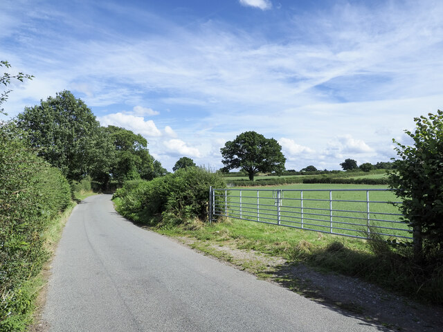
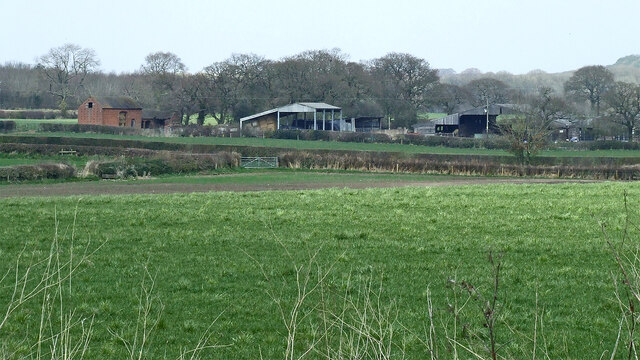
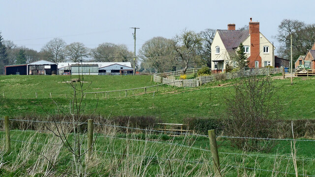
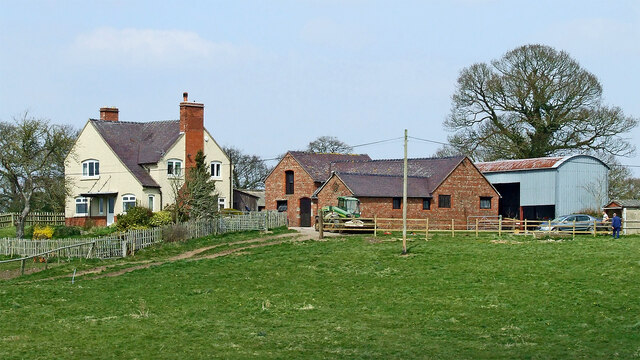
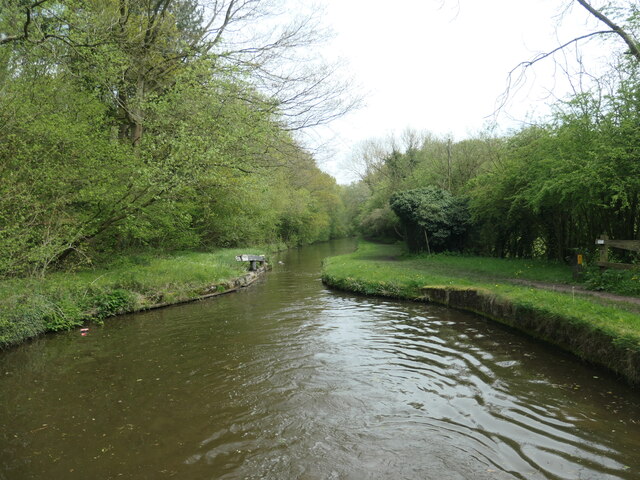
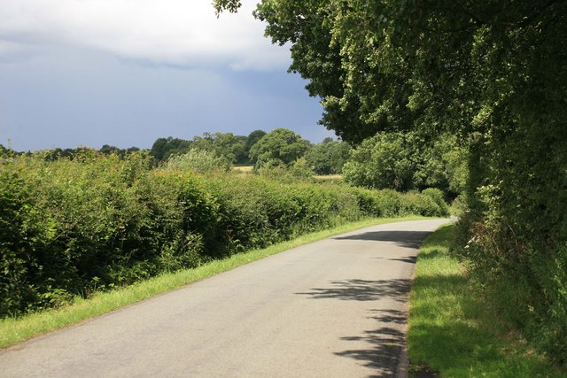
The Jubilee Covert is a picturesque woodland located in Staffordshire, England. Covering an area of approximately 200 acres, it is a renowned destination for nature lovers and outdoor enthusiasts. The woodland is situated in the heart of Staffordshire's countryside, offering visitors a tranquil and scenic escape from the hustle and bustle of urban life.

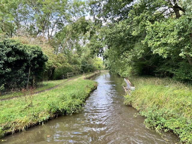
The Jubilee Covert is characterized by its dense canopy of trees, predominantly consisting of native species such as oak, birch, and beech. This diverse mix of trees creates a rich and vibrant ecosystem, providing a habitat for a wide range of flora and fauna. The woodland floor is adorned with an array of wildflowers, adding bursts of color to the landscape during the spring and summer months.

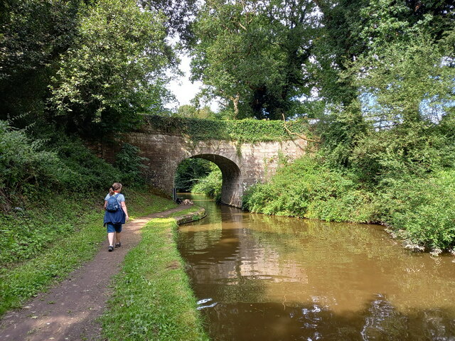
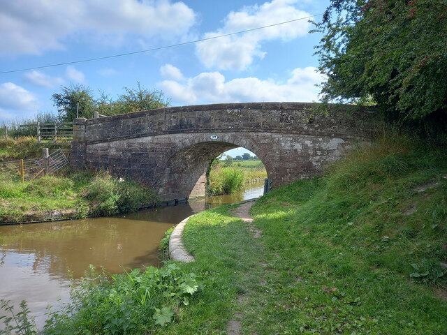
The woodland is crisscrossed by a network of well-maintained trails, making it an ideal destination for walkers, hikers, and joggers. These trails offer visitors the opportunity to explore the woodland at their own pace, taking in the sights and sounds of nature along the way. In addition to the trails, there are also designated picnic areas where visitors can enjoy a leisurely lunch amidst the tranquility of the forest.

The Jubilee Covert holds a special place in the hearts of locals, as it was created to commemorate the Diamond Jubilee of Queen Elizabeth II. It serves as a testament to the importance of preserving and appreciating the natural beauty of the Staffordshire countryside. Whether it's a leisurely stroll, a family picnic, or wildlife spotting, The Jubilee Covert provides a serene and enchanting setting for all who visit.

If you have any feedback on the listing, please let us know in the comments section below.

The Jubilee Covert Images

Images are sourced within 2km of 52.796703/-2.2893667 or Grid Reference SJ8022. Thanks to Geograph Open Source API. All images are credited.

Plardiwick Bridge, Shropshire Union Canal Erected around 1830 as an agricultural accommodation bridge, and Grade II listed <span class="nowrap"><a title="https://britishlistedbuildings.co.uk/101273080-plardiwick-bridge-no-36-at-sj-815-206-gnosall#.YS5APo5KjIU" rel="nofollow ugc noopener" href="https://britishlistedbuildings.co.uk/101273080-plardiwick-bridge-no-36-at-sj-815-206-gnosall#.YS5APo5KjIU">Link</a><img style="margin-left:2px;" alt="External link" title="External link - shift click to open in new window" src="https://s1.geograph.org.uk/img/external.png" width="10" height="10"/></span> & <span class="nowrap"><a title="https://historicengland.org.uk/listing/the-list/list-entry/1273080" rel="nofollow ugc noopener" href="https://historicengland.org.uk/listing/the-list/list-entry/1273080">Link</a><img style="margin-left:2px;" alt="External link" title="External link - shift click to open in new window" src="https://s1.geograph.org.uk/img/external.png" width="10" height="10"/></span> in Oct 1991.
Plardiwick Bridge, Shropshire Union Canal
Erected around 1830 as an agricultural accommodation bridge, and Grade II listed LinkExternal link & LinkExternal link in Oct 1991.
Cast iron rope fender at Plardiwick Bridge One of the two well-worn rope fenders on the bridge at Plardiwick. It's included in the Grade II listing that the bridge holds.
Cast iron rope fender at Plardiwick Bridge
One of the two well-worn rope fenders on the bridge at Plardiwick. It's included in the Grade II listing that the bridge holds.
Machin's Barn Bridge at Gnosall Heath Built around 1830 as an accommodation bridge, and Grade II listed <span class="nowrap"><a title="https://britishlistedbuildings.co.uk/101243117-shropshire-union-canal-barn-bridge-number-37-at-sj-809-211-gnosall#.YS5CpI5KjIU" rel="nofollow ugc noopener" href="https://britishlistedbuildings.co.uk/101243117-shropshire-union-canal-barn-bridge-number-37-at-sj-809-211-gnosall#.YS5CpI5KjIU">Link</a><img style="margin-left:2px;" alt="External link" title="External link - shift click to open in new window" src="https://s1.geograph.org.uk/img/external.png" width="10" height="10"/></span> & <span class="nowrap"><a title="https://historicengland.org.uk/listing/the-list/list-entry/1243117" rel="nofollow ugc noopener" href="https://historicengland.org.uk/listing/the-list/list-entry/1243117">Link</a><img style="margin-left:2px;" alt="External link" title="External link - shift click to open in new window" src="https://s1.geograph.org.uk/img/external.png" width="10" height="10"/></span> in October 1991.
Machin's Barn Bridge at Gnosall Heath
Built around 1830 as an accommodation bridge, and Grade II listed LinkExternal link & LinkExternal link in October 1991.
Cast iron rope fender on the wall of Machin's Barn Bridge Scarred and grooved by the passage of many years of horse-drawn barges along the canal, this is one of a pair of cast-iron fenders on the bridge, and is included in the Grade II listing details for the site <span class="nowrap"><a title="https://britishlistedbuildings.co.uk/101243117-shropshire-union-canal-barn-bridge-number-37-at-sj-809-211-gnosall" rel="nofollow ugc noopener" href="https://britishlistedbuildings.co.uk/101243117-shropshire-union-canal-barn-bridge-number-37-at-sj-809-211-gnosall">Link</a><img style="margin-left:2px;" alt="External link" title="External link - shift click to open in new window" src="https://s1.geograph.org.uk/img/external.png" width="10" height="10"/></span> & <span class="nowrap"><a title="https://historicengland.org.uk/listing/the-list/list-entry/1243117" rel="nofollow ugc noopener" href="https://historicengland.org.uk/listing/the-list/list-entry/1243117">Link</a><img style="margin-left:2px;" alt="External link" title="External link - shift click to open in new window" src="https://s1.geograph.org.uk/img/external.png" width="10" height="10"/></span>
Cast iron rope fender on the wall of Machin's Barn Bridge
Scarred and grooved by the passage of many years of horse-drawn barges along the canal, this is one of a pair of cast-iron fenders on the bridge, and is included in the Grade II listing details for the site LinkExternal link & LinkExternal link
Wide gates to field entry east of Barn Bridge Farm The size of modern farm machinery has resulted in the access to many fields being widened; this must be an example of that.
Wide gates to field entry east of Barn Bridge Farm
The size of modern farm machinery has resulted in the access to many fields being widened; this must be an example of that.
Railway path passing beneath bridge The path is named the Way for the Millennium which is an 'easy walking' path, here following the route of the disused Newport to Stafford railway line. The high bridge carries the A518.
Railway path passing beneath bridge
The path is named the Way for the Millennium which is an 'easy walking' path, here following the route of the disused Newport to Stafford railway line. The high bridge carries the A518.
Boat passing boat near Machins Barn Bridge Intrepid, a smaller vessel, is passing the narrowboat Angelica, which is moored just north-west of bridge 37, on the Shropshire Union Canal near to Gnosall Heath.
Boat passing boat near Machins Barn Bridge
Intrepid, a smaller vessel, is passing the narrowboat Angelica, which is moored just north-west of bridge 37, on the Shropshire Union Canal near to Gnosall Heath.
Detached house at or near Cotonwood The cottage is among a group of buildings including at least one other house, accessed from the minor road, Radmore Lane. A public footpath passes between the buildings.
Detached house at or near Cotonwood
The cottage is among a group of buildings including at least one other house, accessed from the minor road, Radmore Lane. A public footpath passes between the buildings.
Plardiwick Bridge Grade II listed. Listing number 1273080. Accommodation bridge. c1829-32. Telford design. Stone, with stone band and copings. Single elliptical arch with voussoirs. Solid parapet and pier. Oval number-plate on east side. Two iron rope fenders.
Plardiwick Bridge
Grade II listed. Listing number 1273080. Accommodation bridge. c1829-32. Telford design. Stone, with stone band and copings. Single elliptical arch with voussoirs. Solid parapet and pier. Oval number-plate on east side. Two iron rope fenders.
Barn Bridge Farm Near Gnosall Heath.
Barn Bridge Farm
Near Gnosall Heath.
Barn Bridge Grade II listed. Listing number 1243117. Accommodation bridge. c1829-32. Telford design. Stone, with stone band and copings. Single elliptical arch with voussoirs. Slightly cambered, solid parapet and piers. Oval iron number plate on south side. 2 iron rope fenders.
Barn Bridge
Grade II listed. Listing number 1243117. Accommodation bridge. c1829-32. Telford design. Stone, with stone band and copings. Single elliptical arch with voussoirs. Slightly cambered, solid parapet and piers. Oval iron number plate on south side. 2 iron rope fenders.
Shropshire Union Canal In Shelmore Wood.
Shropshire Union Canal
In Shelmore Wood.
Plardiwick Bridge near Gnosall Heath in Staffordshire This shows the Shropshire Union Canal at Plardiwick Bridge, No 36, looking south-east towards Gnosall Heath. The accommodation bridge also carries a public footpath.
Plardiwick Bridge near Gnosall Heath in Staffordshire
This shows the Shropshire Union Canal at Plardiwick Bridge, No 36, looking south-east towards Gnosall Heath. The accommodation bridge also carries a public footpath.
Staffordshire farmland west of Gnosall Looking north from the Shropshire Union Canal towards Plardiwick Manor Farm.
Staffordshire farmland west of Gnosall
Looking north from the Shropshire Union Canal towards Plardiwick Manor Farm.
Farmland north-west of Gnosall Heath in Staffordshire The image shows Barn Bridge Farm, north of the Shropshire Union Canal.
Farmland north-west of Gnosall Heath in Staffordshire
The image shows Barn Bridge Farm, north of the Shropshire Union Canal.
Barn Bridge Farm near Gnosall Heath in Staffordshire Looking north from the Shropshire Union Canal.
Barn Bridge Farm near Gnosall Heath in Staffordshire
Looking north from the Shropshire Union Canal.
Stop gate, south end of Shelmore embankment If the embankment was breached, the flow of water would pull the gate shut. This stops a much longer stretch of the canal from emptying and reduces the size of the flood below the breach.
Stop gate, south end of Shelmore embankment
If the embankment was breached, the flow of water would pull the gate shut. This stops a much longer stretch of the canal from emptying and reduces the size of the flood below the breach.
Norbury Road sunshine and cloud Sunlight highlights the hedge while black clouds beyond bring heavy showers to some.
Norbury Road sunshine and cloud
Sunlight highlights the hedge while black clouds beyond bring heavy showers to some.
Show me another place!

The Jubilee Covert is located at Grid Ref: SJ8022 (Lat: 52.796703, Lng: -2.2893667)

Administrative County: Staffordshire

District: Stafford

Police Authority: Staffordshire

What 3 Words

///remotes.sundial.stops. Near Gnosall, Staffordshire

Related Wikis

Norbury Junction

Norbury Junction (grid reference SJ793228) is a hamlet and former canal junction which lies about 1 mile (1.6 km) to the south east of Norbury, in Staffordshire...

Gnosall Rural District

Gnosall was a rural district in Staffordshire, England from 1894 to 1934. It was formed under the Local Government Act 1894 from that part of the Newport...

Coton, Staffordshire

Coton is a hamlet in the English county of Staffordshire.It lies on the A518 road some two miles west of Gnosall. == See also == Listed buildings in Gnosall...

Norbury, Staffordshire

Norbury is a village and civil parish in the Borough of Stafford, in west Staffordshire, England. The population as taken at the 2011 census was 371.It...

Loynton

Loynton is a hamlet on the A519 near the villages of Norbury, and Woodseaves in Staffordshire, England. It lies in the civil parish of Norbury. Loynton...

St Lawrence's Church, Gnosall

St Lawrence's Church is an Anglican church in Gnosall, Staffordshire, England. It is a Grade I listed building. The earliest parts of the church are of...

Gnosall

Gnosall () is a village and civil parish in the Borough of Stafford, Staffordshire, England, with a population of 4,736 across 2,048 households (2011 census...

Gnosall railway station

Gnosall railway station was a station in Gnosall, Staffordshire, England. The station was opened in June 1849 and closed on 7 September 1964. == References... ==

Nearby Amenities

Located within 500m of 52.796703,-2.2893667
Source: www.npemap.org.uk
Uk Postcode Centroid: ST20
Lat/Long: 52.797652/-2.294623
Power: pole
Lat/Long: 52.7955789/-2.2832465
Power: pole
Lat/Long: 52.796638/-2.2847754
Power: pole
Lat/Long: 52.79885/-2.2879565
Power: pole
Lat/Long: 52.8010069/-2.2910544
Power: pole
Lat/Long: 52.8005041/-2.2874603
Power: pole
Lat/Long: 52.7999058/-2.2866046
Power: pole
Lat/Long: 52.7985533/-2.2846654
Power: pole
Lat/Long: 52.7978608/-2.2836918
Power: pole
Lat/Long: 52.7971488/-2.2826457
The data included in this document is from www.openstreetmap.org. The data is made available under ODbL.

Have you been to The Jubilee Covert?

Leave your review of The Jubilee Covert below (or comments, questions and feedback).