The Fishing Pool Covert

Wood, Forest in Staffordshire Stafford

England

The Fishing Pool Covert

Machin's Barn Bridge at Gnosall Heath Built around 1830 as an accommodation bridge, and Grade II listed <span class="nowrap"><a title="https://britishlistedbuildings.co.uk/101243117-shropshire-union-canal-barn-bridge-number-37-at-sj-809-211-gnosall#.YS5CpI5KjIU" rel="nofollow ugc noopener" href="https://britishlistedbuildings.co.uk/101243117-shropshire-union-canal-barn-bridge-number-37-at-sj-809-211-gnosall#.YS5CpI5KjIU">Link</a><img style="margin-left:2px;" alt="External link" title="External link - shift click to open in new window" src="https://s1.geograph.org.uk/img/external.png" width="10" height="10"/></span> & <span class="nowrap"><a title="https://historicengland.org.uk/listing/the-list/list-entry/1243117" rel="nofollow ugc noopener" href="https://historicengland.org.uk/listing/the-list/list-entry/1243117">Link</a><img style="margin-left:2px;" alt="External link" title="External link - shift click to open in new window" src="https://s1.geograph.org.uk/img/external.png" width="10" height="10"/></span> in October 1991.
Machin's Barn Bridge at Gnosall Heath Credit: Richard Law

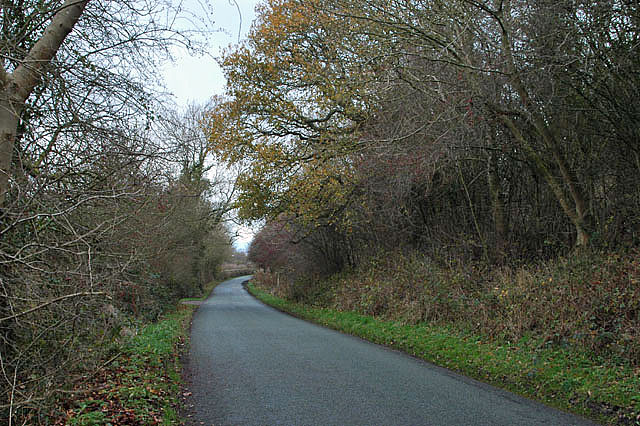
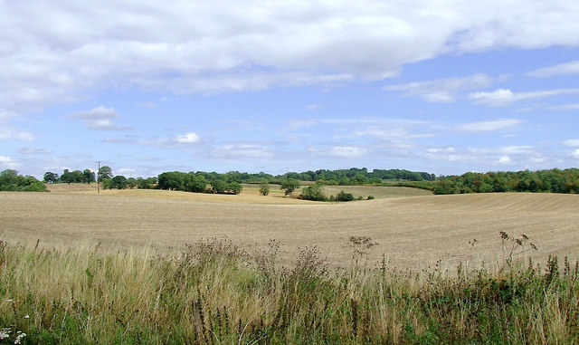
The Fishing Pool Covert is a serene and picturesque woodland located in Staffordshire, England. Nestled amidst the stunning landscape of the county, this hidden gem offers a tranquil retreat for nature enthusiasts and fishing aficionados alike.

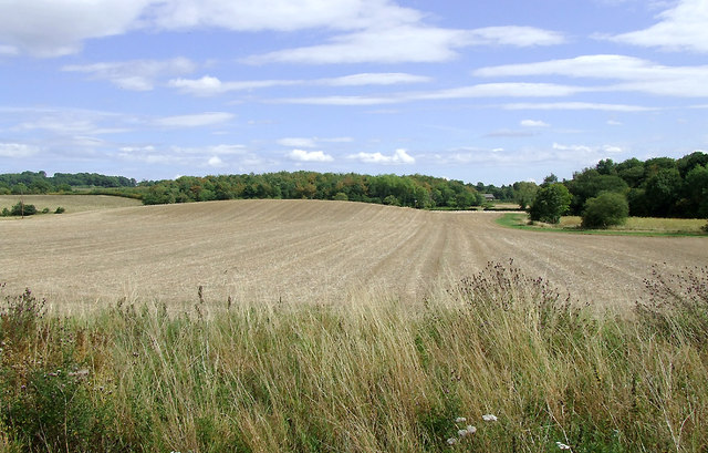
Covering an expansive area, the woodland is characterized by its dense growth of various trees, including oak, birch, and pine. The verdant canopy provides ample shade, creating a cool and refreshing atmosphere, even during warmer months. The forest floor is blanketed with a myriad of wildflowers, adding vibrant pops of color to the landscape.

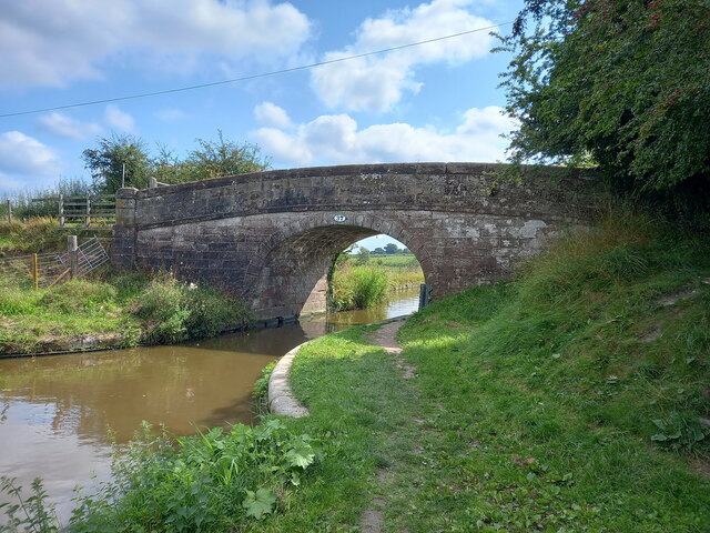
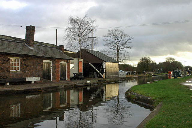
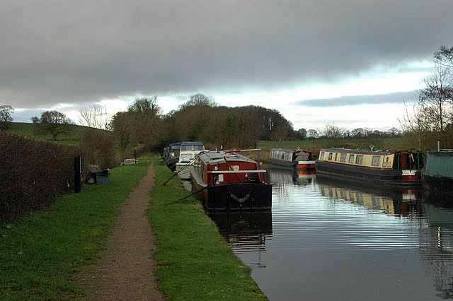
The main attraction of The Fishing Pool Covert is its well-maintained fishing pool, which is stocked with a variety of freshwater fish species. Anglers can cast their lines and enjoy the peacefulness of their surroundings as they wait for a bite. The pool is known for its healthy fish population, providing a rewarding experience for both experienced anglers and novices.

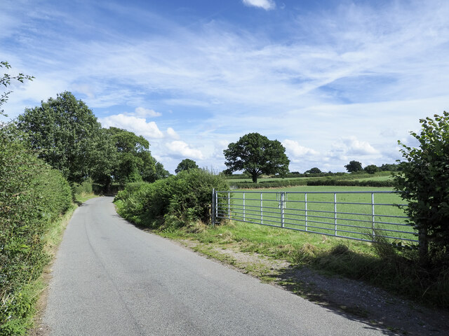
Visitors to The Fishing Pool Covert can also take advantage of the numerous walking trails that wind through the woodland. These paths offer the perfect opportunity to explore the diverse flora and fauna, as well as to spot local wildlife such as deer, rabbits, and a variety of bird species.

The Fishing Pool Covert is a haven for those seeking solace in nature. Its idyllic setting, coupled with the chance to engage in fishing or simply enjoy a peaceful stroll, make it a must-visit destination for nature enthusiasts and those looking to escape the hustle and bustle of everyday life.

If you have any feedback on the listing, please let us know in the comments section below.

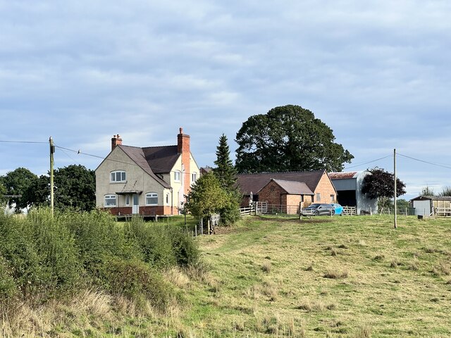
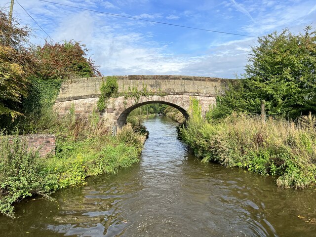
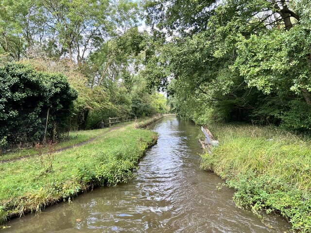
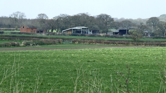
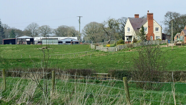
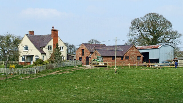
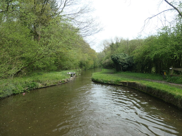
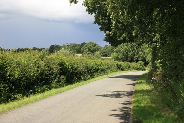
The Fishing Pool Covert Images

Images are sourced within 2km of 52.799991/-2.2901153 or Grid Reference SJ8022. Thanks to Geograph Open Source API. All images are credited.

Machin's Barn Bridge at Gnosall Heath Built around 1830 as an accommodation bridge, and Grade II listed <span class="nowrap"><a title="https://britishlistedbuildings.co.uk/101243117-shropshire-union-canal-barn-bridge-number-37-at-sj-809-211-gnosall#.YS5CpI5KjIU" rel="nofollow ugc noopener" href="https://britishlistedbuildings.co.uk/101243117-shropshire-union-canal-barn-bridge-number-37-at-sj-809-211-gnosall#.YS5CpI5KjIU">Link</a><img style="margin-left:2px;" alt="External link" title="External link - shift click to open in new window" src="https://s1.geograph.org.uk/img/external.png" width="10" height="10"/></span> & <span class="nowrap"><a title="https://historicengland.org.uk/listing/the-list/list-entry/1243117" rel="nofollow ugc noopener" href="https://historicengland.org.uk/listing/the-list/list-entry/1243117">Link</a><img style="margin-left:2px;" alt="External link" title="External link - shift click to open in new window" src="https://s1.geograph.org.uk/img/external.png" width="10" height="10"/></span> in October 1991.
Machin's Barn Bridge at Gnosall Heath
Built around 1830 as an accommodation bridge, and Grade II listed LinkExternal link & LinkExternal link in October 1991.
Cast iron rope fender on the wall of Machin's Barn Bridge Scarred and grooved by the passage of many years of horse-drawn barges along the canal, this is one of a pair of cast-iron fenders on the bridge, and is included in the Grade II listing details for the site <span class="nowrap"><a title="https://britishlistedbuildings.co.uk/101243117-shropshire-union-canal-barn-bridge-number-37-at-sj-809-211-gnosall" rel="nofollow ugc noopener" href="https://britishlistedbuildings.co.uk/101243117-shropshire-union-canal-barn-bridge-number-37-at-sj-809-211-gnosall">Link</a><img style="margin-left:2px;" alt="External link" title="External link - shift click to open in new window" src="https://s1.geograph.org.uk/img/external.png" width="10" height="10"/></span> & <span class="nowrap"><a title="https://historicengland.org.uk/listing/the-list/list-entry/1243117" rel="nofollow ugc noopener" href="https://historicengland.org.uk/listing/the-list/list-entry/1243117">Link</a><img style="margin-left:2px;" alt="External link" title="External link - shift click to open in new window" src="https://s1.geograph.org.uk/img/external.png" width="10" height="10"/></span>
Cast iron rope fender on the wall of Machin's Barn Bridge
Scarred and grooved by the passage of many years of horse-drawn barges along the canal, this is one of a pair of cast-iron fenders on the bridge, and is included in the Grade II listing details for the site LinkExternal link & LinkExternal link
Wide gates to field entry east of Barn Bridge Farm The size of modern farm machinery has resulted in the access to many fields being widened; this must be an example of that.
Wide gates to field entry east of Barn Bridge Farm
The size of modern farm machinery has resulted in the access to many fields being widened; this must be an example of that.
Boat passing boat near Machins Barn Bridge Intrepid, a smaller vessel, is passing the narrowboat Angelica, which is moored just north-west of bridge 37, on the Shropshire Union Canal near to Gnosall Heath.
Boat passing boat near Machins Barn Bridge
Intrepid, a smaller vessel, is passing the narrowboat Angelica, which is moored just north-west of bridge 37, on the Shropshire Union Canal near to Gnosall Heath.
Detached house at or near Cotonwood The cottage is among a group of buildings including at least one other house, accessed from the minor road, Radmore Lane. A public footpath passes between the buildings.
Detached house at or near Cotonwood
The cottage is among a group of buildings including at least one other house, accessed from the minor road, Radmore Lane. A public footpath passes between the buildings.
Barn Bridge Farm Near Gnosall Heath.
Barn Bridge Farm
Near Gnosall Heath.
Barn Bridge Grade II listed. Listing number 1243117. Accommodation bridge. c1829-32. Telford design. Stone, with stone band and copings. Single elliptical arch with voussoirs. Slightly cambered, solid parapet and piers. Oval iron number plate on south side. 2 iron rope fenders.
Barn Bridge
Grade II listed. Listing number 1243117. Accommodation bridge. c1829-32. Telford design. Stone, with stone band and copings. Single elliptical arch with voussoirs. Slightly cambered, solid parapet and piers. Oval iron number plate on south side. 2 iron rope fenders.
Shropshire Union Canal In Shelmore Wood.
Shropshire Union Canal
In Shelmore Wood.
Staffordshire farmland west of Gnosall Looking north from the Shropshire Union Canal towards Plardiwick Manor Farm.
Staffordshire farmland west of Gnosall
Looking north from the Shropshire Union Canal towards Plardiwick Manor Farm.
Farmland north-west of Gnosall Heath in Staffordshire The image shows Barn Bridge Farm, north of the Shropshire Union Canal.
Farmland north-west of Gnosall Heath in Staffordshire
The image shows Barn Bridge Farm, north of the Shropshire Union Canal.
Barn Bridge Farm near Gnosall Heath in Staffordshire Looking north from the Shropshire Union Canal.
Barn Bridge Farm near Gnosall Heath in Staffordshire
Looking north from the Shropshire Union Canal.
Stop gate, south end of Shelmore embankment If the embankment was breached, the flow of water would pull the gate shut. This stops a much longer stretch of the canal from emptying and reduces the size of the flood below the breach.
Stop gate, south end of Shelmore embankment
If the embankment was breached, the flow of water would pull the gate shut. This stops a much longer stretch of the canal from emptying and reduces the size of the flood below the breach.
Norbury Road sunshine and cloud Sunlight highlights the hedge while black clouds beyond bring heavy showers to some.
Norbury Road sunshine and cloud
Sunlight highlights the hedge while black clouds beyond bring heavy showers to some.
Lane to Norbury
Lane to Norbury
Workshops at Norbury Junction
Shropshire Union Canal - just north of Norbury
Arable fields east of Norbury, Staffordshire Seen from the Shropshire Union Canal, the woodland ahead is Little Campions; that by the right edge is Moat Covert.
Arable fields east of Norbury, Staffordshire
Seen from the Shropshire Union Canal, the woodland ahead is Little Campions; that by the right edge is Moat Covert.
Arable fields east of Norbury, Staffordshire Seen from the Shropshire Union Canal, the woodland at the right edge is known as Little Campions. Straight ahead and more distant are Gorsey Covert and Ball's Rough, on the skyline.
Arable fields east of Norbury, Staffordshire
Seen from the Shropshire Union Canal, the woodland at the right edge is known as Little Campions. Straight ahead and more distant are Gorsey Covert and Ball's Rough, on the skyline.
Show me another place!

The Fishing Pool Covert is located at Grid Ref: SJ8022 (Lat: 52.799991, Lng: -2.2901153)

Administrative County: Staffordshire

District: Stafford

Police Authority: Staffordshire

What 3 Words

///seducing.causes.laminated. Near Gnosall, Staffordshire

Related Wikis

Norbury Junction

Norbury Junction (grid reference SJ793228) is a hamlet and former canal junction which lies about 1 mile (1.6 km) to the south east of Norbury, in Staffordshire...

Gnosall Rural District

Gnosall was a rural district in Staffordshire, England from 1894 to 1934. It was formed under the Local Government Act 1894 from that part of the Newport...

Norbury, Staffordshire

Norbury is a village and civil parish in the Borough of Stafford, in west Staffordshire, England. The population as taken at the 2011 census was 371.It...

Loynton

Loynton is a hamlet on the A519 near the villages of Norbury, and Woodseaves in Staffordshire, England. It lies in the civil parish of Norbury. Loynton...

Nearby Amenities

Located within 500m of 52.799991,-2.2901153
Source: www.npemap.org.uk
Uk Postcode Centroid: ST20
Lat/Long: 52.797652/-2.294623
Power: pole
Lat/Long: 52.79885/-2.2879565
Power: pole
Lat/Long: 52.8010069/-2.2910544
Power: pole
Lat/Long: 52.8017593/-2.2921488
Power: pole
Lat/Long: 52.8024858/-2.2931948
Power: pole
Lat/Long: 52.8033063/-2.2943643
Power: pole
Lat/Long: 52.8033695/-2.2929803
Power: pole
Lat/Long: 52.8025457/-2.2911215
Power: pole
Lat/Long: 52.8016928/-2.2891581
Power: pole
Lat/Long: 52.8005041/-2.2874603
Power: pole
Lat/Long: 52.7999058/-2.2866046
Power: pole
Lat/Long: 52.7985533/-2.2846654
Power: pole
Lat/Long: 52.7978608/-2.2836918
The data included in this document is from www.openstreetmap.org. The data is made available under ODbL.

Have you been to The Fishing Pool Covert?

Leave your review of The Fishing Pool Covert below (or comments, questions and feedback).