Mill Wood

Wood, Forest in Gloucestershire Cotswold

England

Mill Wood

Stone Stile, Ozleworth Park To the left of the main gates to the Old Rectory, on Gloucestershire footpath NOZ2 (listed as a Bridleway). Off Blacksmiths Hill.
Stone Stile, Ozleworth Park Credit: Mike Kom

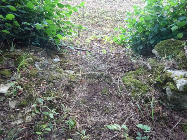
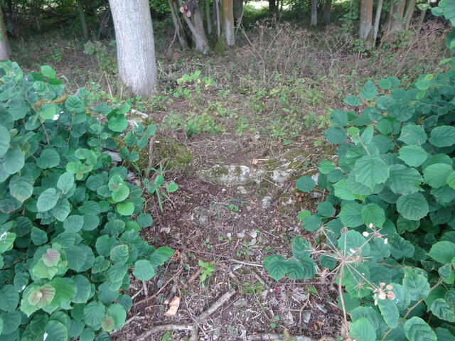
Mill Wood is a picturesque woodland located in Gloucestershire, England. Situated in the heart of the Forest of Dean, this woodland area is renowned for its natural beauty and rich biodiversity. Covering an area of approximately 100 acres, it offers visitors a peaceful and tranquil environment.

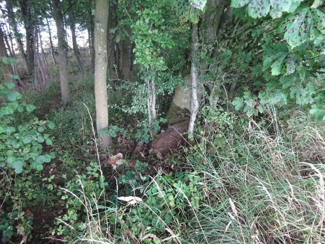
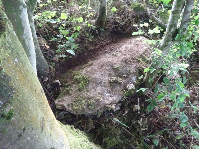
The woodland is characterized by its dense canopy of tall, mature trees, including oak, beech, and ash, which provide shade and shelter to a variety of flora and fauna. The forest floor is adorned with an array of wildflowers, ferns, and mosses, creating a vibrant tapestry of colors throughout the seasons.

Mill Wood is intersected by a small stream, which meanders through the forest, adding to its charm and providing a habitat for numerous species of aquatic life. The babbling sound of the water coupled with the gentle rustling of leaves creates a soothing ambiance for visitors.

The woodland is home to a diverse range of wildlife, including deer, foxes, badgers, and a variety of bird species. Nature enthusiasts and birdwatchers flock to Mill Wood to catch a glimpse of elusive species such as woodpeckers, owls, and kingfishers.

The area is also popular among walkers, hikers, and cyclists, with a network of well-maintained trails and paths that allow visitors to explore the woodland at their own pace. These trails lead to various points of interest, including a small waterfall and a historic mill.

In conclusion, Mill Wood is a natural gem nestled in the Forest of Dean, offering visitors a chance to immerse themselves in the beauty of nature and discover the wonders of Gloucestershire's woodlands.

If you have any feedback on the listing, please let us know in the comments section below.

Mill Wood Images

Images are sourced within 2km of 51.635449/-2.2825897 or Grid Reference ST8092. Thanks to Geograph Open Source API. All images are credited.

Stone Stile, Ozleworth Park To the left of the main gates to the Old Rectory, on Gloucestershire footpath NOZ2 (listed as a Bridleway). Off Blacksmiths Hill.
Stone Stile, Ozleworth Park
To the left of the main gates to the Old Rectory, on Gloucestershire footpath NOZ2 (listed as a Bridleway). Off Blacksmiths Hill.
In Ozleworth Bottom This is looking past a benchmark <a href="https://www.geograph.org.uk/photo/6935226">ST8092 : Benchmark in Ozleworth Bottom</a> on the right hand of two posts at the eastern end of Ozleworth Bottom to a flat area (extending into the next square east) that looks as if it was an area of water at some time in the recent past. Unlike a more obvious benchmark close-by <a href="https://www.geograph.org.uk/photo/6603653">ST8092 : Benchmark by a track</a>, this one has recently been made more accessible by the absence of trees cut down because of ash dieback.
In Ozleworth Bottom
This is looking past a benchmark ST8092 : Benchmark in Ozleworth Bottom on the right hand of two posts at the eastern end of Ozleworth Bottom to a flat area (extending into the next square east) that looks as if it was an area of water at some time in the recent past. Unlike a more obvious benchmark close-by ST8092 : Benchmark by a track, this one has recently been made more accessible by the absence of trees cut down because of ash dieback.
Benchmark in Ozleworth Bottom This benchmark (OS description: STO P E SIDE TK S SIDE FOOTPATH) needed a bit of gardening to reveal it, even though a number of trees near it had been removed <a href="https://www.geograph.org.uk/photo/6935219">ST8192 : In Ozleworth Bottom</a>.
Benchmark in Ozleworth Bottom
This benchmark (OS description: STO P E SIDE TK S SIDE FOOTPATH) needed a bit of gardening to reveal it, even though a number of trees near it had been removed ST8192 : In Ozleworth Bottom.
Unmapped pond near Ozleworth Bottom There isn't always water in this pond: this image, taken In September, can be compared with December <a href="https://www.geograph.org.uk/photo/300553">ST8193 : Lake in Ozleworth Bottom</a>.
Unmapped pond near Ozleworth Bottom
There isn't always water in this pond: this image, taken In September, can be compared with December ST8193 : Lake in Ozleworth Bottom.
Pond now on OS maps There is an earlier image of this pond <a href="https://www.geograph.org.uk/photo/2355412">ST8193 : Pond near Ozleworth Bottom</a>. It is now marked on the 1:25000 OS map.
Pond now on OS maps
There is an earlier image of this pond ST8193 : Pond near Ozleworth Bottom. It is now marked on the 1:25000 OS map.
Stone Stile, Bagpath Off a dead-end road connecting with Scrubbett's Lane. Opposite Brook House, on Gloucestershire footpath NKS30, looking SE to a field.
Stone Stile, Bagpath
Off a dead-end road connecting with Scrubbett's Lane. Opposite Brook House, on Gloucestershire footpath NKS30, looking SE to a field.
Stone Stile, Bagpath On Gloucestershire footpaths NKS26 & NKS27, 65 metres SE from Ashcroft Rd, at its nearest point.
Stone Stile, Bagpath
On Gloucestershire footpaths NKS26 & NKS27, 65 metres SE from Ashcroft Rd, at its nearest point.
Stone Stile, Boxwell On Gloucestershire footpaths NBL11 & LHT3, and on the boundary between the parishes of Boxwell with Leighterton and Hillesley & Tresham. This "Fallen Idle" is the remains of a slab in the wall of Stonehill Wood. The view is NE looking out of the wood, the view looking in is <a href="https://www.geograph.org.uk/photo/7261338">ST8091 : Stone Stile, Boxwell</a>.
Stone Stile, Boxwell
On Gloucestershire footpaths NBL11 & LHT3, and on the boundary between the parishes of Boxwell with Leighterton and Hillesley & Tresham. This "Fallen Idle" is the remains of a slab in the wall of Stonehill Wood. The view is NE looking out of the wood, the view looking in is ST8091 : Stone Stile, Boxwell.
Stone Stile, Boxwell On Gloucestershire footpaths NBL11 & LHT3, and on the boundary between the parishes of Boxwell with Leighterton and Hillesley & Tresham. This "Fallen Idle" is the remains of a slab  in the wall of Stonehill Wood. The view is SW looking into the wood, the view looking out is <a href="https://www.geograph.org.uk/photo/7261335">ST8091 : Stone Stile, Boxwell</a>.
Stone Stile, Boxwell
On Gloucestershire footpaths NBL11 & LHT3, and on the boundary between the parishes of Boxwell with Leighterton and Hillesley & Tresham. This "Fallen Idle" is the remains of a slab in the wall of Stonehill Wood. The view is SW looking into the wood, the view looking out is ST8091 : Stone Stile, Boxwell.
Stone Stile, Tresham A "Fallen Idle" on Gloucestershire footpath LHT3, on the remains of the NW wall of Stonehill Wood. The view is looking South, the view North is <a href="https://www.geograph.org.uk/photo/7261350">ST8091 : Stone Stile, Tresham</a>.
Stone Stile, Tresham
A "Fallen Idle" on Gloucestershire footpath LHT3, on the remains of the NW wall of Stonehill Wood. The view is looking South, the view North is ST8091 : Stone Stile, Tresham.
Stone Stile, Tresham A "Fallen Idle" on Gloucestershire footpath LHT3, on the remains of the NW wall of Stonehill Wood. The view is looking North, the view South is <a href="https://www.geograph.org.uk/photo/7261349">ST8091 : Stone Stile, Tresham</a>.
Stone Stile, Tresham
A "Fallen Idle" on Gloucestershire footpath LHT3, on the remains of the NW wall of Stonehill Wood. The view is looking North, the view South is ST8091 : Stone Stile, Tresham.
Tractor and trailer turning on to A46 Heading north.
Tractor and trailer turning on to A46
Heading north.
Newington Bagpath (Glos) St Bartholomew's Church The sad semi-derelict church, sold by the Gloucester diocese and still awaiting conversion by its new owners at the point of submission of this picture, which dates from 2002
Newington Bagpath (Glos) St Bartholomew's Church
The sad semi-derelict church, sold by the Gloucester diocese and still awaiting conversion by its new owners at the point of submission of this picture, which dates from 2002
Ozleworth (Glos) St Nicholas of Myra's Church Difficult to find but a delightful walk to this church vested in the Churches Conservation Trust
Ozleworth (Glos) St Nicholas of Myra's Church
Difficult to find but a delightful walk to this church vested in the Churches Conservation Trust
St Nicholas of Myra, Ozleworth
Cotswold dry stone wall and water trough Cotswold dry stone wall above Ozleworth Bottom.
Cotswold dry stone wall and water trough
Cotswold dry stone wall above Ozleworth Bottom.
Farmland to the east of Tresham Viewed from the extreme north-west corner of this square, there are no buildings in the square, the entire square is farmland.
Farmland to the east of Tresham
Viewed from the extreme north-west corner of this square, there are no buildings in the square, the entire square is farmland.
Sheep in a field to the west of Boxwell View to the north-west from the Monarch's Way between Tresham and Boxwell. On the horizon to the right of centre is the radio station at Goose Green.
Sheep in a field to the west of Boxwell
View to the north-west from the Monarch's Way between Tresham and Boxwell. On the horizon to the right of centre is the radio station at Goose Green.
Show me another place!

Mill Wood is located at Grid Ref: ST8092 (Lat: 51.635449, Lng: -2.2825897)

Administrative County: Gloucestershire

District: Cotswold

Police Authority: Gloucestershire

What 3 Words

///connector.hence.rosier. Near Wotton-under-Edge, Gloucestershire

Nearby Locations

West Wood Mill Wood

Related Wikis

Boxwell Court

Boxwell Court is a country house near Leighterton in Gloucestershire, England, about 5 km or 3 miles east of Wotton-under-Edge, dating from the 15th and...

Boxwell SSSI

Boxwell SSSI (grid reference ST816928) is a 5.31-hectare (13.1-acre) biological Site of Special Scientific Interest in Gloucestershire, notified in 1954...

St Nicholas of Myra's Church, Ozleworth

St Nicholas of Myra's Church is a redundant Anglican church in the village of Ozleworth, Gloucestershire, England, in the care of The Churches Conservation...

Ozleworth

Ozleworth is a village and civil parish in Gloucestershire, England, approximately 30 km (19 mi) south of Gloucester. It lies in the Cotswolds, an Area...

Lasborough Park

Lasborough Park (or Lasborough House) is a Grade II listed country house in Newington Bagpath/Lasborough, Tetbury, Gloucestershire, England. The estate...

Boxwell

Boxwell is a hamlet in Gloucestershire, England, near the village of Leighterton Boxwell Court is a Grade II* listed manor house from the 15th or 16th...

Bagpath

Bagpath is a hamlet in Gloucestershire, England, in the Ozleworth valley south of the village of Kingscote and forming part of Kingscote civil parish....

Lasborough

Lasborough is a settlement in Gloucestershire, England, part of the Westonbirt with Lasborough civil parish. Lasborough lies to the west of the A46, about...

Nearby Amenities

Located within 500m of 51.635449,-2.2825897
Ford: yes
Lat/Long: 51.633616/-2.2873248
Barrier: stile
Foot: yes
Lat/Long: 51.6344889/-2.2877558
The data included in this document is from www.openstreetmap.org. The data is made available under ODbL.

Have you been to Mill Wood?

Leave your review of Mill Wood below (or comments, questions and feedback).