The Clump

Wood, Forest in Gloucestershire Stroud

England

The Clump

Old Milestone  A4135, Coopers Wood Stone post by the A4135, in parish of DURSLEY (STROUD District), Coopers Wood; opposite footpath sign between house and garage on verge, by the road, on South side of road. MS erected by the Coldharbour District turnpike trust in the 19th century. The modern plate was commissioned by the house owners (behind) and installed in 2020 with advice from the Milestone Society. Cancelled BM below plate was 639.5 ft ASL.
Earlier image see <a href="https://www.geograph.org.uk/photo/6049249">ST7796 : Old Milestone by the A4135, Coopers Wood, Dursley parish</a>

Inscription: Dursley 1½ / Wotton 4 / Horsley 4 / Tetbury 8½ 

Milestone Society National ID: GL_TBDY08
Old Milestone A4135, Coopers Wood Credit: Mr Red

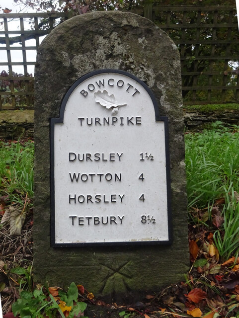
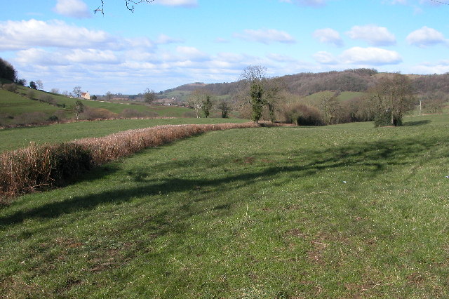
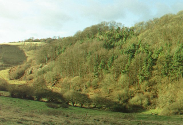
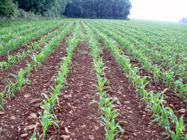
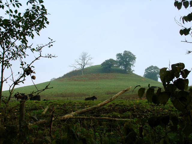
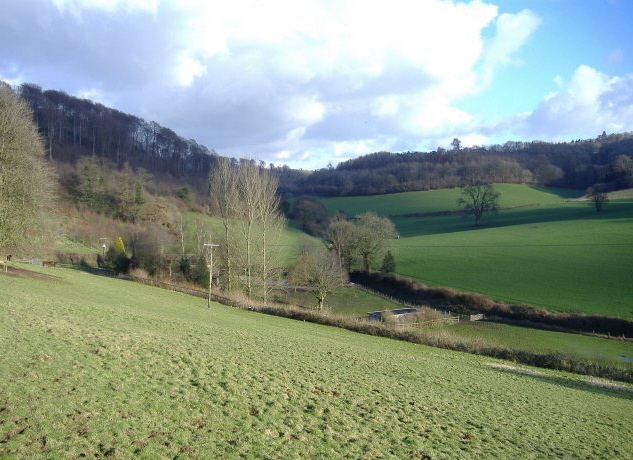
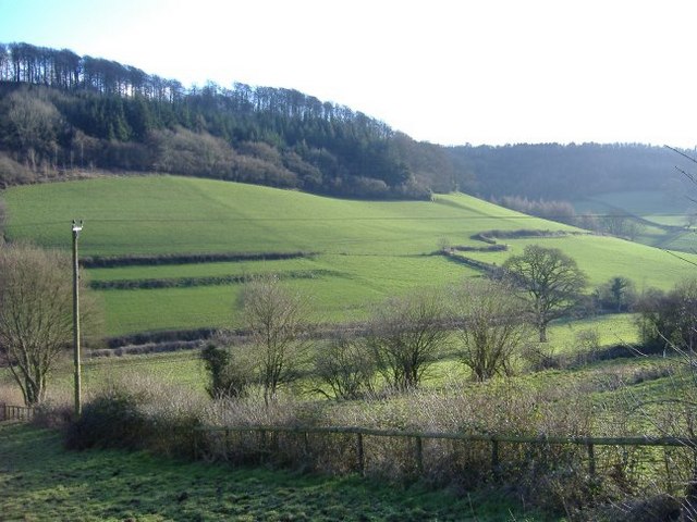
The Clump, located in Gloucestershire, is a picturesque woodland area situated in the Forest of Dean. Covering an approximate area of 50 acres, The Clump is a significant natural attraction in the region. The woodland is predominantly composed of a variety of trees such as oak, beech, and birch, creating a diverse and vibrant ecosystem.

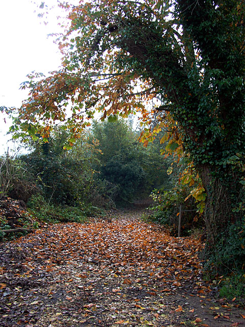
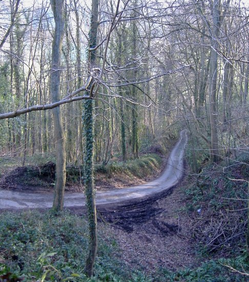
Visitors to The Clump are greeted with a well-maintained network of walking trails, allowing them to explore the woodland at their own pace. The trails wind through the trees, offering glimpses of enchanting flora and fauna along the way. This makes The Clump an ideal destination for nature enthusiasts, hikers, and families seeking a peaceful escape from the hustle and bustle of daily life.

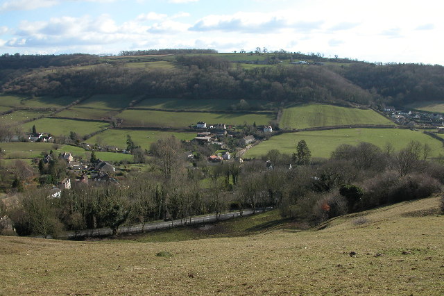
Moreover, The Clump is renowned for its stunning views, particularly from the summit of its highest hill. From this vantage point, visitors can marvel at panoramic vistas of the surrounding countryside, including rolling hills, meandering rivers, and charming villages. It's a sight that truly highlights the beauty of Gloucestershire's natural landscape.

Furthermore, The Clump is also home to a variety of wildlife species, including deer, foxes, and a range of bird species. Birdwatchers can delight in spotting rare and migratory birds that frequent the area.

Overall, The Clump is a magnificent woodland destination that beckons visitors with its tranquil atmosphere, scenic trails, and breathtaking views. Whether one seeks a peaceful walk in nature or a chance to observe wildlife, The Clump offers an unforgettable experience for all who venture into its lush embrace.

If you have any feedback on the listing, please let us know in the comments section below.
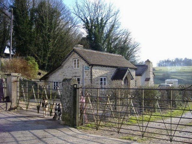
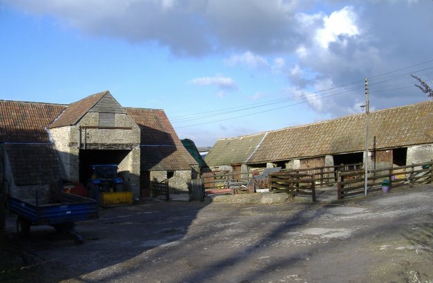
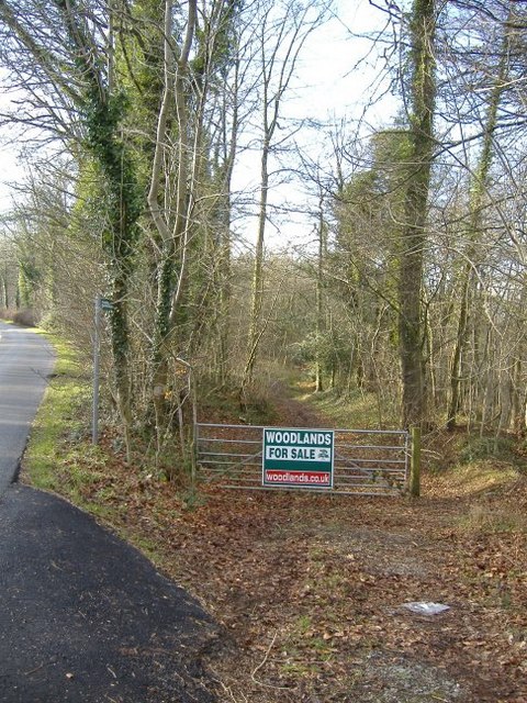
The Clump Images

Images are sourced within 2km of 51.656018/-2.3187845 or Grid Reference ST7895. Thanks to Geograph Open Source API. All images are credited.

Old Milestone  A4135, Coopers Wood Stone post by the A4135, in parish of DURSLEY (STROUD District), Coopers Wood; opposite footpath sign between house and garage on verge, by the road, on South side of road. MS erected by the Coldharbour District turnpike trust in the 19th century. The modern plate was commissioned by the house owners (behind) and installed in 2020 with advice from the Milestone Society. Cancelled BM below plate was 639.5 ft ASL.
Earlier image see <a href="https://www.geograph.org.uk/photo/6049249">ST7796 : Old Milestone by the A4135, Coopers Wood, Dursley parish</a>

Inscription: Dursley 1½ / Wotton 4 / Horsley 4 / Tetbury 8½ 

Milestone Society National ID: GL_TBDY08
Old Milestone A4135, Coopers Wood
Stone post by the A4135, in parish of DURSLEY (STROUD District), Coopers Wood; opposite footpath sign between house and garage on verge, by the road, on South side of road. MS erected by the Coldharbour District turnpike trust in the 19th century. The modern plate was commissioned by the house owners (behind) and installed in 2020 with advice from the Milestone Society. Cancelled BM below plate was 639.5 ft ASL. Earlier image see ST7796 : Old Milestone by the A4135, Coopers Wood, Dursley parish Inscription: Dursley 1½ / Wotton 4 / Horsley 4 / Tetbury 8½ Milestone Society National ID: GL_TBDY08
Coombe The village of Coombe viewed from Coombe Hill
Coombe
The village of Coombe viewed from Coombe Hill
Spuncombe Bottom Spuncombe Bottom, one of many valleys in the south Cotswolds.
Spuncombe Bottom
Spuncombe Bottom, one of many valleys in the south Cotswolds.
Tyley Bottom, nr Wotton-under-Edge Looking west across one of the many deep coombes that cut far into this part of the Cotswold scarp, to Golden Knoll Wood.
Tyley Bottom, nr Wotton-under-Edge
Looking west across one of the many deep coombes that cut far into this part of the Cotswold scarp, to Golden Knoll Wood.
Lines of maize
Lines of maize
Choices To the left lies the lane to Ozleworth Bottom, to the right the lane to Newark Park.  In the middle is Goose Green radio station mast.
Choices
To the left lies the lane to Ozleworth Bottom, to the right the lane to Newark Park. In the middle is Goose Green radio station mast.
Coombe Hill lower slopes
Lane leading to Coombehall Farm High sided lane leading down to Coombehall Farm and Greenhay Farm.
Lane leading to Coombehall Farm
High sided lane leading down to Coombehall Farm and Greenhay Farm.
Wimley Hill
Wimley Hill
Track leading along Tyley Bottom
Hollowley Cover Field and copse, immediately north of Ashcroft House.
Hollowley Cover
Field and copse, immediately north of Ashcroft House.
Baleful barn To the north of the A4135 from Tetbury to Dursley.
Baleful barn
To the north of the A4135 from Tetbury to Dursley.
Bowcott Lodge Guarding the entrance to Dingle Wood.
Bowcott Lodge
Guarding the entrance to Dingle Wood.
Bowcott farm The quintessential farmyard.
Bowcott farm
The quintessential farmyard.
Folly Wood 'For Sale' on the ridge, north of the A4135.
Folly Wood
'For Sale' on the ridge, north of the A4135.
Whiteway Wood A steep, narrow, twisting lane, leads down to Waterley Bottom.
Whiteway Wood
A steep, narrow, twisting lane, leads down to Waterley Bottom.
Waterley Bottom
Waterley Bottom
Waterley Bottom Looking across to Monkcombe Wood.
Waterley Bottom
Looking across to Monkcombe Wood.
Show me another place!

The Clump is located at Grid Ref: ST7895 (Lat: 51.656018, Lng: -2.3187845)

Administrative County: Gloucestershire

District: Stroud

Police Authority: Gloucestershire

What 3 Words

///munched.porridge.pepper. Near Wotton-under-Edge, Gloucestershire

Related Wikis

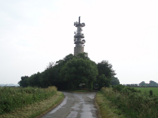
Wotton-under-Edge BT Tower

Wotton-under-Edge Tower is a 76.2 metres ( 250 ft) tall telecommunication tower built of reinforced concrete at Wotton-under-Edge in Gloucestershire, UK...

Coombe, Gloucestershire

Coombe is a settlement in the English county of Gloucestershire. It is adjacent to the town of Wotton-under-Edge. The town name can also be found spelled...

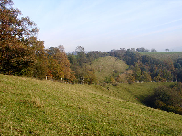
Coombe Hill (Cotswolds)

Coombe Hill (grid reference ST765942) is a 15.4-hectare (38-acre) biological Site of Special Scientific Interest in Gloucestershire, notified in 1994.The...

Ozleworth

Ozleworth is a village and civil parish in Gloucestershire, England, approximately 30 km (19 mi) south of Gloucester. It lies in the Cotswolds, an Area...
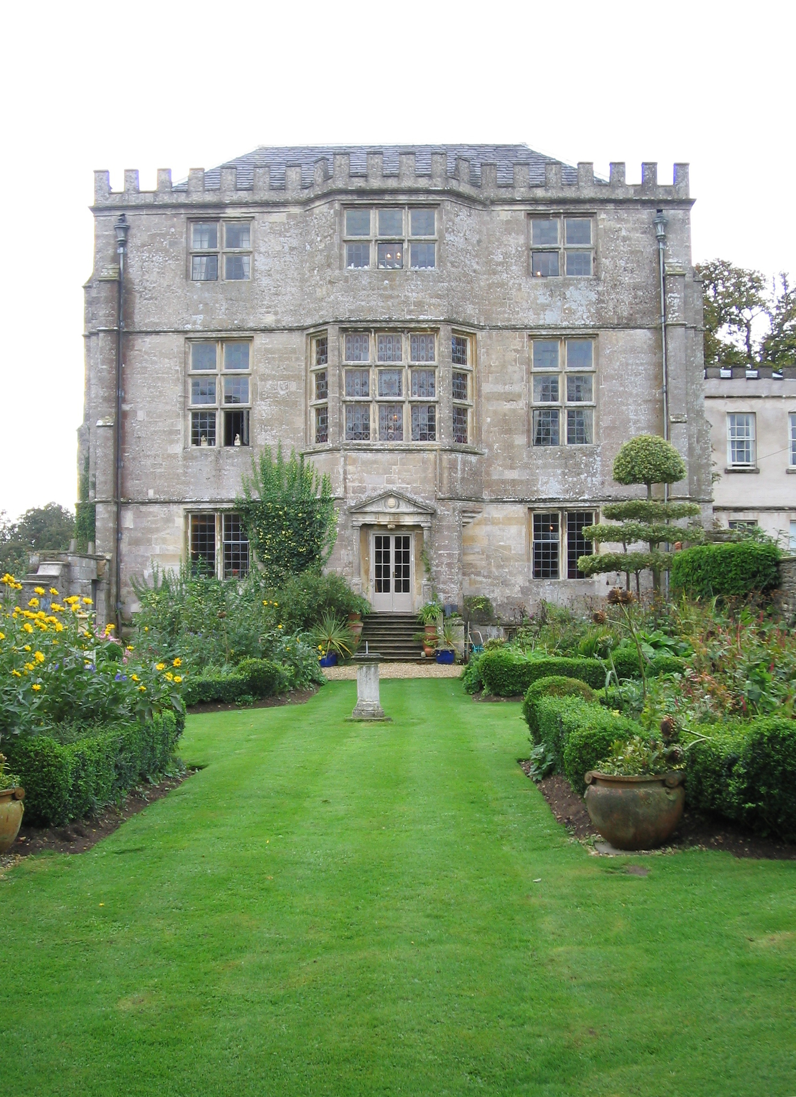
Newark Park

Newark Park is a Grade I listed country house of Tudor origins located near the village of Ozleworth, Wotton-under-Edge, Gloucestershire. The house sits...

St Nicholas of Myra's Church, Ozleworth

St Nicholas of Myra's Church is a redundant Anglican church in the village of Ozleworth, Gloucestershire, England, in the care of The Churches Conservation...

Stouts Hill

Stouts Hill is an 18th-Century Gothic revival country house situated in the Cotswolds, just outside the village of Uley. Although there are records of...

Bencombe

Bencombe is a hamlet made up of 9 mainly traditional stone cottages/houses in the parish of Uley and just south west of Owlpen on the edge of the Cotswolds...

Nearby Amenities

Located within 500m of 51.656018,-2.3187845
Bus Stop
Cotswold Edge Golf Club
Bench: no
Bin: no
Bus: yes
Naptan AtcoCode: 1600GLS701
Naptan Bearing: SW
Naptan CommonName: Cotswold Edge Golf Club
Naptan NaptanCode: gloatgat
Naptan Street: B4058 Upper Rushmire
Naptan Verified: yes
Public Transport: platform
Shelter: no
Source: naptan_import;survey
Lat/Long: 51.6585804/-2.324614
Bus Stop
Cotswold Edge Golf Club
Bench: no
Bin: no
Bus: yes
Naptan AtcoCode: 1600GLS702
Naptan Bearing: NE
Naptan CommonName: Cotswold Edge Golf Club
Naptan Indicator: Opp
Naptan NaptanCode: gloatgdg
Naptan Street: B4058 Upper Rushmire
Naptan Verified: no
Public Transport: platform
Shelter: no
Source: naptan_import
Lat/Long: 51.6587148/-2.3244839
Golf: tee
Lat/Long: 51.6588214/-2.3234732
Golf: pin
Lat/Long: 51.6580753/-2.3236757
Golf: tee
Lat/Long: 51.6578733/-2.3231767
Golf: tee
Lat/Long: 51.6572222/-2.3219027
Golf: pin
Lat/Long: 51.6546708/-2.3241182
Golf: pin
Lat/Long: 51.6553251/-2.3223026
Golf: tee
Lat/Long: 51.6554554/-2.3219695
Golf: pin
Lat/Long: 51.6533691/-2.3240535
Parking
Access: yes
Fee: no
Lit: no
Parking: layby
Smoothness: bad
Surface: compacted
Lat/Long: 51.6590971/-2.3229679
The data included in this document is from www.openstreetmap.org. The data is made available under ODbL.

Have you been to The Clump?

Leave your review of The Clump below (or comments, questions and feedback).