Parker's Hill Wood

Wood, Forest in Gloucestershire Stroud

England

Parker's Hill Wood

Stone Stile, Ozleworth Park To the left of the main gates to the Old Rectory, on Gloucestershire footpath NOZ2 (listed as a Bridleway). Off Blacksmiths Hill.
Stone Stile, Ozleworth Park Credit: Mike Kom

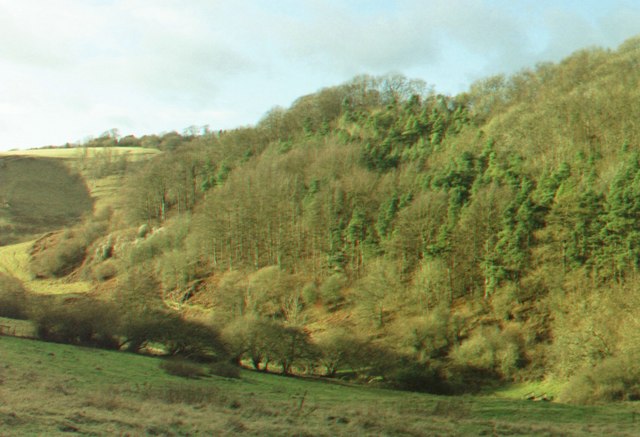
Parker's Hill Wood is a picturesque woodland located in the county of Gloucestershire, England. Situated in the heart of the Cotswolds, this woodland covers an area of approximately 50 acres and is known for its natural beauty and diverse ecosystem.

The wood is predominantly made up of deciduous trees, including oak, beech, and ash, which create a stunning canopy that changes with the seasons. The forest floor is covered in a lush carpet of ferns, bluebells, and wildflowers, providing a haven for a variety of flora and fauna.

Parker's Hill Wood is a popular destination for nature enthusiasts and hikers, offering several well-marked walking trails that wind through the woodland. These trails provide visitors with the opportunity to explore the wood's enchanting surroundings, taking in the sights and sounds of the forest.

The wood is also home to a rich assortment of wildlife, including deer, foxes, badgers, and a plethora of bird species. Birdwatchers can spot woodpeckers, owls, and various songbirds among the treetops, while animal lovers may catch a glimpse of the elusive red deer that roam the area.

In addition to its natural beauty, Parker's Hill Wood has a fascinating history. The wood has been managed for centuries, with evidence of ancient woodland management techniques still visible today. It is believed that the wood has been used for timber production, charcoal making, and grazing animals in the past.

Overall, Parker's Hill Wood is a captivating natural haven that offers visitors a chance to connect with nature, immerse themselves in its beauty, and discover the rich history that lies within its boundaries.

If you have any feedback on the listing, please let us know in the comments section below.

Parker's Hill Wood Images

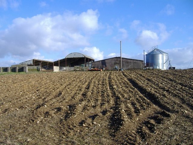
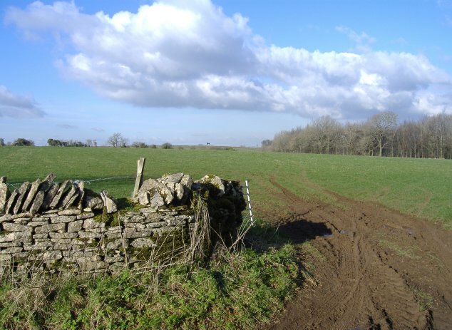
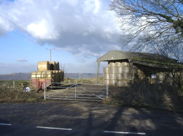
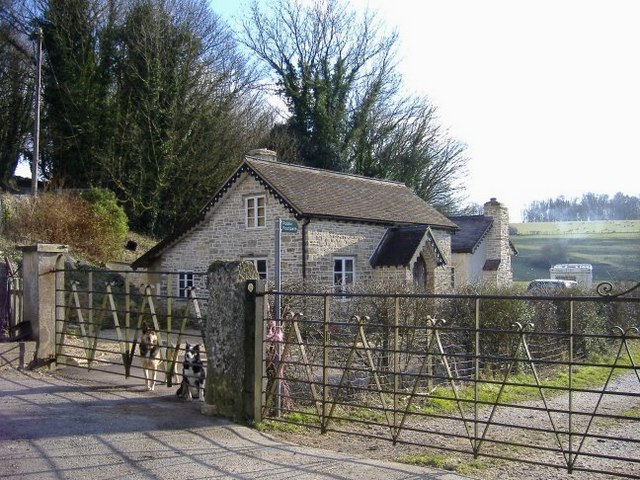
Images are sourced within 2km of 51.657097/-2.305189 or Grid Reference ST7895. Thanks to Geograph Open Source API. All images are credited.

Stone Stile, Ozleworth Park To the left of the main gates to the Old Rectory, on Gloucestershire footpath NOZ2 (listed as a Bridleway). Off Blacksmiths Hill.
Stone Stile, Ozleworth Park
To the left of the main gates to the Old Rectory, on Gloucestershire footpath NOZ2 (listed as a Bridleway). Off Blacksmiths Hill.
St Nicholas of Myra, Ozleworth
Tyley Bottom, nr Wotton-under-Edge Looking west across one of the many deep coombes that cut far into this part of the Cotswold scarp, to Golden Knoll Wood.
Tyley Bottom, nr Wotton-under-Edge
Looking west across one of the many deep coombes that cut far into this part of the Cotswold scarp, to Golden Knoll Wood.
Tracks to the trees Tracks through a wheat field leading to a copse in the near distance.
Tracks to the trees
Tracks through a wheat field leading to a copse in the near distance.
Water tower A Bristol Water owned water tower hidden away in the woods.
Water tower
A Bristol Water owned water tower hidden away in the woods.
Lines of maize
Lines of maize
Choices To the left lies the lane to Ozleworth Bottom, to the right the lane to Newark Park.  In the middle is Goose Green radio station mast.
Choices
To the left lies the lane to Ozleworth Bottom, to the right the lane to Newark Park. In the middle is Goose Green radio station mast.
Ozleworth Bottom A group of dwellings occupy a lovely spot near the head of this secluded valley.
Ozleworth Bottom
A group of dwellings occupy a lovely spot near the head of this secluded valley.
Scrubbett's farm A range of farm buildings, east of Scrubbett's Lane.
Scrubbett's farm
A range of farm buildings, east of Scrubbett's Lane.
Hollowley Cover Field and copse, immediately north of Ashcroft House.
Hollowley Cover
Field and copse, immediately north of Ashcroft House.
Baleful barn To the north of the A4135 from Tetbury to Dursley.
Baleful barn
To the north of the A4135 from Tetbury to Dursley.
Bowcott Lodge Guarding the entrance to Dingle Wood.
Bowcott Lodge
Guarding the entrance to Dingle Wood.
Bowcott farm The quintessential farmyard.
Bowcott farm
The quintessential farmyard.
Fat, fifty-fold flock, forage flat farm field Baaaaa!
Fat, fifty-fold flock, forage flat farm field
Baaaaa!
The 1st fairway A pleasant day at Cotswold Edge golf course
The 1st fairway
A pleasant day at Cotswold Edge golf course
The B4058 after a shower This is the Wotton to Tetbury road.
The B4058 after a shower
This is the Wotton to Tetbury road.
Gate and golf Spot the golfers.
Gate and golf
Spot the golfers.
The road to Goose Green The road leads to the tower in the distance which is a cold war relic. Closer to the camera a footpath leads away to the right as indicated by the marker post. Many of the minor roads in these parts are very narrow.
The road to Goose Green
The road leads to the tower in the distance which is a cold war relic. Closer to the camera a footpath leads away to the right as indicated by the marker post. Many of the minor roads in these parts are very narrow.
Show me another place!

Parker's Hill Wood is located at Grid Ref: ST7895 (Lat: 51.657097, Lng: -2.305189)

Administrative County: Gloucestershire

District: Stroud

Police Authority: Gloucestershire

What 3 Words

///pillows.trouble.hiring. Near Wotton-under-Edge, Gloucestershire

Related Wikis

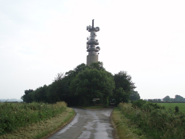
Wotton-under-Edge BT Tower

Wotton-under-Edge Tower is a 76.2 metres ( 250 ft) tall telecommunication tower built of reinforced concrete at Wotton-under-Edge in Gloucestershire, UK...

A4135 road

The A4135 road is a road in Gloucestershire, England, connecting the town of Tetbury with the M5 motorway and the A38 road to the west, passing through...
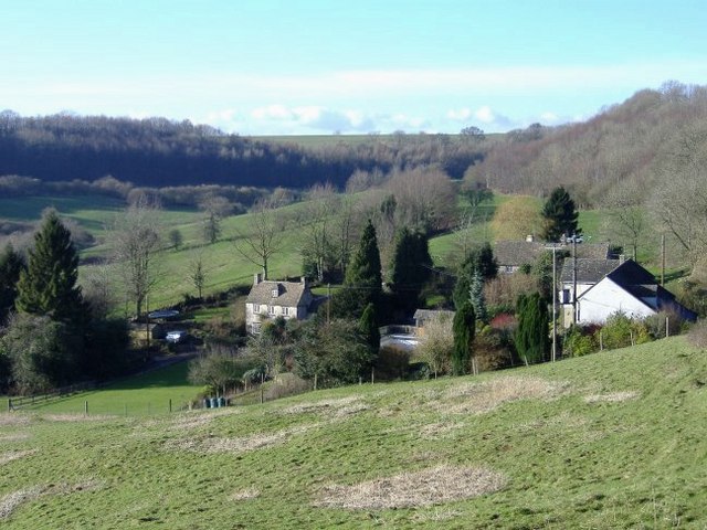
Ozleworth

Ozleworth is a village and civil parish in Gloucestershire, England, approximately 30 km (19 mi) south of Gloucester. It lies in the Cotswolds, an Area...

St Nicholas of Myra's Church, Ozleworth

St Nicholas of Myra's Church is a redundant Anglican church in the village of Ozleworth, Gloucestershire, England, in the care of The Churches Conservation...

Nearby Amenities

Located within 500m of 51.657097,-2.305189
The data included in this document is from www.openstreetmap.org. The data is made available under ODbL.

Have you been to Parker's Hill Wood?

Leave your review of Parker's Hill Wood below (or comments, questions and feedback).