Orchard Coppice
Wood, Forest in Dorset
England
Orchard Coppice
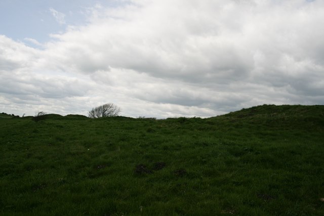
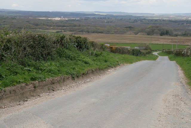
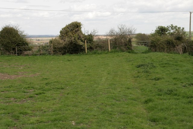
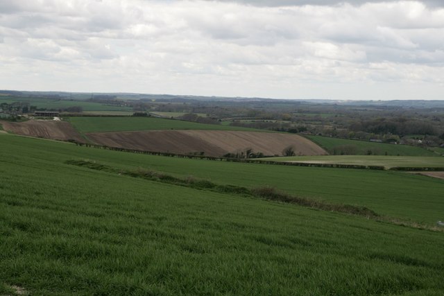
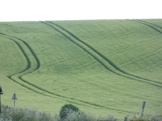
Orchard Coppice is a beautiful woodland located in the county of Dorset, England. Covering an area of approximately 50 acres, it is a popular destination for nature enthusiasts and outdoor lovers alike. The coppice is nestled in the heart of the countryside, offering visitors a peaceful and tranquil setting to explore.
The woodland is predominantly made up of native tree species such as oak, beech, and birch, creating a diverse and vibrant ecosystem. The dense canopy provides ample shade, making it an ideal retreat during hot summer months. Additionally, the forest floor is adorned with a carpet of wildflowers and ferns, adding to its natural beauty.
Orchard Coppice is home to a variety of wildlife, making it a haven for birdwatchers and animal lovers. Visitors may spot species such as woodpeckers, nuthatches, and tawny owls, among others. The forest also provides habitat for small mammals like hedgehogs and foxes, further enhancing its ecological significance.
For those interested in outdoor activities, the woodland offers numerous trails and paths for hiking and walking. There are also designated areas for picnicking and camping, allowing visitors to fully immerse themselves in the serenity of the surroundings. The management of Orchard Coppice focuses on sustainability and conservation, ensuring its preservation for future generations to enjoy.
Overall, Orchard Coppice in Dorset is a captivating natural retreat, where visitors can connect with nature, observe wildlife, and experience the tranquility of a picturesque woodland environment.
If you have any feedback on the listing, please let us know in the comments section below.
Orchard Coppice Images
Images are sourced within 2km of 50.667506/-2.3161411 or Grid Reference SY7785. Thanks to Geograph Open Source API. All images are credited.
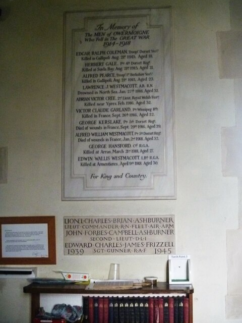
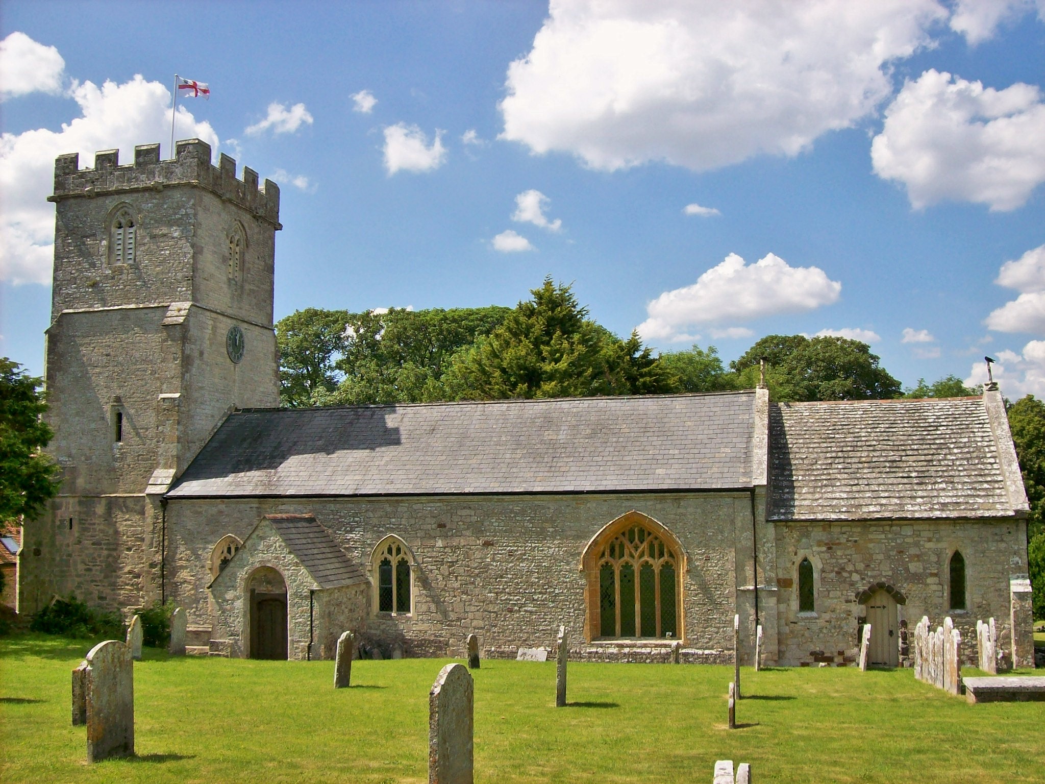
![Parish church [1] The Anglican parish church of St Michael was, except for the early 15th century tower, completely rebuilt in 1883 with some 13th and 16th century windows reset in the chancel. Constructed of rubble stone under tile roofs. Listed, grade II*, with details at: <span class="nowrap"><a title="https://historicengland.org.uk/listing/the-list/list-entry/1119232" rel="nofollow ugc noopener" href="https://historicengland.org.uk/listing/the-list/list-entry/1119232">Link</a><img style="margin-left:2px;" alt="External link" title="External link - shift click to open in new window" src="https://s1.geograph.org.uk/img/external.png" width="10" height="10"/></span>
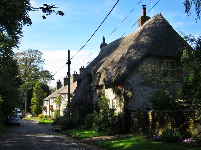
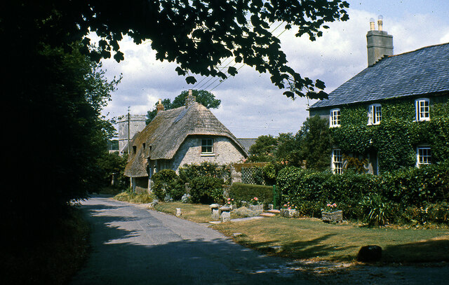
Owermoigne is a small Dorset village adjacent to the A352 road, some 6 miles southeast of Dorchester. Originally a Saxon settlement by the name of Ogre that later became Oweres, and the ancient landholding family of Le Moigne came together to give the village its name. The village surrounds the church of St Michael and most working residents commute into Dorchester.](https://s3.geograph.org.uk/geophotos/07/25/16/7251619_7464b2bf.jpg)
![Parish church [2] The nave and chancel.
The Anglican parish church of St Michael was, except for the early 15th century tower, completely rebuilt in 1883 with some 13th and 16th century windows reset in the chancel. Constructed of rubble stone under tile roofs. Listed, grade II*, with details at: <span class="nowrap"><a title="https://historicengland.org.uk/listing/the-list/list-entry/1119232" rel="nofollow ugc noopener" href="https://historicengland.org.uk/listing/the-list/list-entry/1119232">Link</a><img style="margin-left:2px;" alt="External link" title="External link - shift click to open in new window" src="https://s1.geograph.org.uk/img/external.png" width="10" height="10"/></span>
Owermoigne is a small Dorset village adjacent to the A352 road, some 6 miles southeast of Dorchester. Originally a Saxon settlement by the name of Ogre that later became Oweres, and the ancient landholding family of Le Moigne came together to give the village its name. The village surrounds the church of St Michael and most working residents commute into Dorchester.](https://s3.geograph.org.uk/geophotos/07/25/16/7251651_6528e0a5.jpg)
![Parish church [3] The chancel.
The Anglican parish church of St Michael was, except for the early 15th century tower, completely rebuilt in 1883 with some 13th and 16th century windows reset in the chancel. Constructed of rubble stone under tile roofs. Listed, grade II*, with details at: <span class="nowrap"><a title="https://historicengland.org.uk/listing/the-list/list-entry/1119232" rel="nofollow ugc noopener" href="https://historicengland.org.uk/listing/the-list/list-entry/1119232">Link</a><img style="margin-left:2px;" alt="External link" title="External link - shift click to open in new window" src="https://s1.geograph.org.uk/img/external.png" width="10" height="10"/></span>
Owermoigne is a small Dorset village adjacent to the A352 road, some 6 miles southeast of Dorchester. Originally a Saxon settlement by the name of Ogre that later became Oweres, and the ancient landholding family of Le Moigne came together to give the village its name. The village surrounds the church of St Michael and most working residents commute into Dorchester.](https://s2.geograph.org.uk/geophotos/07/25/16/7251654_3d199b4e.jpg)
![Parish church [4] The roof of the chancel.
The Anglican parish church of St Michael was, except for the early 15th century tower, completely rebuilt in 1883 with some 13th and 16th century windows reset in the chancel. Constructed of rubble stone under tile roofs. Listed, grade II*, with details at: <span class="nowrap"><a title="https://historicengland.org.uk/listing/the-list/list-entry/1119232" rel="nofollow ugc noopener" href="https://historicengland.org.uk/listing/the-list/list-entry/1119232">Link</a><img style="margin-left:2px;" alt="External link" title="External link - shift click to open in new window" src="https://s1.geograph.org.uk/img/external.png" width="10" height="10"/></span>
Owermoigne is a small Dorset village adjacent to the A352 road, some 6 miles southeast of Dorchester. Originally a Saxon settlement by the name of Ogre that later became Oweres, and the ancient landholding family of Le Moigne came together to give the village its name. The village surrounds the church of St Michael and most working residents commute into Dorchester.](https://s3.geograph.org.uk/geophotos/07/25/16/7251655_3e7a83ec.jpg)
![Parish church [5] The 18th century font.
The Anglican parish church of St Michael was, except for the early 15th century tower, completely rebuilt in 1883 with some 13th and 16th century windows reset in the chancel. Constructed of rubble stone under tile roofs. Listed, grade II*, with details at: <span class="nowrap"><a title="https://historicengland.org.uk/listing/the-list/list-entry/1119232" rel="nofollow ugc noopener" href="https://historicengland.org.uk/listing/the-list/list-entry/1119232">Link</a><img style="margin-left:2px;" alt="External link" title="External link - shift click to open in new window" src="https://s1.geograph.org.uk/img/external.png" width="10" height="10"/></span>
Owermoigne is a small Dorset village adjacent to the A352 road, some 6 miles southeast of Dorchester. Originally a Saxon settlement by the name of Ogre that later became Oweres, and the ancient landholding family of Le Moigne came together to give the village its name. The village surrounds the church of St Michael and most working residents commute into Dorchester.](https://s2.geograph.org.uk/geophotos/07/25/25/7252518_2cdf5fe8.jpg)
![Parish church [6] The small organ at the west end.
The Anglican parish church of St Michael was, except for the early 15th century tower, completely rebuilt in 1883 with some 13th and 16th century windows reset in the chancel. Constructed of rubble stone under tile roofs. Listed, grade II*, with details at: <span class="nowrap"><a title="https://historicengland.org.uk/listing/the-list/list-entry/1119232" rel="nofollow ugc noopener" href="https://historicengland.org.uk/listing/the-list/list-entry/1119232">Link</a><img style="margin-left:2px;" alt="External link" title="External link - shift click to open in new window" src="https://s1.geograph.org.uk/img/external.png" width="10" height="10"/></span>
Owermoigne is a small Dorset village adjacent to the A352 road, some 6 miles southeast of Dorchester. Originally a Saxon settlement by the name of Ogre that later became Oweres, and the ancient landholding family of Le Moigne came together to give the village its name. The village surrounds the church of St Michael and most working residents commute into Dorchester.](https://s3.geograph.org.uk/geophotos/07/25/25/7252519_887792dd.jpg)
![Parish church [7] Part of the churchyard.
The Anglican parish church of St Michael was, except for the early 15th century tower, completely rebuilt in 1883 with some 13th and 16th century windows reset in the chancel. Constructed of rubble stone under tile roofs. Listed, grade II*, with details at: <span class="nowrap"><a title="https://historicengland.org.uk/listing/the-list/list-entry/1119232" rel="nofollow ugc noopener" href="https://historicengland.org.uk/listing/the-list/list-entry/1119232">Link</a><img style="margin-left:2px;" alt="External link" title="External link - shift click to open in new window" src="https://s1.geograph.org.uk/img/external.png" width="10" height="10"/></span>
Owermoigne is a small Dorset village adjacent to the A352 road, some 6 miles southeast of Dorchester. Originally a Saxon settlement by the name of Ogre that later became Oweres, and the ancient landholding family of Le Moigne came together to give the village its name. The village surrounds the church of St Michael and most working residents commute into Dorchester.](https://s1.geograph.org.uk/geophotos/07/25/25/7252521_850874b2.jpg)
Orchard Coppice is located at Grid Ref: SY7785 (Lat: 50.667506, Lng: -2.3161411)
Unitary Authority: Dorset
Police Authority: Dorset
What 3 Words
///performed.speeches.hairspray. Near Bovington Camp, Dorset
Nearby Locations
Related Wikis

Owermoigne
Owermoigne ( OH-ər-MOYN) is a village and civil parish in the county of Dorset in southern England, situated 6 miles (9.7 km) south-east of Dorchester...

Five Marys
The Five Marys is a group of Bronze Age round barrows near the village of Chaldon Herring, in Dorset, England. The site is a scheduled monument. ��2�...

Bindon Liberty
Bindon Liberty was a liberty in the county of Dorset, England, containing the following parishes: Chaldon Herring Edmondsham (part) Moreton (part) Pulham...

Chaldon Herring
Chaldon Herring or East Chaldon is a village and civil parish in the English county of Dorset, about 8 miles (13 km) south-east of the county town of Dorchester...

Tadnoll and Winfrith Heath
Tadnoll and Winfrith Heath is a nature reserve of the Dorset Wildlife Trust, near the village of Winfrith Newburgh in Dorset, England. There is heathland...
Winfrith Newburgh
Winfrith Newburgh (), commonly called just Winfrith, is a village and civil parish in Dorset, England. It is about 8 miles (13 km) west of Wareham and...

Warmwell
Warmwell is a small village and civil parish in south west Dorset, England, situated on the B3390 road about 5 miles (8.0 km) southeast of Dorchester....
Crossways, Dorset
Crossways is a village and civil parish in the English county of Dorset. It lies 6 miles (9.7 km) east of the county town Dorchester. In the 2011 census...
Nearby Amenities
Located within 500m of 50.667506,-2.3161411Have you been to Orchard Coppice?
Leave your review of Orchard Coppice below (or comments, questions and feedback).