Moigne Court
Heritage Site in Dorset
England
Moigne Court
Moigne Court, located in the picturesque county of Dorset, England, is a historic heritage site that dates back to the 14th century. Situated near the village of Owermoigne, this magnificent manor house encapsulates the essence of medieval architecture and offers a glimpse into the region's rich history.
The origins of Moigne Court can be traced back to the Moigne family, who owned the property until the 17th century. The manor house itself boasts an impressive stone exterior, adorned with intricate carvings and mullioned windows, showcasing the craftsmanship of the era. The interior features a grand oak-panelled hall, complete with a striking stone fireplace and a vaulted ceiling, all of which have been meticulously preserved over the centuries.
The surrounding grounds of Moigne Court are equally captivating, with sprawling gardens and a tranquil moat that adds to the site's charm. The gardens are meticulously landscaped, featuring manicured lawns, vibrant flower beds, and a variety of mature trees. Exploring the grounds, visitors can discover a charming walled garden, a picturesque orchard, and even a medieval fish pond.
Today, Moigne Court is open to the public and serves as a popular venue for weddings, corporate events, and private functions. Its historical significance and stunning architectural features make it a sought-after location for those seeking a unique and memorable setting.
For history enthusiasts and those seeking a glimpse into the past, Moigne Court in Dorset offers a captivating experience that combines medieval charm with natural beauty.
If you have any feedback on the listing, please let us know in the comments section below.
Moigne Court Images
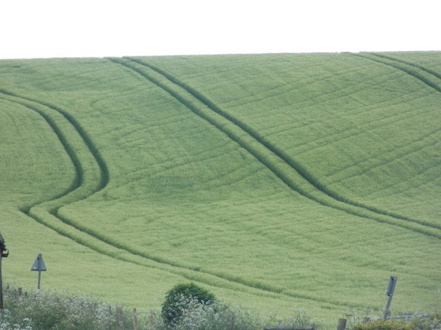
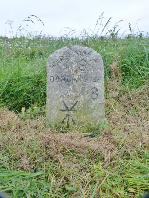
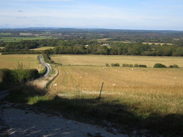
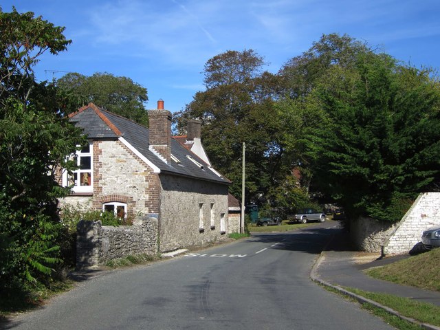
Images are sourced within 2km of 50.668/-2.318 or Grid Reference SY7785. Thanks to Geograph Open Source API. All images are credited.
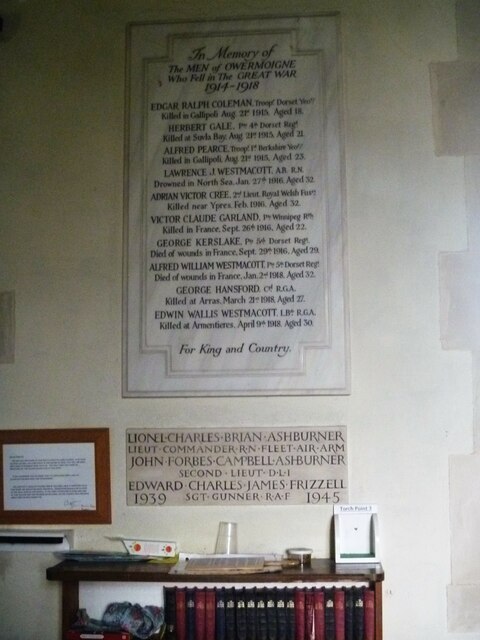
![Parish church [1] The Anglican parish church of St Michael was, except for the early 15th century tower, completely rebuilt in 1883 with some 13th and 16th century windows reset in the chancel. Constructed of rubble stone under tile roofs. Listed, grade II*, with details at: <span class="nowrap"><a title="https://historicengland.org.uk/listing/the-list/list-entry/1119232" rel="nofollow ugc noopener" href="https://historicengland.org.uk/listing/the-list/list-entry/1119232">Link</a><img style="margin-left:2px;" alt="External link" title="External link - shift click to open in new window" src="https://s1.geograph.org.uk/img/external.png" width="10" height="10"/></span>
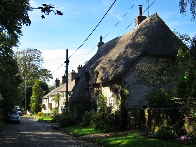
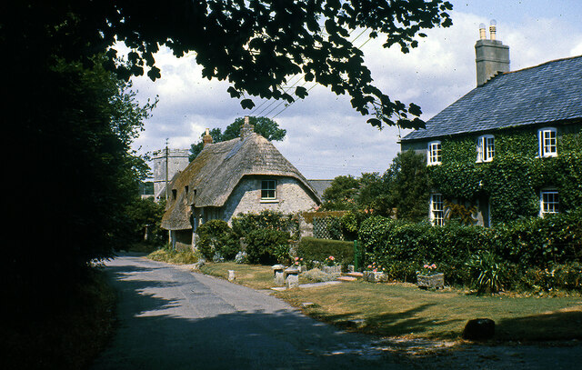
Owermoigne is a small Dorset village adjacent to the A352 road, some 6 miles southeast of Dorchester. Originally a Saxon settlement by the name of Ogre that later became Oweres, and the ancient landholding family of Le Moigne came together to give the village its name. The village surrounds the church of St Michael and most working residents commute into Dorchester.](https://s3.geograph.org.uk/geophotos/07/25/16/7251619_7464b2bf.jpg)
![Parish church [2] The nave and chancel.
The Anglican parish church of St Michael was, except for the early 15th century tower, completely rebuilt in 1883 with some 13th and 16th century windows reset in the chancel. Constructed of rubble stone under tile roofs. Listed, grade II*, with details at: <span class="nowrap"><a title="https://historicengland.org.uk/listing/the-list/list-entry/1119232" rel="nofollow ugc noopener" href="https://historicengland.org.uk/listing/the-list/list-entry/1119232">Link</a><img style="margin-left:2px;" alt="External link" title="External link - shift click to open in new window" src="https://s1.geograph.org.uk/img/external.png" width="10" height="10"/></span>
Owermoigne is a small Dorset village adjacent to the A352 road, some 6 miles southeast of Dorchester. Originally a Saxon settlement by the name of Ogre that later became Oweres, and the ancient landholding family of Le Moigne came together to give the village its name. The village surrounds the church of St Michael and most working residents commute into Dorchester.](https://s3.geograph.org.uk/geophotos/07/25/16/7251651_6528e0a5.jpg)
![Parish church [3] The chancel.
The Anglican parish church of St Michael was, except for the early 15th century tower, completely rebuilt in 1883 with some 13th and 16th century windows reset in the chancel. Constructed of rubble stone under tile roofs. Listed, grade II*, with details at: <span class="nowrap"><a title="https://historicengland.org.uk/listing/the-list/list-entry/1119232" rel="nofollow ugc noopener" href="https://historicengland.org.uk/listing/the-list/list-entry/1119232">Link</a><img style="margin-left:2px;" alt="External link" title="External link - shift click to open in new window" src="https://s1.geograph.org.uk/img/external.png" width="10" height="10"/></span>
Owermoigne is a small Dorset village adjacent to the A352 road, some 6 miles southeast of Dorchester. Originally a Saxon settlement by the name of Ogre that later became Oweres, and the ancient landholding family of Le Moigne came together to give the village its name. The village surrounds the church of St Michael and most working residents commute into Dorchester.](https://s2.geograph.org.uk/geophotos/07/25/16/7251654_3d199b4e.jpg)
![Parish church [4] The roof of the chancel.
The Anglican parish church of St Michael was, except for the early 15th century tower, completely rebuilt in 1883 with some 13th and 16th century windows reset in the chancel. Constructed of rubble stone under tile roofs. Listed, grade II*, with details at: <span class="nowrap"><a title="https://historicengland.org.uk/listing/the-list/list-entry/1119232" rel="nofollow ugc noopener" href="https://historicengland.org.uk/listing/the-list/list-entry/1119232">Link</a><img style="margin-left:2px;" alt="External link" title="External link - shift click to open in new window" src="https://s1.geograph.org.uk/img/external.png" width="10" height="10"/></span>
Owermoigne is a small Dorset village adjacent to the A352 road, some 6 miles southeast of Dorchester. Originally a Saxon settlement by the name of Ogre that later became Oweres, and the ancient landholding family of Le Moigne came together to give the village its name. The village surrounds the church of St Michael and most working residents commute into Dorchester.](https://s3.geograph.org.uk/geophotos/07/25/16/7251655_3e7a83ec.jpg)
![Parish church [5] The 18th century font.
The Anglican parish church of St Michael was, except for the early 15th century tower, completely rebuilt in 1883 with some 13th and 16th century windows reset in the chancel. Constructed of rubble stone under tile roofs. Listed, grade II*, with details at: <span class="nowrap"><a title="https://historicengland.org.uk/listing/the-list/list-entry/1119232" rel="nofollow ugc noopener" href="https://historicengland.org.uk/listing/the-list/list-entry/1119232">Link</a><img style="margin-left:2px;" alt="External link" title="External link - shift click to open in new window" src="https://s1.geograph.org.uk/img/external.png" width="10" height="10"/></span>
Owermoigne is a small Dorset village adjacent to the A352 road, some 6 miles southeast of Dorchester. Originally a Saxon settlement by the name of Ogre that later became Oweres, and the ancient landholding family of Le Moigne came together to give the village its name. The village surrounds the church of St Michael and most working residents commute into Dorchester.](https://s2.geograph.org.uk/geophotos/07/25/25/7252518_2cdf5fe8.jpg)
![Parish church [6] The small organ at the west end.
The Anglican parish church of St Michael was, except for the early 15th century tower, completely rebuilt in 1883 with some 13th and 16th century windows reset in the chancel. Constructed of rubble stone under tile roofs. Listed, grade II*, with details at: <span class="nowrap"><a title="https://historicengland.org.uk/listing/the-list/list-entry/1119232" rel="nofollow ugc noopener" href="https://historicengland.org.uk/listing/the-list/list-entry/1119232">Link</a><img style="margin-left:2px;" alt="External link" title="External link - shift click to open in new window" src="https://s1.geograph.org.uk/img/external.png" width="10" height="10"/></span>
Owermoigne is a small Dorset village adjacent to the A352 road, some 6 miles southeast of Dorchester. Originally a Saxon settlement by the name of Ogre that later became Oweres, and the ancient landholding family of Le Moigne came together to give the village its name. The village surrounds the church of St Michael and most working residents commute into Dorchester.](https://s3.geograph.org.uk/geophotos/07/25/25/7252519_887792dd.jpg)
![Parish church [7] Part of the churchyard.
The Anglican parish church of St Michael was, except for the early 15th century tower, completely rebuilt in 1883 with some 13th and 16th century windows reset in the chancel. Constructed of rubble stone under tile roofs. Listed, grade II*, with details at: <span class="nowrap"><a title="https://historicengland.org.uk/listing/the-list/list-entry/1119232" rel="nofollow ugc noopener" href="https://historicengland.org.uk/listing/the-list/list-entry/1119232">Link</a><img style="margin-left:2px;" alt="External link" title="External link - shift click to open in new window" src="https://s1.geograph.org.uk/img/external.png" width="10" height="10"/></span>
Owermoigne is a small Dorset village adjacent to the A352 road, some 6 miles southeast of Dorchester. Originally a Saxon settlement by the name of Ogre that later became Oweres, and the ancient landholding family of Le Moigne came together to give the village its name. The village surrounds the church of St Michael and most working residents commute into Dorchester.](https://s1.geograph.org.uk/geophotos/07/25/25/7252521_850874b2.jpg)
Moigne Court is located at Grid Ref: SY7785 (Lat: 50.668, Lng: -2.318)
Unitary Authority: Dorset
Police Authority: Dorset
What 3 Words
///static.bland.machine. Near Bovington Camp, Dorset
Nearby Locations
Related Wikis

Owermoigne
Owermoigne ( OH-ər-MOYN) is a village and civil parish in the county of Dorset in southern England, situated 6 miles (9.7 km) south-east of Dorchester...

Five Marys
The Five Marys is a group of Bronze Age round barrows near the village of Chaldon Herring, in Dorset, England. The site is a scheduled monument. ��2�...

Bindon Liberty
Bindon Liberty was a liberty in the county of Dorset, England, containing the following parishes: Chaldon Herring Edmondsham (part) Moreton (part) Pulham...

Chaldon Herring
Chaldon Herring or East Chaldon is a village and civil parish in the English county of Dorset, about 8 miles (13 km) south-east of the county town of Dorchester...
Nearby Amenities
Located within 500m of 50.668,-2.318Have you been to Moigne Court?
Leave your review of Moigne Court below (or comments, questions and feedback).