Pendock's Grove

Wood, Forest in Herefordshire

England

Pendock's Grove

A449 at Wayend Street
A449 at Wayend Street Credit: Peter Whatley

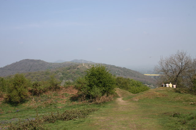
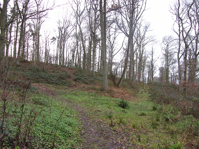
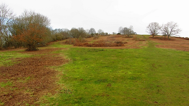
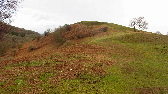
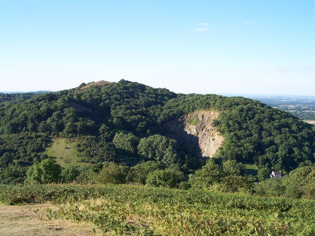
Pendock's Grove is a picturesque woodland located in Herefordshire, England. Situated in the heart of the county, it covers an area of approximately 50 acres and is renowned for its natural beauty and diverse array of flora and fauna.

The grove predominantly consists of broadleaf trees, including oak, beech, and ash, which create a dense canopy overhead, providing a cool and tranquil atmosphere. The forest floor is covered in a thick carpet of moss, ferns, and wildflowers, adding to the enchanting ambiance of the woodland.

Pendock's Grove is a haven for wildlife, with various species calling it home. It is common to spot deer grazing peacefully among the trees, while squirrels scurry about, collecting acorns and nuts. The grove is also a nesting ground for several species of birds, including woodpeckers and owls, which can be heard echoing through the trees.

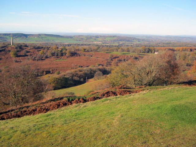
The woodland is intersected by a meandering stream, which adds to the charm of the landscape and provides a refreshing spot for visitors to rest and take in the natural surroundings. Several walking trails, varying in length and difficulty, have been established within the grove, allowing visitors to explore and appreciate the beauty of the woodland at their own pace.

Pendock's Grove is a popular destination for nature enthusiasts, hikers, and photographers alike. Its tranquil setting and abundance of wildlife make it a must-visit location for those seeking solace in the beauty of nature.

If you have any feedback on the listing, please let us know in the comments section below.

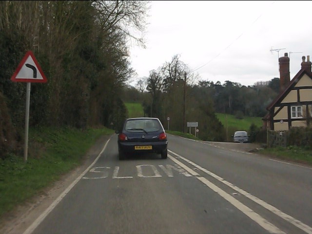
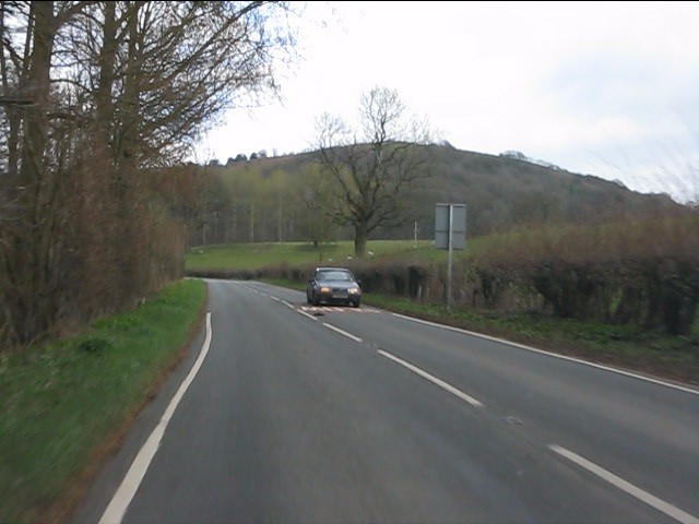
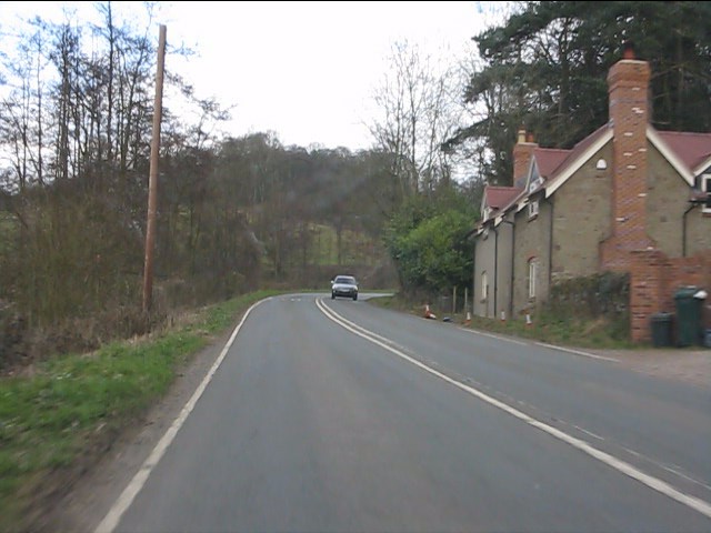
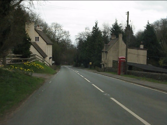
Pendock's Grove Images

Images are sourced within 2km of 52.021399/-2.3573002 or Grid Reference SO7535. Thanks to Geograph Open Source API. All images are credited.

A449 at Wayend Street
Hollybush Hill from the A438
Roadside cottages near Hollybush
A438 at Hollybush
A438 at Hollybush
Hollybush crossroads, A438
A438 near Coombegreen Common
A438 descends toward Rye Cross
Hollybush Hill It can be quite hard to imagine that 2000 years ago this quiet spot was part of a busy town - the Midsummer Hill iron-age hill-fort. 
Excavations in the late 1960s by Stan Stanford showed the area full of small building plots. 
Each plot had been reused time and time again over the centuries suggesting continuous occupation. 
The buildings used four posts arranged in a square - not at all like the round huts usually depicted for this era.
Evidence for similar square buildings have been found in other so called "hill-forts" in Herefordshire and the Welsh Marches
Hollybush Hill
It can be quite hard to imagine that 2000 years ago this quiet spot was part of a busy town - the Midsummer Hill iron-age hill-fort. Excavations in the late 1960s by Stan Stanford showed the area full of small building plots. Each plot had been reused time and time again over the centuries suggesting continuous occupation. The buildings used four posts arranged in a square - not at all like the round huts usually depicted for this era. Evidence for similar square buildings have been found in other so called "hill-forts" in Herefordshire and the Welsh Marches
North gate of Midsummer Hill iron-age  hill-fort Looking north along the Malvern Hills.
Another hill-fort occupies Herefordshire Beacon on the left.
Straight ahead are three overlapping peaks of Pinnacle Hill (north and south) and Black Hill.
In the far distance one can just make out Worcestershire Beacon in the haze.
North gate of Midsummer Hill iron-age hill-fort
Looking north along the Malvern Hills. Another hill-fort occupies Herefordshire Beacon on the left. Straight ahead are three overlapping peaks of Pinnacle Hill (north and south) and Black Hill. In the far distance one can just make out Worcestershire Beacon in the haze.
The shelter on Midsummer Hill The shelter was built by the owners of Eastnor Castle and the hill.
In 1923 the hill was given to the National Trust in memory of Captain Reginald Somers Cocks, MC who died in the first world war.
The shelter on Midsummer Hill
The shelter was built by the owners of Eastnor Castle and the hill. In 1923 the hill was given to the National Trust in memory of Captain Reginald Somers Cocks, MC who died in the first world war.
Hillfort ditch on Midsummer Hill Looking north-west from Midsummer Hill with the Somers Obelisk on the left and Peacock Villa on the right. A commanding view across the countryside as autumn takes a grip. The ditch just below runs around the complete top of Midsummer Hill and Hollybush Hill to enclose a large area. Less well-known than its neighbour the Hereford Beacon, but may well have been just as important in the Iron Age.
Hillfort ditch on Midsummer Hill
Looking north-west from Midsummer Hill with the Somers Obelisk on the left and Peacock Villa on the right. A commanding view across the countryside as autumn takes a grip. The ditch just below runs around the complete top of Midsummer Hill and Hollybush Hill to enclose a large area. Less well-known than its neighbour the Hereford Beacon, but may well have been just as important in the Iron Age.
The obelisk from Midsummer Hill From Midsummer Hill looking west across Eastnor Park to Frith Hill above Ledbury.
The obelisk from Midsummer Hill
From Midsummer Hill looking west across Eastnor Park to Frith Hill above Ledbury.
Hollybush Fete, Hollybush Church Hall, 2011 An auction of donated items too good for the bric-a-brac stall is taking place.
On the other side of the hall the skittles competition was taking place.
On this side books, CDs, a raffle.
Inside the hall, Cakes, jams, produce (I bought a box of quinces for £1!) clothes, and the bric-a-brac stall.
Scrummy cakes and cups of tea served in the adjoining room.
Hollybush Fete, Hollybush Church Hall, 2011
An auction of donated items too good for the bric-a-brac stall is taking place. On the other side of the hall the skittles competition was taking place. On this side books, CDs, a raffle. Inside the hall, Cakes, jams, produce (I bought a box of quinces for £1!) clothes, and the bric-a-brac stall. Scrummy cakes and cups of tea served in the adjoining room.
Skittles, Hollybush village fete, 2011 At the back of the church hall.
The ball return guttering is still working despite slowly deteriorating over the decades.
Skittles, Hollybush village fete, 2011
At the back of the church hall. The ball return guttering is still working despite slowly deteriorating over the decades.
Farmhouse at Golden Valley One of several timber-framed houses dotted around this part of the common. Beyond to the north is the ridge of the Malvern Hills.
Farmhouse at Golden Valley
One of several timber-framed houses dotted around this part of the common. Beyond to the north is the ridge of the Malvern Hills.
Hayes Coppice One of the many small woodlands in the surrounds of the Malvern Hills. This is a great place to visit if you like traditional old English woodland.  This is the Bromesberrow Estate in Gloucestershire, just to the north in Herefordshire is Eastnor which is also well wooded and very light on the Sitka.
 Oaks dominate the deep soils on the sandstones. Further up the hill on thin soils above Uriconian rocks ashes, some huge are the favoured tree.  Sadly the invasive sycamore is too common in the Malvern Hills, it thrived when grazing stopped.
Hayes Coppice
One of the many small woodlands in the surrounds of the Malvern Hills. This is a great place to visit if you like traditional old English woodland. This is the Bromesberrow Estate in Gloucestershire, just to the north in Herefordshire is Eastnor which is also well wooded and very light on the Sitka. Oaks dominate the deep soils on the sandstones. Further up the hill on thin soils above Uriconian rocks ashes, some huge are the favoured tree. Sadly the invasive sycamore is too common in the Malvern Hills, it thrived when grazing stopped.
Chase End Hill Path junction on the southern end of the Malvern Hills. It is much quieter here than up at the Malvern end and the paths are grass or moss covered. The common is about to be grazed again and fencing has been put in to keep the stock in.
In 2001 the Malvern Hills was closed off as part of precautions against foot and mouth disease. I can remember the feeling of being conned when  I later found out that there was no livestock up at the Malvern end as the sheep kept getting out and trashing expensive gardens. There was of course no need whatsoever to close the place down and we were all caught admiring the King's dashing new threads.  
The cessation of grazing has encouraged sycamores as well as the more desirable succession woodlands. Chase End has been regularly mown.
Chase End Hill
Path junction on the southern end of the Malvern Hills. It is much quieter here than up at the Malvern end and the paths are grass or moss covered. The common is about to be grazed again and fencing has been put in to keep the stock in. In 2001 the Malvern Hills was closed off as part of precautions against foot and mouth disease. I can remember the feeling of being conned when I later found out that there was no livestock up at the Malvern end as the sheep kept getting out and trashing expensive gardens. There was of course no need whatsoever to close the place down and we were all caught admiring the King's dashing new threads. The cessation of grazing has encouraged sycamores as well as the more desirable succession woodlands. Chase End has been regularly mown.
Chase End Hill Southern terminus of the Malvern Hills and an Uriconian foothold in Gloucestershire. The march with Worcestershire runs along the ridge with this western side being in Gloucestershire. The common is grazed again after a long period of being left.
Chase End Hill
Southern terminus of the Malvern Hills and an Uriconian foothold in Gloucestershire. The march with Worcestershire runs along the ridge with this western side being in Gloucestershire. The common is grazed again after a long period of being left.
Show me another place!

Pendock's Grove is located at Grid Ref: SO7535 (Lat: 52.021399, Lng: -2.3573002)

Unitary Authority: County of Herefordshire

Police Authority: West Mercia

What 3 Words

///submitted.sketches.usual. Near Donnington, Herefordshire

Related Wikis

Whiteleaved Oak

Whiteleaved Oak is a hamlet in the English county of Herefordshire, lying in a valley at the southern end of the Malvern Hills between Raggedstone Hill...

Raggedstone Hill

Raggedstone Hill is situated on the range of Malvern Hills that runs approximately 13 kilometres (8 mi) north-south along the Herefordshire-Worcestershire...

Hollybush, Worcestershire

Hollybush is a small village in Worcestershire at the southern end of the Malvern Hills and close to the borders of both Gloucestershire and Herefordshire...

Bronsil Castle

Bronsil Castle was a fortified manor house about 1 mile (1.6 km) to the east of Eastnor in Herefordshire, England near Ledbury). It is a Grade II* listed...

Midsummer Hill

Midsummer Hill is situated in the range of Malvern Hills that runs approximately 13 kilometres (8 mi) north-south along the Herefordshire-Worcestershire...

Hollybush Hill

Hollybush Hill is situated in the range of Malvern Hills that runs approximately 13 kilometres (8 mi) north–south along the Herefordshire–Worcestershire...

Rye Cross

Rye Cross is a hamlet in south-west Worcestershire 1 mile west of Castlemorton, 0.5 miles east of Berrow and 1 mile south of Hollybush, near the borders...

Eastnor Castle

Eastnor Castle, Eastnor, Herefordshire, is a 19th-century mock castle. Eastnor was built for John Cocks, 1st Earl Somers, who employed Robert Smirke, later...

Related Videos

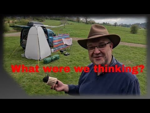
3 Youtubers go camping. Eastnor Castle April 2023

Join me, Damon and Rick for a relaxation packed weekend of Rain, blown down Toilet Tents, Clothes Pegs, Vodka laced Ice ...

Eastnor Castle in England 🏰 #england #ledbury #castle #shorts #travel #britain #royal

exploring the scenic views if Loch Lomond in Scotland. We went on a boat tour, had lunch and then the kids went inside Sea Life ...
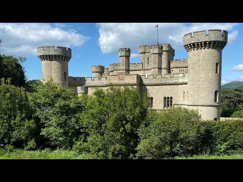
Eastnor Castle

Eastnor Castle interiors. Eastnor was built for The 1st Earl Somers, who employed Robert Smirke, who was later to work at the ...

B123 Ledbury & Eastnor Castle circular September 11th 2022

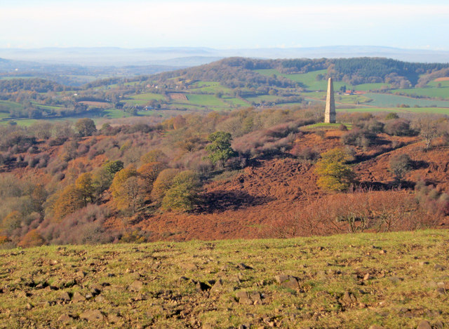
This walk takes you slowly up to the obelisk and down past the castle. Walking through Eastnor and back over the woods to ...

Nearby Amenities

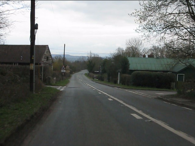
Located within 500m of 52.021399,-2.3573002
Whiteleaved Oak
Created By: Potlatch 0.10f
Is In: Herefordshire
Place: hamlet
Wikidata: Q3784154
Lat/Long: 52.0213882/-2.3516257
Barrier: cattle_grid
Lat/Long: 52.0201709/-2.3530398
Fixme: incomplete
Lat/Long: 52.0200758/-2.3537436
Post Box
Collection Times: Mo-Fr 10:30; Sa 10:30
Description: 10m W of a short spur leading to some houses.
There is a notice-board at this junction./(unnamed)
Post Box Mounting: pier
Post Box Type: lamp
Ref: HR8 332
Royal Cypher: EIIR
Royal Cypher Wikidata: Q33102113
Lat/Long: 52.0211463/-2.3513709
Information: board
Tourism: information
Lat/Long: 52.0212401/-2.3511703
Grit Bin
Lat/Long: 52.0211282/-2.3508186
Whiteleaved Oak
Power: pole
Transformer: distribution
Voltage Primary: 11000
Lat/Long: 52.0207861/-2.350688
The data included in this document is from www.openstreetmap.org. The data is made available under ODbL.

Have you been to Pendock's Grove?

Leave your review of Pendock's Grove below (or comments, questions and feedback).