Cattle Plantation Lower

Wood, Forest in Lancashire Hyndburn

England

Cattle Plantation Lower

Rossendale Way descending into Deep Clough After a long level stretch the Rossendale Way descends into the clough, to immediately climb up the other side.
Rossendale Way descending into Deep Clough Credit: Chris Heaton

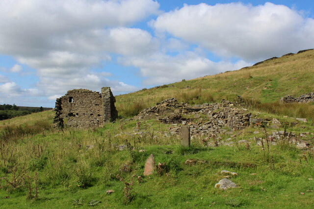
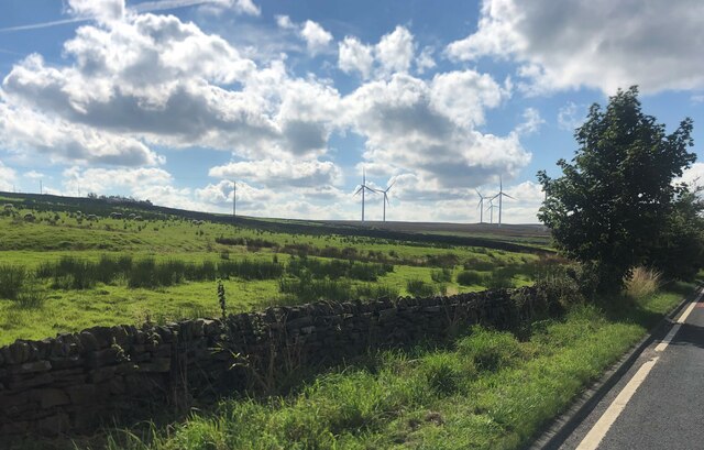
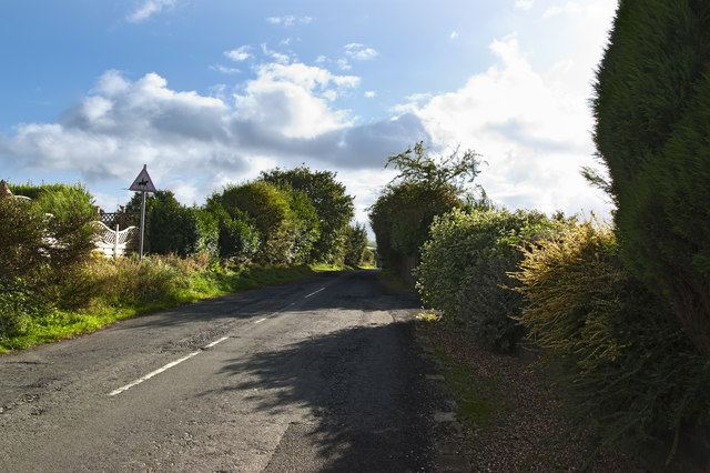
Cattle Plantation Lower is a picturesque woodland located in the county of Lancashire, England. Situated in the heart of the Forest of Bowland, this woodland area covers a vast expanse of approximately 500 acres, providing a tranquil and scenic retreat for nature enthusiasts and outdoor adventurers alike.

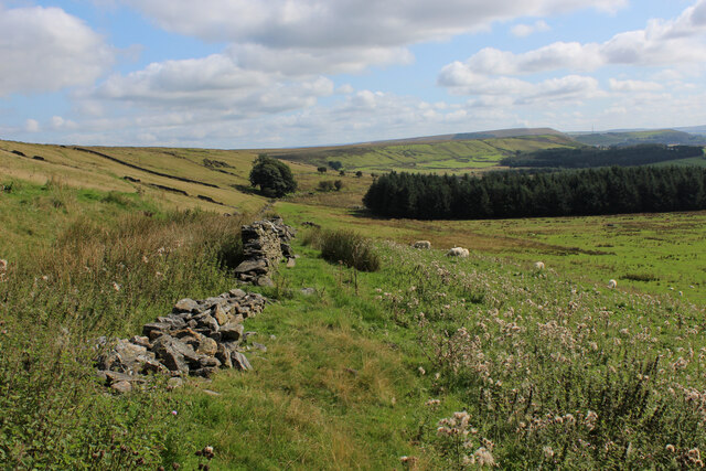
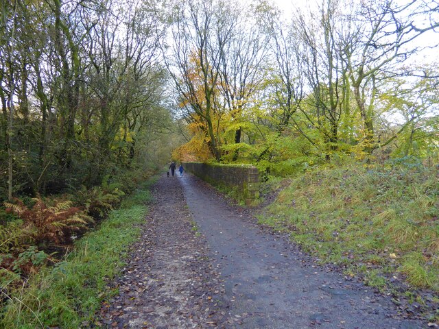
The wood is primarily composed of dense, mature trees, including oak, beech, and birch, which create a lush green canopy overhead. The forest floor is adorned with a variety of wildflowers, ferns, and mosses, adding to the area's natural beauty. Additionally, the woodland is intersected by babbling brooks and streams, creating a serene atmosphere and providing a habitat for various aquatic species.

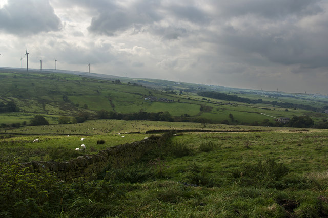
Cattle Plantation Lower is renowned for its diverse wildlife population. Visitors may catch a glimpse of deer, rabbits, squirrels, and a wide array of bird species, including woodpeckers, owls, and songbirds. The woodland is also home to several rare and protected species, such as the red squirrel and the great crested newt, making it a site of special scientific interest.

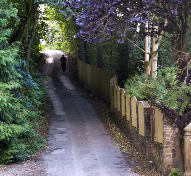
The plantation offers a network of well-maintained footpaths and trails, allowing visitors to explore the woodland at their own pace. Hiking, birdwatching, and photography are popular activities enjoyed by visitors. The tranquil setting of Cattle Plantation Lower also makes it an ideal spot for picnics and relaxation.

Overall, Cattle Plantation Lower, Lancashire, is a hidden gem within the Forest of Bowland, offering a unique opportunity to immerse oneself in the natural beauty and tranquility of a traditional English woodland.

If you have any feedback on the listing, please let us know in the comments section below.

Cattle Plantation Lower Images

Images are sourced within 2km of 53.723337/-2.3750163 or Grid Reference SD7525. Thanks to Geograph Open Source API. All images are credited.

Rossendale Way descending into Deep Clough After a long level stretch the Rossendale Way descends into the clough, to immediately climb up the other side.
Rossendale Way descending into Deep Clough
After a long level stretch the Rossendale Way descends into the clough, to immediately climb up the other side.
Deep Clough Short watercourse smothered in vegetation, draining off Haslingden Moor into Jamestone Quarry and onto Ogden Reservoir
Deep Clough
Short watercourse smothered in vegetation, draining off Haslingden Moor into Jamestone Quarry and onto Ogden Reservoir
Rossendale Way passing a Ruined Farmhouse The upper reaches of the Ogden Valley is littered with the ruins of many buildings.
Rossendale Way passing a Ruined Farmhouse
The upper reaches of the Ogden Valley is littered with the ruins of many buildings.
Rossendale Way below Nab Hill A 41 mile circular high level route that roughly follows the boundary of Rossendale Borough.
Yellow indicators stamped with an "RW" logo in green leads the walker around the environs of Bacup, Rawtenstall, Haslingden and Whitworth.
Rossendale Way below Nab Hill
A 41 mile circular high level route that roughly follows the boundary of Rossendale Borough. Yellow indicators stamped with an "RW" logo in green leads the walker around the environs of Bacup, Rawtenstall, Haslingden and Whitworth.
Windmills on Oswaltwistle Moor
Cycle path following route of former railway On the Hyndburn Greenway with the walling on the right protecting traffic from falling down a steep drop into Woodnook Water
Cycle path following route of former railway
On the Hyndburn Greenway with the walling on the right protecting traffic from falling down a steep drop into Woodnook Water
A steep path up Nab Hill
Wind Turbine on Oswaldtwistle Moor
Houses by the junction at Green Haworth
Pot House Lane
Pot House Lane
Hoyle Bottom
Hoyle Bottom
Hyndburn Wind Farm
Hyndburn Wind Farm
Hyndburn Wind Farm The wind farm has 12 x 2.05 MW turbines which are 122 metres high to the tip of the blade. The total installed capacity is 24.6 MW. They generated enough electricity to power the equivalent of over 36,847 homes between October 2012 and October 2014.
Hyndburn Wind Farm
The wind farm has 12 x 2.05 MW turbines which are 122 metres high to the tip of the blade. The total installed capacity is 24.6 MW. They generated enough electricity to power the equivalent of over 36,847 homes between October 2012 and October 2014.
Looking down the hill near Rothwell Heights
A fellow Geographer?
Green Haworth C of E Primary School
Hyndburn Wind Farm The wind farm has 12 x 2.05 MW turbines which are 122 metres high to the tip of the blade. The total installed capacity is 24.6 MW. They generated enough electricity to power the equivalent of over 36,847 homes between October 2012 and October 2014.
Hyndburn Wind Farm
The wind farm has 12 x 2.05 MW turbines which are 122 metres high to the tip of the blade. The total installed capacity is 24.6 MW. They generated enough electricity to power the equivalent of over 36,847 homes between October 2012 and October 2014.
A drystone wall overgrown in places
Show me another place!

Cattle Plantation Lower is located at Grid Ref: SD7525 (Lat: 53.723337, Lng: -2.3750163)

Administrative County: Lancashire

District: Hyndburn

Police Authority: Lancashire

What 3 Words

///originals.locate.radiates. Near Church, Lancashire

Related Wikis

The Hollins

The Hollins (formerly known as The Hollins Technology College until 2017) is a coeducational secondary school located in Accrington in the English county...

Baxenden railway station

Baxenden railway station served the villages of Baxenden in Hyndburn and Rising Bridge in Rossendale. It was situated just inside the old boundary of Haslingden...

Haworth Art Gallery

The Haworth Art Gallery is a public art gallery located in Accrington, Lancashire, northwest England, and is the home of the largest collection in Europe...

Mount Carmel Roman Catholic High School

Mount Carmel Roman Catholic High School is a coeducational Roman Catholic secondary school located in Accrington, a town located in the county of Lancashire...

Nearby Amenities

Located within 500m of 53.723337,-2.3750163
The data included in this document is from www.openstreetmap.org. The data is made available under ODbL.

Have you been to Cattle Plantation Lower?

Leave your review of Cattle Plantation Lower below (or comments, questions and feedback).