Cowcliffe

Settlement in Yorkshire

England

Cowcliffe

The Peacock on Leeds Road
The Peacock on Leeds Road Credit: Ian S

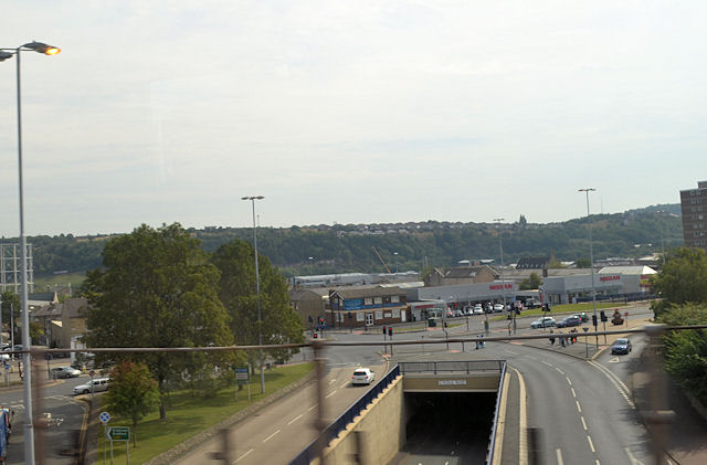
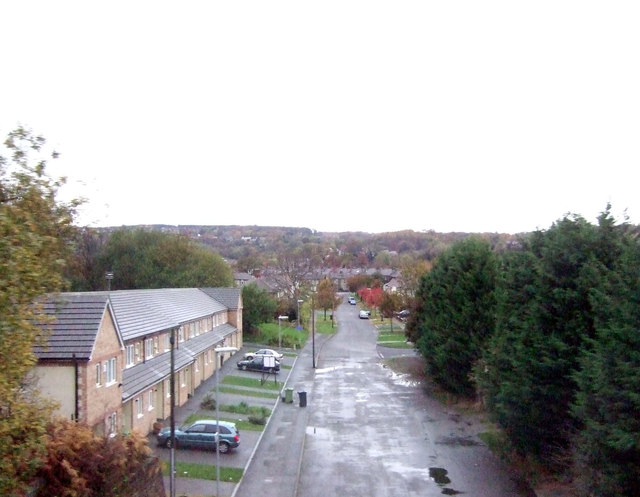
Cowcliffe is a small suburban area located in Huddersfield, West Yorkshire, England. It is situated on the southern slopes of the Holme Valley, approximately 3 miles northeast of Huddersfield town center. The area is predominantly residential and offers a tranquil environment with picturesque views of the surrounding countryside.

Cowcliffe benefits from its close proximity to Huddersfield, providing convenient access to a wide range of amenities and services. The nearby town offers numerous shopping centers, supermarkets, restaurants, and entertainment options, catering to the diverse needs of the community.

The housing in Cowcliffe primarily consists of semi-detached and detached houses, many of which boast spacious gardens and ample parking. The area is known for its well-maintained properties and a strong sense of community. The local schools, including Cowcliffe Junior School and Cowcliffe Infant and Nursery School, are highly regarded for their quality education.

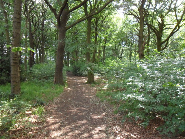
For outdoor enthusiasts, Cowcliffe offers easy access to the beautiful countryside of Yorkshire. The area is surrounded by rolling hills and green spaces, providing ample opportunities for walking, hiking, and exploring nature. The nearby Castle Hill, a prominent local landmark, offers panoramic views of the surrounding area.

Transportation in Cowcliffe is convenient, with regular bus services connecting the area to Huddersfield and other nearby towns. The M62 motorway is easily accessible, providing convenient links to major cities such as Leeds and Manchester.

Overall, Cowcliffe is a charming residential area that combines the tranquility of the countryside with the convenience of nearby urban amenities, making it an attractive place to live for families and individuals alike.

If you have any feedback on the listing, please let us know in the comments section below.
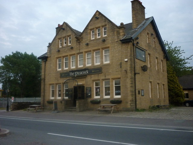
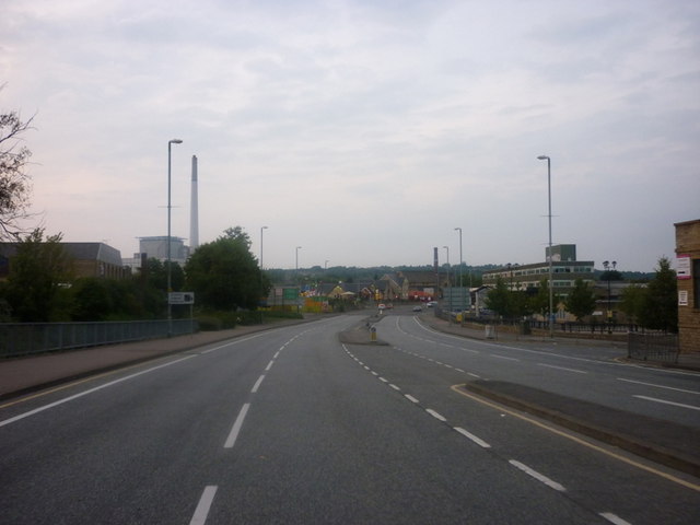
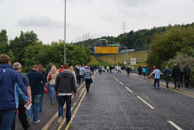
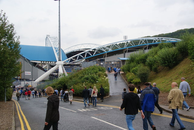
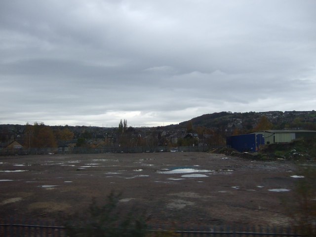
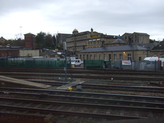
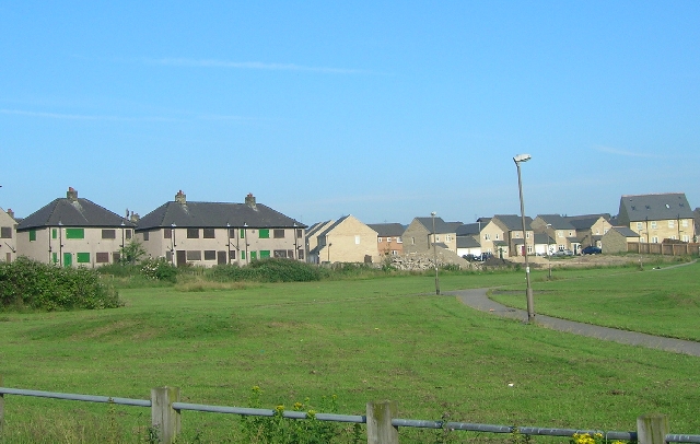
Cowcliffe Images

Images are sourced within 2km of 53.666839/-1.788835 or Grid Reference SE1418. Thanks to Geograph Open Source API. All images are credited.

The Peacock on Leeds Road
The A62, Leeds Road
The A62, Leeds Road
Walking to the Galpharm Stadium The road crosses the River Colne just here.
Walking to the Galpharm Stadium
The road crosses the River Colne just here.
The Galpharm Stadium The approach from the south west end. I understand that the stadium was going to be renamed a couple of years ago because Galpharm were taken over, but nothing appears to have happened since.
The Galpharm Stadium
The approach from the south west end. I understand that the stadium was going to be renamed a couple of years ago because Galpharm were taken over, but nothing appears to have happened since.
Before the match in the Galpharm Stadium The first match of the new season. Huddersfield Town FC are the League One title favourites, but were disappointed by a draw in this match.
Before the match in the Galpharm Stadium
The first match of the new season. Huddersfield Town FC are the League One title favourites, but were disappointed by a draw in this match.
Gasworks Street Aptly named street with the gasholder still in use.
Gasworks Street
Aptly named street with the gasholder still in use.
Leeds Road, Huddersfield This is the A62 shortly before it reaches the inner ring road.
Leeds Road, Huddersfield
This is the A62 shortly before it reaches the inner ring road.
House under construction, Halifax Old Road, Cowcliffe
Castlegate Huddersfield from railway bridge
Across Huddersfield to football stadium
Lower Fell Greave Public footpath through Lower Fell Greave on a sunny summer morning.  There has been a wood here since at least the twelfth century when it was part of the Fountains Abbey estate.
Lower Fell Greave
Public footpath through Lower Fell Greave on a sunny summer morning. There has been a wood here since at least the twelfth century when it was part of the Fountains Abbey estate.
Huddersfield Broad Canal With a pipe bridge & beyond that Gasworks Street road bridge.
Huddersfield Broad Canal
With a pipe bridge & beyond that Gasworks Street road bridge.
'The Fantastic Media Stand', Galpharm Stadium Huddersfield Town vs Preston North End 22 October 2011, just prior to the teams emergence. 
Result = HTAFC 3(Jordan Rhodes hat-trick) - PNE 1.
'The Fantastic Media Stand', Galpharm Stadium
Huddersfield Town vs Preston North End 22 October 2011, just prior to the teams emergence. Result = HTAFC 3(Jordan Rhodes hat-trick) - PNE 1.
Almost kick-off time at the Galpharm Stadium Huddersfield Town and Preston North End, with attendant mascots, shake hands before the kick-off. HTAFC 3 PNE 1. Jordan Rhodes hat-trick.
Almost kick-off time at the Galpharm Stadium
Huddersfield Town and Preston North End, with attendant mascots, shake hands before the kick-off. HTAFC 3 PNE 1. Jordan Rhodes hat-trick.
The Final Score Disconsolate (or worse) Preston supporters leaving the visitors stand under the display screen. A hat-trick the second in successive games for Jordan Rhodes.
The Final Score
Disconsolate (or worse) Preston supporters leaving the visitors stand under the display screen. A hat-trick the second in successive games for Jordan Rhodes.
Red Doles Road
Red Doles Road
Industrial site, Hillhouse
Railway near Huddersfield Station
Show me another place!

Cowcliffe is located at Grid Ref: SE1418 (Lat: 53.666839, Lng: -1.788835)

Division: West Riding

Unitary Authority: Kirklees

Police Authority: West Yorkshire

What 3 Words

///slime.lonely.pipes. Near Huddersfield, West Yorkshire

Related Wikis

Cowcliffe

Cowcliffe is an area of Huddersfield, West Yorkshire, England. It is situated between Fixby and Birkby based around Cowcliffe Hill Road. Cowcliffe is a...
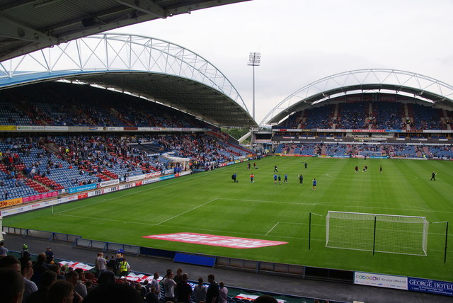
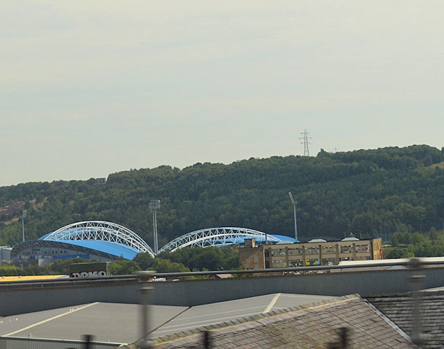
Fartown Ground

The Fartown Ground or just simply Fartown is a sports ground located in the Huddersfield suburb of Fartown in West Yorkshire, England and is predominantly...

Fartown, Huddersfield

Fartown is a district of Huddersfield, West Yorkshire, England that starts 0.6 miles (1 km) north of the town centre. Fartown runs for approximately 1...

Birkby, Huddersfield

Birkby is a large multi-cultural suburb close to the town centre in Huddersfield, in the Kirklees borough of West Yorkshire, England. It has a population...

Fixby

Fixby is a suburb in north-west Kirklees bordering neighbouring Calderdale and is traditionally part of Huddersfield in the English county of West Yorkshire...

Huddersfield workhouse scandal

The Huddersfield workhouse scandal concerned the conditions in the workhouse at Huddersfield, England in 1848. The problems included overcrowding, disease...

North Huddersfield Trust School

North Huddersfield Trust School (formerly Fartown High School) is a coeducational secondary school located in the Fartown area of Huddersfield, West Yorkshire...

Brackenhall

Brackenhall is a district of Huddersfield, West Yorkshire, England located 2 miles (3 km) north of Huddersfield town centre between Fixby and Sheepridge...

Nearby Amenities

Located within 500m of 53.666839,-1.788835
Bus Stop
Halifax Old Road Grimscar Avenue
Bus: yes
Local Ref: 45022116
Naptan AtcoCode: 450022116
Naptan Bearing: E
Naptan CommonName: Halifax Old Road Grimscar Avenue
Naptan Crossing: Grimscar Avenue
Naptan Indicator: Stop 45022116
Naptan Notes: OSR taken place 301105
Naptan PlusbusZoneRef: LEEDS
Naptan ShortCommonName: Scale Hill
Naptan Street: Halifax Old Road
Naptan Verified: no
Public Transport: platform
Source: naptan_import
Lat/Long: 53.663396/-1.7907299
Bus Stop
Halifax Old Road Grimescar Avenue
Local Ref: 45022117
Naptan AtcoCode: 450022117
Naptan Bearing: W
Naptan CommonName: Halifax Old Road Grimescar Avenue
Naptan Crossing: Grimscar Avenue
Naptan Indicator: Stop 45022117
Naptan Notes: OSR taken place 301105
Naptan PlusbusZoneRef: LEEDS
Naptan ShortCommonName: Grimscar Avenue
Naptan Street: Halifax Old Road
Naptan Verified: no
Source: naptan_import
Lat/Long: 53.6634243/-1.7912985
Bus Stop
Cowcliffe Hill Road Halifax Old Road
Local Ref: 45022120
Naptan AtcoCode: 450022120
Naptan Bearing: SW
Naptan CommonName: Cowcliffe Hill Road Halifax Old Road
Naptan Crossing: Halifax Old Road
Naptan Indicator: Stop 45022120
Naptan PlusbusZoneRef: LEEDS
Naptan ShortCommonName: Halifax Old Road
Naptan Street: Cowcliffe Hill Road
Naptan Verified: no
Source: naptan_import
Lat/Long: 53.6630138/-1.788734
Bus Stop
Cowcliffe Hill Road Birklands Road
Local Ref: 45022121
Naptan AtcoCode: 450022121
Naptan Bearing: S
Naptan CommonName: Cowcliffe Hill Road Birklands Road
Naptan Crossing: Birklands Road
Naptan Indicator: Stop 45022121
Naptan PlusbusZoneRef: LEEDS
Naptan ShortCommonName: Birklands Road
Naptan Street: Cowcliffe Hill Road
Naptan Verified: no
Source: naptan_import
Lat/Long: 53.6646977/-1.7904509
Bus Stop
Cowcliffe Hill Road Birklands Road
Local Ref: 45022122
Naptan AtcoCode: 450022122
Naptan Bearing: N
Naptan CommonName: Cowcliffe Hill Road Birklands Road
Naptan Crossing: Birklands Road
Naptan Indicator: Stop 45022122
Naptan PlusbusZoneRef: LEEDS
Naptan ShortCommonName: Birklands Road
Naptan Street: Cowcliffe Hill Road
Naptan Verified: no
Source: naptan_import
Lat/Long: 53.664842/-1.7907529
Bus Stop
Cowcliffe Hill Road Netheroyd Hill Road
Local Ref: 45022123
Naptan AtcoCode: 450022123
Naptan Bearing: N
Naptan CommonName: Cowcliffe Hill Road Netheroyd Hill Road
Naptan Crossing: North Cross Road
Naptan Indicator: Stop 45022123
Naptan Landmark: Shepherds Arms PH
Naptan Notes: OSR taken place 301105
Naptan PlusbusZoneRef: LEEDS
Naptan ShortCommonName: North Cross Road
Naptan Street: Cowcliffe Hill Road
Naptan Verified: no
Source: naptan_import
Lat/Long: 53.6671785/-1.7904386
Bus Stop
Netheroyd Hill Road Cowcliffe Hill Road
Local Ref: 45022124
Naptan AtcoCode: 450022124
Naptan Bearing: W
Naptan CommonName: Netheroyd Hill Road Cowcliffe Hill Road
Naptan Crossing: Netheroyd Hill Road
Naptan Indicator: Stop 45022124
Naptan Landmark: Shepherds Arms PH
Naptan Notes: OSR taken place 301105
Naptan PlusbusZoneRef: LEEDS
Naptan ShortCommonName: Netheroyd Hill Road
Naptan Street: Cowcliffe Hill Road
Naptan Verified: no
Source: naptan_import
Lat/Long: 53.6674029/-1.7902861
Bus Stop
Netheroyd Hill Road Folly Road
Local Ref: 45022125
Naptan AtcoCode: 450022125
Naptan Bearing: NE
Naptan CommonName: Netheroyd Hill Road Folly Road
Naptan Crossing: Nr-Opp Folly Road
Naptan Indicator: Stop 45022125
Naptan PlusbusZoneRef: LEEDS
Naptan ShortCommonName: Folly Road
Naptan Street: Netheroyd Hill Road
Naptan Verified: no
Source: naptan_import
Lat/Long: 53.668016/-1.7862873
Bus Stop
Netheroyd Hill Road Folly Road
Local Ref: 45022126
Naptan AtcoCode: 450022126
Naptan Bearing: SW
Naptan CommonName: Netheroyd Hill Road Folly Road
Naptan Crossing: Nr-At Folly Road
Naptan Indicator: Stop 45022126
Naptan PlusbusZoneRef: LEEDS
Naptan ShortCommonName: Folly Road
Naptan Street: Netheroyd Hill Road
Naptan Verified: no
Source: naptan_import
Lat/Long: 53.667944/-1.786212
Bus Stop
Netheroyd Hill Road Folly Road
Local Ref: 45022127
Naptan AtcoCode: 450022127
Naptan Bearing: SE
Naptan CommonName: Netheroyd Hill Road Folly Road
Naptan Indicator: Stop 45022127
Naptan Notes: OSR taken place 301105 size 2 case fitted
Naptan PlusbusZoneRef: LEEDS
Naptan ShortCommonName: Folly Road
Naptan Street: Netheroyd Hill Road
Naptan Verified: no
Source: naptan_import
Lat/Long: 53.669354/-1.7855998
Bus Stop
Netheroyd Hill Road Folly Road
Local Ref: 45022128
Naptan AtcoCode: 450022128
Naptan Bearing: NW
Naptan CommonName: Netheroyd Hill Road Folly Road
Naptan Indicator: Stop 45022128
Naptan PlusbusZoneRef: LEEDS
Naptan ShortCommonName: Ivy House Farm
Naptan Street: Netheroyd Hill Road
Naptan Verified: no
Source: naptan_import
Lat/Long: 53.6697956/-1.7861875
Bus Stop
York Avenue Cawthorne Avenue
Local Ref: 45022139
Naptan AtcoCode: 450022139
Naptan Bearing: SW
Naptan CommonName: York Avenue Cawthorne Avenue
Naptan Crossing: Cawthorne Avenue
Naptan Indicator: Stop 45022139
Naptan PlusbusZoneRef: LEEDS
Naptan ShortCommonName: Cawthorne Avenue
Naptan Street: York Avenue
Naptan Verified: no
Source: naptan_import
Lat/Long: 53.6653062/-1.7838492
Bus Stop
York Avenue Cawthorne Avenue
Local Ref: 45022140
Naptan AtcoCode: 450022140
Naptan Bearing: NE
Naptan CommonName: York Avenue Cawthorne Avenue
Naptan Crossing: Cawthorne Avenue
Naptan Indicator: Stop 45022140
Naptan Notes: OSR taken place 301105
Naptan PlusbusZoneRef: LEEDS
Naptan ShortCommonName: Cawthorne Avenue
Naptan Street: York Avenue
Naptan Verified: no
Source: naptan_import
Lat/Long: 53.6653963/-1.783985
Bus Stop
York Avenue Pateley Crescent
Local Ref: 45022141
Naptan AtcoCode: 450022141
Naptan Bearing: E
Naptan CommonName: York Avenue Pateley Crescent
Naptan Crossing: Pateley Crescent
Naptan Indicator: Stop 45022141
Naptan Notes: OSR taken place 301105
Naptan PlusbusZoneRef: LEEDS
Naptan ShortCommonName: Pateley Crescent
Naptan Street: York Avenue
Naptan Verified: no
Source: naptan_import
Lat/Long: 53.6648272/-1.7874537
Bus Stop
York Avenue Pateley Crescent
Local Ref: 45022142
Naptan AtcoCode: 450022142
Naptan Bearing: NW
Naptan CommonName: York Avenue Pateley Crescent
Naptan Crossing: Pateley Crescent
Naptan Indicator: Stop 45022142
Naptan Notes: OSR taken place 301105
Naptan PlusbusZoneRef: LEEDS
Naptan ShortCommonName: Pateley Crescent
Naptan Street: York Avenue
Naptan Verified: no
Source: naptan_import
Lat/Long: 53.6648188/-1.7877413
Bus Stop
York Avenue Cowcliffe Hill Road
Local Ref: 45022143
Naptan AtcoCode: 450022143
Naptan Bearing: E
Naptan CommonName: York Avenue Cowcliffe Hill Road
Naptan Crossing: Cowcliffe Hill Road
Naptan Indicator: Stop 45022143
Naptan PlusbusZoneRef: LEEDS
Naptan ShortCommonName: Cowcliffe Hill Road
Naptan Street: York Avenue
Naptan Verified: no
Source: naptan_import
Lat/Long: 53.665039/-1.7902827
Bus Stop
York Avenue Cowcliffe Hill Road
Local Ref: 45022144
Naptan AtcoCode: 450022144
Naptan Bearing: W
Naptan CommonName: York Avenue Cowcliffe Hill Road
Naptan Crossing: Cowcliffe Hill Road
Naptan Indicator: Stop 45022144
Naptan Landmark: Sub Station
Naptan Notes: OSR taken place 301105 size 1 case fitted
Naptan PlusbusZoneRef: LEEDS
Naptan ShortCommonName: Birklands Road
Naptan Street: York Avenue
Naptan Verified: no
Source: naptan_import
Lat/Long: 53.6649224/-1.7904649
Bus Stop
Cowcliffe Hall Road Halifax Old Road
Local Ref: 45027527
Naptan AtcoCode: 450027527
Naptan Bearing: NE
Naptan CommonName: Cowcliffe Hall Road Halifax Old Road
Naptan Crossing: Halifax Old Road
Naptan Indicator: Stop 45027527
Naptan PlusbusZoneRef: LEEDS
Naptan ShortCommonName: Halifax Old Road
Naptan Street: Cowcliffe Hall Road
Naptan Verified: no
Source: naptan_import
Lat/Long: 53.6630949/-1.7888395
Cowcliffe
Is In: Huddersfield
Is In Country: UK
Is In County: West Yorkshire
Is In District: Kirklees
Is In Town: Huddersfield
Place: suburb
Lat/Long: 53.6678728/-1.7896515
Post Box
Operator: Royal Mail
Post Box Type: lamp
Royal Cypher: EIIR
Royal Cypher Wikidata: Q33102113
Source: survey
Lat/Long: 53.6702455/-1.7863953
Pub
The Shepherds Arms
Source: survey
Lat/Long: 53.6676267/-1.7902224
Leisure: playground
Source: survey
Lat/Long: 53.6688958/-1.7896476
Generator Method: photovoltaic
Generator Output Electricity: yes
Generator Source: solar
Generator Type: solar_photovoltaic_panel
Location: roof
Power: generator
Lat/Long: 53.6694227/-1.7916915
Generator Method: photovoltaic
Generator Output Electricity: yes
Generator Source: solar
Generator Type: solar_photovoltaic_panel
Location: roof
Power: generator
Lat/Long: 53.6691176/-1.7918525
Barrier: stile
Foot: designated
Material: stone
Stile: squeezer
Lat/Long: 53.6666285/-1.7950977
Bench
Backrest: yes
Material: wood
Lat/Long: 53.6639502/-1.7837172
Recycling
Recycling Type: container
Lat/Long: 53.6689687/-1.7904564
The data included in this document is from www.openstreetmap.org. The data is made available under ODbL.

Have you been to Cowcliffe?

Leave your review of Cowcliffe below (or comments, questions and feedback).