Fartown

Settlement in Yorkshire

England

Fartown

Huddersfield station and statue of Harold Wilson One of the premier station frontages in England forms the backcloth to a statue of a famous former premier of Britain. The statue is located in the restored St Georges Square.
Huddersfield station and statue of Harold Wilson Credit: Michael Fox

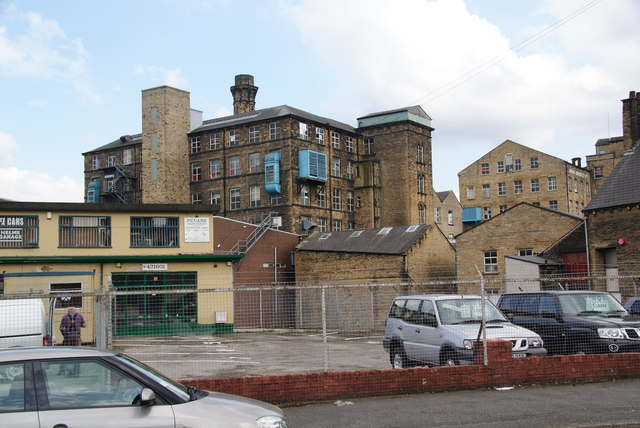
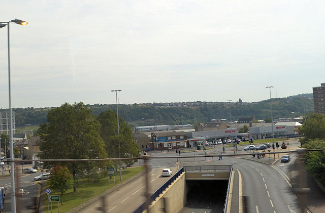
Fartown is a suburb located in Huddersfield, West Yorkshire, England. Situated approximately two miles northeast of Huddersfield city center, it is a relatively small area covering around 0.5 square miles. Fartown primarily comprises residential housing, with a mix of terraced houses, semi-detached homes, and some larger detached properties.

The suburb has a rich history, dating back to the 18th century when it was predominantly an agricultural area. Over time, it has seen significant urban development, and today, Fartown is a vibrant and diverse community. The area is known for its strong sense of community spirit and friendly atmosphere, with many long-term residents contributing to the close-knit neighborhood.

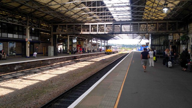
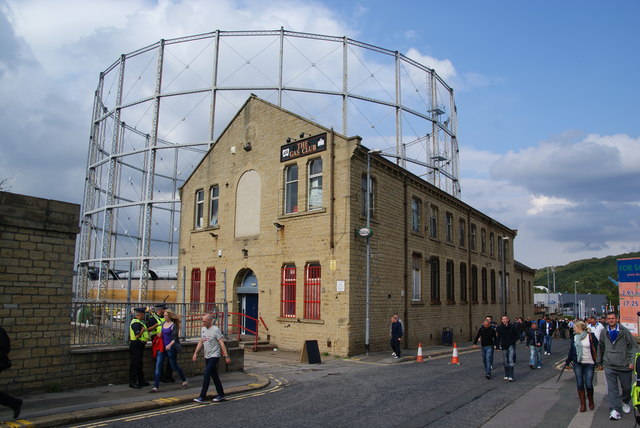
Fartown offers various amenities to its residents, including several local shops, supermarkets, and small businesses. There are also a few local pubs, restaurants, and cafes, providing options for leisure and dining. The suburb benefits from good transport links, with regular bus services connecting it to Huddersfield town center and surrounding areas.

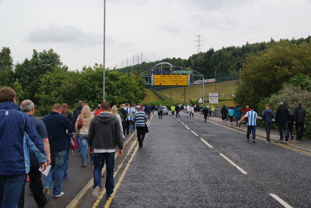
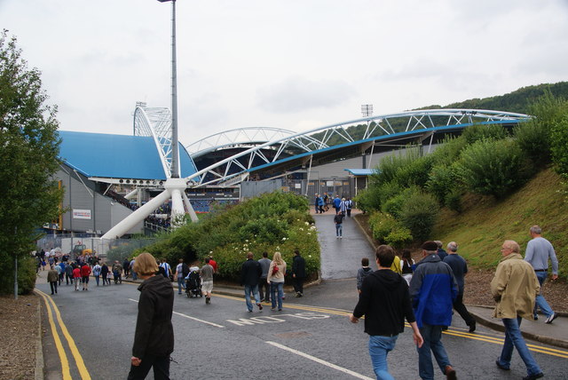
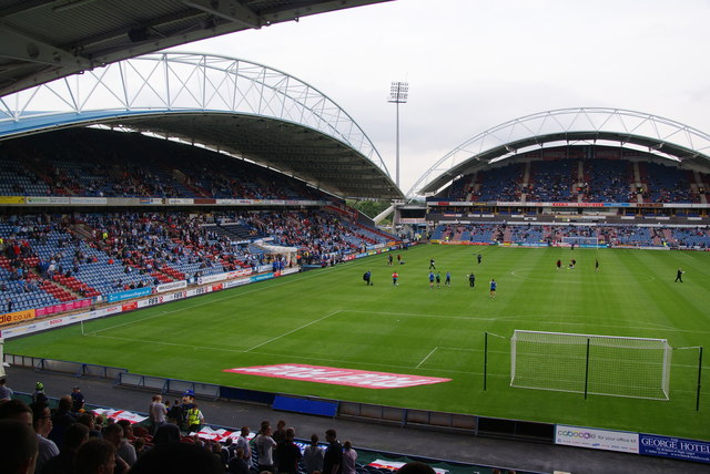
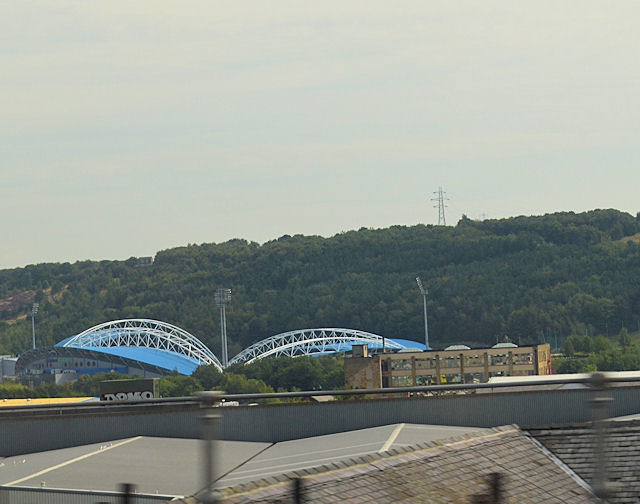
Education is well-catered for in Fartown, with a number of primary and secondary schools located within the vicinity. Additionally, the suburb is home to the John Smith's Stadium, which is shared by Huddersfield Town Football Club and the Huddersfield Giants Rugby League Club. The stadium hosts regular sporting events, attracting visitors from both within and outside the area.

Overall, Fartown offers a pleasant residential environment with a strong sense of community, convenient amenities, and easy access to nearby attractions, making it a desirable place to live in Yorkshire.

If you have any feedback on the listing, please let us know in the comments section below.

Fartown Images

Images are sourced within 2km of 53.662787/-1.785072 or Grid Reference SE1418. Thanks to Geograph Open Source API. All images are credited.

Huddersfield station and statue of Harold Wilson One of the premier station frontages in England forms the backcloth to a statue of a famous former premier of Britain. The statue is located in the restored St Georges Square.
Huddersfield station and statue of Harold Wilson
One of the premier station frontages in England forms the backcloth to a statue of a famous former premier of Britain. The statue is located in the restored St Georges Square.
Continental Food & Drink on Leeds Road
The Peacock on Leeds Road
The A62, Leeds Road
The A62, Leeds Road
Huddersfield Train Station
Matchday parking off St Andrew's Road This is an official pay-and-display car park.
Matchday parking off St Andrew's Road
This is an official pay-and-display car park.
Walking to the Galpharm Stadium The road crosses the River Colne just here.
Walking to the Galpharm Stadium
The road crosses the River Colne just here.
The Galpharm Stadium The approach from the south west end. I understand that the stadium was going to be renamed a couple of years ago because Galpharm were taken over, but nothing appears to have happened since.
The Galpharm Stadium
The approach from the south west end. I understand that the stadium was going to be renamed a couple of years ago because Galpharm were taken over, but nothing appears to have happened since.
Before the match in the Galpharm Stadium The first match of the new season. Huddersfield Town FC are the League One title favourites, but were disappointed by a draw in this match.
Before the match in the Galpharm Stadium
The first match of the new season. Huddersfield Town FC are the League One title favourites, but were disappointed by a draw in this match.
Gasworks Street Aptly named street with the gasholder still in use.
Gasworks Street
Aptly named street with the gasholder still in use.
Leeds Road, Huddersfield This is the A62 shortly before it reaches the inner ring road.
Leeds Road, Huddersfield
This is the A62 shortly before it reaches the inner ring road.
Old Leeds Road, Huddersfield This used to be the main road, but now is a side road servicing mainly industrial premises.
Old Leeds Road, Huddersfield
This used to be the main road, but now is a side road servicing mainly industrial premises.
Mills on Quay Street Viewed from Old Leeds Road.
Mills on Quay Street
Viewed from Old Leeds Road.
Pulley bridge on the Huddersfield Broad Canal This is where Quay Street crosses the canal.
Pulley bridge on the Huddersfield Broad Canal
This is where Quay Street crosses the canal.
The Huddersfield Broad Canal Viewed from the Quay Street bridge, past the Sainsbury's superstore. In the distance is Castle Hill which provides a good viewpoint over the town.
The Huddersfield Broad Canal
Viewed from the Quay Street bridge, past the Sainsbury's superstore. In the distance is Castle Hill which provides a good viewpoint over the town.
House under construction, Halifax Old Road, Cowcliffe
Castlegate Huddersfield from railway bridge
Across Huddersfield to football stadium
Show me another place!

Fartown is located at Grid Ref: SE1418 (Lat: 53.662787, Lng: -1.785072)

Division: West Riding

Unitary Authority: Kirklees

Police Authority: West Yorkshire

What 3 Words

///planet.cattle.vision. Near Huddersfield, West Yorkshire

Related Wikis

Fartown Ground

The Fartown Ground or just simply Fartown is a sports ground located in the Huddersfield suburb of Fartown in West Yorkshire, England and is predominantly...

Fartown, Huddersfield

Fartown is a district of Huddersfield, West Yorkshire, England that starts 0.6 miles (1 km) north of the town centre. Fartown runs for approximately 1...

Cowcliffe

Cowcliffe is an area of Huddersfield, West Yorkshire, England. It is situated between Fixby and Birkby based around Cowcliffe Hill Road. Cowcliffe is a...

Huddersfield workhouse scandal

The Huddersfield workhouse scandal concerned the conditions in the workhouse at Huddersfield, England in 1848. The problems included overcrowding, disease...

Kirklees EfW

The Kirklees EfW is a major moving grate incineration plant in Huddersfield, Kirklees, England. The incinerator is owned and operated by Suez Recycling...

Birkby, Huddersfield

Birkby is a large multi-cultural suburb close to the town centre in Huddersfield, in the Kirklees borough of West Yorkshire, England. It has a population...

North Huddersfield Trust School

North Huddersfield Trust School (formerly Fartown High School) is a coeducational secondary school located in the Fartown area of Huddersfield, West Yorkshire...

Huddersfield power station

Huddersfield power station supplied electricity to the town of Huddersfield and the wider area from 1893 to 1981. It was owned and operated by Huddersfield...

Nearby Amenities

Located within 500m of 53.662787,-1.785072
Traffic Signals
Source: survey
Lat/Long: 53.662202/-1.7804375
Bus Stop
Lat/Long: 53.6595808/-1.7812785
Bus Stop
Lat/Long: 53.6625632/-1.7805243
Bus Stop
Lat/Long: 53.665008/-1.7802815
Bus Stop
Fartown Green Road Pollard Street
Local Ref: 45017507
Naptan AtcoCode: 450017507
Naptan Bearing: NE
Naptan CommonName: Fartown Green Road Pollard Street
Naptan Crossing: Pollard Street
Naptan Indicator: Stop 45017507
Naptan Notes: OSR taken place 291105
Naptan PlusbusZoneRef: LEEDS
Naptan ShortCommonName: Pollard Street
Naptan Street: Fartown Green Road
Naptan Verified: no
Source: naptan_import
Lat/Long: 53.6631734/-1.7775796
Bus Stop
Fartown Green Road Leonard Street
Local Ref: 45017508
Naptan AtcoCode: 450017508
Naptan Bearing: W
Naptan CommonName: Fartown Green Road Leonard Street
Naptan Crossing: Leonard Street
Naptan Indicator: Stop 45017508
Naptan PlusbusZoneRef: LEEDS
Naptan ShortCommonName: Leonard Street
Naptan Street: Fartown Green Road
Naptan Verified: no
Source: naptan_import
Lat/Long: 53.6624389/-1.7789607
Bus Stop
Fartown Green Road Leonard Street
Local Ref: 45017509
Naptan AtcoCode: 450017509
Naptan Bearing: E
Naptan CommonName: Fartown Green Road Leonard Street
Naptan Crossing: Leonard Street
Naptan Indicator: Stop 45017509
Naptan Landmark: Show room
Naptan PlusbusZoneRef: LEEDS
Naptan ShortCommonName: Fartown Bar
Naptan Street: Fartown Green Road
Naptan Verified: no
Source: naptan_import
Lat/Long: 53.6624583/-1.7797172
Bus Stop
Alder Street Abbey Road
Local Ref: 45017511
Naptan AtcoCode: 450017511
Naptan Bearing: N
Naptan CommonName: Alder Street Abbey Road
Naptan Crossing: Abbey Road
Naptan Indicator: Stop 45017511
Naptan Notes: OSR taken place 291105
Naptan PlusbusZoneRef: LEEDS
Naptan ShortCommonName: Abbey Road
Naptan Street: Alder Street
Naptan Verified: no
Source: naptan_import
Lat/Long: 53.6613501/-1.7783308
Bus Stop
Bradford Road Dewhurst Road
Local Ref: 45017537
Naptan AtcoCode: 450017537
Naptan Bearing: S
Naptan CommonName: Bradford Road Dewhurst Road
Naptan Crossing: Dewhurst Road
Naptan Indicator: Stop 45017537
Naptan PlusbusZoneRef: LEEDS
Naptan ShortCommonName: Dewhurst Road
Naptan Street: Bradford Road
Naptan Verified: no
Source: naptan_import
Lat/Long: 53.6646161/-1.7800238
Bus Stop
Bradford Road Fartown Green Road
Local Ref: 45017538
Naptan AtcoCode: 450017538
Naptan Bearing: S
Naptan CommonName: Bradford Road Fartown Green Road
Naptan Crossing: Fartown Gren Road
Naptan Indicator: Stop 45017538
Naptan Landmark: Barclays Bank
Naptan Notes: OSR taken place 291105
Naptan PlusbusZoneRef: LEEDS
Naptan ShortCommonName: Fartown Green Road
Naptan Street: Bradford Road
Naptan Verified: no
Source: naptan_import
Lat/Long: 53.6618842/-1.780371
Bus Stop
Bradford Road Moorfield Road
Local Ref: 45017539
Naptan AtcoCode: 450017539
Naptan Bearing: E
Naptan CommonName: Bradford Road Moorfield Road
Naptan Crossing: Moorfield Road
Naptan Indicator: Stop 45017539
Naptan Notes: OSR taken place 291105
Naptan PlusbusZoneRef: LEEDS
Naptan ShortCommonName: Moorfield Road
Naptan Street: Bradford Road
Naptan Verified: no
Source: naptan_import
Lat/Long: 53.6607792/-1.7806945
Bus Stop
Bradford Road Cobcroft Road
Local Ref: 45017546
Naptan AtcoCode: 450017546
Naptan Bearing: N
Naptan CommonName: Bradford Road Cobcroft Road
Naptan Crossing: Cobcroft Road
Naptan Indicator: Stop 45017546
Naptan Landmark: Railway Inn PH
Naptan Notes: OSR taken place 291105
Naptan PlusbusZoneRef: LEEDS
Naptan ShortCommonName: Cobcroft Road
Naptan Street: Bradford Road
Naptan Verified: no
Source: naptan_import
Lat/Long: 53.6596566/-1.7812148
Bus Stop
Bradford Road Spaines Road
Local Ref: 45017547
Naptan AtcoCode: 450017547
Naptan Bearing: N
Naptan CommonName: Bradford Road Spaines Road
Naptan Crossing: Spaines Road
Naptan Indicator: Stop 45017547
Naptan PlusbusZoneRef: LEEDS
Naptan ShortCommonName: Fartown Bar
Naptan Street: Bradford Road
Naptan Verified: no
Source: naptan_import
Lat/Long: 53.6625138/-1.7805796
Bus Stop
Bradford Road Dewhurst Road
Local Ref: 45017548
Naptan AtcoCode: 450017548
Naptan Bearing: N
Naptan CommonName: Bradford Road Dewhurst Road
Naptan Crossing: Dewhurst Road
Naptan Indicator: Stop 45017548
Naptan PlusbusZoneRef: LEEDS
Naptan ShortCommonName: Dewhurst Road
Naptan Street: Bradford Road
Naptan Verified: no
Source: naptan_import
Lat/Long: 53.6651378/-1.7802632
Bus Stop
Birkby Hall Road Crescent Road
Local Ref: 45022106
Naptan AtcoCode: 450022106
Naptan Bearing: NE
Naptan CommonName: Birkby Hall Road Crescent Road
Naptan Crossing: Crescent Road
Naptan Indicator: Stop 45022106
Naptan PlusbusZoneRef: LEEDS
Naptan ShortCommonName: Crescent Road
Naptan Street: Birkby Hall Road
Naptan Verified: no
Source: naptan_import
Lat/Long: 53.6605443/-1.7900175
Bus Stop
Birkby Hall Road Norman Road
Local Ref: 45022107
Naptan AtcoCode: 450022107
Naptan Bearing: SW
Naptan CommonName: Birkby Hall Road Norman Road
Naptan Crossing: Crescent Road
Naptan Indicator: Stop 45022107
Naptan Notes: OSR taken place 071205 size 2 case fitted
Naptan PlusbusZoneRef: LEEDS
Naptan ShortCommonName: Crescent Road
Naptan Street: Birkby Hall Road
Naptan Verified: no
Source: naptan_import
Lat/Long: 53.6605793/-1.789518
Bus Stop
Birkby Hall Road Halifax Old Road
Local Ref: 45022108
Naptan AtcoCode: 450022108
Naptan Bearing: SW
Naptan CommonName: Birkby Hall Road Halifax Old Road
Naptan Crossing: Halifax Old Road
Naptan Indicator: Stop 45022108
Naptan PlusbusZoneRef: LEEDS
Naptan ShortCommonName: Halifax Old Road
Naptan Street: Birkby Hall Road
Naptan Verified: no
Source: naptan_import
Lat/Long: 53.6610262/-1.7880327
Bus Stop
Spaines Road Halifax Old Road
Local Ref: 45022109
Naptan AtcoCode: 450022109
Naptan Bearing: E
Naptan CommonName: Spaines Road Halifax Old Road
Naptan Crossing: Halifax Old Road
Naptan Indicator: Stop 45022109
Naptan PlusbusZoneRef: LEEDS
Naptan ShortCommonName: Halifax Old Road
Naptan Street: Spaines Road
Naptan Verified: no
Source: naptan_import
Lat/Long: 53.6613479/-1.7869869
Bus Stop
Spaines Road Yew Street
Local Ref: 45022110
Naptan AtcoCode: 450022110
Naptan Bearing: NW
Naptan CommonName: Spaines Road Yew Street
Naptan Crossing: Yew Street
Naptan Indicator: Stop 45022110
Naptan Landmark: Pavilion
Naptan PlusbusZoneRef: LEEDS
Naptan ShortCommonName: Yew Street
Naptan Street: Spaines Road
Naptan Verified: no
Source: naptan_import
Lat/Long: 53.6611028/-1.7856413
Bus Stop
Spaines Road Yew Street
Local Ref: 45022111
Naptan AtcoCode: 450022111
Naptan Bearing: E
Naptan CommonName: Spaines Road Yew Street
Naptan Crossing: Yew Tree
Naptan Indicator: Stop 45022111
Naptan Landmark: The Pavilion
Naptan PlusbusZoneRef: LEEDS
Naptan ShortCommonName: Yew Street
Naptan Street: Spaines Road
Naptan Verified: no
Source: naptan_import
Lat/Long: 53.6610921/-1.784688
Bus Stop
Spaines Road Wasps Nest Road
Local Ref: 45022112
Naptan AtcoCode: 450022112
Naptan Bearing: E
Naptan CommonName: Spaines Road Wasps Nest Road
Naptan Crossing: Wasps Nest Road
Naptan Indicator: Stop 45022112
Naptan Notes: OSR taken place 291105
Naptan PlusbusZoneRef: LEEDS
Naptan ShortCommonName: Wasps Nest Road
Naptan Street: Spaines Road
Naptan Verified: no
Source: naptan_import
Lat/Long: 53.6615021/-1.7827791
Bus Stop
Spaines Road Woodbine Road
Local Ref: 45022113
Naptan AtcoCode: 450022113
Naptan Bearing: SW
Naptan CommonName: Spaines Road Woodbine Road
Naptan Crossing: Woodbine Road
Naptan Indicator: Stop 45022113
Naptan Landmark: Health Centre
Naptan PlusbusZoneRef: LEEDS
Naptan ShortCommonName: Woodbine Road
Naptan Street: Spaines Road
Naptan Verified: no
Source: naptan_import
Lat/Long: 53.6615906/-1.7819917
Bus Stop
Halifax Old Road Grimscar Avenue
Bus: yes
Local Ref: 45022116
Naptan AtcoCode: 450022116
Naptan Bearing: E
Naptan CommonName: Halifax Old Road Grimscar Avenue
Naptan Crossing: Grimscar Avenue
Naptan Indicator: Stop 45022116
Naptan Notes: OSR taken place 301105
Naptan PlusbusZoneRef: LEEDS
Naptan ShortCommonName: Scale Hill
Naptan Street: Halifax Old Road
Naptan Verified: no
Public Transport: platform
Source: naptan_import
Lat/Long: 53.663396/-1.7907299
Bus Stop
Halifax Old Road Grimescar Avenue
Local Ref: 45022117
Naptan AtcoCode: 450022117
Naptan Bearing: W
Naptan CommonName: Halifax Old Road Grimescar Avenue
Naptan Crossing: Grimscar Avenue
Naptan Indicator: Stop 45022117
Naptan Notes: OSR taken place 301105
Naptan PlusbusZoneRef: LEEDS
Naptan ShortCommonName: Grimscar Avenue
Naptan Street: Halifax Old Road
Naptan Verified: no
Source: naptan_import
Lat/Long: 53.6634243/-1.7912985
Bus Stop
Halifax Old Road Spaines Road
Local Ref: 45022118
Naptan AtcoCode: 450022118
Naptan Bearing: S
Naptan CommonName: Halifax Old Road Spaines Road
Naptan Crossing: Spaines Road
Naptan Indicator: Stop 45022118
Naptan PlusbusZoneRef: LEEDS
Naptan ShortCommonName: Spaines Road
Naptan Street: Halifax Old Road
Naptan Verified: no
Source: naptan_import
Lat/Long: 53.6616278/-1.7876816
Bus Stop
Halifax Old Road Birkby Hall Road
Local Ref: 45022119
Naptan AtcoCode: 450022119
Naptan Bearing: N
Naptan CommonName: Halifax Old Road Birkby Hall Road
Naptan Crossing: Birkby Hall Road
Naptan Indicator: Stop 45022119
Naptan Landmark: Public Park
Naptan PlusbusZoneRef: LEEDS
Naptan ShortCommonName: Birkby Hall Road
Naptan Street: Halifax Old Road
Naptan Verified: no
Source: naptan_import
Lat/Long: 53.6616096/-1.7877794
Bus Stop
Cowcliffe Hill Road Halifax Old Road
Local Ref: 45022120
Naptan AtcoCode: 450022120
Naptan Bearing: SW
Naptan CommonName: Cowcliffe Hill Road Halifax Old Road
Naptan Crossing: Halifax Old Road
Naptan Indicator: Stop 45022120
Naptan PlusbusZoneRef: LEEDS
Naptan ShortCommonName: Halifax Old Road
Naptan Street: Cowcliffe Hill Road
Naptan Verified: no
Source: naptan_import
Lat/Long: 53.6630138/-1.788734
Bus Stop
Cowcliffe Hill Road Birklands Road
Local Ref: 45022121
Naptan AtcoCode: 450022121
Naptan Bearing: S
Naptan CommonName: Cowcliffe Hill Road Birklands Road
Naptan Crossing: Birklands Road
Naptan Indicator: Stop 45022121
Naptan PlusbusZoneRef: LEEDS
Naptan ShortCommonName: Birklands Road
Naptan Street: Cowcliffe Hill Road
Naptan Verified: no
Source: naptan_import
Lat/Long: 53.6646977/-1.7904509
Bus Stop
Cowcliffe Hill Road Birklands Road
Local Ref: 45022122
Naptan AtcoCode: 450022122
Naptan Bearing: N
Naptan CommonName: Cowcliffe Hill Road Birklands Road
Naptan Crossing: Birklands Road
Naptan Indicator: Stop 45022122
Naptan PlusbusZoneRef: LEEDS
Naptan ShortCommonName: Birklands Road
Naptan Street: Cowcliffe Hill Road
Naptan Verified: no
Source: naptan_import
Lat/Long: 53.664842/-1.7907529
Bus Stop
York Avenue Cawthorne Avenue
Local Ref: 45022139
Naptan AtcoCode: 450022139
Naptan Bearing: SW
Naptan CommonName: York Avenue Cawthorne Avenue
Naptan Crossing: Cawthorne Avenue
Naptan Indicator: Stop 45022139
Naptan PlusbusZoneRef: LEEDS
Naptan ShortCommonName: Cawthorne Avenue
Naptan Street: York Avenue
Naptan Verified: no
Source: naptan_import
Lat/Long: 53.6653062/-1.7838492
Bus Stop
York Avenue Cawthorne Avenue
Local Ref: 45022140
Naptan AtcoCode: 450022140
Naptan Bearing: NE
Naptan CommonName: York Avenue Cawthorne Avenue
Naptan Crossing: Cawthorne Avenue
Naptan Indicator: Stop 45022140
Naptan Notes: OSR taken place 301105
Naptan PlusbusZoneRef: LEEDS
Naptan ShortCommonName: Cawthorne Avenue
Naptan Street: York Avenue
Naptan Verified: no
Source: naptan_import
Lat/Long: 53.6653963/-1.783985
Bus Stop
York Avenue Pateley Crescent
Local Ref: 45022141
Naptan AtcoCode: 450022141
Naptan Bearing: E
Naptan CommonName: York Avenue Pateley Crescent
Naptan Crossing: Pateley Crescent
Naptan Indicator: Stop 45022141
Naptan Notes: OSR taken place 301105
Naptan PlusbusZoneRef: LEEDS
Naptan ShortCommonName: Pateley Crescent
Naptan Street: York Avenue
Naptan Verified: no
Source: naptan_import
Lat/Long: 53.6648272/-1.7874537
Bus Stop
York Avenue Pateley Crescent
Local Ref: 45022142
Naptan AtcoCode: 450022142
Naptan Bearing: NW
Naptan CommonName: York Avenue Pateley Crescent
Naptan Crossing: Pateley Crescent
Naptan Indicator: Stop 45022142
Naptan Notes: OSR taken place 301105
Naptan PlusbusZoneRef: LEEDS
Naptan ShortCommonName: Pateley Crescent
Naptan Street: York Avenue
Naptan Verified: no
Source: naptan_import
Lat/Long: 53.6648188/-1.7877413
Bus Stop
York Avenue Cowcliffe Hill Road
Local Ref: 45022143
Naptan AtcoCode: 450022143
Naptan Bearing: E
Naptan CommonName: York Avenue Cowcliffe Hill Road
Naptan Crossing: Cowcliffe Hill Road
Naptan Indicator: Stop 45022143
Naptan PlusbusZoneRef: LEEDS
Naptan ShortCommonName: Cowcliffe Hill Road
Naptan Street: York Avenue
Naptan Verified: no
Source: naptan_import
Lat/Long: 53.665039/-1.7902827
Bus Stop
York Avenue Cowcliffe Hill Road
Local Ref: 45022144
Naptan AtcoCode: 450022144
Naptan Bearing: W
Naptan CommonName: York Avenue Cowcliffe Hill Road
Naptan Crossing: Cowcliffe Hill Road
Naptan Indicator: Stop 45022144
Naptan Landmark: Sub Station
Naptan Notes: OSR taken place 301105 size 1 case fitted
Naptan PlusbusZoneRef: LEEDS
Naptan ShortCommonName: Birklands Road
Naptan Street: York Avenue
Naptan Verified: no
Source: naptan_import
Lat/Long: 53.6649224/-1.7904649
Bus Stop
Halifax Old Road King Cliffe Road
Local Ref: 45022154
Naptan AtcoCode: 450022154
Naptan Bearing: SE
Naptan CommonName: Halifax Old Road King Cliffe Road
Naptan Crossing: King Cliffe Road
Naptan Indicator: Stop 45022154
Naptan Landmark: Grimescar PH
Naptan PlusbusZoneRef: LEEDS
Naptan ShortCommonName: King Cliff Road
Naptan Street: Halifax Old Road
Naptan Verified: no
Source: naptan_import
Lat/Long: 53.6585587/-1.7854424
Bus Stop
Bradford Road Beverley Court
Local Ref: 45024186
Naptan AtcoCode: 450024186
Naptan Bearing: S
Naptan CommonName: Bradford Road Beverley Court
Naptan Crossing: Skipton Ave
Naptan Indicator: Stop 45024186
Naptan Landmark: Police Station
Naptan PlusbusZoneRef: LEEDS
Naptan ShortCommonName: Beverley Court
Naptan Street: Bradford Road
Naptan Verified: no
Source: naptan_import
Lat/Long: 53.6634478/-1.780151
Bus Stop
Cowcliffe Hall Road Halifax Old Road
Local Ref: 45027527
Naptan AtcoCode: 450027527
Naptan Bearing: NE
Naptan CommonName: Cowcliffe Hall Road Halifax Old Road
Naptan Crossing: Halifax Old Road
Naptan Indicator: Stop 45027527
Naptan PlusbusZoneRef: LEEDS
Naptan ShortCommonName: Halifax Old Road
Naptan Street: Cowcliffe Hall Road
Naptan Verified: no
Source: naptan_import
Lat/Long: 53.6630949/-1.7888395
Post Office
Source: OS OpenData StreetView
Lat/Long: 53.663041/-1.7779462
Fartown
Is In: Huddersfield
Is In Country: UK
Is In County: West Yorkshire
Is In District: Kirklees
Is In Town: Huddersfield
Place: suburb
Lat/Long: 53.6626339/-1.7799126
Crossing
Crossing: marked
Crossing Island: no
Lat/Long: 53.6610351/-1.7850131
Turning Circle
Blackhouse Road
Lat/Long: 53.6646276/-1.7798989
Pharmacy
Dispensing: yes
Lat/Long: 53.6621039/-1.7810422
Shop: dry_cleaning
Source: survey
Lat/Long: 53.6626752/-1.7808469
Brand: SEAT
Shop: car
Source: survey
Lat/Long: 53.6628892/-1.7797907
Police
Source: survey
Lat/Long: 53.6633078/-1.7800972
Doctors
Wheelchair: yes
Lat/Long: 53.6628169/-1.7779516
Atm
Fee: no
Lat/Long: 53.6630253/-1.7779081
Library
Source: survey
Lat/Long: 53.6593667/-1.7839481
Place Of Worship
Markazi Jamia Masjid Riza Islamic Centre
Religion: muslim
Source: survey
Source Name: survey
Lat/Long: 53.6591761/-1.7862765
Pub
The Grimescar
Source: survey
Lat/Long: 53.6584146/-1.7856549
Pub
The Lamb Inn
Source: survey
Lat/Long: 53.6583323/-1.7856047
Fartown War Memorial
Historic: monument
Lat/Long: 53.6619238/-1.7883663
Noexit: yes
Lat/Long: 53.661726/-1.7789081
Generator Method: photovoltaic
Generator Output Electricity: yes
Generator Source: solar
Generator Type: solar_photovoltaic_panel
Location: roof
Power: generator
Lat/Long: 53.6604292/-1.7910988
Barrier: bollard
Lat/Long: 53.6601831/-1.7897078
Crossing
Crossing: traffic_signals
Lat/Long: 53.6644083/-1.7802453
Crossing
Crossing: traffic_signals
Lat/Long: 53.6644596/-1.7800511
Direction: backward
Traffic Calming: choker
Lat/Long: 53.6644164/-1.7804138
Description: Memorial to Yorkshire and England players Wilfred Rhodes, George Hirst and Schofield Haigh.
Historic: memorial
Material: stone
Memorial: column
Lat/Long: 53.6612927/-1.7850909
Bench
Backrest: yes
Material: wood
Lat/Long: 53.6639502/-1.7837172
Noexit: yes
Lat/Long: 53.6592978/-1.7896273
Bar
Addr Street: Bradford Road
Lat/Long: 53.6614372/-1.7809241
Addr City: Huddersfield
Addr Housenumber: 1-2
Addr Postcode: HD2 2RT
Addr Street: Back Beacon Street
Addr Suburb: Birkby
Lat/Long: 53.658614/-1.7865191
The data included in this document is from www.openstreetmap.org. The data is made available under ODbL.

Have you been to Fartown?

Leave your review of Fartown below (or comments, questions and feedback).