Higher Turnerford Wood

Wood, Forest in Yorkshire Craven

England

Higher Turnerford Wood

Fingerpost sign next to River Wenning A repaired fingerpost sign near Clapham Station, North Yorkshire
Fingerpost sign next to River Wenning Credit: Bob McPartland

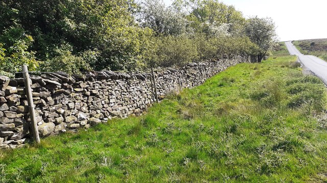
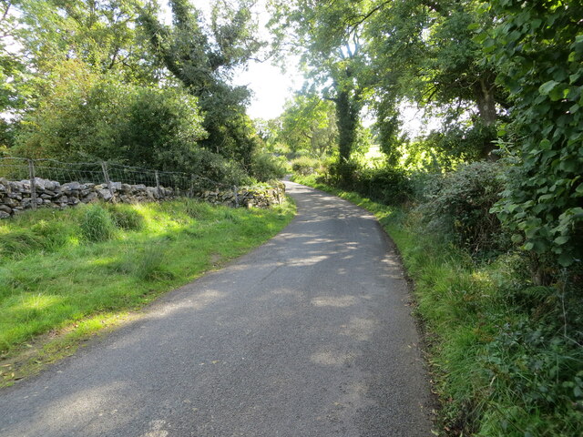
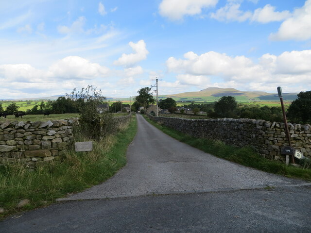
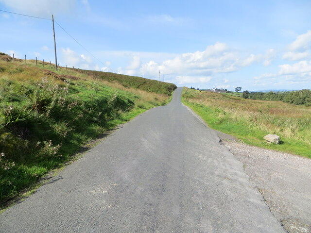
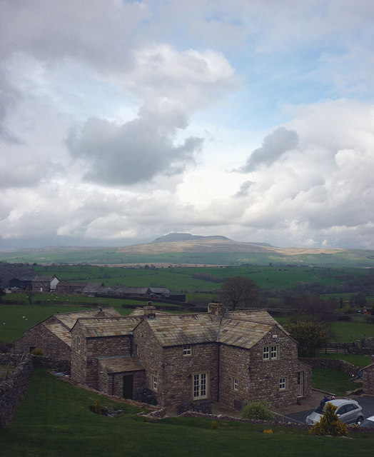
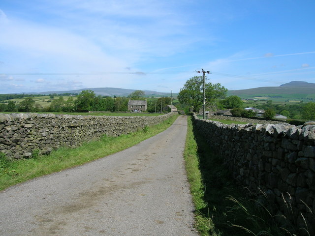
Higher Turnerford Wood is a dense forest located in the county of Yorkshire, England. Stretching across a vast area, it is well-known for its natural beauty and diverse ecosystem. The wood is situated in a rural setting, surrounded by picturesque landscapes and rolling hills.

The forest is predominantly composed of deciduous trees such as oak, beech, and birch, which create a vibrant and colorful canopy during the autumn months. This rich vegetation provides a home for a wide variety of wildlife, including deer, foxes, rabbits, and numerous species of birds.

Higher Turnerford Wood offers numerous walking trails and paths, allowing visitors to explore its beauty at their own pace. These trails wind through the forest and provide breathtaking views of the surrounding countryside. The wood also features a small stream that meanders through its heart, adding to its picturesque charm.

In addition to its natural beauty, Higher Turnerford Wood has historical significance as well. It is believed that the wood has been in existence since medieval times and has witnessed various historical events.

The wood is open to the public year-round, with visitors enjoying activities such as hiking, birdwatching, and photography. It is a popular destination for nature enthusiasts and provides a peaceful retreat from the hustle and bustle of everyday life.

Overall, Higher Turnerford Wood in Yorkshire is a captivating forest that showcases the beauty of nature and offers a tranquil escape for visitors seeking solace in its serene surroundings.

If you have any feedback on the listing, please let us know in the comments section below.

Higher Turnerford Wood Images

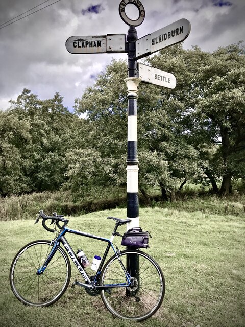
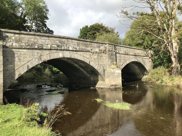
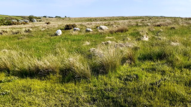
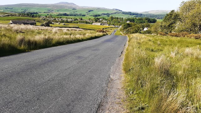
Images are sourced within 2km of 54.091969/-2.4301192 or Grid Reference SD7166. Thanks to Geograph Open Source API. All images are credited.

Fingerpost sign next to River Wenning A repaired fingerpost sign near Clapham Station, North Yorkshire
Fingerpost sign next to River Wenning
A repaired fingerpost sign near Clapham Station, North Yorkshire
Wenning Bank Bridge Stone bridge over the River Wenning near Clapham Station, North Yorkshire
Wenning Bank Bridge
Stone bridge over the River Wenning near Clapham Station, North Yorkshire
Sheep grazing on Clapham Moor
Looking NE along moorland road leading to Clapham Station
Diesel multiple unit 158850 leaves Clapham Station for Morecambe The train is the Northern service from Leeds
Diesel multiple unit 158850 leaves Clapham Station for Morecambe
The train is the Northern service from Leeds
Benchmark on western parapet of Wenning Bridge Ordnance Survey cut mark benchmark levelled at 125.971m above Newlyn Datum verified 1953
Benchmark on western parapet of Wenning Bridge
Ordnance Survey cut mark benchmark levelled at 125.971m above Newlyn Datum verified 1953
Wenning Bridge, taking Wenning Bank over River Wenning There is an Ordnance Survey benchmark <a href="https://www.geograph.org.uk/photo/7500665">SD7367 : Benchmark on western parapet of Wenning Bridge</a> on the left hand parapet over the centre of the river
Wenning Bridge, taking Wenning Bank over River Wenning
There is an Ordnance Survey benchmark SD7367 : Benchmark on western parapet of Wenning Bridge on the left hand parapet over the centre of the river
Benchmark on roadside wall west of Meldingscale Farm Ordnance Survey rivet benchmark levelled at 132.094m above Newlyn Datum verified 1953
Benchmark on roadside wall west of Meldingscale Farm
Ordnance Survey rivet benchmark levelled at 132.094m above Newlyn Datum verified 1953
Dry stone wall beside rural road at Meldingscale Farm There is an Ordnance Survey benchmark on the stone at the base of the wall right of the nearest fence post at the left hand edge of the image
Dry stone wall beside rural road at Meldingscale Farm
There is an Ordnance Survey benchmark on the stone at the base of the wall right of the nearest fence post at the left hand edge of the image
Benchmark on dry stone wall on west side of road south of Wenning Bridge Ordnance Survey rivet benchmark levelled at 140.568m above Newlyn Datum verified 1953
Benchmark on dry stone wall on west side of road south of Wenning Bridge
Ordnance Survey rivet benchmark levelled at 140.568m above Newlyn Datum verified 1953
Dry stone wall and trees on southeast side of road on Clapham Moor There is an Ordnance Survey benchmark <a href="https://www.geograph.org.uk/photo/7500700">SD7367 : Benchmark on dry stone wall on west side of road south of Wenning Bridge</a> on a stone at the base of the wall left of a foxglove
Dry stone wall and trees on southeast side of road on Clapham Moor
There is an Ordnance Survey benchmark SD7367 : Benchmark on dry stone wall on west side of road south of Wenning Bridge on a stone at the base of the wall left of a foxglove
Clapham Station looking towards overbridge and Station House
Hollin Lane at Ratton Syke Bridge Looking south-eastward.
Hollin Lane at Ratton Syke Bridge
Looking south-eastward.
Access to Hammon Head Hall Looking northward from Bloe Beck Lane. Ingleborough is visible on the skyline.
Access to Hammon Head Hall
Looking northward from Bloe Beck Lane. Ingleborough is visible on the skyline.
Mewith Lane beside Cinder Hill Looking north-westward.
Mewith Lane beside Cinder Hill
Looking north-westward.
Laneside Barn, Mewith Head A new conversion, there is an open air swimming pool under construction just where the footpath comes in from Mewith Head Hall.
Laneside Barn, Mewith Head
A new conversion, there is an open air swimming pool under construction just where the footpath comes in from Mewith Head Hall.
Mewith Head There are several dwellings here and nearby which are either new builds made to look 'rustic' (with a local stone cladding) or conversions. It will take some years for these to weather. There is a fine view of Ingleborough across the Wenning dale.
Mewith Head
There are several dwellings here and nearby which are either new builds made to look 'rustic' (with a local stone cladding) or conversions. It will take some years for these to weather. There is a fine view of Ingleborough across the Wenning dale.
Track to Hammonhead
Track to Hammonhead
Show me another place!

Higher Turnerford Wood is located at Grid Ref: SD7166 (Lat: 54.091969, Lng: -2.4301192)

Division: West Riding

Administrative County: North Yorkshire

District: Craven

Police Authority: North Yorkshire

What 3 Words

///wipe.graph.spine. Near High Bentham, North Yorkshire

Related Wikis

Keasden

Keasden is a hamlet in the civil parish of Clapham-cum-Newby, in the Craven district of the county of North Yorkshire, in the north-western England. It...

Keasden Beck

Keasden Beck is a stream in Yorkshire (formerly the West Riding) rising near Keasden Head, joining the River Wenning south west of Clapham. == References... ==

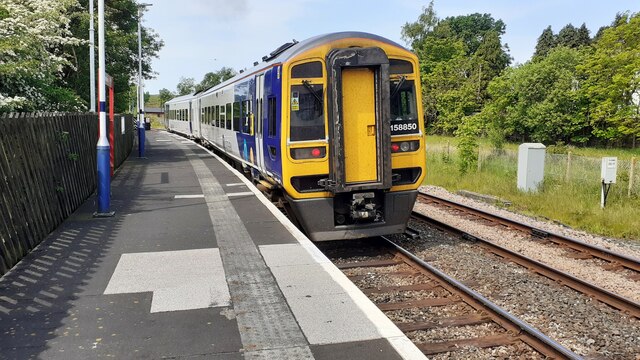
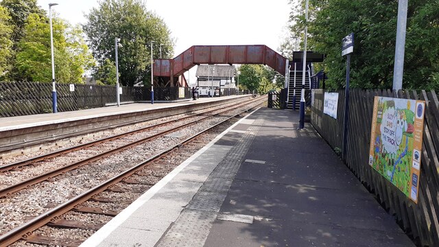
Clapham railway station

Clapham is a railway station on the Bentham Line, which runs between Leeds and Morecambe via Skipton. The station, situated 48 miles (77 km) north-west...

Clapham cum Newby

Clapham cum Newby is a civil parish in the Craven district of North Yorkshire, England. It was formerly in the Settle Rural District. It contains the villages...

Clapham, North Yorkshire

Clapham is a village in the civil parish of Clapham cum Newby in the Craven district of North Yorkshire, England. It was previously in the West Riding...

Eldroth

Eldroth is a village in North Yorkshire, England. It is in the civil parish of Lawkland, part of the former Craven District, some 3.25 miles (5.23 km)...

Great Stone of Fourstones

The Great Stone of Fourstones, or the Big Stone as it is known locally, is a glacial deposit on the moorlands of Tatham Fells, England, straddling the...

Austwick

Austwick is a village and civil parish in the Craven district of North Yorkshire, England, about 5 miles (8 km) north-west of Settle. The village is on...

Nearby Amenities

Located within 500m of 54.091969,-2.4301192
Telephone
Booth: KX100
Covered: booth
Lat/Long: 54.09457/-2.4248432
Barrier: stile
Material: stone
Source: survey;gps
Stile: stepover
Lat/Long: 54.0912915/-2.4331895
Ford: yes
Lat/Long: 54.0912889/-2.4331588
Barrier: stile
Material: wood
Source: survey;gps
Stile: stepover
Lat/Long: 54.0900896/-2.4248317
Fixme: longer than this
Lat/Long: 54.0905908/-2.4252038
Barrier: stile
Material: stone
Source: survey;gps
Stile: stepover
Lat/Long: 54.0904144/-2.425123
Fixme: longer than this
Lat/Long: 54.0900497/-2.4247974
Power: pole
Source: Bing
Lat/Long: 54.0900429/-2.4236035
Power: pole
Source: Bing
Lat/Long: 54.0915962/-2.422981
Power: pole
Source: Bing
Lat/Long: 54.0922428/-2.4237151
Power: pole
Source: Bing
Lat/Long: 54.092935/-2.4245399
Power: pole
Source: Bing
Lat/Long: 54.093583/-2.4253025
Power: pole
Source: Bing
Lat/Long: 54.0942904/-2.426143
Power: pole
Source: Bing
Lat/Long: 54.0948274/-2.4271754
Power: pole
Source: Bing
Lat/Long: 54.0953659/-2.4282285
Power: pole
Source: Bing
Lat/Long: 54.0958785/-2.4292246
Power: pole
Source: Bing
Lat/Long: 54.0964064/-2.4302388
Power: pole
Source: Bing
Lat/Long: 54.0939101/-2.4243298
Power: pole
Source: Bing
Lat/Long: 54.0941763/-2.4235075
Power: pole
Lat/Long: 54.0897835/-2.4250898
Power: pole
Lat/Long: 54.0895675/-2.4264231
Power: pole
Lat/Long: 54.0894108/-2.4273232
Power: pole
Lat/Long: 54.0892237/-2.4284542
Power: pole
Lat/Long: 54.0885771/-2.429113
Power: pole
Lat/Long: 54.0880491/-2.4297122
Power: pole
Lat/Long: 54.0875988/-2.4302414
Power: pole
Lat/Long: 54.0892252/-2.4297018
Power: pole
Lat/Long: 54.0892571/-2.4309158
Power: pole
Lat/Long: 54.0892754/-2.432109
Power: pole
Lat/Long: 54.0893058/-2.4333411
Power: pole
Lat/Long: 54.0893363/-2.4346614
Power: pole
Lat/Long: 54.0893576/-2.4360206
The data included in this document is from www.openstreetmap.org. The data is made available under ODbL.

Have you been to Higher Turnerford Wood?

Leave your review of Higher Turnerford Wood below (or comments, questions and feedback).