Covehithe

Settlement in Suffolk East Suffolk

England

Covehithe

Field south-east of Wrentham
Field south-east of Wrentham Credit: Christopher Hilton

Covehithe is a small coastal village located in the County of Suffolk, England. Situated on the eastern coast of England, Covehithe is part of the Waveney District and lies within the Suffolk Coast and Heaths Area of Outstanding Natural Beauty.

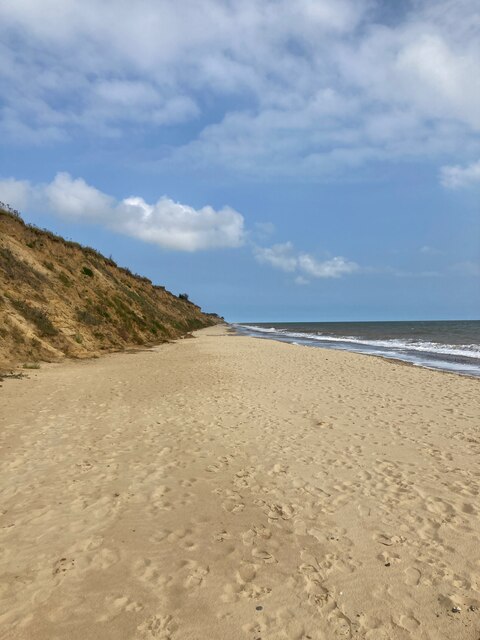
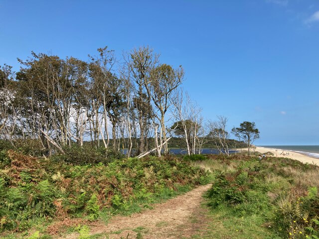
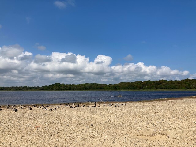
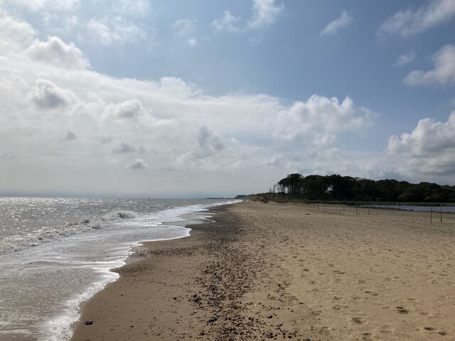
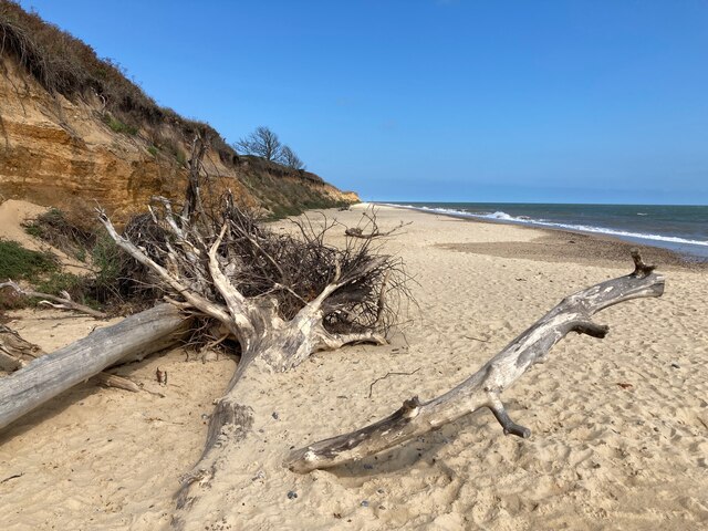
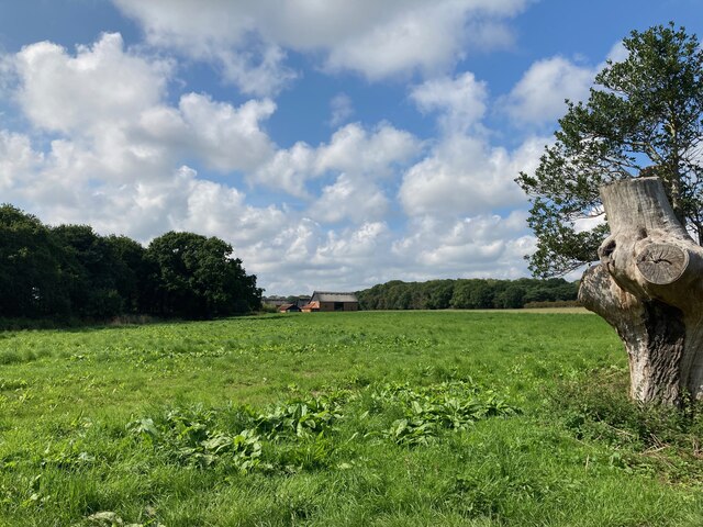
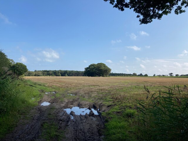
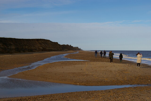
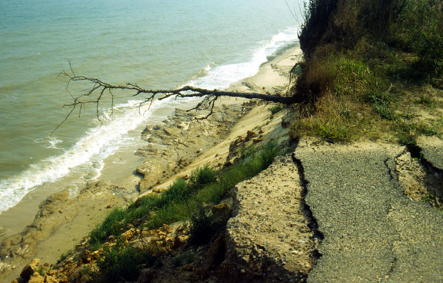
The village is known for its picturesque setting, with a stunning beach and breathtaking cliffs that overlook the North Sea. It is a popular destination for nature lovers and those seeking tranquility away from the hustle and bustle of city life.

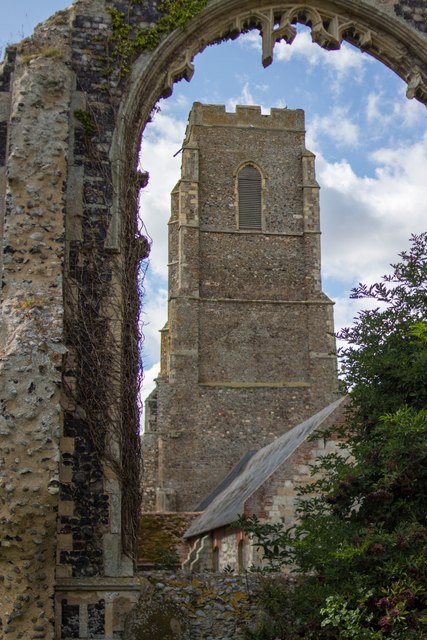
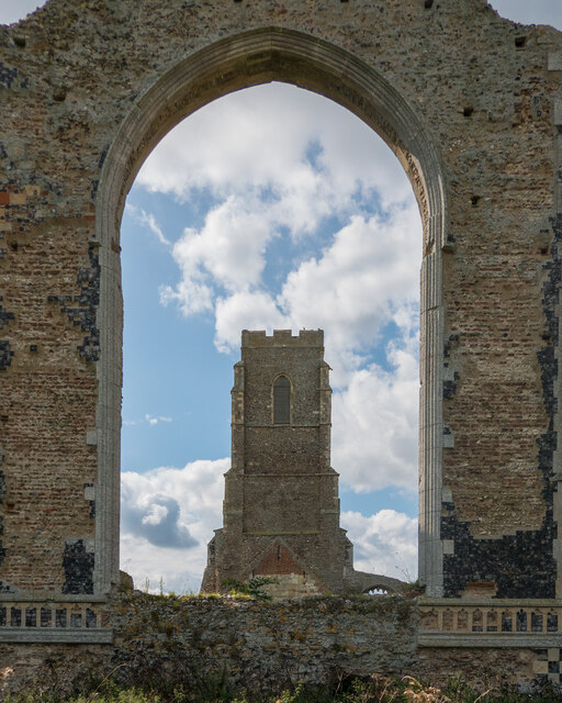
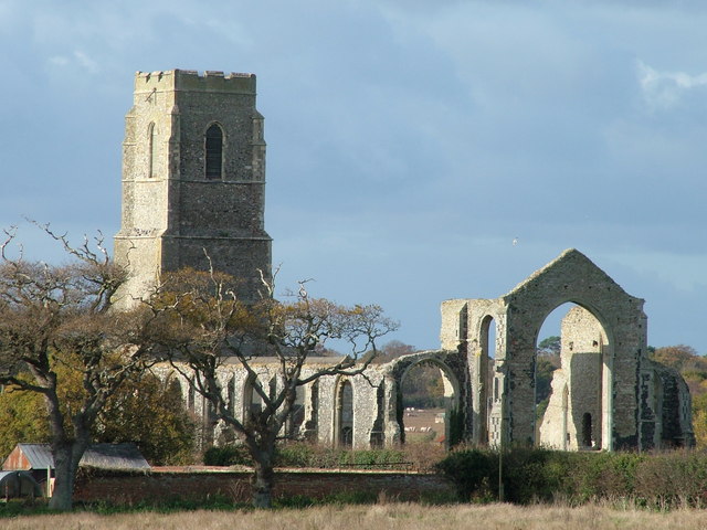
Covehithe is renowned for its historic church, St. Andrew's Church, which dates back to the 15th century. The church is a prominent landmark in the village and attracts visitors from far and wide who come to admire its unique architecture and rich history.

Despite its natural beauty, Covehithe is a small and quiet village with only a handful of houses and a population of around 25 residents. Over the years, erosion has taken its toll on the coastline, resulting in the loss of several houses and parts of the village. This has led to a sense of preservation and protection among the local community, who actively work to maintain and safeguard the remaining structures.

Covehithe offers visitors a chance to escape the crowds and immerse themselves in the peacefulness of rural Suffolk. With its unspoiled beaches, stunning coastal views, and charming church, Covehithe is a hidden gem that continues to captivate all who visit.

If you have any feedback on the listing, please let us know in the comments section below.

Covehithe Images

Images are sourced within 2km of 52.37617/1.703323 or Grid Reference TM5281. Thanks to Geograph Open Source API. All images are credited.

Field south-east of Wrentham
St. Andrew's Church, Covehithe A view of the tower from one of the ruined windows.

See also: <span class="nowrap"><a title="http://www.suffolkchurches.co.uk/covehithe.htm" rel="nofollow ugc noopener" href="http://www.suffolkchurches.co.uk/covehithe.htm">Link</a><img style="margin-left:2px;" alt="External link" title="External link - shift click to open in new window" src="https://s1.geograph.org.uk/img/external.png" width="10" height="10"/></span> (Suffolk Churches Website)
St. Andrew's Church, Covehithe
A view of the tower from one of the ruined windows. See also: LinkExternal link (Suffolk Churches Website)
Covehithe Beach
Covehithe Beach
Long Covert and Benacre Broad
Benacre Broad
Benacre Broad
Beach at Benacre
Beach at Benacre
Fallen trees on the beach
Bales in the field near Hall Farm
Looking towards Wood Farm
Looking towards North Common Wood
Beach below Covehithe Cliffs
Sandbar at Benacre Broad
Church of St. Andrew, Covehithe <span class="nowrap"><a title="https://historicengland.org.uk/listing/the-list/list-entry/1032168?section=official-list-entry" rel="nofollow ugc noopener" href="https://historicengland.org.uk/listing/the-list/list-entry/1032168?section=official-list-entry">Link</a><img style="margin-left:2px;" alt="External link" title="External link - shift click to open in new window" src="https://s1.geograph.org.uk/img/external.png" width="10" height="10"/></span>
Church of St. Andrew, Covehithe
Anchor House, Covehithe <span class="nowrap"><a title="https://historicengland.org.uk/listing/the-list/list-entry/1352545?section=official-list-entry" rel="nofollow ugc noopener" href="https://historicengland.org.uk/listing/the-list/list-entry/1352545?section=official-list-entry">Link</a><img style="margin-left:2px;" alt="External link" title="External link - shift click to open in new window" src="https://s1.geograph.org.uk/img/external.png" width="10" height="10"/></span>
Anchor House, Covehithe
Church of St. Andrew, Covehithe A church within a church. <span class="nowrap"><a title="https://historicengland.org.uk/listing/the-list/list-entry/1032168?section=official-list-entry" rel="nofollow ugc noopener" href="https://historicengland.org.uk/listing/the-list/list-entry/1032168?section=official-list-entry">Link</a><img style="margin-left:2px;" alt="External link" title="External link - shift click to open in new window" src="https://s1.geograph.org.uk/img/external.png" width="10" height="10"/></span>
Church of St. Andrew, Covehithe
A church within a church. LinkExternal link
Font in Church of St. Andrew, Covehithe <span class="nowrap"><a title="https://historicengland.org.uk/listing/the-list/list-entry/1032168?section=official-list-entry" rel="nofollow ugc noopener" href="https://historicengland.org.uk/listing/the-list/list-entry/1032168?section=official-list-entry">Link</a><img style="margin-left:2px;" alt="External link" title="External link - shift click to open in new window" src="https://s1.geograph.org.uk/img/external.png" width="10" height="10"/></span>
Font in Church of St. Andrew, Covehithe
Whitehouse Farmhouse, Covehithe <span class="nowrap"><a title="https://historicengland.org.uk/listing/the-list/list-entry/1032169?section=official-list-entry" rel="nofollow ugc noopener" href="https://historicengland.org.uk/listing/the-list/list-entry/1032169?section=official-list-entry">Link</a><img style="margin-left:2px;" alt="External link" title="External link - shift click to open in new window" src="https://s1.geograph.org.uk/img/external.png" width="10" height="10"/></span>
Whitehouse Farmhouse, Covehithe
Show me another place!

Covehithe is located at Grid Ref: TM5281 (Lat: 52.37617, Lng: 1.703323)

Administrative County: Suffolk

District: East Suffolk

Police Authority: Suffolk

What 3 Words

///carpets.dockers.dodges. Near Kessingland, Suffolk

Related Wikis

Covehithe

Covehithe is a village and civil parish in the East Suffolk district of the English county of Suffolk. It lies on the North Sea coast around 4 miles (6...

St Andrew's Church, Covehithe

St Andrew's Church is a partly redundant Anglican church in the hamlet of Covehithe in the English county of Suffolk. It is recorded in the National Heritage...

Benacre National Nature Reserve

Benacre National Nature Reserve is a national nature reserve in the English county of Suffolk. It is located on the North Sea coast in the parishes of...

Pakefield to Easton Bavents

Pakefield to Easton Bavents is a 735.4-hectare (1,817-acre) biological and geological Site of Special Scientific Interest which stretches along the Suffolk...

Nearby Amenities

Located within 500m of 52.37617,1.703323
Source: PGS
Lat/Long: 52.3741484/1.7087603
Source: PGS
Lat/Long: 52.3751374/1.709463
Source: PGS
Lat/Long: 52.3759136/1.7100638
Covehithe
Place: village
Source: npe
Wikidata: Q2690061
Lat/Long: 52.37635/1.7055067
Bus Stop
Church Covehithe
Bus: yes
Naptan AtcoCode: 390070305
Naptan Bearing: E
Naptan BusStopType: CUS
Naptan CommonName: Church
Naptan Indicator: o/s
Naptan Landmark: Church
Naptan NaptanCode: sufgwptj
Naptan Street: Unclassified
Naptan Verified: no
Public Transport: platform
Shelter: no
Source: naptan_import
Lat/Long: 52.376451/1.7052373
Bench
Backrest: yes
Lat/Long: 52.3762181/1.702854
Parking
Orientation: parallel
Parking: street_side
Lat/Long: 52.3764032/1.7021839
Parking
Orientation: parallel
Parking: street_side
Lat/Long: 52.3760167/1.7018952
Information: board
Tourism: information
Lat/Long: 52.3762308/1.7037159
Post Box
Brand: Royal Mail
Brand Wikidata: Q638098
Brand Wikipedia: en:Royal Mail
Collection Times: Mo-Fr 16:00; Sa 09:00
Operator: Royal Mail
Operator Type: private
Operator Wikidata: Q638098
Post Box Type: lamp
Ref: NR34 3422
Royal Cypher: EIIR
Royal Cypher Wikidata: Q33102113
Lat/Long: 52.3761795/1.7032275
The data included in this document is from www.openstreetmap.org. The data is made available under ODbL.

Have you been to Covehithe?

Leave your review of Covehithe below (or comments, questions and feedback).