Coven

Settlement in Staffordshire South Staffordshire

England

Coven

Sparrows End Lane-Somerford Lane Crossroads Looking across the crossroads is the entrance to Somerford Hall.
Sparrows End Lane-Somerford Lane Crossroads Credit: Mick Malpass

Coven is a small village located in the county of Staffordshire, England. Situated approximately three miles south-west of the town of Stafford, Coven is surrounded by picturesque countryside and offers residents a tranquil and rural setting. The village is part of the South Staffordshire district and falls within the West Midlands region.

Coven has a rich history, with evidence of human settlement dating back to Roman times. The village is known for its charming and well-preserved buildings, including St. Paul's Church, which is a Grade II listed structure. The church is a focal point of the community and holds regular services, as well as hosting various cultural and social events throughout the year.

The village is home to a close-knit community, with a population of around 2,500 people. Residents enjoy a range of amenities, including a primary school, a village hall, and several local shops and businesses. The nearby town of Stafford provides additional amenities and services, such as supermarkets, healthcare facilities, and leisure activities.

Coven benefits from its rural location, surrounded by beautiful countryside and green spaces. The area offers opportunities for outdoor activities, including walking, cycling, and horse riding. The village is also well-connected, with good transport links to nearby towns and cities. The M6 motorway is easily accessible, providing convenient access to Birmingham, Manchester, and beyond.

Overall, Coven offers a peaceful and idyllic place to call home, with a strong sense of community and a range of amenities to cater to residents' needs.

If you have any feedback on the listing, please let us know in the comments section below.
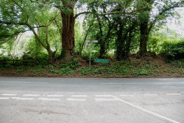
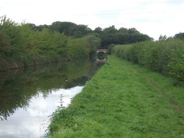
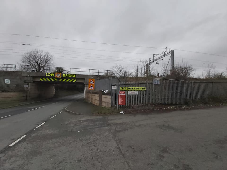
Coven Images

Images are sourced within 2km of 52.66017/-2.133771 or Grid Reference SJ9106. Thanks to Geograph Open Source API. All images are credited.

Sparrows End Lane-Somerford Lane Crossroads Looking across the crossroads is the entrance to Somerford Hall.
Sparrows End Lane-Somerford Lane Crossroads
Looking across the crossroads is the entrance to Somerford Hall.
Somerford Lane meets Brewood Road-Coven Road
Shropshire Union Canal - View towards Park Bridge
Along Coven Road Along Coven Road, at the junction with Lower Avenue.
Along Coven Road
Along Coven Road, at the junction with Lower Avenue.
Trees in Lower Avenue An oak in the woodland strip surrounding the Lower Avenue bridleway, which would once have been part of the Chillington Estate.
Trees in Lower Avenue
An oak in the woodland strip surrounding the Lower Avenue bridleway, which would once have been part of the Chillington Estate.
A small pond near Coven This looks like proper 'Mr Crabtree' fishing to me - a small pond, lily pads and overhanging trees. Must be crawling with tench, carp, perch and roach.
A small pond near Coven
This looks like proper 'Mr Crabtree' fishing to me - a small pond, lily pads and overhanging trees. Must be crawling with tench, carp, perch and roach.
Park Bridge, no 8, on the Shroppy Public access to the top of this one is more or less impossible - it's not a right of way, and it's heavily discouraged by fencing and wire. There is a damaged OS rivet mark on the parapet stonework, not easily photographed <a href="https://www.geograph.org.uk/photo/4091853">SJ8906 : OS rivet & cutmark - Park Bridge</a>
Park Bridge, no 8, on the Shroppy
Public access to the top of this one is more or less impossible - it's not a right of way, and it's heavily discouraged by fencing and wire. There is a damaged OS rivet mark on the parapet stonework, not easily photographed SJ8906 : OS rivet & cutmark - Park Bridge
OS rivet & cutmark - Park Bridge The rivet's gone, and the stonework surrounding the mark is not in the greatest of order, but the benchmark is still visible on the left. Originally levelled at 108.506m above Ordnance Datum Newlyn.
OS rivet & cutmark - Park Bridge
The rivet's gone, and the stonework surrounding the mark is not in the greatest of order, but the benchmark is still visible on the left. Originally levelled at 108.506m above Ordnance Datum Newlyn.
Lamb Field The view off Lower avenue, Coven.
Lamb Field
The view off Lower avenue, Coven.
Lower Avenue Scene The Avenue leads over the canal to Upper Avenue and on to Chillington Hall, Brewood.
Lower Avenue Scene
The Avenue leads over the canal to Upper Avenue and on to Chillington Hall, Brewood.
Canal Drain The view from the Shropshire Union Canal Towpath.
Canal Drain
The view from the Shropshire Union Canal Towpath.
Shropshire Union Canal south of Chillington Bridge
Lower Avenue The start of a long footpath leading to Chillington Hall
Lower Avenue
The start of a long footpath leading to Chillington Hall
Shropshire Union Canal Approaching Bridge 8, 'Park Bridge'
Shropshire Union Canal
Approaching Bridge 8, 'Park Bridge'
Brewood Park Farm
Brewood Park Farm
Shropshire Union Canal Milepost
The White House Large farmhouse on Somerford Lane. The track past the house leads to Somerford Hall.
The White House
Large farmhouse on Somerford Lane. The track past the house leads to Somerford Hall.
Heron near Park Bridge Herons are a common sight on the canal network; this one had taken refuge in the trees to escape an approaching boat.
Heron near Park Bridge
Herons are a common sight on the canal network; this one had taken refuge in the trees to escape an approaching boat.
Show me another place!

Coven is located at Grid Ref: SJ9106 (Lat: 52.66017, Lng: -2.133771)

Administrative County: Staffordshire

District: South Staffordshire

Police Authority: Staffordshire

What 3 Words

///onions.zooms.nests. Near Coven, Staffordshire

Related Wikis

St Paul's Church, Coven

St Paul's Church, Coven is a Grade II listed parish church in the Church of England in Coven, Staffordshire == History == The church was built in 1857...

Coven, Staffordshire

Coven is a village in the district of South Staffordshire, England, near to the border with Wolverhampton. Together with Brewood it forms part of the...

Brinsford Parkway railway station

Brinsford Parkway is a proposed mainline railway station to the north of Wolverhampton, England. It has yet to be passed and is still in planning stages...

Four Ashes, Staffordshire

Four Ashes is a village in the district of South Staffordshire in Staffordshire, England, located about 4 miles (6.4 km) west of Cannock, 7 miles (11 km...

Four Ashes railway station

Four Ashes railway station was a railway station built by the Grand Junction Railway in 1837.: 28  It served the small village of Four Ashes, Staffordshire...

Somerford Hall

Somerford Hall is an 18th-century Palladian style mansion house at Brewood, Staffordshire. It is a Grade II* listed building. Somerford is a name of Old...

Wolverhampton Casuals F.C.

Wolverhampton Casuals Football Club are a football club based in Featherstone, near Wolverhampton, England. Established in 1899, they are currently members...

HM Prison Featherstone

HM Prison Featherstone is a Category C men's prison, located in the village of Featherstone (near Wolverhampton), in Staffordshire, England. The prison...

Nearby Amenities

Located within 500m of 52.66017,-2.133771
Mini Roundabout
Direction: clockwise
Lat/Long: 52.6608289/-2.1407338
Mini Roundabout
Direction: clockwise
Lat/Long: 52.658343/-2.1356519
Coven
Created By: Potlatch 0.10b
Is In: Staffordshire
Place: village
Lat/Long: 52.6579576/-2.1367008
Bus Stop
Church Lane
Bus: yes
Naptan AtcoCode: 3800C601700
Naptan Bearing: NW
Naptan BusStopType: CUS
Naptan CommonName: Birchcroft
Naptan Indicator: Adj
Naptan Landmark: Birchcroft
Naptan Street: Brewood Road
Naptan Verified: no
Public Transport: platform
Source: naptan_import
Lat/Long: 52.6568782/-2.1337116
Bus Stop
Church Lane
Bus: yes
Naptan AtcoCode: 3800C601701
Naptan Bearing: SE
Naptan CommonName: Church Lane
Naptan Indicator: Adj
Naptan Landmark: Church Lane
Naptan Street: Brewood Road
Naptan Verified: no
Public Transport: platform
Source: naptan_import
Lat/Long: 52.6569467/-2.1336433
Bus Stop
Post Office
Bus: yes
Naptan AtcoCode: 3800C601800
Naptan Bearing: SW
Naptan CommonName: Post Office
Naptan Indicator: Adj
Naptan Landmark: Post Office
Naptan Street: Brewood Road
Naptan Verified: no
Public Transport: platform
Source: naptan_import
Lat/Long: 52.6585825/-2.1352629
Bus Stop
Post Office
Bus: yes
Naptan AtcoCode: 3800C601801
Naptan Bearing: NE
Naptan CommonName: Post Office
Naptan Indicator: Opp
Naptan Landmark: Post Office
Naptan Street: Brewood Road
Naptan Verified: no
Public Transport: platform
Source: naptan_import
Lat/Long: 52.6587083/-2.1353373
Bus Stop
Brewood Road
Bus: yes
Naptan AtcoCode: 3800C619001
Naptan Bearing: N
Naptan CommonName: Brewood Road
Naptan Indicator: adj
Naptan Landmark: Brewood Road
Naptan Street: School Lane
Naptan Verified: no
Public Transport: platform
Source: naptan_import
Lat/Long: 52.6605227/-2.1359704
Bus Stop
Brewood Road
Bus: yes
Naptan AtcoCode: 3800C619002
Naptan Bearing: N
Naptan BusStopType: CUS
Naptan CommonName: Brewood Road
Naptan Indicator: opp
Naptan Street: School Lane
Naptan Verified: no
Public Transport: platform
Source: naptan_import
Lat/Long: 52.6605504/-2.1360378
Bus Stop
Sunset Close
Bus: yes
Naptan AtcoCode: 3800C619101
Naptan Bearing: N
Naptan CommonName: Sunset Close
Naptan Indicator: Adj
Naptan Landmark: Sunset Close
Naptan Street: School Lane
Naptan Verified: no
Public Transport: platform
Source: naptan_import
Lat/Long: 52.6642726/-2.1357832
Bus Stop
Sunset Close
Bus: yes
Naptan AtcoCode: 3800C619102
Naptan Bearing: S
Naptan BusStopType: CUS
Naptan CommonName: Sunset Close
Naptan Indicator: opp
Naptan Street: School Lane
Naptan Verified: no
Public Transport: platform
Source: naptan_import
Lat/Long: 52.6642725/-2.135872
Bus Stop
School Lane
Bus: yes
Naptan AtcoCode: 3800C629701
Naptan Bearing: SE
Naptan CommonName: School Lane
Naptan Indicator: Adj
Naptan Landmark: School Lane
Naptan Street: Brewood Road
Naptan Verified: no
Public Transport: platform
Source: naptan_import
Lat/Long: 52.660386/-2.1383142
Bus Stop
School Lane
Bus: yes
Naptan AtcoCode: 3800C629702
Naptan Bearing: NW
Naptan CommonName: School Lane
Naptan Indicator: Opp
Naptan Landmark: School Lane
Naptan Street: Brewood Road
Naptan Verified: no
Public Transport: platform
Source: naptan_import
Lat/Long: 52.660305/-2.1384175
Bus Stop
Light Ash Cul de Sac
Bus: yes
Naptan AtcoCode: 3800C639301
Naptan Bearing: S
Naptan CommonName: Light Ash Cul de Sac
Naptan Indicator: Adj
Naptan Landmark: Light Ash Cul de Sac
Naptan Street: Stafford Road
Naptan Verified: no
Public Transport: platform
Source: naptan_import
Lat/Long: 52.6619492/-2.1313699
Barrier: kissing_gate
Lat/Long: 52.66362/-2.1382782
Noexit: yes
Lat/Long: 52.6587636/-2.1343242
Shop: hairdresser
Lat/Long: 52.658622/-2.135079
Fast Food
Coven Fish Bar
Cuisine: fish_and_chips
Lat/Long: 52.6576312/-2.1354913
Post Office
Coven Post Office
Addr City: Wolverhampton
Addr Housename: 4 Parade Shops
Addr Postcode: WV9 5BX
Addr Street: Brewood Road
Addr Village: Coven
Brand: Post Office
Brand Wikidata: Q1783168
Opening Hours: Mo-Fr 09:00-17:30; Sa 09:00-14:30
Ref Pol Id: 127389
Website: https://www.postoffice.co.uk/branch-finder/6974589/coven
Lat/Long: 52.6585634/-2.135095
Shop: greengrocer
Lat/Long: 52.658456/-2.1352345
Pharmacy
Coven Pharmacy
Healthcare: pharmacy
Lat/Long: 52.6576726/-2.1355779
Post Box
Lat/Long: 52.6586122/-2.1351701
Defibrillator
Defibrillator Location: On wall outside Co-Op store, right hand side facing front.
Emergency: defibrillator
Source: West Midlands Ambulance Service FOI request
Lat/Long: 52.6577907/-2.1357907
Traffic Calming: chicane
Lat/Long: 52.6590488/-2.1373386
Noexit: yes
Lat/Long: 52.6634831/-2.1380693
Noexit: yes
Lat/Long: 52.6635286/-2.1366906
Noexit: yes
Lat/Long: 52.6634587/-2.1372472
Generator Method: photovoltaic
Generator Output Electricity: yes
Generator Source: solar
Generator Type: solar_photovoltaic_panel
Location: roof
Power: generator
Lat/Long: 52.659926/-2.1406737
Generator Method: photovoltaic
Generator Output Electricity: yes
Generator Source: solar
Generator Type: solar_photovoltaic_panel
Location: roof
Power: generator
Lat/Long: 52.6636775/-2.1359772
Generator Method: photovoltaic
Generator Output Electricity: yes
Generator Source: solar
Generator Type: solar_photovoltaic_panel
Location: roof
Power: generator
Lat/Long: 52.6569943/-2.1324366
Man Made: utility_pole
Material: wood
Utility: telecom
Lat/Long: 52.6563041/-2.1359948
Barrier: kissing_gate
Bicycle: no
Foot: yes
Horse: no
Motor Vehicle: no
Lat/Long: 52.6607412/-2.1355285
Crossing
Crossing: unmarked
Crossing Markings: no
Lat/Long: 52.6566547/-2.1297631
Crossing
Crossing: unmarked
Crossing Island: yes
Crossing Markings: no
Tactile Paving: yes
Lat/Long: 52.6569993/-2.1299326
Barrier: kissing_gate
Foot: yes
Lat/Long: 52.6587255/-2.1329104
Barrier: kissing_gate
Lat/Long: 52.6640571/-2.1358895
Crossing
Lat/Long: 52.6602812/-2.1377666
Crossing
Lat/Long: 52.6594852/-2.1304681
Crossing
Lat/Long: 52.6595186/-2.130271
The data included in this document is from www.openstreetmap.org. The data is made available under ODbL.

Have you been to Coven?

Leave your review of Coven below (or comments, questions and feedback).