Covehithe Cliffs

Cliff, Slope in Suffolk East Suffolk

England

Covehithe Cliffs

St. Andrew's Church, Covehithe A view of the tower from one of the ruined windows.

See also: <span class="nowrap"><a title="http://www.suffolkchurches.co.uk/covehithe.htm" rel="nofollow ugc noopener" href="http://www.suffolkchurches.co.uk/covehithe.htm">Link</a><img style="margin-left:2px;" alt="External link" title="External link - shift click to open in new window" src="https://s1.geograph.org.uk/img/external.png" width="10" height="10"/></span> (Suffolk Churches Website)
St. Andrew's Church, Covehithe Credit: Roger Jones

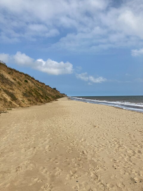
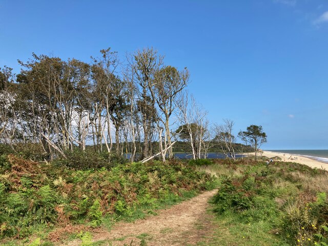
Covehithe Cliffs, located in Suffolk, England, are a stunning natural geological formation that stretches along the coastline of the North Sea. These cliffs are part of the Suffolk Coast and Heaths Area of Outstanding Natural Beauty, known for its diverse and unique landscapes. Covehithe Cliffs specifically lie within the parish of Covehithe, near the town of Lowestoft.

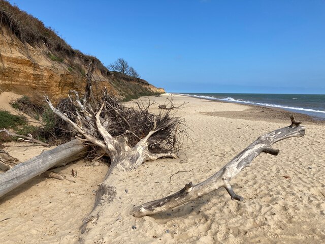
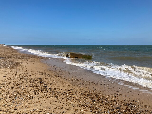
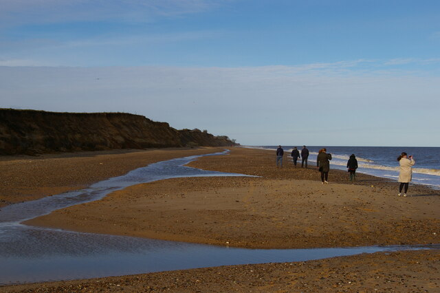
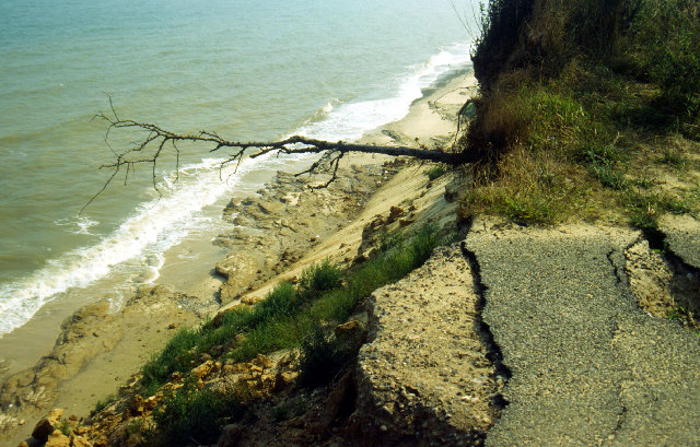
These cliffs are composed of layers of sedimentary rock, primarily consisting of sand and clay. Over thousands of years, the relentless force of the sea has eroded the softer clay layers, leaving behind dramatic, towering cliffs that can reach up to 20 meters in height. The exposed layers of rock in the cliffs provide a visual record of the area's geological history, with distinct bands of different colored sediments.

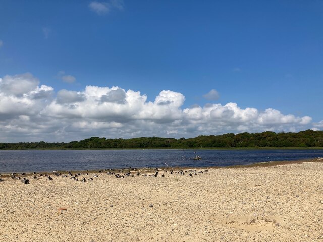
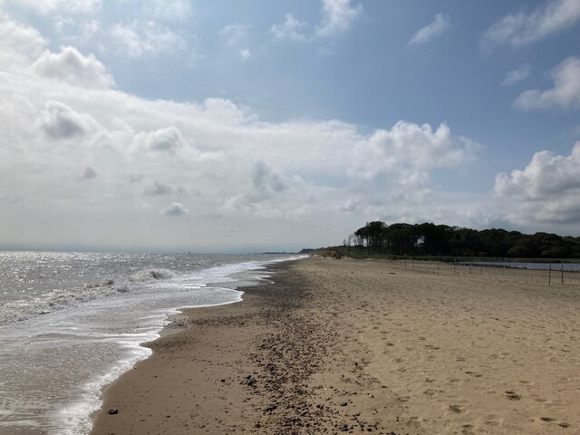
What makes Covehithe Cliffs particularly remarkable is the constant process of erosion and deposition that is actively shaping the coastline. The cliffs are constantly being undercut by the powerful waves, causing sections to collapse and retreat further inland. This dynamic process creates a steep slope at the base of the cliffs, where debris from the eroding cliffs accumulates, forming a unique beach.

Visiting Covehithe Cliffs offers a chance to witness the raw power of nature and appreciate the ever-changing landscape. It is also a haven for wildlife, with various bird species often seen nesting on the cliffs. The area is protected by the Suffolk Coast and Heaths Area of Outstanding Natural Beauty designation, ensuring its preservation and conservation for future generations to enjoy.

If you have any feedback on the listing, please let us know in the comments section below.

Covehithe Cliffs Images

Images are sourced within 2km of 52.377296/1.7111125 or Grid Reference TM5281. Thanks to Geograph Open Source API. All images are credited.

St. Andrew's Church, Covehithe A view of the tower from one of the ruined windows.

See also: <span class="nowrap"><a title="http://www.suffolkchurches.co.uk/covehithe.htm" rel="nofollow ugc noopener" href="http://www.suffolkchurches.co.uk/covehithe.htm">Link</a><img style="margin-left:2px;" alt="External link" title="External link - shift click to open in new window" src="https://s1.geograph.org.uk/img/external.png" width="10" height="10"/></span> (Suffolk Churches Website)
St. Andrew's Church, Covehithe
A view of the tower from one of the ruined windows. See also: LinkExternal link (Suffolk Churches Website)
Covehithe Beach
Covehithe Beach
Long Covert and Benacre Broad
Benacre Broad
Benacre Broad
Beach at Benacre
Beach at Benacre
Fallen trees on the beach
Looking towards North Common Wood
Pillbox on the beach near Benacre
Beach below Covehithe Cliffs
Pillbox in the Sea near Benacre It seems like this pillbox is moving further and further into the sea. In reality the pillbox remains in the same place and the cliff is moving westward.
Pillbox in the Sea near Benacre
It seems like this pillbox is moving further and further into the sea. In reality the pillbox remains in the same place and the cliff is moving westward.
Sugar Beet on the edge of the cliff When this crop was planted the cliff edge must have been elsewhere.  There has clearly been rapid coastal erosion in this area in the past few months.
Sugar Beet on the edge of the cliff
When this crop was planted the cliff edge must have been elsewhere. There has clearly been rapid coastal erosion in this area in the past few months.
Sand Martin Burrows Near Benacre
Sandbar at Benacre Broad
Bracken Rhizomes exposed by Coastal Erosion
Church of St. Andrew, Covehithe <span class="nowrap"><a title="https://historicengland.org.uk/listing/the-list/list-entry/1032168?section=official-list-entry" rel="nofollow ugc noopener" href="https://historicengland.org.uk/listing/the-list/list-entry/1032168?section=official-list-entry">Link</a><img style="margin-left:2px;" alt="External link" title="External link - shift click to open in new window" src="https://s1.geograph.org.uk/img/external.png" width="10" height="10"/></span>
Church of St. Andrew, Covehithe
Anchor House, Covehithe <span class="nowrap"><a title="https://historicengland.org.uk/listing/the-list/list-entry/1352545?section=official-list-entry" rel="nofollow ugc noopener" href="https://historicengland.org.uk/listing/the-list/list-entry/1352545?section=official-list-entry">Link</a><img style="margin-left:2px;" alt="External link" title="External link - shift click to open in new window" src="https://s1.geograph.org.uk/img/external.png" width="10" height="10"/></span>
Anchor House, Covehithe
Church of St. Andrew, Covehithe A church within a church. <span class="nowrap"><a title="https://historicengland.org.uk/listing/the-list/list-entry/1032168?section=official-list-entry" rel="nofollow ugc noopener" href="https://historicengland.org.uk/listing/the-list/list-entry/1032168?section=official-list-entry">Link</a><img style="margin-left:2px;" alt="External link" title="External link - shift click to open in new window" src="https://s1.geograph.org.uk/img/external.png" width="10" height="10"/></span>
Church of St. Andrew, Covehithe
A church within a church. LinkExternal link
Show me another place!

Covehithe Cliffs is located at Grid Ref: TM5281 (Lat: 52.377296, Lng: 1.7111125)

Administrative County: Suffolk

District: East Suffolk

Police Authority: Suffolk

What 3 Words

///swanky.passage.forgotten. Near Kessingland, Suffolk

Related Wikis

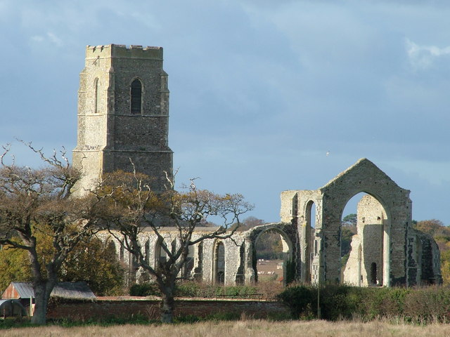
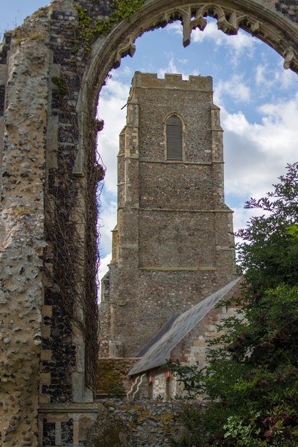
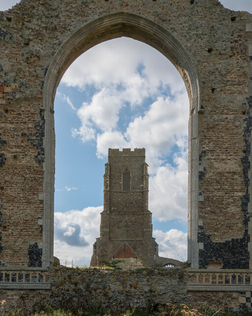
St Andrew's Church, Covehithe

St Andrew's Church is a partly redundant Anglican church in the hamlet of Covehithe in the English county of Suffolk. It is recorded in the National Heritage...

Covehithe

Covehithe is a village and civil parish in the East Suffolk district of the English county of Suffolk. It lies on the North Sea coast around 4 miles (6...

Pakefield to Easton Bavents

Pakefield to Easton Bavents is a 735.4-hectare (1,817-acre) biological and geological Site of Special Scientific Interest which stretches along the Suffolk...

Benacre National Nature Reserve

Benacre National Nature Reserve is a national nature reserve in the English county of Suffolk. It is located on the North Sea coast in the parishes of...

Nearby Amenities

Located within 500m of 52.377296,1.7111125
Source: PGS
Lat/Long: 52.3741484/1.7087603
Source: PGS
Lat/Long: 52.3751374/1.709463
Source: PGS
Lat/Long: 52.3759136/1.7100638
Source: PGS
Lat/Long: 52.3780193/1.7118448
Source: PGS
Lat/Long: 52.3787757/1.7124993
Source: PGS
Lat/Long: 52.3802984/1.7137813
Access: private
Barrier: bollard
Bicycle: private
Foot: private
Motor Vehicle: private
Note: Hanging off edge of cliff on 2019-11-16
Lat/Long: 52.3771865/1.7107544
Covehithe
Place: village
Source: npe
Wikidata: Q2690061
Lat/Long: 52.37635/1.7055067
Bus Stop
Church Covehithe
Bus: yes
Naptan AtcoCode: 390070305
Naptan Bearing: E
Naptan BusStopType: CUS
Naptan CommonName: Church
Naptan Indicator: o/s
Naptan Landmark: Church
Naptan NaptanCode: sufgwptj
Naptan Street: Unclassified
Naptan Verified: no
Public Transport: platform
Shelter: no
Source: naptan_import
Lat/Long: 52.376451/1.7052373
The data included in this document is from www.openstreetmap.org. The data is made available under ODbL.

Have you been to Covehithe Cliffs?

Leave your review of Covehithe Cliffs below (or comments, questions and feedback).