Sandpit Shrubbery

Wood, Forest in Somerset

England

Sandpit Shrubbery

Saltford - Mead Lane & the River Avon
Saltford - Mead Lane & the River Avon Credit: Colin Park

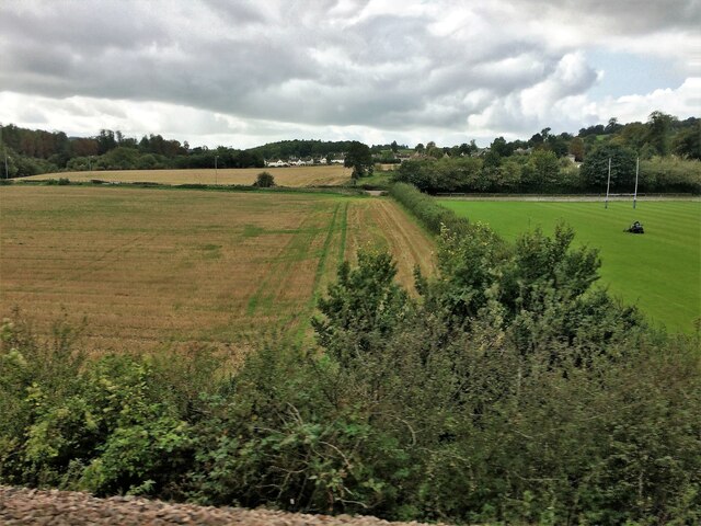
Sandpit Shrubbery is a picturesque woodland area located in Somerset, England. Nestled amidst the rolling hills and idyllic countryside, this natural gem covers an expansive area of approximately 100 acres. The woodland is primarily composed of native tree species, including oak, beech, and birch, creating a diverse and vibrant ecosystem.

The forest floor is blanketed with a lush carpet of mosses, ferns, and wildflowers, adding to the area's enchanting beauty. The dense undergrowth provides a safe and nurturing habitat for a variety of wildlife, including rabbits, squirrels, and numerous bird species. Visitors often have the opportunity to spot woodland creatures going about their daily routines, making it a popular destination for nature enthusiasts and photographers.

Tranquility and serenity are hallmarks of Sandpit Shrubbery, with its peaceful atmosphere and secluded paths inviting visitors to explore and enjoy the natural surroundings. The wood is crisscrossed by a network of well-maintained trails, providing easy access for walkers, hikers, and joggers to immerse themselves in the beauty of the landscape.

Sandpit Shrubbery also boasts a rich historical significance. The wood has been documented as far back as the 12th century, and remnants of ancient settlements and structures can still be found within its boundaries. Archaeological evidence suggests that the area was once inhabited by early settlers, adding an intriguing layer to its allure.

Overall, Sandpit Shrubbery is a haven of tranquility, natural beauty, and historical intrigue. Its woodland charm, diverse wildlife, and well-preserved trails make it a must-visit destination for those seeking a peaceful retreat in the heart of Somerset's enchanting countryside.

If you have any feedback on the listing, please let us know in the comments section below.

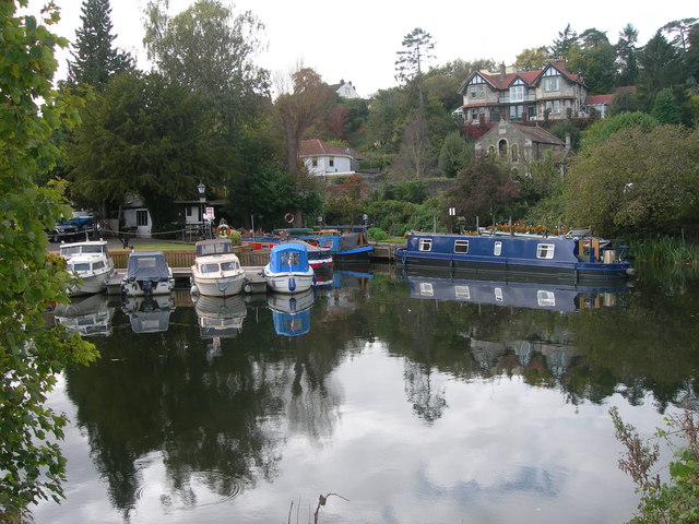
Sandpit Shrubbery Images

Images are sourced within 2km of 51.39976/-2.4242625 or Grid Reference ST7066. Thanks to Geograph Open Source API. All images are credited.

Saltford - Mead Lane & the River Avon
Saltford - The River Avon by the Riverside Inn
Saltford - The River Avon east of Saltford Marina
Flood Relief Railway Tunnels, Saltford. These tunnels cut underneath the disused Midland Railway line (now a cycle path) to stop any flooding from the River Avon nearby damaging it. It allowed flood water through to farm fields on the other side. Access to these tunnels is now available to view since a diverted footpath has been made through woods alongside the original path in the fields to the west.
Flood Relief Railway Tunnels, Saltford.
These tunnels cut underneath the disused Midland Railway line (now a cycle path) to stop any flooding from the River Avon nearby damaging it. It allowed flood water through to farm fields on the other side. Access to these tunnels is now available to view since a diverted footpath has been made through woods alongside the original path in the fields to the west.
Old Boundary Markers beside the A4 on Newton Bridge On Newton Bridge over Corston Brook, on the southwest side of the A4 Bristol Road.

On the left, on the boundary of Newton St Loe and Corston parishes, is Turnpike Parish Boundary Marker SO_BABR03pb. On its left face is NEWT.N / P.H and on its right face is CORST.N / P.H with BRISTOL TURNPIKE TRUST vertically between them and 1823 horizontally above. See also <a title="https://www.geograph.org.uk/photo/6038123" href="https://www.geograph.org.uk/photo/6038123">Link</a>.

On the right, entirely in Corston parish, is bridge marker SO_CORST01br.
Old Boundary Markers beside the A4 on Newton Bridge
On Newton Bridge over Corston Brook, on the southwest side of the A4 Bristol Road. On the left, on the boundary of Newton St Loe and Corston parishes, is Turnpike Parish Boundary Marker SO_BABR03pb. On its left face is NEWT.N / P.H and on its right face is CORST.N / P.H with BRISTOL TURNPIKE TRUST vertically between them and 1823 horizontally above. See also Link. On the right, entirely in Corston parish, is bridge marker SO_CORST01br.
River Avon and Kelston Brass Mill The end of Saltford Lock is seen on the extreme right. There is a heron on the weir. The two annealing furnace chimneys are the remains of a former brass mill and are Listed Grade II.
River Avon and Kelston Brass Mill
The end of Saltford Lock is seen on the extreme right. There is a heron on the weir. The two annealing furnace chimneys are the remains of a former brass mill and are Listed Grade II.
Kelston Brass Mill The outer shells of two former annealing furnaces that are Listed Grade II. There is a good view across the River Avon but no public access to the site.
Kelston Brass Mill
The outer shells of two former annealing furnaces that are Listed Grade II. There is a good view across the River Avon but no public access to the site.
Saltford Lock On the River Avon between Bath and Bristol.
Saltford Lock
On the River Avon between Bath and Bristol.
Saltford Lock On the River Avon. The remains of Kelston Brass Mill are seen on the other side of the weir.
Saltford Lock
On the River Avon. The remains of Kelston Brass Mill are seen on the other side of the weir.
From a Swindon-Bristol train, fields and playing field near Corston
From a Swindon-Bristol train, alongside the River Avon
River Avon and walkway bridge View to the east/north side of the Bristol & Bath Railway path.
River Avon and walkway bridge
View to the east/north side of the Bristol & Bath Railway path.
Old Boundary Marker beside the A39 Wells Road, Corston Turnpike Parish Boundary Marker on the grass verge on the south side of the A39 Wells Road east of Corston village. Corston parish. Grade II Listed details <span class="nowrap"><a title="https://historicengland.org.uk/listing/the-list/list-entry/1320799" rel="nofollow ugc noopener" href="https://historicengland.org.uk/listing/the-list/list-entry/1320799">Link</a><img style="margin-left:2px;" alt="External link" title="External link - shift click to open in new window" src="https://s1.geograph.org.uk/img/external.png" width="10" height="10"/></span>. For an older photo, see <a title="https://www.geograph.org.uk/photo/6048086" href="https://www.geograph.org.uk/photo/6048086">Link</a>. See also <a title="https://www.geograph.org.uk/photo/5883994" href="https://www.geograph.org.uk/photo/5883994">Link</a> and <a title="https://www.geograph.org.uk/photo/1719253" href="https://www.geograph.org.uk/photo/1719253">Link</a>.

Milestone Society National ID: SO_BAMK03pb
Old Boundary Marker beside the A39 Wells Road, Corston
Turnpike Parish Boundary Marker on the grass verge on the south side of the A39 Wells Road east of Corston village. Corston parish. Grade II Listed details LinkExternal link. For an older photo, see Link. See also Link and Link. Milestone Society National ID: SO_BAMK03pb
Old Milestone by the A4, Bath Road, Saltford Metal plate attached to stone post by the A4, in parish of SALTFORD (BATH AND NORTH EAST SOMERSET District), Bath Road, near top of hill going into Saltford from Bath, embedded in stone retaining wall beside pavement, on West side of road. Bristol iron plate, erected by the Bristol turnpike trust in the 19th century. 

Inscription reads:- : 7 / MILES / TO / BRISTOL : 
Serifs. Carved benchmark at base of stone.

Milestone Society National ID: SO_BABR05.
Old Milestone by the A4, Bath Road, Saltford
Metal plate attached to stone post by the A4, in parish of SALTFORD (BATH AND NORTH EAST SOMERSET District), Bath Road, near top of hill going into Saltford from Bath, embedded in stone retaining wall beside pavement, on West side of road. Bristol iron plate, erected by the Bristol turnpike trust in the 19th century. Inscription reads:- : 7 / MILES / TO / BRISTOL : Serifs. Carved benchmark at base of stone. Milestone Society National ID: SO_BABR05.
The marina at Saltford
The River Avon by Saltford
The River Avon by Corston
River Avon, Saltford An area popular with boat lovers.
River Avon, Saltford
An area popular with boat lovers.
Show me another place!

Sandpit Shrubbery is located at Grid Ref: ST7066 (Lat: 51.39976, Lng: -2.4242625)

Unitary Authority: Bath and North East Somerset

Police Authority: Avon and Somerset

What 3 Words

///assembles.mailing.obvious. Near Corston, Somerset

Related Wikis

Kelston toll road

The Kelston toll road was a 1,198-foot-long (365 m) private, temporary toll road, built by a private entrepreneur without planning permission between Bath...

Kelston

Kelston is a small village and civil parish in Somerset, 4 miles (6.4 km) north west of Bath, and 8 miles (12.9 km) east of Bristol, on the A431 road....

Kelston Knoll

Kelston Knoll is a Grade II listed building on the National Heritage List for England, located in the parish of Kelston, a village near Bath, in Somerset...

Kelston Park

Kelston Park is an 18th-century country house in the village of Kelston, approximately 3 miles from Bath in North East Somerset, England. Altogether the...

Nearby Amenities

Located within 500m of 51.39976,-2.4242625
Bus Stop
Kelston Park
Bus: yes
Naptan AtcoCode: 0180BAC30653
Naptan Bearing: NW
Naptan CommonName: Kelston Park
Naptan NaptanCode: bthdjdg
Naptan Street: Kelston Road
Naptan Verified: no
Public Transport: platform
Source: naptan_import
Lat/Long: 51.3966879/-2.4230157
Bus Stop
Kelston Pk
Bus: yes
Naptan AtcoCode: 0180BAC30654
Naptan Bearing: SE
Naptan CommonName: Kelston Pk
Naptan NaptanCode: bthdjda
Naptan Street: Kelston Road
Naptan Verified: no
Public Transport: platform
Source: naptan_import
Lat/Long: 51.39684/-2.4232328
Power: pole
Lat/Long: 51.396447/-2.4290731
Power: pole
Lat/Long: 51.3964647/-2.4278819
Power: pole
Lat/Long: 51.396466/-2.4266378
Power: pole
Lat/Long: 51.3964863/-2.4253715
Power: pole
Lat/Long: 51.396499/-2.4241498
Power: pole
Transformer: distribution
Lat/Long: 51.3965002/-2.4230196
Power: pole
Lat/Long: 51.3969657/-2.4220764
Power: pole
Lat/Long: 51.3970811/-2.4210112
Power: pole
Lat/Long: 51.3968842/-2.4231324
The data included in this document is from www.openstreetmap.org. The data is made available under ODbL.

Have you been to Sandpit Shrubbery?

Leave your review of Sandpit Shrubbery below (or comments, questions and feedback).