Kelston Park

Downs, Moorland in Somerset

England

Kelston Park

Saltford - Mead Lane & the River Avon
Saltford - Mead Lane & the River Avon Credit: Colin Park

Kelston Park is a picturesque estate located in Somerset, England. It is situated on the outskirts of the village of Kelston, nestled within the rolling hills of the Somerset Downs. This idyllic location offers visitors breathtaking views of the surrounding countryside, making it a popular destination for nature enthusiasts and outdoor enthusiasts alike.

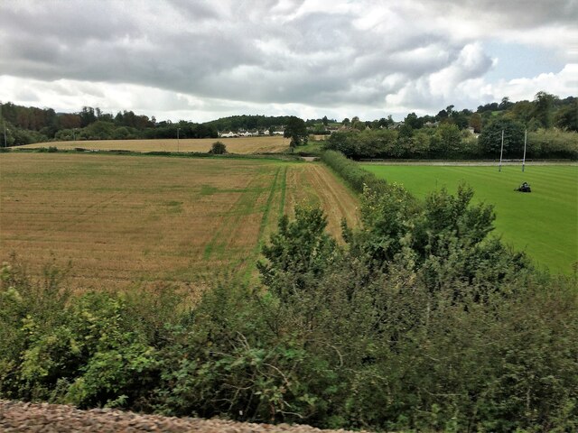
The park covers a vast area, encompassing both downs and moorland. The downs, characterized by their gently sloping hills and grassy landscapes, provide ample space for recreational activities such as walking, hiking, and picnicking. Visitors can explore the numerous walking trails that wind their way through the downs, offering a chance to immerse themselves in the beauty of nature.

In contrast, the moorland within Kelston Park offers a unique and diverse ecosystem. Here, visitors can discover a variety of flora and fauna, including heather, gorse, and mosses. The moorland is also home to several species of birds and small mammals, making it a haven for wildlife enthusiasts and birdwatchers.

Kelston Park is not just a natural haven; it also holds historical significance. The estate is home to Kelston Round Hill, an ancient hillfort that dates back to the Iron Age. This archaeological site provides a fascinating glimpse into the region's rich history and offers visitors a chance to step back in time.

Overall, Kelston Park is a hidden gem in the Somerset countryside, offering a perfect blend of natural beauty, outdoor activities, and historical significance. Whether one seeks a peaceful retreat or an adventurous day out, this park has something to offer for everyone.

If you have any feedback on the listing, please let us know in the comments section below.
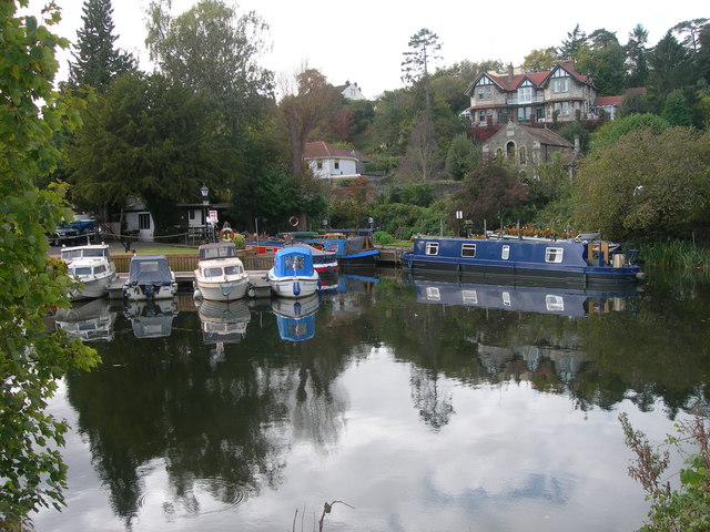
Kelston Park Images

Images are sourced within 2km of 51.397765/-2.4289013 or Grid Reference ST7066. Thanks to Geograph Open Source API. All images are credited.

Saltford - Mead Lane & the River Avon
Saltford Manor The Saltford Manor is thought to be the oldest continuously occupied private house in England, and has been designated as a Grade II listed building.
The original Norman construction was by William Fitz Robert, 2nd Earl of Gloucester, and was built on an estate owned at the time of the Domesday Book by Geoffrey de Montbray the Bishop of Coutances. It is contemporary with nearby Horton Court which was a prebendary house, therefore it is likely that Saltford had an association with Keynsham Abbey, and has long been associated with St Mary's Church in Saltford. (source Wikipedia)
Saltford Manor
The Saltford Manor is thought to be the oldest continuously occupied private house in England, and has been designated as a Grade II listed building. The original Norman construction was by William Fitz Robert, 2nd Earl of Gloucester, and was built on an estate owned at the time of the Domesday Book by Geoffrey de Montbray the Bishop of Coutances. It is contemporary with nearby Horton Court which was a prebendary house, therefore it is likely that Saltford had an association with Keynsham Abbey, and has long been associated with St Mary's Church in Saltford. (source Wikipedia)
Saltford - The River Avon by the Riverside Inn
Saltford - The River Avon east of Saltford Marina
Flood Relief Railway Tunnels, Saltford. These tunnels cut underneath the disused Midland Railway line (now a cycle path) to stop any flooding from the River Avon nearby damaging it. It allowed flood water through to farm fields on the other side. Access to these tunnels is now available to view since a diverted footpath has been made through woods alongside the original path in the fields to the west.
Flood Relief Railway Tunnels, Saltford.
These tunnels cut underneath the disused Midland Railway line (now a cycle path) to stop any flooding from the River Avon nearby damaging it. It allowed flood water through to farm fields on the other side. Access to these tunnels is now available to view since a diverted footpath has been made through woods alongside the original path in the fields to the west.
Old Boundary Markers beside the A4 on Newton Bridge On Newton Bridge over Corston Brook, on the southwest side of the A4 Bristol Road.

On the left, on the boundary of Newton St Loe and Corston parishes, is Turnpike Parish Boundary Marker SO_BABR03pb. On its left face is NEWT.N / P.H and on its right face is CORST.N / P.H with BRISTOL TURNPIKE TRUST vertically between them and 1823 horizontally above. See also <a title="https://www.geograph.org.uk/photo/6038123" href="https://www.geograph.org.uk/photo/6038123">Link</a>.

On the right, entirely in Corston parish, is bridge marker SO_CORST01br.
Old Boundary Markers beside the A4 on Newton Bridge
On Newton Bridge over Corston Brook, on the southwest side of the A4 Bristol Road. On the left, on the boundary of Newton St Loe and Corston parishes, is Turnpike Parish Boundary Marker SO_BABR03pb. On its left face is NEWT.N / P.H and on its right face is CORST.N / P.H with BRISTOL TURNPIKE TRUST vertically between them and 1823 horizontally above. See also Link. On the right, entirely in Corston parish, is bridge marker SO_CORST01br.
River Avon and Kelston Brass Mill The end of Saltford Lock is seen on the extreme right. There is a heron on the weir. The two annealing furnace chimneys are the remains of a former brass mill and are Listed Grade II.
River Avon and Kelston Brass Mill
The end of Saltford Lock is seen on the extreme right. There is a heron on the weir. The two annealing furnace chimneys are the remains of a former brass mill and are Listed Grade II.
Kelston Brass Mill The outer shells of two former annealing furnaces that are Listed Grade II. There is a good view across the River Avon but no public access to the site.
Kelston Brass Mill
The outer shells of two former annealing furnaces that are Listed Grade II. There is a good view across the River Avon but no public access to the site.
Saltford Lock On the River Avon between Bath and Bristol.
Saltford Lock
On the River Avon between Bath and Bristol.
Saltford Lock On the River Avon. The remains of Kelston Brass Mill are seen on the other side of the weir.
Saltford Lock
On the River Avon. The remains of Kelston Brass Mill are seen on the other side of the weir.
From a Swindon-Bristol train, fields and playing field near Corston
From a Swindon-Bristol train, alongside the River Avon
River Avon and walkway bridge View to the east/north side of the Bristol & Bath Railway path.
River Avon and walkway bridge
View to the east/north side of the Bristol & Bath Railway path.
Old Boundary Marker beside the A39 Wells Road, Corston Turnpike Parish Boundary Marker on the grass verge on the south side of the A39 Wells Road east of Corston village. Corston parish. Grade II Listed details <span class="nowrap"><a title="https://historicengland.org.uk/listing/the-list/list-entry/1320799" rel="nofollow ugc noopener" href="https://historicengland.org.uk/listing/the-list/list-entry/1320799">Link</a><img style="margin-left:2px;" alt="External link" title="External link - shift click to open in new window" src="https://s1.geograph.org.uk/img/external.png" width="10" height="10"/></span>. For an older photo, see <a title="https://www.geograph.org.uk/photo/6048086" href="https://www.geograph.org.uk/photo/6048086">Link</a>. See also <a title="https://www.geograph.org.uk/photo/5883994" href="https://www.geograph.org.uk/photo/5883994">Link</a> and <a title="https://www.geograph.org.uk/photo/1719253" href="https://www.geograph.org.uk/photo/1719253">Link</a>.

Milestone Society National ID: SO_BAMK03pb
Old Boundary Marker beside the A39 Wells Road, Corston
Turnpike Parish Boundary Marker on the grass verge on the south side of the A39 Wells Road east of Corston village. Corston parish. Grade II Listed details LinkExternal link. For an older photo, see Link. See also Link and Link. Milestone Society National ID: SO_BAMK03pb
The marina at Saltford
The River Avon by Saltford
The River Avon by Corston
River Avon, Saltford An area popular with boat lovers.
River Avon, Saltford
An area popular with boat lovers.
Show me another place!

Kelston Park is located at Grid Ref: ST7066 (Lat: 51.397765, Lng: -2.4289013)

Unitary Authority: Bath and North East Somerset

Police Authority: Avon and Somerset

What 3 Words

///finishes.recliner.scatters. Near Corston, Somerset

Related Wikis

Kelston Park

Kelston Park is an 18th-century country house in the village of Kelston, approximately 3 miles from Bath in North East Somerset, England. Altogether the...

Kelston

Kelston is a small village and civil parish in Somerset, 4 miles (6.4 km) north west of Bath, and 8 miles (12.9 km) east of Bristol, on the A431 road....

Kelston toll road

The Kelston toll road was a 1,198-foot-long (365 m) private, temporary toll road, built by a private entrepreneur without planning permission between Bath...

Kelston Knoll

Kelston Knoll is a Grade II listed building on the National Heritage List for England, located in the parish of Kelston, a village near Bath, in Somerset...

Avon County Rowing Club

Avon County Rowing Club is a rowing club on the River Avon based at the Saltford Rowing Centre, Bath Road, Saltford, Bristol. == History == The club was...

University of Bristol Boat Club

University of Bristol Boat Club is a rowing club on the River Avon based at the Saltford Rowing Centre, Bath Road, Saltford, Bristol. == History == The...

Kelston Lock

Kelston Lock is a canal lock situated on the River Avon, between the villages of Kelston and Saltford, between Bristol and Bath, England. The Bristol Avon...

Saltford railway station

Saltford railway station was a small station on the Great Western Main Line between Bath and Bristol in use between 1840 and 1970. It served the village...

Nearby Amenities

Located within 500m of 51.397765,-2.4289013
Bus Stop
Kelston Park
Bus: yes
Naptan AtcoCode: 0180BAC30653
Naptan Bearing: NW
Naptan CommonName: Kelston Park
Naptan NaptanCode: bthdjdg
Naptan Street: Kelston Road
Naptan Verified: no
Public Transport: platform
Source: naptan_import
Lat/Long: 51.3966879/-2.4230157
Bus Stop
Kelston Pk
Bus: yes
Naptan AtcoCode: 0180BAC30654
Naptan Bearing: SE
Naptan CommonName: Kelston Pk
Naptan NaptanCode: bthdjda
Naptan Street: Kelston Road
Naptan Verified: no
Public Transport: platform
Source: naptan_import
Lat/Long: 51.39684/-2.4232328
Power: pole
Lat/Long: 51.397927/-2.4358238
Power: pole
Lat/Long: 51.3969847/-2.4346671
Power: pole
Lat/Long: 51.3975567/-2.4353888
Power: pole
Lat/Long: 51.3963899/-2.4339293
Power: pole
Lat/Long: 51.3964051/-2.4327239
Power: pole
Lat/Long: 51.3958369/-2.4332483
Power: pole
Lat/Long: 51.3964178/-2.4315062
Power: pole
Lat/Long: 51.3964381/-2.4302886
Power: pole
Lat/Long: 51.396447/-2.4290731
Power: pole
Lat/Long: 51.3964647/-2.4278819
Power: pole
Lat/Long: 51.396466/-2.4266378
Power: pole
Lat/Long: 51.3964863/-2.4253715
Power: pole
Lat/Long: 51.396499/-2.4241498
Power: pole
Transformer: distribution
Lat/Long: 51.3965002/-2.4230196
Power: pole
Lat/Long: 51.3969657/-2.4220764
Power: pole
Lat/Long: 51.3968842/-2.4231324
Power: pole
Lat/Long: 51.3952776/-2.4325572
Power: pole
Lat/Long: 51.3947043/-2.4318518
The data included in this document is from www.openstreetmap.org. The data is made available under ODbL.

Have you been to Kelston Park?

Leave your review of Kelston Park below (or comments, questions and feedback).