Sayerclose Wood

Wood, Forest in Yorkshire South Lakeland

England

Sayerclose Wood

Fields Beside Road To Hebblethwaite Hall
Fields Beside Road To Hebblethwaite Hall Credit: David Robinson

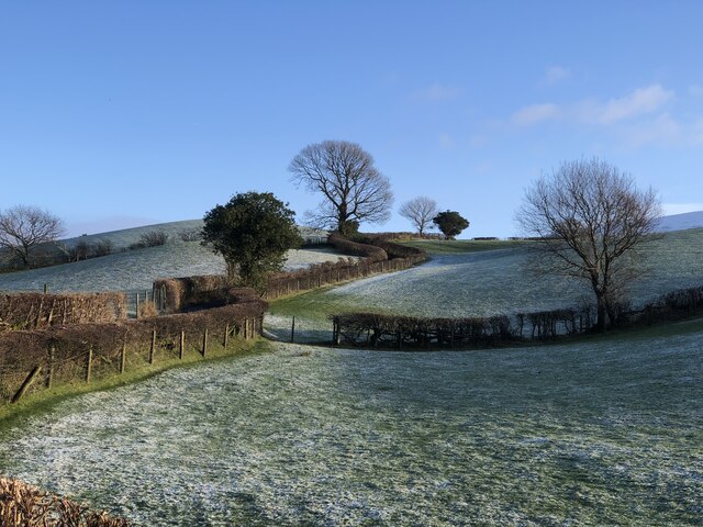
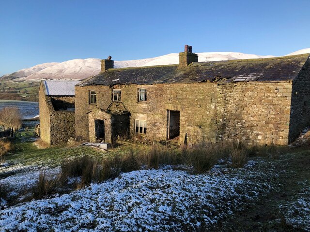
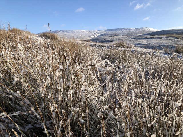
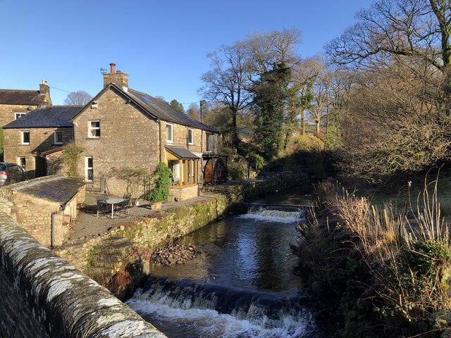
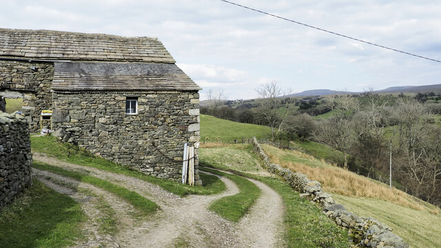
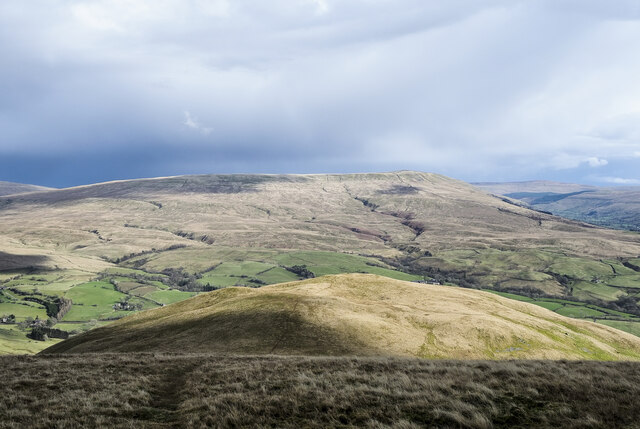
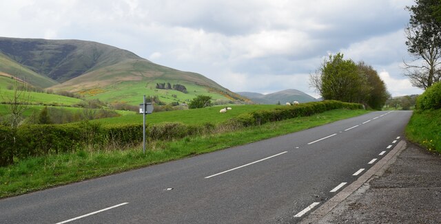
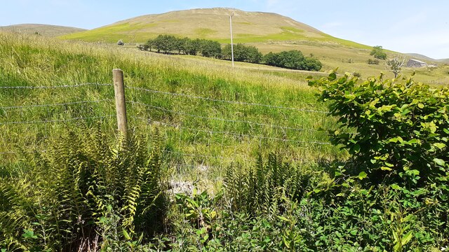
Sayerclose Wood is a picturesque woodland located in the county of Yorkshire, England. Situated in the heart of the countryside, this charming forest covers an area of approximately 100 acres. The wood is known for its tranquil and serene atmosphere, making it a popular destination for nature enthusiasts and those seeking a peaceful retreat.

The wood is predominantly made up of a mixture of deciduous and coniferous trees, creating a diverse and rich habitat for various wildlife species. Visitors to Sayerclose Wood can expect to encounter a range of flora and fauna, including oak, beech, and birch trees, as well as squirrels, foxes, and a variety of bird species.

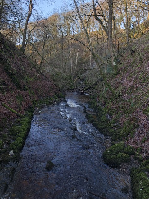
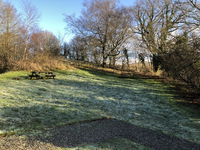
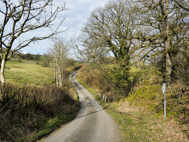
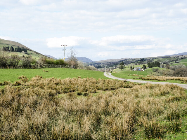
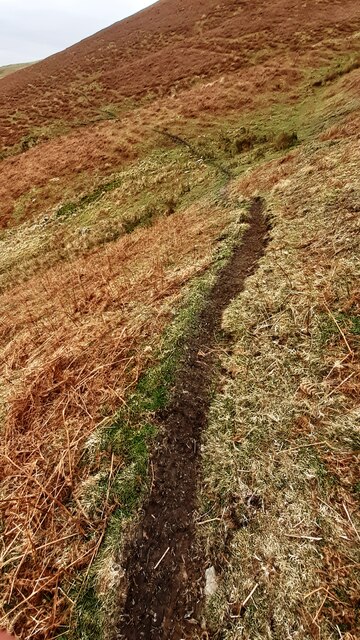
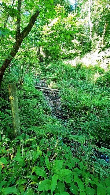
The woodland features well-maintained walking trails, allowing visitors to explore the forest at their own pace. These paths meander through the wood, leading to secluded clearings and enchanting groves. The area is also home to a small stream, which adds to the overall charm of the woodland.

Sayerclose Wood is a haven for outdoor activities such as hiking, birdwatching, and photography. The peaceful ambiance and natural beauty of the wood make it an ideal location for those looking to escape the hustle and bustle of daily life.

Overall, Sayerclose Wood offers a tranquil and idyllic setting for visitors to immerse themselves in the beauty of nature. With its diverse flora and fauna, well-maintained trails, and serene atmosphere, this woodland is a true gem in the Yorkshire countryside.

If you have any feedback on the listing, please let us know in the comments section below.

Sayerclose Wood Images

Images are sourced within 2km of 54.340785/-2.4733513 or Grid Reference SD6994. Thanks to Geograph Open Source API. All images are credited.

Fields Beside Road To Hebblethwaite Hall
Hebblethwaite Hall Gill
Abandoned Farmhouse at Sarthwaite
Icy Moorland Above Sarthwaite
Weirs on Hebblethwaite Hall Gill at Burntmill Bridge
Picnic Area Beside A 683
Minor road with passing place The road is seen heading north towards the farm at Thursgill where it ends as a publicly motorable route. It's climbing from a stream crossing near to Ellerthwaite.
Minor road with passing place
The road is seen heading north towards the farm at Thursgill where it ends as a publicly motorable route. It's climbing from a stream crossing near to Ellerthwaite.
Ridge rising to Great Dummacks Great Dummacks is an elongated rib of ground at the top of the rising ridge and across the head of the valley to the left. As with most Howgill ridges there's a quad bike track following this one which acts perfectly as a path for those on foot.
Ridge rising to Great Dummacks
Great Dummacks is an elongated rib of ground at the top of the rising ridge and across the head of the valley to the left. As with most Howgill ridges there's a quad bike track following this one which acts perfectly as a path for those on foot.
Barn at Fawcett Bank Fawcett Bank is a farm in the valley of the River Rawthey. The farm road, also a public footpath, is the course of a named long distance path based on a walk made by Alfred Wainwright in 1938, 'A Pennine Journey'.
Barn at Fawcett Bank
Fawcett Bank is a farm in the valley of the River Rawthey. The farm road, also a public footpath, is the course of a named long distance path based on a walk made by Alfred Wainwright in 1938, 'A Pennine Journey'.
Route of 'A Pennine Journey' The road is the access route for the farm at Fawcett Bank; it's not a public road for motoring but is a public footpath and is now the route of the long distance walk. The route is not the one followed in 1938 by Alfred Wainwright and recorded by him in a version not originally intended for publication, but a similar one made in 1998 by David and Heather Pitt.
Route of 'A Pennine Journey'
The road is the access route for the farm at Fawcett Bank; it's not a public road for motoring but is a public footpath and is now the route of the long distance walk. The route is not the one followed in 1938 by Alfred Wainwright and recorded by him in a version not originally intended for publication, but a similar one made in 1998 by David and Heather Pitt.
Moorland path crossing Hollow Gill
Looking down Hollow Gill
Knott Knott is one of the lesser hills of the Howgill group; it lies to the east of Sickers Fell from which the image was taken.
The higher and more massive hill in the distance is Baugh Fell.
Knott
Knott is one of the lesser hills of the Howgill group; it lies to the east of Sickers Fell from which the image was taken. The higher and more massive hill in the distance is Baugh Fell.
The A683 Beside the picnic area.
The A683
Beside the picnic area.
Garage across minor road (Buckbank Lane) from Ellerthwaite
Ellerthwaite on west side of Buckbank Lane
Stream on west side of Buckbank Lane near Ellerthwaite
View towards Knott from Buckbank Lane
Show me another place!

Sayerclose Wood is located at Grid Ref: SD6994 (Lat: 54.340785, Lng: -2.4733513)

Division: West Riding

Administrative County: Cumbria

District: South Lakeland

Police Authority: Cumbria

What 3 Words

///logbook.turntable.socket. Near Sedbergh, Cumbria

Related Wikis

Clough River

The Clough River is a river in Cumbria, England. A tributary of the River Rawthey, it flows for 21.8 kilometres (13.5 mi) primarily through the Garsdale...

Calders (Yorkshire Dales)

Calders is a summit of 2,211 feet (674 m) in the Howgill Fells, Cumbria, England. It lies about 2⁄3 mile (1 km) south east of the summit of The Calf and...

Settlebeck School

Settlebeck School is a small coeducational secondary school with academy status. It is located in Sedbergh in the English county of Cumbria, drawing pupils...

The Calf

The Calf, at 676 m, is the highest top in the Howgill Fells, an area of high ground in the north-west of the Yorkshire Dales in the county of Cumbria...

The Bull Hotel, Sedbergh

The Bull Hotel, formerly The Black Bull Hotel, is a 17th-century coaching inn in Sedbergh, Cumbria. It is located in a narrow passage parallel with the...

Sedbergh

Sedbergh ( SED-bər or locally SEB-ər) is a town and civil parish in the ceremonial county of Cumbria. It falls within the historic boundaries of the West...

St Andrew's Church, Sedbergh

St Andrew's Church is in Main Street, Sedbergh, Cumbria, England. It is an active Anglican parish church in the deanery of Kendal, and the diocese of Carlisle...

Sedbergh People's Hall

Sedbergh People's Hall is a village hall in Sedbergh, unique because it was built by the people, for the people. == Land and lease == The land on which...

Nearby Amenities

Located within 500m of 54.340785,-2.4733513
Sayerclose Wood
Natural: woodland
Source: OS OpenData StreetView
Lat/Long: 54.3410538/-2.472713
Give Way
Direction: forward
Lat/Long: 54.3416052/-2.4792058
Entrance: main
Lat/Long: 54.3420261/-2.4792853
Power: pole
Lat/Long: 54.344398/-2.4751291
Power: pole
Lat/Long: 54.3435279/-2.4717937
Power: pole
Lat/Long: 54.3434708/-2.4734768
Power: pole
Lat/Long: 54.3434662/-2.4746476
Power: pole
Lat/Long: 54.3434677/-2.4761724
Power: pole
Lat/Long: 54.3425749/-2.4769422
Power: pole
Lat/Long: 54.3420769/-2.4774183
Power: pole
Lat/Long: 54.3410899/-2.4782894
Power: pole
Lat/Long: 54.3406283/-2.4786991
Power: pole
Lat/Long: 54.3395212/-2.4794944
Barrier: stile
Material: wood
Source: survey;gps
Stile: stepover
Lat/Long: 54.3436495/-2.4710121
Tourism: camp_pitch
Lat/Long: 54.3396932/-2.479599
Tourism: camp_pitch
Lat/Long: 54.3397511/-2.479713
Tourism: camp_pitch
Lat/Long: 54.3398097/-2.4798109
Tourism: camp_pitch
Lat/Long: 54.3398613/-2.4799195
T5
Tourism: camp_pitch
Lat/Long: 54.3399184/-2.4800254
T4
Tourism: camp_pitch
Lat/Long: 54.33997/-2.480126
Power: pole
Lat/Long: 54.3417094/-2.4791094
Power: pole
Lat/Long: 54.341877/-2.479725
Power: pole
Lat/Long: 54.3421591/-2.4793058
Power: pole
Lat/Long: 54.3424663/-2.4788291
Power: pole
Lat/Long: 54.3427442/-2.4784027
The data included in this document is from www.openstreetmap.org. The data is made available under ODbL.

Have you been to Sayerclose Wood?

Leave your review of Sayerclose Wood below (or comments, questions and feedback).