Camerton Wood

Wood, Forest in Somerset

England

Camerton Wood

St John the Baptist Church at Peasdown St John.
St John the Baptist Credit: Wayland Smith

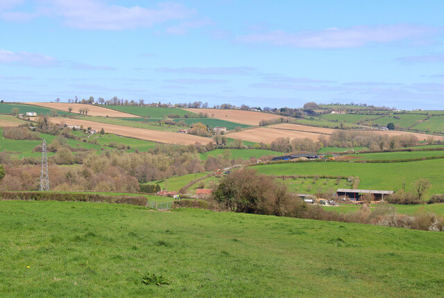
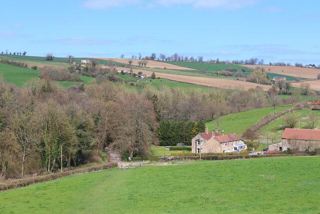
Camerton Wood is a picturesque woodland located in Somerset, England. Situated near the village of Camerton, this thriving forest covers an area of approximately 30 hectares. The woodland is predominantly composed of deciduous trees, including oak, ash, beech, and sycamore, creating a rich and diverse ecosystem.

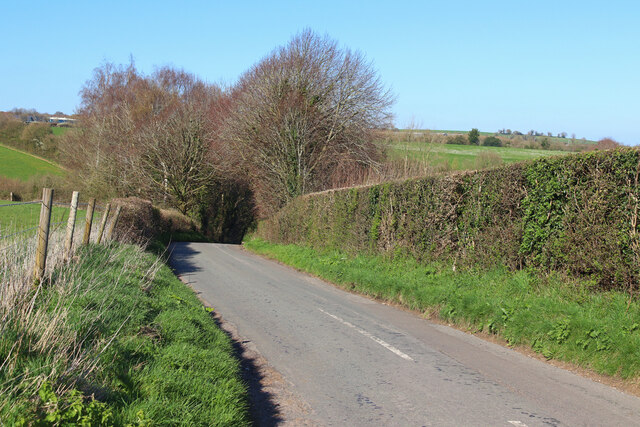
As visitors enter Camerton Wood, they are greeted by a well-maintained network of walking trails that meander through the forest. These paths provide an opportunity to explore the natural beauty of the area while enjoying a peaceful and serene atmosphere. The woodland floor is adorned with an array of wildflowers, creating a colorful carpet during the spring and summer months.

The wood is home to a variety of wildlife, making it a popular spot for nature enthusiasts and birdwatchers. Visitors may catch a glimpse of woodland birds such as woodpeckers, owls, and nuthatches, as well as larger mammals like deer, foxes, and badgers.

Camerton Wood has a rich history, dating back centuries. It was once part of the great Forest of Selwood, an extensive woodland that covered much of Somerset and Wiltshire. Today, it is managed by a local conservation organization, ensuring the preservation of its natural beauty for future generations to enjoy.

Overall, Camerton Wood offers a peaceful retreat from the hustle and bustle of daily life, providing a sanctuary for both wildlife and visitors alike. Its tranquil ambiance, stunning scenery, and diverse flora and fauna make it a must-visit destination for anyone seeking solace in nature.

If you have any feedback on the listing, please let us know in the comments section below.

Camerton Wood Images

Images are sourced within 2km of 51.312962/-2.4414672 or Grid Reference ST6957. Thanks to Geograph Open Source API. All images are credited.

St John the Baptist Church at Peasdown St John.
St John the Baptist
Church at Peasdown St John.
Unsuitable for wide users A footpath/road has some conflicts of restriction.
Unsuitable for wide users
A footpath/road has some conflicts of restriction.
It's an old question The chicken was one of several that were roaming free on the quiet roads hereabouts, calmly and serenely exploring for morsels. There was a moment to pose the obvious; he stopped for a short pause but said he had other plots to hatch.
It's an old question
The chicken was one of several that were roaming free on the quiet roads hereabouts, calmly and serenely exploring for morsels. There was a moment to pose the obvious; he stopped for a short pause but said he had other plots to hatch.
Stoneage Lane An unusual name for a lane, but one that is quite old.
Stoneage Lane
An unusual name for a lane, but one that is quite old.
St John's hall Next to the church is a metal-clad hall. It stands where the original church stood in the past.
St John's hall
Next to the church is a metal-clad hall. It stands where the original church stood in the past.
Carlingcott Methodist church The building was founded in 1851, along with a schoolroom, as a United Free Methodist church. They faced some competition not far up the road in the form of a Wesleyan chapel. The Free church later became the Carlingcott Methodist chapel, before closure a few years ago. The church, its attached gates, piers and flanking walls are Grade II listed.
Carlingcott Methodist church
The building was founded in 1851, along with a schoolroom, as a United Free Methodist church. They faced some competition not far up the road in the form of a Wesleyan chapel. The Free church later became the Carlingcott Methodist chapel, before closure a few years ago. The church, its attached gates, piers and flanking walls are Grade II listed.
Difficult to notice Carlingcott Methodist church appears to have been disused for a few years, as the old wooden notice shows.
Difficult to notice
Carlingcott Methodist church appears to have been disused for a few years, as the old wooden notice shows.
Houses in Clandown Houses on the edge of Clandown.
Houses in Clandown
Houses on the edge of Clandown.
Bath Road, Peasedown St John Bath Road bisects Peasedown St John and contains most of its shops and services. On the right are the premises of the former 'Daily Bread' bakery (which did not long survive a bad food hygiene rating in 2018). Beyond it are the Zodiac Hair Studio <span class="nowrap"><a title="http://zodiac-hair-studio.edan.io/" rel="nofollow ugc noopener" href="http://zodiac-hair-studio.edan.io/">Link</a><img style="margin-left:2px;" alt="External link" title="External link - shift click to open in new window" src="https://s1.geograph.org.uk/img/external.png" width="10" height="10"/></span> and the Barber Zone <span class="nowrap"><a title="https://barber-zone-peasedown-st-john.business.site/" rel="nofollow ugc noopener" href="https://barber-zone-peasedown-st-john.business.site/">Link</a><img style="margin-left:2px;" alt="External link" title="External link - shift click to open in new window" src="https://s1.geograph.org.uk/img/external.png" width="10" height="10"/></span> ; the latter replacing a coffee shop which was presumably killed off by closure in the pandemic.
Bath Road, Peasedown St John
Bath Road bisects Peasedown St John and contains most of its shops and services. On the right are the premises of the former 'Daily Bread' bakery (which did not long survive a bad food hygiene rating in 2018). Beyond it are the Zodiac Hair Studio LinkExternal link and the Barber Zone LinkExternal link ; the latter replacing a coffee shop which was presumably killed off by closure in the pandemic.
Off Firgrove Lane Looking across fields towards Splott Farm.
Off Firgrove Lane
Looking across fields towards Splott Farm.
Splott Farm Near Carlingcott.
Splott Farm
Near Carlingcott.
Ashgrove Cemetery Ashgrove Cemetery, Peasdown St John.
Ashgrove Cemetery
Ashgrove Cemetery, Peasdown St John.
Green Street Looking down the hill towards Shoscombe.
Green Street
Looking down the hill towards Shoscombe.
A cart on Dunkerton Hill An old colliery item stands as to welcome visitors to the old mining village.
A cart on Dunkerton Hill
An old colliery item stands as to welcome visitors to the old mining village.
Eckweek Lane An unusual name, and an older one than most of the surroundings. This was a lane in the nineteenth century that went to Eckweek Cottages and then Eckweek House - both are now lost to the modern housing. At that time Eckweek Road was merely a footpath, and the area was known as Ashgrove (perhaps after a cottage of that name, which has also gone).
Eckweek Lane
An unusual name, and an older one than most of the surroundings. This was a lane in the nineteenth century that went to Eckweek Cottages and then Eckweek House - both are now lost to the modern housing. At that time Eckweek Road was merely a footpath, and the area was known as Ashgrove (perhaps after a cottage of that name, which has also gone).
Thumbs up from the big man St Joseph's R.C. church in Peasedown stands on the main road, and is a modern version of the older church which was here before.
Thumbs up from the big man
St Joseph's R.C. church in Peasedown stands on the main road, and is a modern version of the older church which was here before.
Half a hall The Christadelphian church in Peasedown St John have had a hall on Huddox Hill since the early twentieth century. However it is now being demolished.
Half a hall
The Christadelphian church in Peasedown St John have had a hall on Huddox Hill since the early twentieth century. However it is now being demolished.
The hall is open The Christadelphian hall is halfway through being brought down. It seems to be a sudden turn of events as the hall still has lots of furniture inside still.
The hall is open
The Christadelphian hall is halfway through being brought down. It seems to be a sudden turn of events as the hall still has lots of furniture inside still.
Show me another place!

Camerton Wood is located at Grid Ref: ST6957 (Lat: 51.312962, Lng: -2.4414672)

Unitary Authority: Bath and North East Somerset

Police Authority: Avon and Somerset

What 3 Words

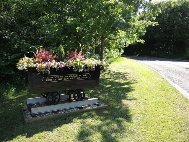
///invested.stretcher.poorly. Near Peasedown St John, Somerset

Related Wikis

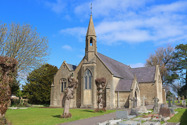
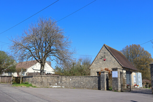
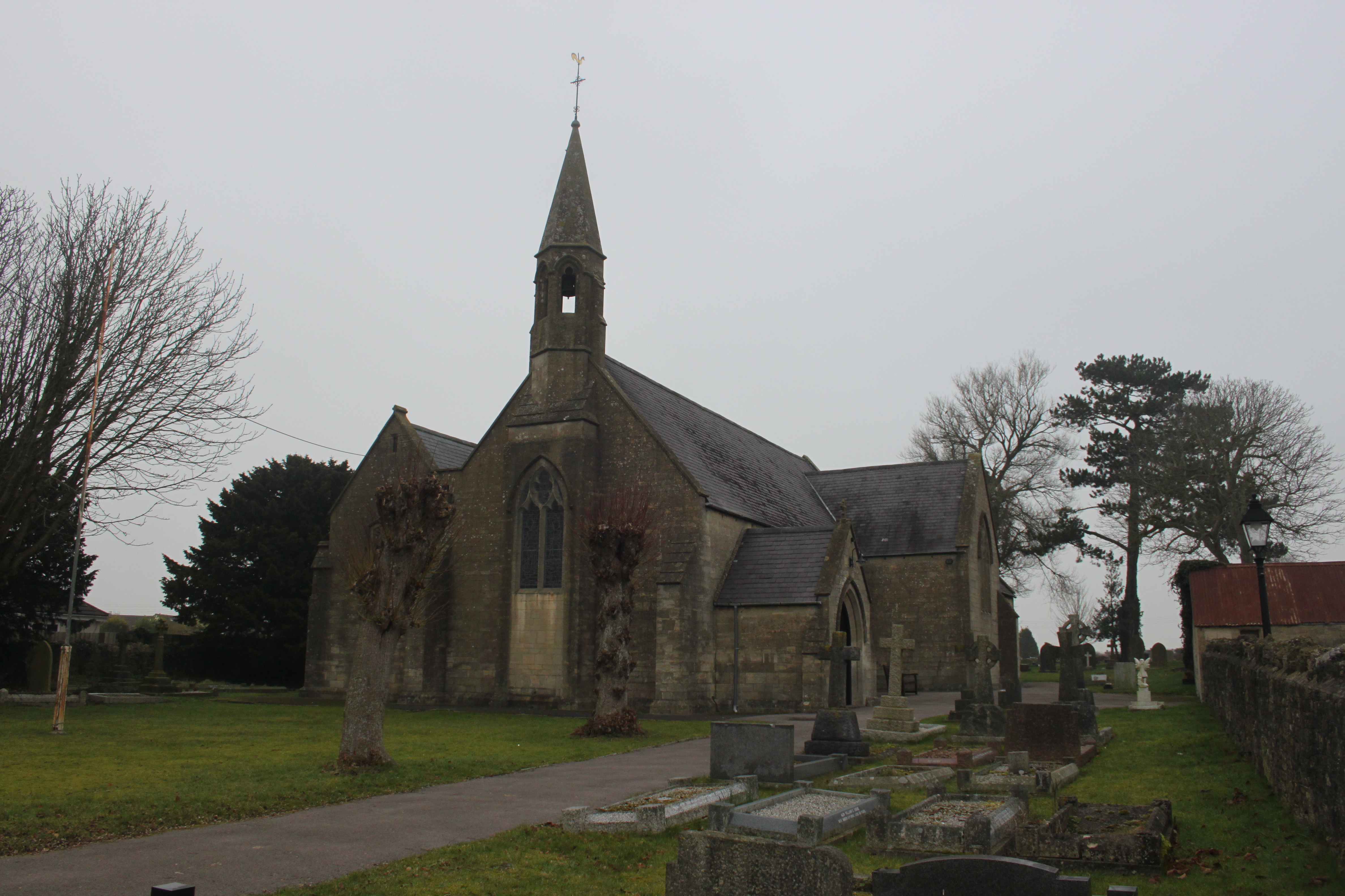
St Peter's Church, Camerton Park

The Church of St Peter at Camerton Park in Camerton, Somerset, England was built in the 15th century and has been designated as a Grade I listed building...

St John's Church, Peasedown St John

St John's Church, Peasedown St John (or more formally the Church of St John the Baptist, Peasedown) is the Anglican parish church for the village of Peasedown...

Camerton Court

Camerton Court is a historic house in the village of Camerton, Somerset, England. It has been designated as a Grade II listed building. == House == The...

Camerton, Somerset

Camerton is a village and civil parish in Somerset, 6 miles (9.7 km) south west of Bath, lying on the Cam Brook. The parish has a population of 655....

Peasedown St John

Peasedown St John (commonly referred to as Peasedown) is a village and civil parish in Somerset, England, standing on a hilltop roughly 5 miles (8 km)...

Camerton railway station (Somerset)

Camerton (Somerset) railway station served the village of Camerton, England from 1882 to 1951 on the Bristol and North Somerset Railway. In common with...
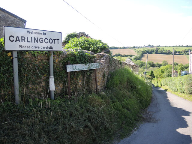
Clandown

Clandown is a village lying north of Radstock in Somerset, England, just off the Fosseway. It is 1 mile (1.6 km) north of Radstock. The nearby Bowlditch...

Holy Trinity Church, Clandown

Holy Trinity Church is a former Church of England church in Clandown, Somerset, England. Designed by George Phillips Manners, it was built in 1846–47 and...

Nearby Amenities

Located within 500m of 51.312962,-2.4414672
Barrier: entrance
Lat/Long: 51.3087059/-2.4410034
Barrier: stile
Lat/Long: 51.3087897/-2.4411616
Barrier: stile
Lat/Long: 51.3096733/-2.4448577
Barrier: stile
Lat/Long: 51.3109359/-2.4459921
Barrier: stile
Lat/Long: 51.3112761/-2.4462904
Barrier: stile
Lat/Long: 51.3121622/-2.4475979
Barrier: stile
Lat/Long: 51.3121908/-2.4476356
Barrier: stile
Lat/Long: 51.3122399/-2.447711
Generator Method: photovoltaic
Generator Output Electricity: yes
Generator Source: solar
Generator Type: solar_photovoltaic_panel
Location: roof
Power: generator
Lat/Long: 51.3161839/-2.4381103
Generator Method: photovoltaic
Generator Output Electricity: yes
Generator Source: solar
Generator Type: solar_photovoltaic_panel
Location: roof
Power: generator
Lat/Long: 51.3150265/-2.4387512
The data included in this document is from www.openstreetmap.org. The data is made available under ODbL.

Have you been to Camerton Wood?

Leave your review of Camerton Wood below (or comments, questions and feedback).