Rhume Hill

Hill, Mountain in Yorkshire South Lakeland

England

Rhume Hill

Fields Beside Road To Hebblethwaite Hall
Fields Beside Road To Hebblethwaite Hall Credit: David Robinson

Rhume Hill is a prominent geographical feature located in the county of Yorkshire, England. It is situated within the picturesque region of the Yorkshire Dales, renowned for its stunning natural landscapes and scenic beauty. Rhume Hill is classified as a hill and is found in the northern part of the Yorkshire Dales National Park.

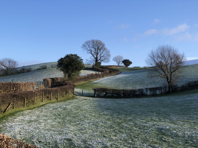
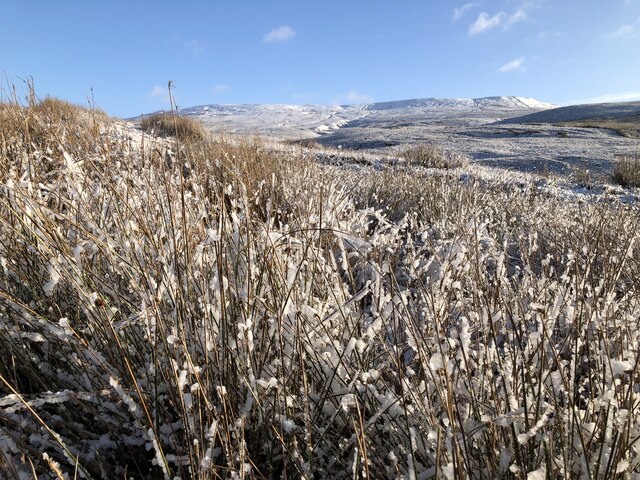
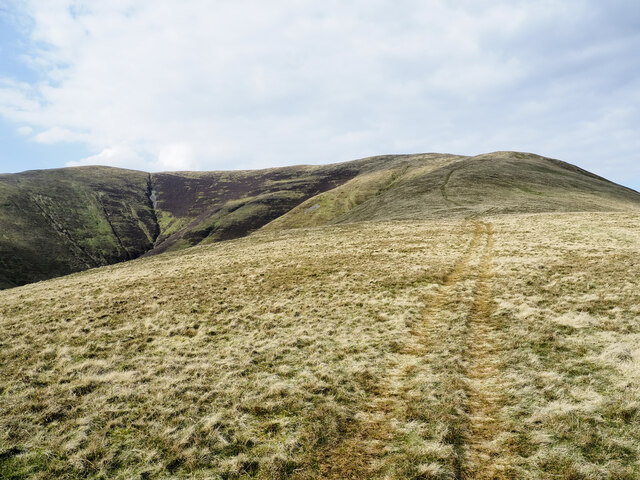
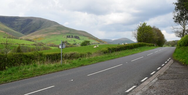
Standing at an elevation of approximately 500 meters (1,640 feet), Rhume Hill offers breathtaking panoramic views of the surrounding countryside. Its distinctive shape and steep slopes make it a popular destination for hikers and nature enthusiasts. The hill is covered in lush green vegetation, consisting of grasses, heather, and scattered trees, which add to its visual appeal.

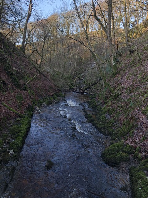
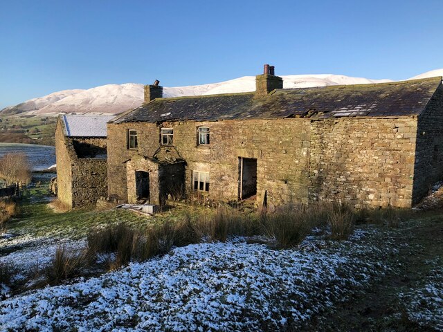
Rhume Hill is part of a larger network of hills and mountains in the Yorkshire Dales, providing a variety of walking routes and trails for visitors to explore. The hill is also home to a diverse range of wildlife, including birds, mammals, and plant species, making it an attractive destination for nature lovers.

Visitors to Rhume Hill can enjoy a range of outdoor activities, such as hiking, birdwatching, and photography. The hill's location within the Yorkshire Dales National Park ensures there are amenities available for visitors, including parking areas, information boards, and nearby accommodations.

Rhume Hill is a picturesque and popular destination within the Yorkshire Dales, offering visitors a chance to immerse themselves in the natural beauty and tranquility of the region.

If you have any feedback on the listing, please let us know in the comments section below.
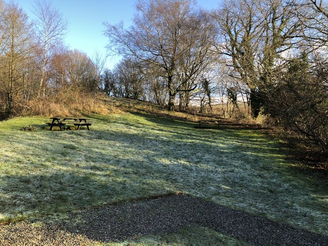
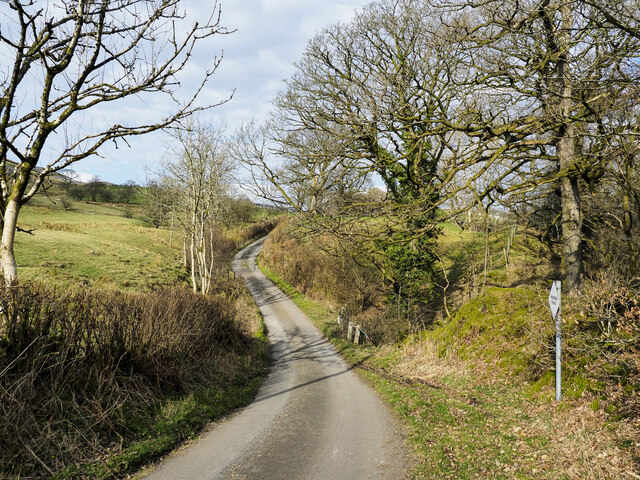
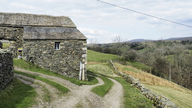
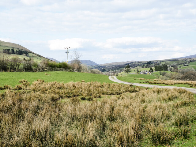
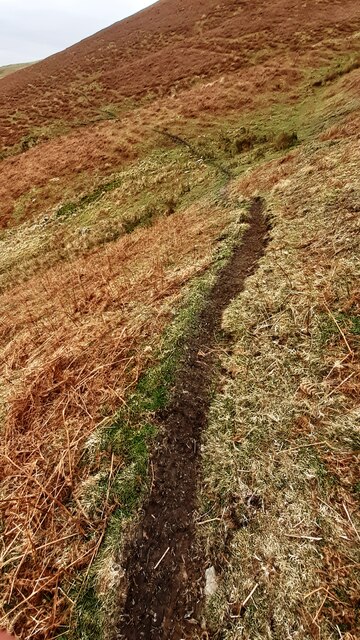
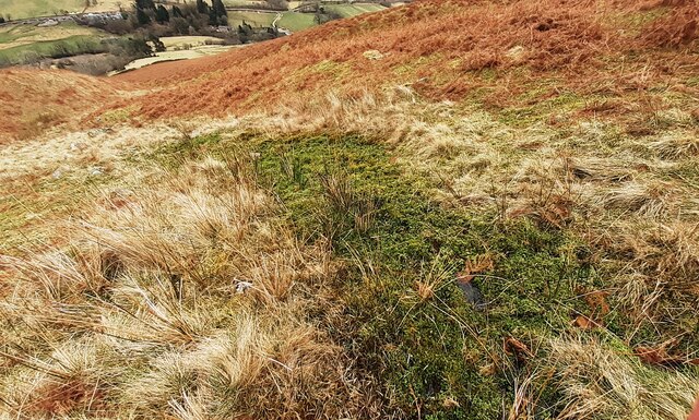
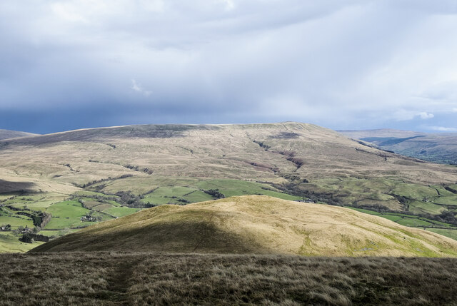
Rhume Hill Images

Images are sourced within 2km of 54.34575/-2.474516 or Grid Reference SD6994. Thanks to Geograph Open Source API. All images are credited.

Fields Beside Road To Hebblethwaite Hall
Hebblethwaite Hall Gill
Abandoned Farmhouse at Sarthwaite
Icy Moorland Above Sarthwaite
Picnic Area Beside A 683
Minor road with passing place The road is seen heading north towards the farm at Thursgill where it ends as a publicly motorable route. It's climbing from a stream crossing near to Ellerthwaite.
Minor road with passing place
The road is seen heading north towards the farm at Thursgill where it ends as a publicly motorable route. It's climbing from a stream crossing near to Ellerthwaite.
Ridge rising to Great Dummacks Great Dummacks is an elongated rib of ground at the top of the rising ridge and across the head of the valley to the left. As with most Howgill ridges there's a quad bike track following this one which acts perfectly as a path for those on foot.
Ridge rising to Great Dummacks
Great Dummacks is an elongated rib of ground at the top of the rising ridge and across the head of the valley to the left. As with most Howgill ridges there's a quad bike track following this one which acts perfectly as a path for those on foot.
Barn at Fawcett Bank Fawcett Bank is a farm in the valley of the River Rawthey. The farm road, also a public footpath, is the course of a named long distance path based on a walk made by Alfred Wainwright in 1938, 'A Pennine Journey'.
Barn at Fawcett Bank
Fawcett Bank is a farm in the valley of the River Rawthey. The farm road, also a public footpath, is the course of a named long distance path based on a walk made by Alfred Wainwright in 1938, 'A Pennine Journey'.
Route of 'A Pennine Journey' The road is the access route for the farm at Fawcett Bank; it's not a public road for motoring but is a public footpath and is now the route of the long distance walk. The route is not the one followed in 1938 by Alfred Wainwright and recorded by him in a version not originally intended for publication, but a similar one made in 1998 by David and Heather Pitt.
Route of 'A Pennine Journey'
The road is the access route for the farm at Fawcett Bank; it's not a public road for motoring but is a public footpath and is now the route of the long distance walk. The route is not the one followed in 1938 by Alfred Wainwright and recorded by him in a version not originally intended for publication, but a similar one made in 1998 by David and Heather Pitt.
View towards Great Dummacks
Path on eastern flank of Great Dummacks
Moorland path passing rock approaching Hollow Gill
View up Hollow Gill
View up Hollow Gill
Moorland path crossing Hollow Gill
Looking down Hollow Gill
Stream gulley on eastern flank of Great Dummacks
Knott Knott is one of the lesser hills of the Howgill group; it lies to the east of Sickers Fell from which the image was taken.
The higher and more massive hill in the distance is Baugh Fell.
Knott
Knott is one of the lesser hills of the Howgill group; it lies to the east of Sickers Fell from which the image was taken. The higher and more massive hill in the distance is Baugh Fell.
The A683 Beside the picnic area.
The A683
Beside the picnic area.
Show me another place!

Rhume Hill is located at Grid Ref: SD6994 (Lat: 54.34575, Lng: -2.474516)

Division: West Riding

Administrative County: Cumbria

District: South Lakeland

Police Authority: Cumbria

What 3 Words

///earth.fights.pose. Near Sedbergh, Cumbria

Related Wikis

Calders (Yorkshire Dales)

Calders is a summit of 2,211 feet (674 m) in the Howgill Fells, Cumbria, England. It lies about 2⁄3 mile (1 km) south-east of the summit of The Calf and...

Clough River

The Clough River is a river in Cumbria, England. A tributary of the River Rawthey, it flows for 21.8 kilometres (13.5 mi) primarily through the Garsdale...

The Calf

The Calf, at an elevation of 676 metres (2,218 ft), is the highest point in the Howgill Fells, an area of high ground in north-west England. It is in the...

Settlebeck School

Settlebeck School is a small coeducational secondary school with academy status. It is located in Sedbergh in the English county of Cumbria, drawing pupils...

Nearby Amenities

Located within 500m of 54.34575,-2.474516
Post Box
Collection Times: Mo-Fr 11:00; Sa 11:00
Drive Through: no
Post Box Type: wall
Ref: LA10 153
Lat/Long: 54.3455834/-2.4769376
Rhume Hill
Natural: peak
Source: OS OpenData StreetView
Lat/Long: 54.3455465/-2.4747313
High Birks
Place: farm
Source: OS_OpenData_StreetView
Lat/Long: 54.3473027/-2.4707427
Birks
Place: farm
Source: OS_OpenData_StreetView
Lat/Long: 54.3464653/-2.4717941
Entrance: main
Lat/Long: 54.3457608/-2.4766481
Parking
Fee: no
Park Ride: no
Parking: layby
Supervised: no
Surface: asphalt
Lat/Long: 54.3455357/-2.4771004
Give Way
Direction: backward
Lat/Long: 54.3499062/-2.4748368
Grit Bin
Lat/Long: 54.3472074/-2.475809
Give Way
Direction: forward
Lat/Long: 54.3471665/-2.475853
Entrance: main
Lat/Long: 54.3449841/-2.4774283
Power: pole
Lat/Long: 54.3500465/-2.4724562
Power: pole
Lat/Long: 54.3489444/-2.4724858
Power: pole
Lat/Long: 54.3478016/-2.4725072
Power: pole
Lat/Long: 54.3467674/-2.472534
Power: pole
Lat/Long: 54.3461999/-2.4731583
Power: pole
Lat/Long: 54.3453033/-2.4741299
Power: pole
Lat/Long: 54.344398/-2.4751291
Power: pole
Lat/Long: 54.3435279/-2.4717937
Power: pole
Lat/Long: 54.3434708/-2.4734768
Power: pole
Lat/Long: 54.3434662/-2.4746476
Power: pole
Lat/Long: 54.3434677/-2.4761724
Power: pole
Lat/Long: 54.3425749/-2.4769422
Power: pole
Lat/Long: 54.3420769/-2.4774183
Barrier: stile
Material: wood
Source: survey;gps
Stile: stepover
Lat/Long: 54.3436495/-2.4710121
Ford: yes
Lat/Long: 54.3484674/-2.4728039
Ford: yes
Lat/Long: 54.34818/-2.4781543
Power: pole
Lat/Long: 54.3453778/-2.4764719
Power: pole
Lat/Long: 54.3457017/-2.4762252
Power: pole
Lat/Long: 54.3460494/-2.4759641
Power: pole
Lat/Long: 54.3464474/-2.4756646
Power: pole
Lat/Long: 54.3467392/-2.4754346
Power: pole
Lat/Long: 54.3472977/-2.4749747
Power: pole
Lat/Long: 54.3477278/-2.4749939
Power: pole
Lat/Long: 54.3424663/-2.4788291
Power: pole
Lat/Long: 54.3427442/-2.4784027
The data included in this document is from www.openstreetmap.org. The data is made available under ODbL.

Have you been to Rhume Hill?

Leave your review of Rhume Hill below (or comments, questions and feedback).