Park Wood

Wood, Forest in Gloucestershire Forest of Dean

England

Park Wood

Oxenhall Canal Tunnel Southern Portal, 1979 A photograph taken in what looks to be fairly wintry conditions sometime in 1978/79.

It was in a pretty sorry state back then; work was undertaken to renovate it in the 90s (see David Stowell's picture here: <a title="https://www.geograph.org.uk/photo/3682" href="https://www.geograph.org.uk/photo/3682">Link</a> )  but it has, sadly, since fallen back into disrepair (John Winder's picture of 2011: <span class="nowrap"><a title="https://m.geograph.org.uk/photo/5997716" rel="nofollow ugc noopener" href="https://m.geograph.org.uk/photo/5997716">Link</a><img style="margin-left:2px;" alt="External link" title="External link - shift click to open in new window" src="https://s1.geograph.org.uk/img/external.png" width="10" height="10"/></span> )
Oxenhall Canal Tunnel Southern Portal, 1979 Credit: Bill Blair

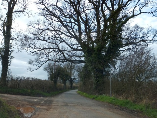
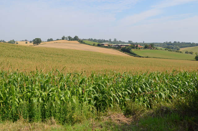
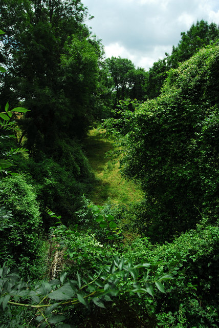
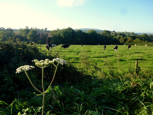
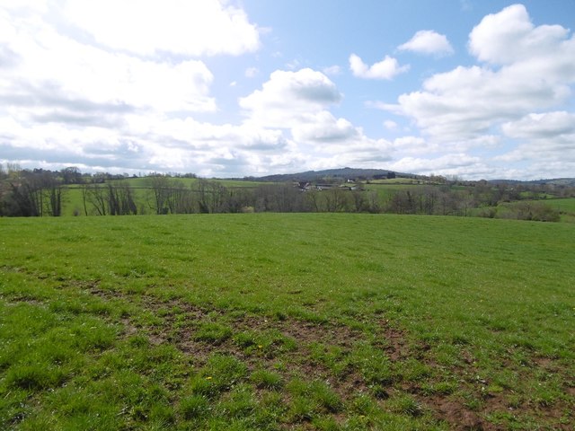
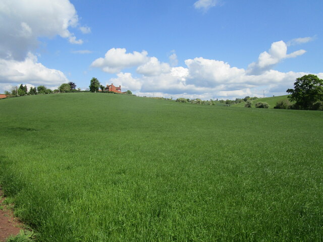
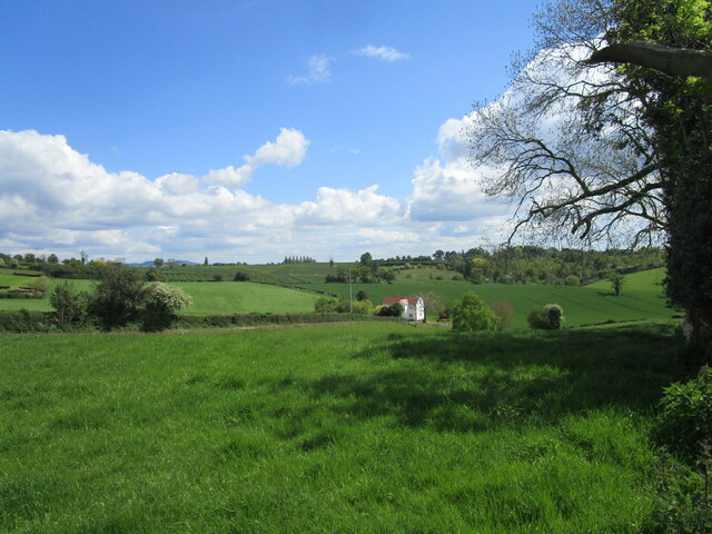
Park Wood is a picturesque woodland located in the county of Gloucestershire in England. Spread over an area of approximately 50 acres, it is nestled within the beautiful Forest of Dean. The wood is known for its diverse range of flora and fauna, making it a popular destination for nature enthusiasts, hikers, and photographers.

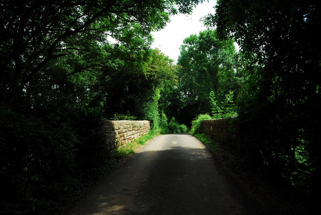
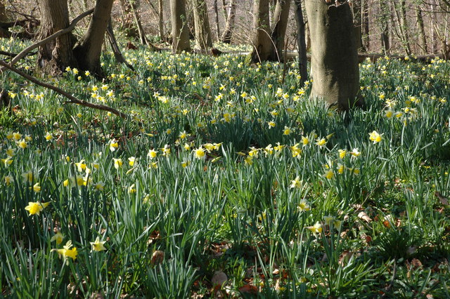
The wood is predominantly covered with a mixture of broadleaf trees, including oak, beech, and birch, creating a lush green canopy that provides shade during the summer months. Walking through the wood, visitors can admire the carpet of bluebells that bloom in spring, adding a splash of vibrant color to the landscape.

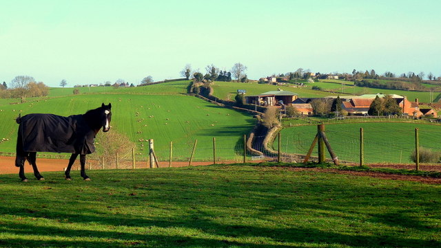
Park Wood is also home to a variety of wildlife. Birdwatchers can spot a range of species, including woodpeckers, nuthatches, and tawny owls. Squirrels are a common sight, as they scamper through the trees, gathering food for the winter months.

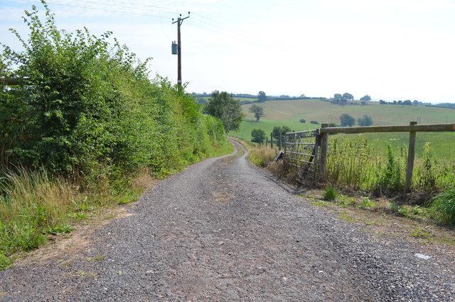
There are several well-maintained paths and trails that wind their way through the wood, offering visitors the opportunity to explore its natural beauty. These paths are suitable for all ages and abilities, making Park Wood an ideal location for a family day out.

The wood is open to the public all year round and is managed by the local forestry commission. Facilities such as picnic areas and parking are available, ensuring visitors have a comfortable and enjoyable experience.

In summary, Park Wood in Gloucestershire is a stunning woodland that offers a tranquil escape from the hustle and bustle of daily life. With its magnificent trees, vibrant flora, and diverse wildlife, it is a haven for nature lovers and a must-visit destination for anyone seeking a peaceful retreat in the heart of the Forest of Dean.

If you have any feedback on the listing, please let us know in the comments section below.
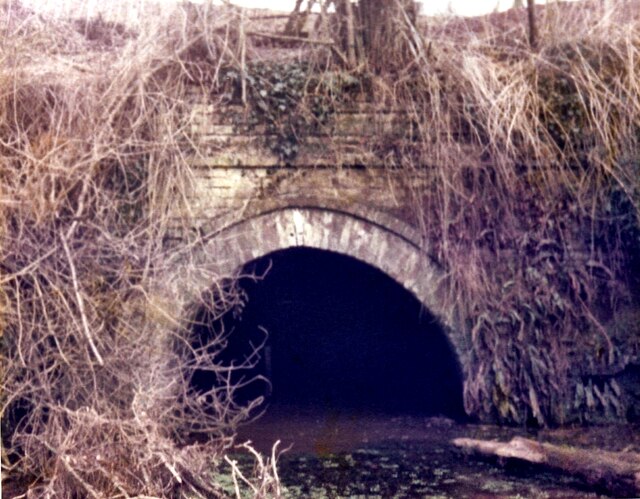
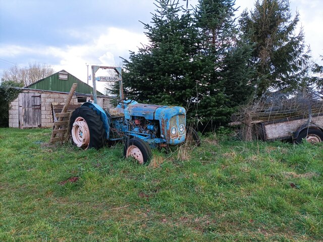
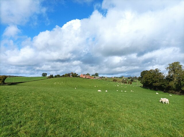
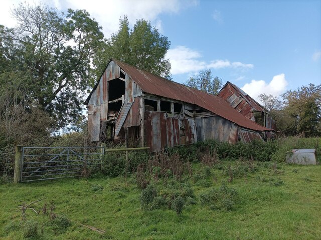
Park Wood Images

Images are sourced within 2km of 51.949211/-2.4518519 or Grid Reference SO6927. Thanks to Geograph Open Source API. All images are credited.

Oxenhall Canal Tunnel Southern Portal, 1979 A photograph taken in what looks to be fairly wintry conditions sometime in 1978/79.

It was in a pretty sorry state back then; work was undertaken to renovate it in the 90s (see David Stowell's picture here: <a title="https://www.geograph.org.uk/photo/3682" href="https://www.geograph.org.uk/photo/3682">Link</a> )  but it has, sadly, since fallen back into disrepair (John Winder's picture of 2011: <span class="nowrap"><a title="https://m.geograph.org.uk/photo/5997716" rel="nofollow ugc noopener" href="https://m.geograph.org.uk/photo/5997716">Link</a><img style="margin-left:2px;" alt="External link" title="External link - shift click to open in new window" src="https://s1.geograph.org.uk/img/external.png" width="10" height="10"/></span> )
Oxenhall Canal Tunnel Southern Portal, 1979
A photograph taken in what looks to be fairly wintry conditions sometime in 1978/79. It was in a pretty sorry state back then; work was undertaken to renovate it in the 90s (see David Stowell's picture here: Link ) but it has, sadly, since fallen back into disrepair (John Winder's picture of 2011: LinkExternal link )
Old tractor A rusty blue tractor on the edge of a field.
Old tractor
A rusty blue tractor on the edge of a field.
Holder's Farm and sheep field Holder's Farm, seen from the footpath through a sheep field.
Holder's Farm and sheep field
Holder's Farm, seen from the footpath through a sheep field.
Abandoned barn A seemingly abandoned, rusty barn in a field near the M50.
Abandoned barn
A seemingly abandoned, rusty barn in a field near the M50.
Mixed hedges and trees at Hillend Green The junction at Hillend Green; the hedges have been trimmed at different times, giving a contrast between the two sides of the road.
Mixed hedges and trees at Hillend Green
The junction at Hillend Green; the hedges have been trimmed at different times, giving a contrast between the two sides of the road.
Maize field
Maize field
Track to Waterdynes
Track to Waterdynes
Former railway bridge near Oxenhall This bridge carries a minor road over the old Gloucester - Ledbury railway, which opened in 1885 and closed to passengers in 1959 (although the Dymock to Gloucester section remained in use by freight traffic until 1964). I didn't get a chance to get onto the trackbed to photograph the bridge itself so this shot of the side walls will have to do!
Former railway bridge near Oxenhall
This bridge carries a minor road over the old Gloucester - Ledbury railway, which opened in 1885 and closed to passengers in 1959 (although the Dymock to Gloucester section remained in use by freight traffic until 1964). I didn't get a chance to get onto the trackbed to photograph the bridge itself so this shot of the side walls will have to do!
Course of old railway at Oxenhall Taken from the old overbridge on the road between Dymock and Oxenhall. Much of this railway was constructed on the route of the old Gloucester - Hereford canal. However, the part pictured here was constructed by the GWR on a new alignment in order to avoid the canal tunnel at Oxenhall, which had been built down to a price and was falling to bits almost before it opened.
Course of old railway at Oxenhall
Taken from the old overbridge on the road between Dymock and Oxenhall. Much of this railway was constructed on the route of the old Gloucester - Hereford canal. However, the part pictured here was constructed by the GWR on a new alignment in order to avoid the canal tunnel at Oxenhall, which had been built down to a price and was falling to bits almost before it opened.
Holder's Farm on its hill Paddocks in the foreground in this early spring scene.
Holder's Farm on its hill
Paddocks in the foreground in this early spring scene.
Misty view of May Hill Looking south from Whitehouse Lane over rolling countryside, opposite the entrance to Peter's Farm.
Misty view of May Hill
Looking south from Whitehouse Lane over rolling countryside, opposite the entrance to Peter's Farm.
May Hill, Easter Monday morning For another view from Whitehouse Lane see <a href="https://www.geograph.org.uk/photo/4419776">SO7026 : Misty view of May Hill</a>.
May Hill, Easter Monday morning
For another view from Whitehouse Lane see SO7026 : Misty view of May Hill.
Dairy pasture View south of Hawthorne Hill with May Hill in the distance.
Dairy pasture
View south of Hawthorne Hill with May Hill in the distance.
View towards May Hill May Hill with its clump of trees is a landmark seen from over a great area.   It is on the northern edge of the Forest of Dean and is well wooded.
View towards May Hill
May Hill with its clump of trees is a landmark seen from over a great area. It is on the northern edge of the Forest of Dean and is well wooded.
Oxenhall canal tunnel: southern portal Oxenhall Tunnel was completed in 1798, but the canal it was built for was out competed by the railways from an early point in its history and never really made any money. Construction cost far more than predicted during the first phase of construction which saw the canal open only as far as Ledbury which remained the terminus of the canal for forty years. The canal eventually opened as far as Hereford in 1845, but had cost well over three times the original estimate and the canal company began almost immediately to try and sell the canal to a railway company. In 1862 the canal was leased to the Great Western Railway and in 1881, they closed the southern half of the canal and converted much of it to the Gloucester - Ledbury line. The tunnel pictured here was never used by rail traffic, the GWR sensibly deciding to bypass it altogether and avoid the problems of enlarging it for railway use. An interesting footnote is that the canal company received rent for the route from the GWR which was distributed to shareholders as dividends; this arrangement continued until the nationalisation of the railways in 1948.
There's an active restoration scheme for the canal. David Stowell's <a href="https://www.geograph.org.uk/photo/3682">SO7027 : Oxenhall Tunnel</a> shows the same scene in 1997, just after extensive work by the Hereford & Gloucester Canal Trust. Sadly, this stretch of canal is not in their ownership and the canal has become very overgrown in the 14 years between his photo and mine.
Oxenhall canal tunnel: southern portal
Oxenhall Tunnel was completed in 1798, but the canal it was built for was out competed by the railways from an early point in its history and never really made any money. Construction cost far more than predicted during the first phase of construction which saw the canal open only as far as Ledbury which remained the terminus of the canal for forty years. The canal eventually opened as far as Hereford in 1845, but had cost well over three times the original estimate and the canal company began almost immediately to try and sell the canal to a railway company. In 1862 the canal was leased to the Great Western Railway and in 1881, they closed the southern half of the canal and converted much of it to the Gloucester - Ledbury line. The tunnel pictured here was never used by rail traffic, the GWR sensibly deciding to bypass it altogether and avoid the problems of enlarging it for railway use. An interesting footnote is that the canal company received rent for the route from the GWR which was distributed to shareholders as dividends; this arrangement continued until the nationalisation of the railways in 1948. There's an active restoration scheme for the canal. David Stowell's SO7027 : Oxenhall Tunnel shows the same scene in 1997, just after extensive work by the Hereford & Gloucester Canal Trust. Sadly, this stretch of canal is not in their ownership and the canal has become very overgrown in the 14 years between his photo and mine.
Holders Lane - Hillend Green, Gloucestershire A view on Holders Lane in the scattered village of Hillend Green in Gloucestershire. It lies to the north of Newent <a href="https://www.geograph.org.uk/gridref/SO+7225">SO 7225</a> and east of the M50 (M - Motorway). Time photo taken not available.
Holders Lane - Hillend Green, Gloucestershire
A view on Holders Lane in the scattered village of Hillend Green in Gloucestershire. It lies to the north of Newent SO 7225 and east of the M50 (M - Motorway). Time photo taken not available.
Grass field and Holder's Farm
Grass field and Waterdynes
Show me another place!

Park Wood is located at Grid Ref: SO6927 (Lat: 51.949211, Lng: -2.4518519)

Administrative County: Gloucestershire

District: Forest of Dean

Police Authority: Gloucestershire

What 3 Words

///slab.thousands.smokers. Near Newent, Gloucestershire

Related Wikis

Gwen and Vera's Fields

Gwen and Vera's Fields (grid reference SO696277) is a 0.28-hectare (0.69-acre) nature reserve in Gloucestershire.The site, which consists of two separate...

Dymock Woods SSSI

Dymock Woods (grid reference SO684288, SO692290, SO697283) is a 53-hectare (130-acre) biological Site of Special Scientific Interest in Gloucestershire...

Ledbury and Gloucester Railway

The Ledbury and Gloucester Railway, (also known as the Daffodil Line), was a railway line in Herefordshire and Gloucestershire, England, running between...

Four Oaks Halt railway station

Four Oaks Halt was a request stop on the former Ledbury and Gloucester Railway. It was located 2 miles north of Newent. The station opened on 16 October...

Oxenhall

Oxenhall is a village and civil parish 10 miles (16 km) north west of Gloucester, in the Forest of Dean district, in the county of Gloucestershire, England...

Gorsley

Gorsley is a small village in the Forest of Dean district of Gloucestershire, forming part of the civil parish of Gorsley and Kilcot in the South West...

Kempley

Kempley is a village and civil parish in the Forest of Dean district of Gloucestershire, England, close to the border with Herefordshire. It lies 17 miles...

Pauntley

Pauntley is a village and civil parish in the district of Forest of Dean, Gloucestershire, England. In 2019 it had a population of 304. == School == Pauntley...

Nearby Amenities

Located within 500m of 51.949211,-2.4518519
Bus Stop
Forestry Commission Depot
Bus: yes
Naptan AtcoCode: 1600GLF319
Naptan Bearing: SW
Naptan CommonName: Forestry Commission Depot
Naptan Indicator: Opp
Naptan NaptanCode: gloamdmw
Naptan Street: Four Oaks Rd
Naptan Verified: no
Public Transport: platform
Source: naptan_import
Lat/Long: 51.9475331/-2.4501337
Bus Stop
Forestry Commission Depot
Naptan AtcoCode: 1600GLF320
Naptan Bearing: NE
Naptan CommonName: Forestry Commission Depot
Naptan NaptanCode: gloamdmt
Naptan Street: Four Oaks Rd
Naptan Verified: no
Source: naptan_import
Lat/Long: 51.9475777/-2.450236
Parking
Capacity: 3
Fee: no
Lat/Long: 51.9449985/-2.4543709
Barrier: lift_gate
Lat/Long: 51.9494894/-2.4579412
Barrier: kissing_gate
Lat/Long: 51.947717/-2.4451904
Power: pole
Lat/Long: 51.9474922/-2.4453954
Power: pole
Lat/Long: 51.947779/-2.4455135
Power: pole
Lat/Long: 51.9484106/-2.4458152
Shaw Common West
Power: pole
Transformer: distribution
Voltage Primary: 11000
Lat/Long: 51.9466639/-2.4521533
Power: pole
Lat/Long: 51.9469259/-2.4513781
Power: pole
Lat/Long: 51.9471921/-2.4505922
Power: pole
Lat/Long: 51.9473351/-2.4501577
Power: pole
Lat/Long: 51.9474682/-2.4497648
Power: pole
Lat/Long: 51.9477021/-2.4490741
Power: pole
Lat/Long: 51.9479212/-2.4484451
Power: pole
Lat/Long: 51.9481617/-2.4479006
Power: pole
Lat/Long: 51.9484808/-2.4471925
Power: pole
Lat/Long: 51.9489933/-2.4460714
Power: pole
Lat/Long: 51.9495562/-2.4463208
Greenaways
Power: pole
Transformer: distribution
Voltage Primary: 11000
Lat/Long: 51.9500886/-2.4465582
Power: pole
Lat/Long: 51.9507283/-2.4463946
Power: pole
Lat/Long: 51.9513582/-2.4462403
The data included in this document is from www.openstreetmap.org. The data is made available under ODbL.

Have you been to Park Wood?

Leave your review of Park Wood below (or comments, questions and feedback).