Shaw Common

Wood, Forest in Gloucestershire Forest of Dean

England

Shaw Common

Oxenhall Canal Tunnel Southern Portal, 1979 A photograph taken in what looks to be fairly wintry conditions sometime in 1978/79.

It was in a pretty sorry state back then; work was undertaken to renovate it in the 90s (see David Stowell's picture here: <a title="https://www.geograph.org.uk/photo/3682" href="https://www.geograph.org.uk/photo/3682">Link</a> )  but it has, sadly, since fallen back into disrepair (John Winder's picture of 2011: <span class="nowrap"><a title="https://m.geograph.org.uk/photo/5997716" rel="nofollow ugc noopener" href="https://m.geograph.org.uk/photo/5997716">Link</a><img style="margin-left:2px;" alt="External link" title="External link - shift click to open in new window" src="https://s1.geograph.org.uk/img/external.png" width="10" height="10"/></span> )
Oxenhall Canal Tunnel Southern Portal, 1979 Credit: Bill Blair

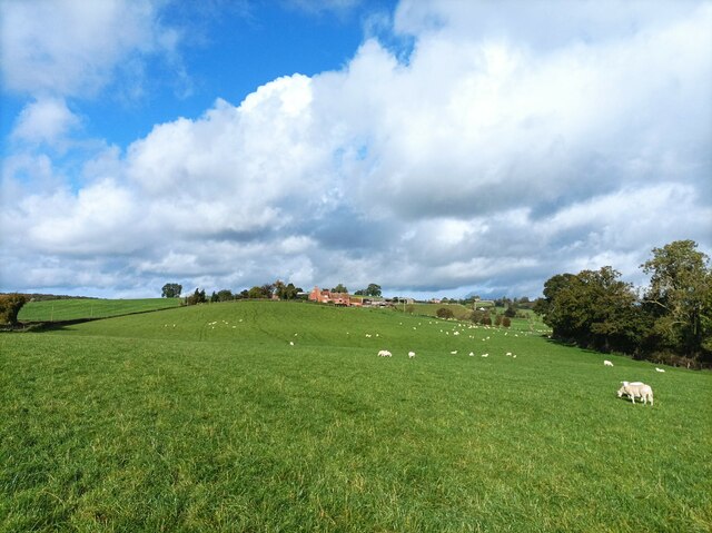
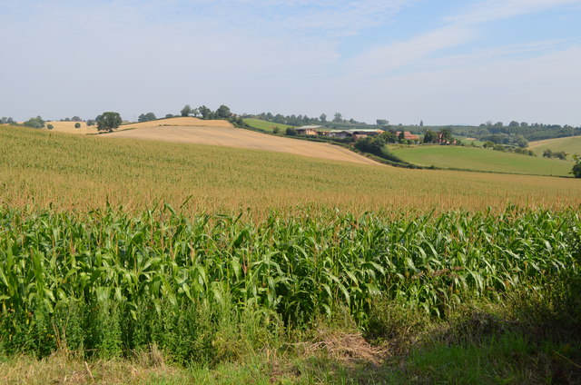
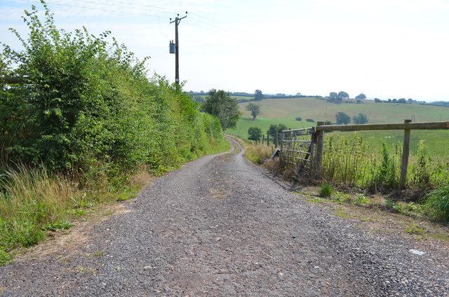
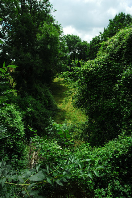
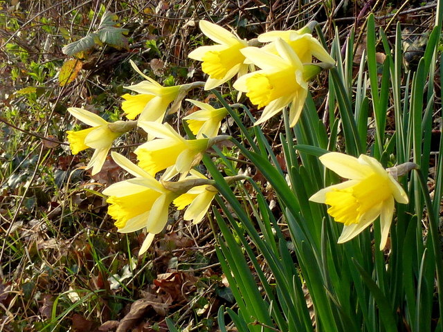
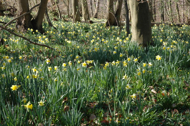
Shaw Common is a picturesque woodland area located in Gloucestershire, England. Situated in the heart of the Forest of Dean, this natural haven covers an area of approximately 200 acres. Shaw Common is renowned for its diverse range of tree species, including oak, beech, and birch, which create a rich and vibrant ecosystem.

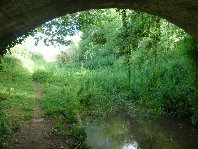
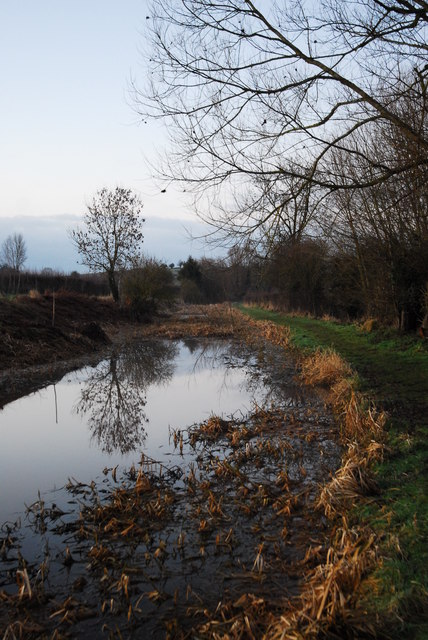
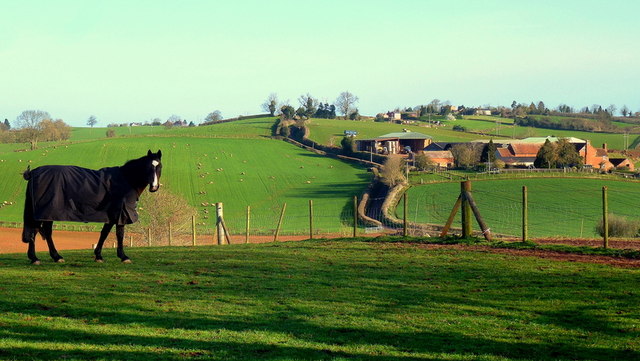
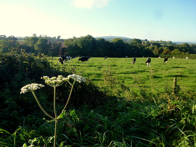
The woodland is characterized by its dense canopy, providing shade and shelter to a variety of wildlife. It is home to numerous bird species, such as woodpeckers, owls, and songbirds, making it a popular destination for birdwatchers. Additionally, Shaw Common is inhabited by several mammal species, including foxes, badgers, and deer.

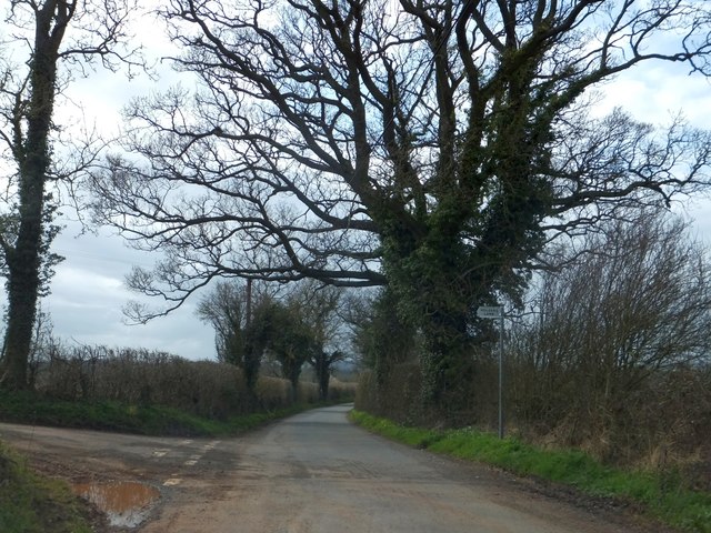
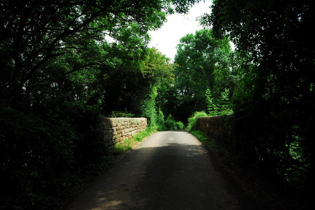
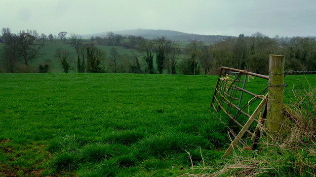
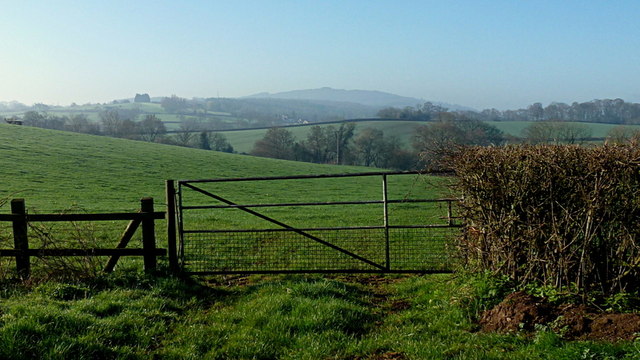
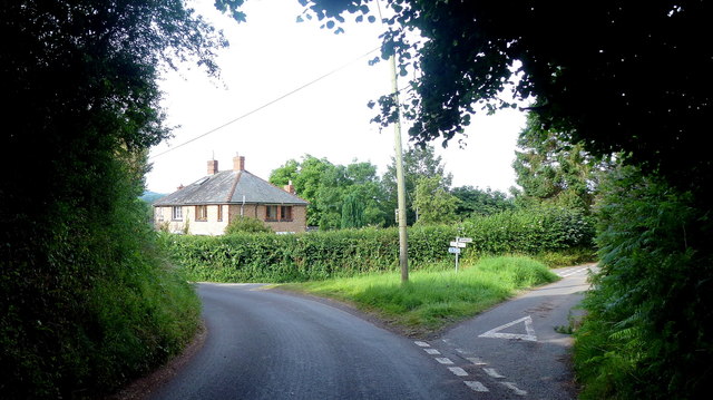
This beautiful woodland offers a range of recreational activities for visitors. A network of walking trails meanders through Shaw Common, allowing visitors to explore its natural beauty at their own pace. The trails are well-maintained and suitable for all levels of fitness, making them an ideal choice for families and nature enthusiasts alike.

Shaw Common also features a designated picnic area, providing a peaceful spot to enjoy a packed lunch amidst the tranquility of nature. The area is equipped with tables and benches, making it a popular destination for families and groups.

Overall, Shaw Common in Gloucestershire is a haven for nature lovers, offering a diverse range of flora and fauna in a stunning woodland setting. Whether visitors are seeking a leisurely walk, a birdwatching adventure, or a peaceful picnic spot, Shaw Common has something to offer for everyone.

If you have any feedback on the listing, please let us know in the comments section below.
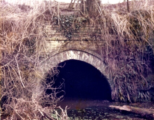
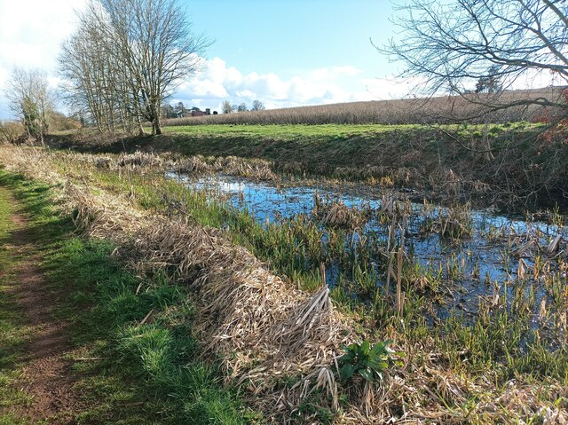
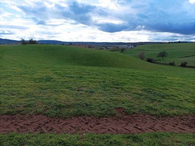
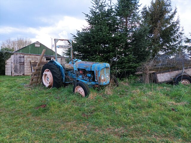
Shaw Common Images

Images are sourced within 2km of 51.946195/-2.448199 or Grid Reference SO6927. Thanks to Geograph Open Source API. All images are credited.

Oxenhall Canal Tunnel Southern Portal, 1979 A photograph taken in what looks to be fairly wintry conditions sometime in 1978/79.

It was in a pretty sorry state back then; work was undertaken to renovate it in the 90s (see David Stowell's picture here: <a title="https://www.geograph.org.uk/photo/3682" href="https://www.geograph.org.uk/photo/3682">Link</a> )  but it has, sadly, since fallen back into disrepair (John Winder's picture of 2011: <span class="nowrap"><a title="https://m.geograph.org.uk/photo/5997716" rel="nofollow ugc noopener" href="https://m.geograph.org.uk/photo/5997716">Link</a><img style="margin-left:2px;" alt="External link" title="External link - shift click to open in new window" src="https://s1.geograph.org.uk/img/external.png" width="10" height="10"/></span> )
Oxenhall Canal Tunnel Southern Portal, 1979
A photograph taken in what looks to be fairly wintry conditions sometime in 1978/79. It was in a pretty sorry state back then; work was undertaken to renovate it in the 90s (see David Stowell's picture here: Link ) but it has, sadly, since fallen back into disrepair (John Winder's picture of 2011: LinkExternal link )
Disused canal The disused Herefordshire and Gloucestershire canal, north of Newent.
Disused canal
The disused Herefordshire and Gloucestershire canal, north of Newent.
Rolling hills A field with grassy rolling hills.
Rolling hills
A field with grassy rolling hills.
Old tractor A rusty blue tractor on the edge of a field.
Old tractor
A rusty blue tractor on the edge of a field.
Holder's Farm and sheep field Holder's Farm, seen from the footpath through a sheep field.
Holder's Farm and sheep field
Holder's Farm, seen from the footpath through a sheep field.
Mixed hedges and trees at Hillend Green The junction at Hillend Green; the hedges have been trimmed at different times, giving a contrast between the two sides of the road.
Mixed hedges and trees at Hillend Green
The junction at Hillend Green; the hedges have been trimmed at different times, giving a contrast between the two sides of the road.
Hereford & Gloucester Canal - from under Cold Harbour Bridge The 34 mile canal was built between 1793 and 1845 but closed in 1881. There are plans for its restoration to navigation. Just north of this bridge is the 2192 yard Oxenhall tunnel that is no longer open throughout.
Hereford & Gloucester Canal - from under Cold Harbour Bridge
The 34 mile canal was built between 1793 and 1845 but closed in 1881. There are plans for its restoration to navigation. Just north of this bridge is the 2192 yard Oxenhall tunnel that is no longer open throughout.
Maize field
Maize field
Track to Waterdynes
Track to Waterdynes
Gloucester - Hereford canal near Newent The canal was opened in 1798 but never really made any money. In 1863 it was leased to the Great Western Railway, who converted much of the route between Gloucester and Ledbury to a railway, which opened in 1885. The section pictured here was never converted, the GWR preferring to build a new section of line to bypass Oxenhall Tunnel.There is an active restoration group working towards the reopening of the canal.
Gloucester - Hereford canal near Newent
The canal was opened in 1798 but never really made any money. In 1863 it was leased to the Great Western Railway, who converted much of the route between Gloucester and Ledbury to a railway, which opened in 1885. The section pictured here was never converted, the GWR preferring to build a new section of line to bypass Oxenhall Tunnel.There is an active restoration group working towards the reopening of the canal.
Former railway bridge near Oxenhall This bridge carries a minor road over the old Gloucester - Ledbury railway, which opened in 1885 and closed to passengers in 1959 (although the Dymock to Gloucester section remained in use by freight traffic until 1964). I didn't get a chance to get onto the trackbed to photograph the bridge itself so this shot of the side walls will have to do!
Former railway bridge near Oxenhall
This bridge carries a minor road over the old Gloucester - Ledbury railway, which opened in 1885 and closed to passengers in 1959 (although the Dymock to Gloucester section remained in use by freight traffic until 1964). I didn't get a chance to get onto the trackbed to photograph the bridge itself so this shot of the side walls will have to do!
Course of old railway at Oxenhall Taken from the old overbridge on the road between Dymock and Oxenhall. Much of this railway was constructed on the route of the old Gloucester - Hereford canal. However, the part pictured here was constructed by the GWR on a new alignment in order to avoid the canal tunnel at Oxenhall, which had been built down to a price and was falling to bits almost before it opened.
Course of old railway at Oxenhall
Taken from the old overbridge on the road between Dymock and Oxenhall. Much of this railway was constructed on the route of the old Gloucester - Hereford canal. However, the part pictured here was constructed by the GWR on a new alignment in order to avoid the canal tunnel at Oxenhall, which had been built down to a price and was falling to bits almost before it opened.
Wild daffodils in Whitehouse Lane After a cold February, these Narcissus pseudonarcissus are just fully opening.
Wild daffodils in Whitehouse Lane
After a cold February, these Narcissus pseudonarcissus are just fully opening.
Holder's Farm on its hill Paddocks in the foreground in this early spring scene.
Holder's Farm on its hill
Paddocks in the foreground in this early spring scene.
Misty view of May Hill Looking south from Whitehouse Lane over rolling countryside, opposite the entrance to Peter's Farm.
Misty view of May Hill
Looking south from Whitehouse Lane over rolling countryside, opposite the entrance to Peter's Farm.
May Hill, Easter Monday morning For another view from Whitehouse Lane see <a href="https://www.geograph.org.uk/photo/4419776">SO7026 : Misty view of May Hill</a>.
May Hill, Easter Monday morning
For another view from Whitehouse Lane see SO7026 : Misty view of May Hill.
Rural lane junction Left is towards Newent, right to Gorsley along White House Lane.
Rural lane junction
Left is towards Newent, right to Gorsley along White House Lane.
Dairy pasture View south of Hawthorne Hill with May Hill in the distance.
Dairy pasture
View south of Hawthorne Hill with May Hill in the distance.
Show me another place!

Shaw Common is located at Grid Ref: SO6927 (Lat: 51.946195, Lng: -2.448199)

Administrative County: Gloucestershire

District: Forest of Dean

Police Authority: Gloucestershire

What 3 Words

///unloaded.professes.ranged. Near Newent, Gloucestershire

Related Wikis

Gwen and Vera's Fields

Gwen and Vera's Fields (grid reference SO696277) is a 0.28-hectare (0.69-acre) nature reserve in Gloucestershire.The site, which consists of two separate...

Ledbury and Gloucester Railway

The Ledbury and Gloucester Railway (also known as the Daffodil Line), was a railway line in Herefordshire and Gloucestershire, England, running between...

Dymock Woods SSSI

Dymock Woods (grid reference SO684288, SO692290, SO697283) is a 53-hectare (130-acre) biological Site of Special Scientific Interest in Gloucestershire...

Oxenhall

Oxenhall is a village and civil parish 10 miles (16 km) north west of Gloucester, in the Forest of Dean district, in the county of Gloucestershire, England...

Gorsley

Gorsley is a small village in the Forest of Dean district of Gloucestershire, forming part of the civil parish of Gorsley and Kilcot in the South West...

Gorsley and Kilcot

Gorsley and Kilcot is a civil parish forming part of the district of the Forest of Dean in the English county of Gloucestershire. The single parish of...

Pauntley

Pauntley is a village and civil parish in the district of Forest of Dean, Gloucestershire, England. In 2019 it had a population of 304. == School == Pauntley...

Castle Tump, Dymock

Castle Tump was a castle in the village of Dymock in Gloucestershire, England. The castle was built in either the 11th or more probably the early 12th...

Nearby Amenities

Located within 500m of 51.946195,-2.448199
Bus Stop
Forestry Commission Depot
Bus: yes
Naptan AtcoCode: 1600GLF319
Naptan Bearing: SW
Naptan CommonName: Forestry Commission Depot
Naptan Indicator: Opp
Naptan NaptanCode: gloamdmw
Naptan Street: Four Oaks Rd
Naptan Verified: no
Public Transport: platform
Source: naptan_import
Lat/Long: 51.9475331/-2.4501337
Bus Stop
Forestry Commission Depot
Naptan AtcoCode: 1600GLF320
Naptan Bearing: NE
Naptan CommonName: Forestry Commission Depot
Naptan NaptanCode: gloamdmt
Naptan Street: Four Oaks Rd
Naptan Verified: no
Source: naptan_import
Lat/Long: 51.9475777/-2.450236
Barrier: stile
Lat/Long: 51.9435248/-2.4439067
Barrier: kissing_gate
Lat/Long: 51.9437697/-2.4448142
Barrier: stile
Lat/Long: 51.9444039/-2.4451285
Parking
Capacity: 3
Fee: no
Lat/Long: 51.9449985/-2.4543709
Parking
Capacity: 4
Fee: no
Lat/Long: 51.9446612/-2.454167
Barrier: kissing_gate
Foot: yes
Lat/Long: 51.9474954/-2.445098
Barrier: kissing_gate
Lat/Long: 51.9469588/-2.4451337
Barrier: kissing_gate
Lat/Long: 51.947717/-2.4451904
Barrier: lift_gate
Lat/Long: 51.9468423/-2.4434144
Barrier: stile
Lat/Long: 51.946618/-2.4450233
Wain House
Power: pole
Transformer: distribution
Voltage Primary: 11000
Lat/Long: 51.9465316/-2.4427816
Power: pole
Lat/Long: 51.9466341/-2.443888
Keepers Cottage
Power: pole
Transformer: distribution
Voltage Primary: 11000
Lat/Long: 51.9467217/-2.4450615
Power: pole
Lat/Long: 51.9470111/-2.4451903
Power: pole
Lat/Long: 51.9474922/-2.4453954
Power: pole
Lat/Long: 51.947779/-2.4455135
Power: pole
Lat/Long: 51.9484106/-2.4458152
Shaw Common West
Power: pole
Transformer: distribution
Voltage Primary: 11000
Lat/Long: 51.9466639/-2.4521533
Power: pole
Lat/Long: 51.9469259/-2.4513781
Power: pole
Lat/Long: 51.9471921/-2.4505922
Power: pole
Lat/Long: 51.9473351/-2.4501577
Power: pole
Lat/Long: 51.9474682/-2.4497648
Power: pole
Lat/Long: 51.9477021/-2.4490741
Power: pole
Lat/Long: 51.9479212/-2.4484451
Power: pole
Lat/Long: 51.9481617/-2.4479006
Power: pole
Lat/Long: 51.9484808/-2.4471925
Power: pole
Lat/Long: 51.9489933/-2.4460714
Power: pole
Lat/Long: 51.9495562/-2.4463208
Greenaways
Power: pole
Transformer: distribution
Voltage Primary: 11000
Lat/Long: 51.9500886/-2.4465582
The data included in this document is from www.openstreetmap.org. The data is made available under ODbL.

Have you been to Shaw Common?

Leave your review of Shaw Common below (or comments, questions and feedback).