Back Plantation

Wood, Forest in Yorkshire Ribble Valley

England

Back Plantation

Barns at Foulscales On the road to Cow Ark.
Barns at Foulscales Credit: Phil and Juliette Platt

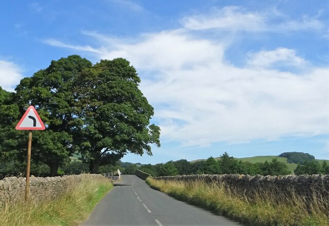
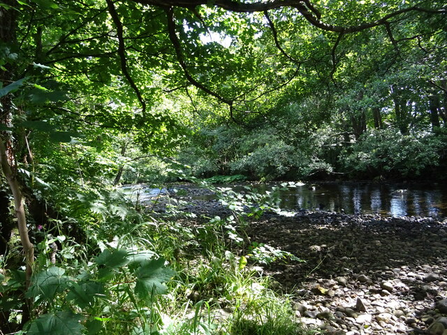
Back Plantation, located in the picturesque region of Yorkshire, is a sprawling woodland area known for its breathtaking beauty and rich biodiversity. Covering a vast expanse, this enchanting forest is a haven for nature enthusiasts and an ideal destination for those seeking tranquility amidst nature's embrace.

The plantation boasts a diverse range of tree species, including oak, beech, and birch, which contribute to its lush green canopy. These towering trees provide a habitat for numerous wildlife species, such as deer, squirrels, and a variety of bird species, making it a popular spot for wildlife enthusiasts and birdwatchers.

Traversing through the woodland, visitors can explore a network of well-maintained paths that offer stunning views at every turn. The forest floor is adorned with a vibrant carpet of wildflowers, adding a splash of color to the already picturesque landscape. The serene ambiance, coupled with the melodious symphony of chirping birds, creates a truly immersive experience for visitors.

Back Plantation also offers a range of recreational activities to cater to different interests. Adventurous souls can indulge in hiking and cycling trails that wind through the forest, providing a thrilling experience amidst the wilderness. For those seeking a more leisurely experience, there are designated picnic areas where families and friends can gather to enjoy a delightful outdoor meal.

With its impressive natural beauty and diverse ecosystem, Back Plantation is a true gem in Yorkshire's crown. Whether it's discovering hidden trails, observing wildlife, or simply basking in the tranquility of nature, this woodland sanctuary offers an unforgettable experience for all who visit.

If you have any feedback on the listing, please let us know in the comments section below.

Back Plantation Images

Images are sourced within 2km of 53.944006/-2.4928554 or Grid Reference SD6749. Thanks to Geograph Open Source API. All images are credited.

Barns at Foulscales On the road to Cow Ark.
Barns at Foulscales
On the road to Cow Ark.
Approaching Langden Bridge Carrying the road over Langden Brook outside Dunsop Bridge.
Approaching Langden Bridge
Carrying the road over Langden Brook outside Dunsop Bridge.
The one that got away A sheep on the wrong side of the fence.
The one that got away
A sheep on the wrong side of the fence.
Foulscales farm A grade II listed farmhouse by Foulscales Brook.
Foulscales farm
A grade II listed farmhouse by Foulscales Brook.
Dunsop Bridge Over the river and in the village of the same name.
Dunsop Bridge
Over the river and in the village of the same name.
Post Office and Puddleduck Tearoom in Dunsop Bridge
Ribble Valley E-bikes Sale and hire of electric bikes in Dunsop Bridge. Strictly speaking, should be the Hodder Valley not the Ribble Valley.
Ribble Valley E-bikes
Sale and hire of electric bikes in Dunsop Bridge. Strictly speaking, should be the Hodder Valley not the Ribble Valley.
A famous telephone kiosk According to the information engraved on the door and inside the kiosk, this was the 100,000th BT kiosk to be erected and stands at the geographical centre of Great Britain, although both factoids are a bit questionable. If there ever were 100,000 kiosks in Britain, the number is now in freefall. And on their own admission, the centre of Britain (as defined by the Ordnance Survey at the centre of gravity) is actually at <a href="https://www.geograph.org.uk/gridref/SD637565">SD637565</a>, way up in the hills. 

Other people have their own definition of the centre of Britain. Principal amongst these is David Taylor proprietor of the Centre of Britain Hotel in Haltwhistle. See <a href="https://www.geograph.org.uk/photo/12977">NY7064 : Centre of Britain Hotel</a> and <a href="https://www.geograph.org.uk/photo/1458607">NY7064 : Haltwhistle claims to be at the centre of Britain</a>. See also <span class="nowrap"><a title="http://news.bbc.co.uk/1/hi/uk/2271914.stm" rel="nofollow ugc noopener" href="http://news.bbc.co.uk/1/hi/uk/2271914.stm">Link</a><img style="margin-left:2px;" alt="External link" title="External link - shift click to open in new window" src="https://s1.geograph.org.uk/img/external.png" width="10" height="10"/></span> for the full story of this bitterly contested subject.
A famous telephone kiosk
According to the information engraved on the door and inside the kiosk, this was the 100,000th BT kiosk to be erected and stands at the geographical centre of Great Britain, although both factoids are a bit questionable. If there ever were 100,000 kiosks in Britain, the number is now in freefall. And on their own admission, the centre of Britain (as defined by the Ordnance Survey at the centre of gravity) is actually at SD637565, way up in the hills. Other people have their own definition of the centre of Britain. Principal amongst these is David Taylor proprietor of the Centre of Britain Hotel in Haltwhistle. See NY7064 : Centre of Britain Hotel and NY7064 : Haltwhistle claims to be at the centre of Britain. See also LinkExternal link for the full story of this bitterly contested subject.
Door of a famous telephone kiosk According to the information engraved on the door and inside the kiosk, this was the 100,000th BT kiosk to be erected and stands at the geographical centre of Great Britain, although both factoids are a bit questionable. If there ever were 100,000 kiosks in Britain, the number is now in freefall. And on their own admission, the centre of Britain (as defined by the Ordnance Survey at the centre of gravity) is actually at <a href="https://www.geograph.org.uk/gridref/SD637565">SD637565</a>, way up in the hills. 

Other people have their own definition of the centre of Britain. Principal amongst these is David Taylor proprietor of the Centre of Britain Hotel in Haltwhistle. See <a href="https://www.geograph.org.uk/photo/12977">NY7064 : Centre of Britain Hotel</a> and <a href="https://www.geograph.org.uk/photo/1458607">NY7064 : Haltwhistle claims to be at the centre of Britain</a>. See also <span class="nowrap"><a title="http://news.bbc.co.uk/1/hi/uk/2271914.stm" rel="nofollow ugc noopener" href="http://news.bbc.co.uk/1/hi/uk/2271914.stm">Link</a><img style="margin-left:2px;" alt="External link" title="External link - shift click to open in new window" src="https://s1.geograph.org.uk/img/external.png" width="10" height="10"/></span> for the full story of this bitterly contested subject.
Door of a famous telephone kiosk
According to the information engraved on the door and inside the kiosk, this was the 100,000th BT kiosk to be erected and stands at the geographical centre of Great Britain, although both factoids are a bit questionable. If there ever were 100,000 kiosks in Britain, the number is now in freefall. And on their own admission, the centre of Britain (as defined by the Ordnance Survey at the centre of gravity) is actually at SD637565, way up in the hills. Other people have their own definition of the centre of Britain. Principal amongst these is David Taylor proprietor of the Centre of Britain Hotel in Haltwhistle. See NY7064 : Centre of Britain Hotel and NY7064 : Haltwhistle claims to be at the centre of Britain. See also LinkExternal link for the full story of this bitterly contested subject.
Rough Sike Road crossing Rough Sike.
Rough Sike
Road crossing Rough Sike.
Public telephone box On the green at Dunsop Bridge. Reputedly, this is the 100,000th box installed and (also reputedly) is sited at the geographical centre of Great Britain.
Public telephone box
On the green at Dunsop Bridge. Reputedly, this is the 100,000th box installed and (also reputedly) is sited at the geographical centre of Great Britain.
St. George's, Dunsop Bridge Originally a cow shed, the building later became a chapel, and now seems to be used as a gymnasium.
St. George's, Dunsop Bridge
Originally a cow shed, the building later became a chapel, and now seems to be used as a gymnasium.
Dunsop Bridge Bridge Cottage and the Working Men's Club.
Dunsop Bridge
Bridge Cottage and the Working Men's Club.
Gateway to Thorneyholme Hall On the eastern edge of Dunsop Bridge village.
Gateway to Thorneyholme Hall
On the eastern edge of Dunsop Bridge village.
War memorial at Dunsop Bridge Remembering the local men who died in the Great War.
War memorial at Dunsop Bridge
Remembering the local men who died in the Great War.
River Dunsop At Dunsop Bridge.
River Dunsop
At Dunsop Bridge.
Wood End Farmhouse Near Dunsop Bridge.
Wood End Farmhouse
Near Dunsop Bridge.
Sugar Loaf Off the road from Dunsop Bridge to Newton.
Sugar Loaf
Off the road from Dunsop Bridge to Newton.
Show me another place!

Back Plantation is located at Grid Ref: SD6749 (Lat: 53.944006, Lng: -2.4928554)

Division: West Riding

Administrative County: Lancashire

District: Ribble Valley

Police Authority: Lancashire

What 3 Words

///worked.drummers.secures. Near Waddington, Lancashire

Related Wikis

River Dunsop

The River Dunsop is a river in the Forest of Bowland in Northern England. It flows into the River Hodder at Dunsop Bridge.It begins at the confluence of...

Langden Brook

Langden Brook is a watercourse in the Trough of Bowland, Lancashire, England. A tributary of the River Hodder, its source is near the summit of Hawthornthwaite...

Bowland Forest High

Bowland Forest High is a civil parish in the Ribble Valley district of Lancashire, England, covering some 20,000 acres (80 km2) of the Forest of Bowland...
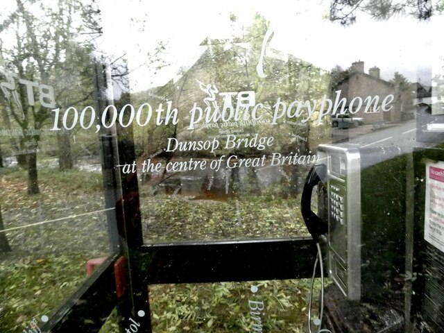
Dunsop Bridge

Dunsop Bridge is a village in the civil parish of Bowland Forest High, in the borough of Ribble Valley, Lancashire, England, 9 miles (14 km) north-west...

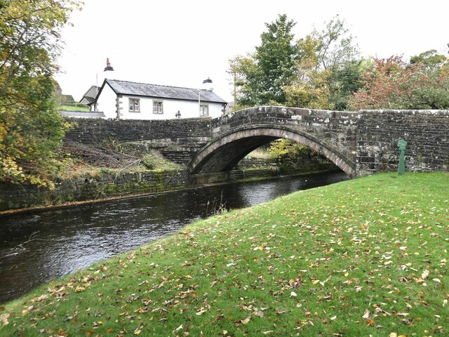
Dunsop Bridge (structure)

Dunsop Bridge is a bridge in the English village of the same name. The structure, which dates to the early 19th century, crosses the River Dunsop. A Grade...

Bowland Forest High milestone

The Bowland Forest High milestone is an historic milestone marker in the English parish of Bowland Forest High, in the Trough of Bowland, Lancashire. A...

Newton-in-Bowland

Newton or Newton-in-Bowland is a village and civil parish in the Ribble Valley district, in the county of Lancashire, England, formerly known as Newton...

Bowland Rural District

Bowland was a rural district in the West Riding of Yorkshire from 1894 to 1974. It was named after the Forest of Bowland, which it included. It was formed...

Nearby Amenities

Located within 500m of 53.944006,-2.4928554
Barrier: stile
Material: wood
Source: survey;gps
Stile: stepover
Lat/Long: 53.9443857/-2.4965447
Barrier: kissing_gate
Source: survey;gps
Lat/Long: 53.9454219/-2.4983546
Barrier: cattle_grid
Bicycle: yes
Foot: yes
Lat/Long: 53.9422858/-2.4921579
Barrier: stile
Material: wood
Source: survey;gps
Stile: stepover
Lat/Long: 53.9433728/-2.4947977
The data included in this document is from www.openstreetmap.org. The data is made available under ODbL.

Have you been to Back Plantation?

Leave your review of Back Plantation below (or comments, questions and feedback).