Mendip Plantations

Wood, Forest in Somerset Mendip

England

Mendip Plantations

Car parked at the start of Fental Lane, Ukrainian flag on fence
Car parked at the start of Fental Lane, Ukrainian flag on fence Credit: Rob Purvis

Mendip Plantations is a sprawling woodland located in Somerset, England. Spanning over a vast area, it is renowned for its rich biodiversity and scenic beauty. The plantation is situated in the Mendip Hills, a designated Area of Outstanding Natural Beauty, which adds to its appeal.

The woodland is predominantly covered with a mix of deciduous and coniferous trees, creating a diverse ecosystem. Oak, beech, and ash trees dominate the area, providing a habitat for a wide range of flora and fauna. The forest floor is adorned with a variety of wildflowers, including bluebells and primroses, adding vibrant colors to the landscape.

Mendip Plantations is a haven for wildlife enthusiasts, offering opportunities for bird watching and animal sightings. The woods are home to numerous bird species, such as woodpeckers, owls, and songbirds, making it an ideal destination for birdwatchers. Mammals like deer, foxes, and badgers can also be spotted in their natural habitat.

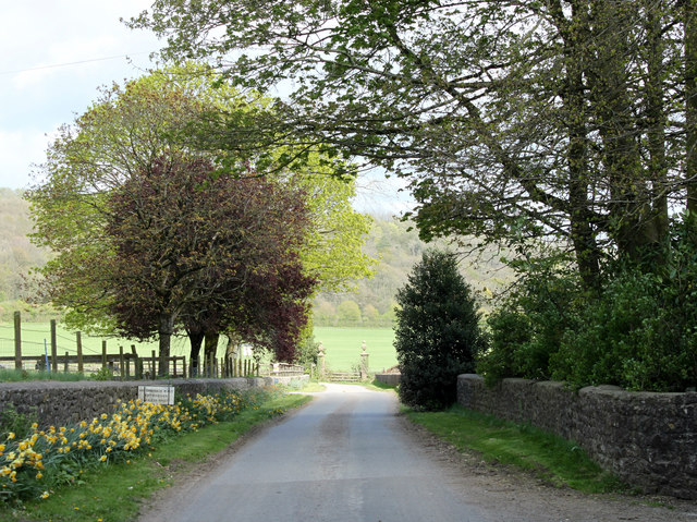
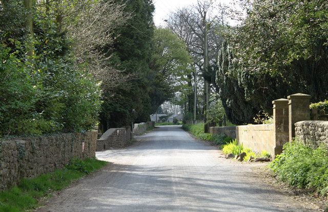
The plantation is a popular destination for nature lovers and outdoor enthusiasts, offering an extensive network of walking trails. These trails wind through the woodland, providing visitors with an opportunity to explore its beauty up close. The paths are well-maintained and suitable for families, making it an ideal location for a leisurely stroll or a picnic amidst nature.

Mendip Plantations also serves as an important resource for the local community. The woodland is sustainably managed, with periodic timber harvesting to ensure the health and longevity of the forest. This practice not only supports the local economy but also contributes to the overall health of the woodland ecosystem.

Overall, Mendip Plantations is a captivating woodland destination in Somerset, offering a tranquil escape into nature and a chance to appreciate the beauty of the Mendip Hills.

If you have any feedback on the listing, please let us know in the comments section below.

Mendip Plantations Images

Images are sourced within 2km of 51.209508/-2.462995 or Grid Reference ST6745. Thanks to Geograph Open Source API. All images are credited.
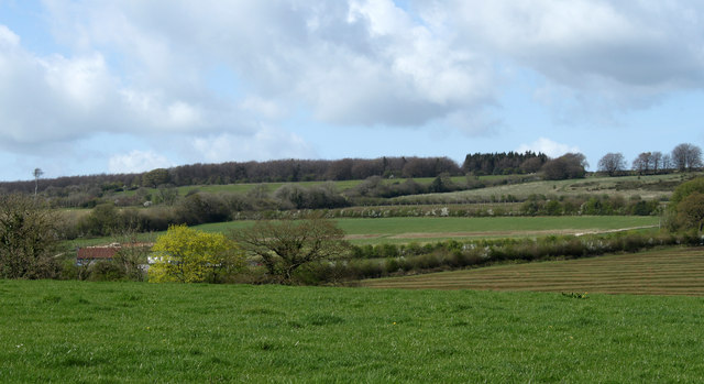
Car parked at the start of Fental Lane, Ukrainian flag on fence
Tadhill House Farm buildings
Old Milepost by A361, village of Dean The Milepost is located on the grass verge near houses on the South of the road.  Parish of Cranmore (Mendip District). Cast iron post, plated iron casting design, erected by the Shepton Mallet turnpike trust in the 19th Century. It has been broken and welded back together (on back of top "BUCI") and repositioned. A photograph before the repainting can be found here: <a title="https://www.geograph.org.uk/photo/6072295" href="https://www.geograph.org.uk/photo/6072295">Link</a> 

Inscription reads:-  
SHEPTON / MALLET / 4 : : FROME / 8 : : LONDON / 111 

Milestone Society National ID: SO_SMFR04
Old Milepost by A361, village of Dean
The Milepost is located on the grass verge near houses on the South of the road.  Parish of Cranmore (Mendip District). Cast iron post, plated iron casting design, erected by the Shepton Mallet turnpike trust in the 19th Century. It has been broken and welded back together (on back of top "BUCI") and repositioned. A photograph before the repainting can be found here: Link  Inscription reads:- SHEPTON / MALLET / 4 : : FROME / 8 : : LONDON / 111 Milestone Society National ID: SO_SMFR04
Old Milestone by Old Wells Road, near Tadhill House Farm The Milestone is located on grass verge on the South of the road.  Parish of Downhead (Mendip District). Stone post (plate lost), Frome square iron plate design, erected by the Frome turnpike trust in the 18th Century, plate repainted by MSS summer 2009. An earlier photograph can be found here: <a title="https://www.geograph.org.uk/photo/6037568" href="https://www.geograph.org.uk/photo/6037568">Link</a> 

Inscription reads:-  
Frome / 6 / Wells / 9 

Grade II listed. List Entry Number: 1345266 <span class="nowrap"><a title="https://historicengland.org.uk/listing/the-list/list-entry/1345266" rel="nofollow ugc noopener" href="https://historicengland.org.uk/listing/the-list/list-entry/1345266">Link</a><img style="margin-left:2px;" alt="External link" title="External link - shift click to open in new window" src="https://s1.geograph.org.uk/img/external.png" width="10" height="10"/></span> 

Milestone Society National ID: SO_FRWL06
Old Milestone by Old Wells Road, near Tadhill House Farm
The Milestone is located on grass verge on the South of the road.  Parish of Downhead (Mendip District). Stone post (plate lost), Frome square iron plate design, erected by the Frome turnpike trust in the 18th Century, plate repainted by MSS summer 2009. An earlier photograph can be found here: Link Inscription reads:- Frome / 6 / Wells / 9 Grade II listed. List Entry Number: 1345266 LinkExternal link Milestone Society National ID: SO_FRWL06
2011 : The former Church of St.James, East Cranmore "The origin of the name Cranmore comes from the Old English Crane Mere meaning 'Cranes/herons' pool'." 
Copied from <span class="nowrap"><a title="http://www.cranmore.org/" rel="nofollow ugc noopener" href="http://www.cranmore.org/">Link</a><img style="margin-left:2px;" alt="External link" title="External link - shift click to open in new window" src="https://s1.geograph.org.uk/img/external.png" width="10" height="10"/></span> a most interesting website.

Seen from the other side in <a href="https://www.geograph.org.uk/photo/485732">ST6843 : Former church at East Cranmore</a>
2011 : The former Church of St.James, East Cranmore
"The origin of the name Cranmore comes from the Old English Crane Mere meaning 'Cranes/herons' pool'." Copied from LinkExternal link a most interesting website. Seen from the other side in ST6843 : Former church at East Cranmore
2011 : Road to Wellington Farm, East Cranmore This is within half a mile of one of the largest quarries on the Mendips yet there is no sight and very little sound of it.
2011 : Road to Wellington Farm, East Cranmore
This is within half a mile of one of the largest quarries on the Mendips yet there is no sight and very little sound of it.
2011 : Main road through East  Cranmore The gateway on the right gives access to <a href="https://www.geograph.org.uk/photo/2357732">ST6843 : 2011 : The former Church of St.James, East Cranmore</a>
A little about East Cranmore in <span class="nowrap"><a title="http://www.francisfrith.com/east-cranmore/#utmcsr=bing.com&utmcmd=referral&utmccn=bing.com" rel="nofollow ugc noopener" href="http://www.francisfrith.com/east-cranmore/#utmcsr=bing.com&utmcmd=referral&utmccn=bing.com">Link</a><img style="margin-left:2px;" alt="External link" title="External link - shift click to open in new window" src="https://s1.geograph.org.uk/img/external.png" width="10" height="10"/></span>
2011 : Main road through East Cranmore
The gateway on the right gives access to ST6843 : 2011 : The former Church of St.James, East Cranmore A little about East Cranmore in LinkExternal link
2011 : Fields and view from the lane east of Cranmore Cranmore Tower [<a href="https://www.geograph.org.uk/gridref/ST6745">ST6745</a>] lifts its head above surrounding trees on the horizon.
A small beech wood begins showing its leaves, the foreground field looks a little sad, not sure what crop it contains.
2011 : Fields and view from the lane east of Cranmore
Cranmore Tower [ST6745] lifts its head above surrounding trees on the horizon. A small beech wood begins showing its leaves, the foreground field looks a little sad, not sure what crop it contains.
2011 : Fields near Western Farm, Cranmore Looking north west from the road between Cranmore and East Cranmore.
2011 : Fields near Western Farm, Cranmore
Looking north west from the road between Cranmore and East Cranmore.
Sign for the Knatchbull Arms For information on this sign visit <span class="nowrap"><a title="http://www.sunriseag.net/adoptapub/more/0042Knatchbull.htm" rel="nofollow ugc noopener" href="http://www.sunriseag.net/adoptapub/more/0042Knatchbull.htm">Link</a><img style="margin-left:2px;" alt="External link" title="External link - shift click to open in new window" src="https://s1.geograph.org.uk/img/external.png" width="10" height="10"/></span>
Sign for the Knatchbull Arms
For information on this sign visit LinkExternal link
The Knatchbull Arms, Stoke St Michael The building dates from the late 17th century and it was originally a house.  For a view of the sign <a href="https://www.geograph.org.uk/photo/2689324">ST6646 : Sign for the Knatchbull Arms</a>
The Knatchbull Arms, Stoke St Michael
The building dates from the late 17th century and it was originally a house. For a view of the sign ST6646 : Sign for the Knatchbull Arms
Bench Mark, St Michael's Church The Ordnance Survey bench mark is to be found on the south west face of the church.  For a view of the church <a href="https://www.geograph.org.uk/photo/2689530">ST6646 : St Michael's Church</a> and for further information on the bench mark and others in the area <span class="nowrap"><a title="http://www.bench-marks.org.uk/bm40134" rel="nofollow ugc noopener" href="http://www.bench-marks.org.uk/bm40134">Link</a><img style="margin-left:2px;" alt="External link" title="External link - shift click to open in new window" src="https://s1.geograph.org.uk/img/external.png" width="10" height="10"/></span>
Bench Mark, St Michael's Church
The Ordnance Survey bench mark is to be found on the south west face of the church. For a view of the church ST6646 : St Michael's Church and for further information on the bench mark and others in the area LinkExternal link
St Michael's Church The tower dates from circa 1400 with the remainder of the church dating from 1838.  It was designed by Jesse Gane of Evercreech and after being rebuilt, the church was consecrated by the Bishop of Bath and Wells, George Henry Law, on 18th September 1838.
St Michael's Church
The tower dates from circa 1400 with the remainder of the church dating from 1838. It was designed by Jesse Gane of Evercreech and after being rebuilt, the church was consecrated by the Bishop of Bath and Wells, George Henry Law, on 18th September 1838.
Chest tombs, St Michael's Church The chests date from the 18th and 19th centuries and are of Doulting stone.  They are to be found near the church porch.
Chest tombs, St Michael's Church
The chests date from the 18th and 19th centuries and are of Doulting stone. They are to be found near the church porch.
Coat of Arms, St Michael's Church The coat of arms hangs in the nave of the church.
Coat of Arms, St Michael's Church
The coat of arms hangs in the nave of the church.
Font, St Michael's Church The font stands in the traditional place near the door, signifying the entry of the child, at baptism, into membership of the church.
Font, St Michael's Church
The font stands in the traditional place near the door, signifying the entry of the child, at baptism, into membership of the church.
Church interior, St Michael's Church Looking east down the chancel towards the sanctuary with its three light window.
Church interior, St Michael's Church
Looking east down the chancel towards the sanctuary with its three light window.
Altar, St Michael's Church The altar has a beautiful embroidered cloth.

For a wider view <a href="https://www.geograph.org.uk/photo/2689789">ST6646 : Church interior, St Michael's Church</a>
Altar, St Michael's Church
The altar has a beautiful embroidered cloth. For a wider view ST6646 : Church interior, St Michael's Church
Show me another place!

Mendip Plantations is located at Grid Ref: ST6745 (Lat: 51.209508, Lng: -2.462995)

Administrative County: Somerset

District: Mendip

Police Authority: Avon and Somerset

What 3 Words

///roughness.altitude.cutlets. Near Shepton Mallet, Somerset

Related Wikis

Dinies Camp

Dinies Camp is a univallate Iron Age hill fort enclosure in the Mendip district of Somerset, England. The hill fort is situated approximately 1 mile (1...

Cranmore Tower

The Cranmore Tower is a 45 metres (148 ft) tall 19th century folly in the parish of Cranmore, Somerset, England. The site is 280 metres (919 ft) above...

Moon's Hill Quarry

Moon's Hill Quarry (grid reference ST665460) is a 3.42 hectare geological Site of Special Scientific Interest at Stoke St Michael in Somerset, notified...

Downhead

Downhead is a village and civil parish close to Leigh-on-Mendip and 5 miles (8 km) north east of Shepton Mallet, in the Mendip district of Somerset, England...

Church of All Saints, Downhead

The Anglican Church Of All Saints in Downhead, within the English county of Somerset, dates from the 14th century. It is a Grade II* listed building.The...

Stoke St Michael

Stoke St Michael is a village and civil parish on the Mendip Hills 4 miles (6.4 km) north east of Shepton Mallet, and 8 miles (12.9 km) west of Frome,...

Church of St Michael, Stoke St Michael

The Anglican Church of St Michael in Stoke St Michael, Somerset, England was built around 1400. It is a Grade II* listed building. == History == The western...

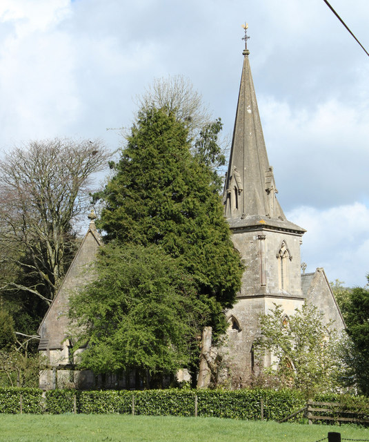
St James' Church, East Cranmore

St James' Church is a former Church of England church in East Cranmore, Somerset, England. Designed by Thomas Henry Wyatt, it was built in 1846 to replace...

Nearby Amenities

Located within 500m of 51.209508,-2.462995
Building: yes
Lat/Long: 51.2083897/-2.4673885
Parking
Parking: surface
Lat/Long: 51.2108053/-2.4690841
The data included in this document is from www.openstreetmap.org. The data is made available under ODbL.

Have you been to Mendip Plantations?

Leave your review of Mendip Plantations below (or comments, questions and feedback).