Costessey Park

Settlement in Norfolk South Norfolk

England

Costessey Park

Richmond Road
Richmond Road Credit: Hugh Venables

Costessey Park is a charming and picturesque park located in the village of Costessey, Norfolk, England. Spread over an area of approximately 180 acres, the park offers a serene and peaceful environment for visitors of all ages.

One of the main attractions of Costessey Park is its beautiful landscaped gardens, which are meticulously maintained throughout the year. These gardens boast a wide variety of flowering plants, shrubs, and trees, providing a burst of colors and scents that are a delight to the senses. The park also features well-manicured lawns, perfect for picnics and outdoor activities.

A notable feature of Costessey Park is its extensive network of walking trails that wind through the park. These trails offer visitors the opportunity to explore the park's diverse flora and fauna, while also providing a peaceful setting for leisurely strolls or invigorating jogs.

For those seeking more active pursuits, Costessey Park offers several sports facilities, including tennis courts and a football field. These amenities cater to sports enthusiasts and provide a space for friendly matches or serious training sessions.

Moreover, Costessey Park features a children's play area, complete with swings, slides, and climbing frames, ensuring that younger visitors have a fun and enjoyable time.

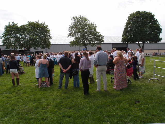
With its well-maintained gardens, walking trails, sports facilities, and children's play area, Costessey Park is a popular destination for locals and tourists alike, offering a tranquil retreat from the hustle and bustle of everyday life.

If you have any feedback on the listing, please let us know in the comments section below.

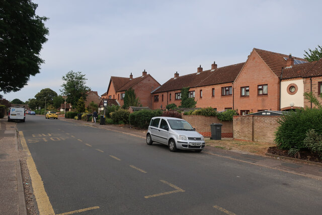
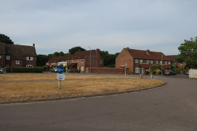
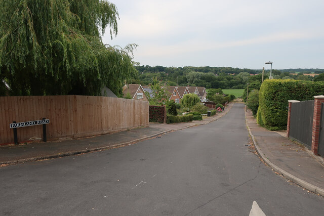
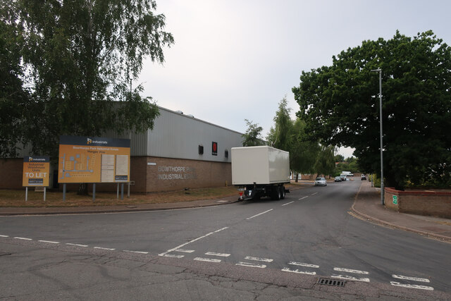
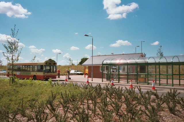
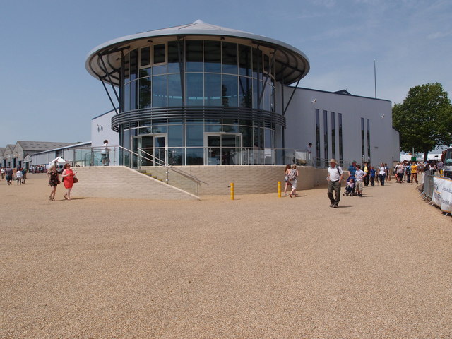
Costessey Park Images

Images are sourced within 2km of 52.653687/1.1919934 or Grid Reference TG1611. Thanks to Geograph Open Source API. All images are credited.

Richmond Road
Richmond Road
Middleton Crescent
Middleton Crescent
Farmland Road, New Costessey
Old Milestone by Dereham Road, near Royal Norfolk Showground Metal plate attached to stone post by the UC road, in parish of COSTESSEY (SOUTH NORFOLK District), Dereham Road, 70yds West of Costessey Lodge entrance, rear of grass verge against wooden fence, on North side of road. Dereham iron plate, erected by the Norwich & Swaffham turnpike trust in the 19th century. An earlier photograph can be found here <a title="https://www.geograph.org.uk/photo/6037516" href="https://www.geograph.org.uk/photo/6037516">Link</a>.

Inscription reads:-
NORWICH
5
DEREHAM
11 
Carved benchmark on lower right side. 

Milestone Society National ID: NO_NSM05.
Old Milestone by Dereham Road, near Royal Norfolk Showground
Metal plate attached to stone post by the UC road, in parish of COSTESSEY (SOUTH NORFOLK District), Dereham Road, 70yds West of Costessey Lodge entrance, rear of grass verge against wooden fence, on North side of road. Dereham iron plate, erected by the Norwich & Swaffham turnpike trust in the 19th century. An earlier photograph can be found here Link. Inscription reads:- NORWICH 5 DEREHAM 11 Carved benchmark on lower right side. Milestone Society National ID: NO_NSM05.
Bowthorpe Park Industrial Estate
Bowthorpe water tower
Sainsbury's, Norwich The Longwater branch that's so big, it could almost be a hypermarket.
Sainsbury's, Norwich
The Longwater branch that's so big, it could almost be a hypermarket.
Costessey Park & Ride bus terminal The site has 1100 parking spaces and bus services to Norwich via the University of East Anglia and to the Norfolk and Norwich University Hospital.
Costessey Park & Ride bus terminal
The site has 1100 parking spaces and bus services to Norwich via the University of East Anglia and to the Norfolk and Norwich University Hospital.
Exhibition Hall and Reception area, Royal Norfolk Showground The latest addition to the Royal Norfolk Show ground at Costessey.
A Norfolk show has been held since 1847 it gained its Royal prefix in 1908. From 1953 until 1962 the show moved round the county being held on suitable parkland sites.  The present site at Costessey covers 375 acres.  New exhibition hall and reception areas are the latest additions to the multipurpose site. Average attendance for the two day show hovers around the 100,000 mark.
Exhibition Hall and Reception area, Royal Norfolk Showground
The latest addition to the Royal Norfolk Show ground at Costessey. A Norfolk show has been held since 1847 it gained its Royal prefix in 1908. From 1953 until 1962 the show moved round the county being held on suitable parkland sites. The present site at Costessey covers 375 acres. New exhibition hall and reception areas are the latest additions to the multipurpose site. Average attendance for the two day show hovers around the 100,000 mark.
Triangulation Pillar on the Royal Norfolk Show ground A well maintained Triangulation Pillar in amongst the stall holders for the annual Royal Norfolk Show.
A Norfolk show has been held since 1847 it gained its Royal prefix in 1908. From 1953 until 1962 the show moved round the county being held on suitable parkland sites.  The present site at Costessey covers 375 acres.  New exhibition hall and reception areas are the latest additions to the multi purpose site. Average attendance for the two day show hovers around the 100,000 mark.
Triangulation Pillar on the Royal Norfolk Show ground
A well maintained Triangulation Pillar in amongst the stall holders for the annual Royal Norfolk Show. A Norfolk show has been held since 1847 it gained its Royal prefix in 1908. From 1953 until 1962 the show moved round the county being held on suitable parkland sites. The present site at Costessey covers 375 acres. New exhibition hall and reception areas are the latest additions to the multi purpose site. Average attendance for the two day show hovers around the 100,000 mark.
Triangulation Pillar on the Royal Norfolk Show ground A well maintained Triangulation Pillar. Not sure how many visitors to the show notice it or know what it was used for. Leaning against probably!
Triangulation Pillar on the Royal Norfolk Show ground
A well maintained Triangulation Pillar. Not sure how many visitors to the show notice it or know what it was used for. Leaning against probably!
Flush bracket no S5280 Flush bracket for the Triangulation Pillar on the Royal Norfolk show ground <a href="https://www.geograph.org.uk/photo/3016131">TG1510 : Triangulation Pillar on the Royal Norfolk Show ground</a>
Flush bracket no S5280
Flush bracket for the Triangulation Pillar on the Royal Norfolk show ground TG1510 : Triangulation Pillar on the Royal Norfolk Show ground
Stockman's quarters Overnight accommodation for stock men who attend The Royal Norfolk Show and need to keep an eye on livestock that are being shown over the two day event.
A Norfolk show has been held since 1847 it gained its Royal prefix in 1908. From 1953 until 1962 the show moved round the county being held on suitable parkland sites. The present site Costessey covers 375 acres. New exhibition hall and reception areas are the latest additions to the multipurpose site. Average attendance for the two day show hovers around the 100,000 mark.
Stockman's quarters
Overnight accommodation for stock men who attend The Royal Norfolk Show and need to keep an eye on livestock that are being shown over the two day event. A Norfolk show has been held since 1847 it gained its Royal prefix in 1908. From 1953 until 1962 the show moved round the county being held on suitable parkland sites. The present site Costessey covers 375 acres. New exhibition hall and reception areas are the latest additions to the multipurpose site. Average attendance for the two day show hovers around the 100,000 mark.
Muck spreaders and ploughs Two long standing bits of equipment that will keep a mixed enterprise farmer happy, a plough and a muck spreader. A trade stand showing off the goods available from the  Agri-Hire (group) Ltd.
A Norfolk show has been held since 1847 it gained its Royal prefix in 1908. From 1953 until 1962 the show moved round the county being held on suitable parkland sites. The present site at Costessey covers 375 acres. New exhibition hall and reception areas are the latest additions to the multipurpose site. Average attendance for the two day show hovers around the 100,000 mark.
Muck spreaders and ploughs
Two long standing bits of equipment that will keep a mixed enterprise farmer happy, a plough and a muck spreader. A trade stand showing off the goods available from the Agri-Hire (group) Ltd. A Norfolk show has been held since 1847 it gained its Royal prefix in 1908. From 1953 until 1962 the show moved round the county being held on suitable parkland sites. The present site at Costessey covers 375 acres. New exhibition hall and reception areas are the latest additions to the multipurpose site. Average attendance for the two day show hovers around the 100,000 mark.
Livestock and exhibition buildings Infrastructure on the Royal Norfolk Show ground.
A Norfolk show has been held since 1847 it gained its Royal prefix in 1908. From 1953 until 1962 the show moved round the county being held on suitable parkland sites. The present site Costessey covers 375 acres. New exhibition hall and reception areas are the latest additions to the multipurpose site. Average attendance for the two day show hovers around the 100,000 mark.
Livestock and exhibition buildings
Infrastructure on the Royal Norfolk Show ground. A Norfolk show has been held since 1847 it gained its Royal prefix in 1908. From 1953 until 1962 the show moved round the county being held on suitable parkland sites. The present site Costessey covers 375 acres. New exhibition hall and reception areas are the latest additions to the multipurpose site. Average attendance for the two day show hovers around the 100,000 mark.
Awards presentation A presentation of awards in one of the stock judging arenas at the Royal Norfolk Show ground. 
A Norfolk show has been held since 1847 it gained its Royal prefix in 1908. From 1953 until 1962 the show moved round the county being held on suitable parkland sites. The present site Costessey covers 375 acres. New exhibition hall and reception areas are the latest additions to the multipurpose site. Average attendance for the two day show hovers around the 100,000 mark.
Awards presentation
A presentation of awards in one of the stock judging arenas at the Royal Norfolk Show ground. A Norfolk show has been held since 1847 it gained its Royal prefix in 1908. From 1953 until 1962 the show moved round the county being held on suitable parkland sites. The present site Costessey covers 375 acres. New exhibition hall and reception areas are the latest additions to the multipurpose site. Average attendance for the two day show hovers around the 100,000 mark.
Show me another place!

Costessey Park is located at Grid Ref: TG1611 (Lat: 52.653687, Lng: 1.1919934)

Administrative County: Norfolk

District: South Norfolk

Police Authority: Norfolk

What 3 Words

///precautions.comically.ranged. Near Costessey, Norfolk

Related Wikis

Costessey Hall

Costessey Hall (pronounced and sometimes spelt Cossey Hall, also written as Cotesby Hall) was a manor house in Costessey, Norfolk, England, four miles...

Ormiston Victory Academy

Ormiston Victory Academy (formerly Costessey High School) is a secondary school and sixth form located in Costessey, Norfolk, England. The academy has...

Costessey

Costessey ( KOSS-ee) is a town and civil parish in the South Norfolk district of Norfolk, England, and is 4 miles (6.4 km) north west of Norwich. The...

Norwich CBS F.C.

Norwich CBS Football Club is a football club based in Norwich, England. They are currently members of the Eastern Counties League Division One North and...

Easton College

Easton College is a college of further and higher education in Norfolk, United Kingdom. It is located on a 200-hectare (490-acre) campus in the village...

Bawburgh

Bawburgh () is a village and civil parish in the South Norfolk district of Norfolk, England, lying in the valley of the River Yare about 5 miles (8.0 km...

Easton, Norfolk

Easton is a village and civil parish in the English county of Norfolk. The village is located 6.2 miles (10.0 km) north-west of Norwich and 9 miles (14...

Bowthorpe

Bowthorpe is a suburban village to the west of Norwich, in the county of Norfolk, England. == Geography == Bowthorpe is primarily a residential area, but...

Nearby Amenities

Located within 500m of 52.653687,1.1919934
Crossing
Crossing: uncontrolled
Lat/Long: 52.6532298/1.1860071
Crossing
Crossing: uncontrolled
Lat/Long: 52.6531861/1.1857705
Crossing
Bicycle: yes
Lat/Long: 52.6510931/1.1860649
Crossing
Bicycle: yes
Lat/Long: 52.6510753/1.1862424
Crossing
Crossing: uncontrolled
Tactile Paving: yes
Lat/Long: 52.6519681/1.1861692
Crossing
Bicycle: yes
Crossing: uncontrolled
Tactile Paving: yes
Lat/Long: 52.6519415/1.1858915
Crossing
Bicycle: yes
Crossing: uncontrolled
Tactile Paving: yes
Lat/Long: 52.6518386/1.1859084
Give Way
Lat/Long: 52.6532093/1.1849915
Crossing
Crossing: uncontrolled
Crossing Ref: zebra
Lat/Long: 52.6527526/1.1855704
Traffic Calming: bump
Lat/Long: 52.6532088/1.1888932
Traffic Calming: bump
Lat/Long: 52.6531718/1.1896026
Traffic Calming: bump
Lat/Long: 52.6529523/1.191307
Crossing
Crossing: uncontrolled
Crossing Ref: zebra
Lat/Long: 52.6539782/1.1851192
Crossing
Crossing: uncontrolled
Crossing Ref: zebra
Tactile Paving: yes
Lat/Long: 52.6539564/1.1849282
Give Way
Lat/Long: 52.6540529/1.1848967
Communication Mobile Phone: yes
Man Made: mast
Material: metal
Operator: Three UK;EE;O2-UK;Vodafone UK
Tower Construction: lattice
Tower Type: communication
Lat/Long: 52.6530662/1.1891234
Bus Stop
McDonalds, adj
Naptan AtcoCode: 2900C2776
Naptan Bearing: N
Naptan CommonName: McDonalds
Naptan Indicator: adj
Naptan Landmark: Sainsbury
Naptan Locality: New Costessey
Naptan NaptanCode: nfoajwat
Naptan Street: William Frost Way
Naptan Verified: no
Shelter: yes
Source: naptan_import
Lat/Long: 52.6526148/1.1857368
Bus Stop
McDonalds, opp
Naptan AtcoCode: 2900C2784
Naptan Bearing: S
Naptan BusStopType: CUS
Naptan CommonName: McDonalds
Naptan Indicator: opp
Naptan Landmark: Sainsbury
Naptan Locality: New Costessey
Naptan NaptanCode: nfogpamt
Naptan Street: William Frost Way
Naptan Verified: no
Shelter: no
Source: naptan_import
Lat/Long: 52.6525139/1.1861435
Milestone
Distance Dereham: 12 mi
Distance Norwich: 4 mi
Material: stone
Lat/Long: 52.6498746/1.1950634
Crossing
Crossing: uncontrolled
Crossing Ref: zebra
Lat/Long: 52.6525605/1.1849513
Motorcycle Parking
Lat/Long: 52.6529671/1.1846895
Crossing
Crossing: unmarked
Tactile Paving: yes
Lat/Long: 52.6493465/1.1923319
Crossing
Crossing: unmarked
Tactile Paving: yes
Lat/Long: 52.6493965/1.192217
Crossing
Crossing: traffic_signals
Crossing Ref: toucan
Tactile Paving: yes
Lat/Long: 52.650111/1.1922866
Crossing
Crossing: uncontrolled
Tactile Paving: yes
Lat/Long: 52.6519194/1.1860377
Give Way
Lat/Long: 52.6517351/1.1862946
Give Way
Lat/Long: 52.651851/1.187151
Crossing
Crossing: uncontrolled
Crossing Ref: zebra
Lat/Long: 52.6508983/1.1875432
Traffic Signals
Traffic Signals: traffic_lights
Lat/Long: 52.6499543/1.1928343
Crossing
Crossing: unmarked
Crossing Island: no
Tactile Paving: no
Lat/Long: 52.6506409/1.1871489
Waste Basket
Lat/Long: 52.6542296/1.1848383
Waste Basket
Lat/Long: 52.6541006/1.184788
Waste Basket
Lat/Long: 52.6539403/1.1850925
Stop
Lat/Long: 52.653942/1.1847623
Give Way
Lat/Long: 52.6542007/1.1849465
Crossing
Crossing: uncontrolled
Crossing Ref: zebra
Tactile Paving: yes
Lat/Long: 52.6540378/1.18493
Crossing
Crossing: uncontrolled
Crossing Ref: zebra
Tactile Paving: yes
Lat/Long: 52.6540686/1.1849609
Barrier: height_restrictor
Maxheight: 2.5
Lat/Long: 52.6540502/1.1850003
Traffic Signals
Note: Through light now forward green arrow
Traffic Signals: traffic_lights
Lat/Long: 52.6501204/1.1922051
Traffic Signals
Traffic Signals: traffic_lights
Lat/Long: 52.649889/1.1924873
Crossing
Crossing: uncontrolled
Crossing Ref: zebra
Lat/Long: 52.6512263/1.1875588
Cafe
Costa
Addr City: Norwich
Addr Housename: Next
Addr Postcode: NR5 0JS
Addr Street: William Frost Way
Addr Suburb: Costessey
Brand: Costa
Brand Wikidata: Q608845
Cuisine: coffee_shop
Fhrs Id: 1197727
Indoor: yes
Opening Hours: Mo-Sa 09:30-19:30
Source Addr: FHRS Open Data
Takeaway: yes
Lat/Long: 52.651511/1.1874542
Entrance: main
Lat/Long: 52.6512773/1.1879045
Entrance: main
Lat/Long: 52.6512847/1.1874644
Customer Collections
Entrance: yes
Lat/Long: 52.6517187/1.1872768
Give Way
Lat/Long: 52.6514183/1.1869891
Give Way
Lat/Long: 52.6513894/1.1871349
Give Way
Lat/Long: 52.6515392/1.1865958
Give Way
Lat/Long: 52.6515307/1.1869499
Bicycle Parking
Bicycle Parking: stands
Capacity: 12
Covered: no
Lat/Long: 52.6513076/1.1868024
Next
Brand: Next
Brand Wikidata: Q246655
Shop: garden_centre
Website: https://stores.next.co.uk/stores/single/784
Lat/Long: 52.6513597/1.18824
Give Way
Lat/Long: 52.65093/1.188154
Give Way
Lat/Long: 52.6509356/1.1879208
Give Way
Lat/Long: 52.6509411/1.1876914
Give Way
Lat/Long: 52.6509482/1.1873944
Give Way
Lat/Long: 52.6509537/1.1871664
Give Way
Lat/Long: 52.6512662/1.1871715
Give Way
Lat/Long: 52.6512059/1.1871698
Give Way
Lat/Long: 52.6511997/1.1874127
Give Way
Lat/Long: 52.6511924/1.1877054
Give Way
Lat/Long: 52.6511865/1.187937
Give Way
Lat/Long: 52.6511807/1.1881675
Camera Mount: pole
Camera Type: fixed
Man Made: surveillance
Surveillance: outdoor
Surveillance Type: camera
Surveillance Zone: parking
Lat/Long: 52.6518975/1.1866508
Crossing
Crossing: uncontrolled
Crossing Ref: zebra
Lat/Long: 52.6513257/1.1871726
Crossing
Crossing: uncontrolled
Crossing Ref: zebra
Lat/Long: 52.6516485/1.1871941
Crossing
Crossing: uncontrolled
Tactile Paving: yes
Lat/Long: 52.6517724/1.1863435
Crossing
Crossing: uncontrolled
Tactile Paving: yes
Lat/Long: 52.651864/1.1863235
Barrier: cycle_barrier
Lat/Long: 52.6508625/1.1875428
Crossing
Crossing: unmarked
Tactile Paving: yes
Lat/Long: 52.6538626/1.1867097
Give Way
Lat/Long: 52.6537593/1.1866908
Give Way
Lat/Long: 52.6543006/1.1849806
Crossing
Crossing: uncontrolled
Crossing Ref: zebra
Lat/Long: 52.6563389/1.1889163
Charging Station
Amperage: 125
Authentication None: yes
Brand: InstaVolt
Capacity: 1
Car: yes
Email: info@instavolt.co.uk
Fee: £0.35 / kWh
Note: Optional App payment available too
Opening Hours: 24/7
Operator: InstaVolt
Payment Contactless: only
Payment Mastercard: yes
Payment Visa: yes
Payment Visa Debit: yes
Phone: +44 8082 814444
Ref: Norwich West 2
Socket Chademo: 1
Socket Type2 Combo: 1
Voltage: 400
Website: https://instavolt.co.uk/find-a-charge-point/
Lat/Long: 52.6537805/1.1859461
Charging Station
Amperage: 125
Authentication None: yes
Brand: InstaVolt
Capacity: 1
Car: yes
Email: info@instavolt.co.uk
Fee: £0.35 / kWh
Note: Optional App payment available too
Opening Hours: 24/7
Operator: InstaVolt
Payment Contactless: only
Payment Mastercard: yes
Payment Visa: yes
Payment Visa Debit: yes
Phone: +44 8082 814444
Ref: Norwich West 1
Socket Chademo: 1
Socket Type2 Combo: 1
Voltage: 400
Website: https://instavolt.co.uk/find-a-charge-point/
Lat/Long: 52.6537845/1.1859779
Crossing
Crossing: island
Tactile Paving: yes
Lat/Long: 52.6532334/1.1853271
Recycling
Recycling Clothes: yes
Recycling Glass: yes
Recycling Glass Bottles: yes
Recycling Type: container
Lat/Long: 52.6520992/1.1856343
Give Way
Lat/Long: 52.6520097/1.1859629
Give Way
Lat/Long: 52.6526752/1.1855096
Give Way
Lat/Long: 52.6528387/1.1855204
Give Way
Lat/Long: 52.6520326/1.1852904
Give Way
Lat/Long: 52.6525118/1.1853164
Give Way
Lat/Long: 52.6525191/1.1850863
Street Lamp
Lat/Long: 52.6498325/1.1952889
Street Lamp
Lat/Long: 52.6497756/1.1947471
Street Lamp
Lat/Long: 52.6498936/1.1948866
Street Lamp
Lat/Long: 52.64997/1.194275
Street Lamp
Lat/Long: 52.6498106/1.1942522
Street Lamp
Lat/Long: 52.649861/1.1936058
Street Lamp
Lat/Long: 52.6500538/1.1936635
Street Lamp
Lat/Long: 52.6499245/1.1930278
Street Lamp
Lat/Long: 52.6501214/1.193068
Crossing
Crossing: traffic_signals
Crossing Island: no
Crossing Ref: toucan
Tactile Paving: yes
Lat/Long: 52.6500115/1.1923492
Street Lamp
Lat/Long: 52.6501938/1.1924404
Street Lamp
Lat/Long: 52.650241/1.1919549
Street Lamp
Lat/Long: 52.6500376/1.1918744
Street Lamp
Lat/Long: 52.6501149/1.191346
Street Lamp
Lat/Long: 52.6502816/1.1914507
Street Lamp
Lat/Long: 52.6503386/1.190874
Street Lamp
Lat/Long: 52.6501824/1.1907881
Street Lamp
Lat/Long: 52.6504053/1.1902826
Street Lamp
Lat/Long: 52.6502442/1.1902142
Street Lamp
Lat/Long: 52.6504704/1.1896871
Street Lamp
Lat/Long: 52.6503191/1.1896509
Street Lamp
Lat/Long: 52.6505347/1.1891145
Street Lamp
Lat/Long: 52.650603/1.1885847
Street Lamp
Lat/Long: 52.6507723/1.1876325
Street Lamp
Lat/Long: 52.6503825/1.1890809
Street Lamp
Lat/Long: 52.6504403/1.1885364
Street Lamp
Lat/Long: 52.6505054/1.188004
Street Lamp
Lat/Long: 52.6505713/1.1875655
Street Lamp
Lat/Long: 52.6512417/1.1865677
Street Lamp
Lat/Long: 52.6509862/1.1869432
Street Lamp
Lat/Long: 52.6508439/1.1874206
Street Lamp
Lat/Long: 52.6506575/1.1869365
Street Lamp
Lat/Long: 52.6508845/1.1867568
Street Lamp
Lat/Long: 52.6510302/1.1864322
Street Lamp
Lat/Long: 52.6508162/1.1865476
Generator Method: photovoltaic
Generator Source: solar
Generator Type: solar_photovoltaic_panel
Location: roof
Power: generator
Lat/Long: 52.6563484/1.1891896
Generator Method: photovoltaic
Generator Source: solar
Generator Type: solar_photovoltaic_panel
Location: roof
Power: generator
Lat/Long: 52.6563256/1.1893693
Generator Method: photovoltaic
Generator Source: solar
Generator Type: solar_photovoltaic_panel
Location: roof
Power: generator
Lat/Long: 52.6544415/1.1894658
Generator Method: photovoltaic
Generator Source: solar
Generator Type: solar_photovoltaic_panel
Location: roof
Power: generator
Lat/Long: 52.6544545/1.189616
Generator Method: photovoltaic
Generator Source: solar
Generator Type: solar_photovoltaic_panel
Location: roof
Power: generator
Lat/Long: 52.6544708/1.1897635
Generator Method: photovoltaic
Generator Source: solar
Generator Type: solar_photovoltaic_panel
Location: roof
Power: generator
Lat/Long: 52.6544887/1.1899325
Generator Method: photovoltaic
Generator Source: solar
Generator Type: solar_photovoltaic_panel
Location: roof
Power: generator
Lat/Long: 52.6545033/1.1901015
Generator Method: photovoltaic
Generator Source: solar
Generator Type: solar_photovoltaic_panel
Location: roof
Power: generator
Lat/Long: 52.6511478/1.1903752
Generator Method: photovoltaic
Generator Output Electricity: yes
Generator Source: solar
Generator Type: solar_photovoltaic_panel
Location: roof
Power: generator
Lat/Long: 52.6494441/1.190449
Generator Method: photovoltaic
Generator Output Electricity: yes
Generator Source: solar
Generator Type: solar_photovoltaic_panel
Location: roof
Power: generator
Lat/Long: 52.6495336/1.190559
Generator Method: photovoltaic
Generator Output Electricity: yes
Generator Source: solar
Generator Type: solar_photovoltaic_panel
Location: roof
Power: generator
Lat/Long: 52.6493245/1.1913266
Golf: pin
Ref: 1
Lat/Long: 52.654802/1.1939779
Golf: pin
Ref: 2
Lat/Long: 52.6566172/1.1951012
Golf: pin
Ref: 7
Lat/Long: 52.6578155/1.1922207
Golf: pin
Ref: 9
Lat/Long: 52.6570842/1.1950336
Golf: pin
Ref: 12
Lat/Long: 52.6556152/1.1936866
Golf: pin
Ref: 13
Lat/Long: 52.6550356/1.1975708
Golf: pin
Ref: 17
Lat/Long: 52.6556402/1.1975588
Passing Place
Lat/Long: 52.6531884/1.1892383
Traffic Calming: bump
Lat/Long: 52.6531069/1.1904032
Give Way
Lat/Long: 52.6540563/1.1873755
Starbucks
Addr City: Norwich
Addr Country: GB
Addr Housename: Starbucks Longwater Drive Thru
Addr Street: Ernest Gage Avenue
Brand Website: https://www.starbucks.co.uk/
Drive Through: yes
Inscription: DRIVE THRU
Internet Access: wlan
Opening Hours: Mo-Fr 06:00-22:00; Sa 07:00-21:00; Su 08:00-20:00
Operator: KBeverage Limited
Ref: 70626-301238
Shop: coffee
Start Date: 2024-04-18 06:00
Takeaway: yes
Lat/Long: 52.6544008/1.1871859
Parking
Access: customers
Capacity: 30
Parking: surface
Lat/Long: 52.6542692/1.1872497
The data included in this document is from www.openstreetmap.org. The data is made available under ODbL.

Have you been to Costessey Park?

Leave your review of Costessey Park below (or comments, questions and feedback).